


Geospatial World Forum (GWF) is a collaborative and interactive platform that demonstrates the collective and shared vision of the global geospatial community. GWF is an annual gathering of geospatial professionals and leaders representing the entire ecosystem of public policies, national mapping agencies, private sector enterprises, multilateral and development organizations, scientific and academic institutions, and large end-users from government businesses and citizen services.
Best-known for its futuristic themes, engaging content, top-level attendees, and valuable networking opportunities, the 15th edition of the Forum will be organized in Postillion Hotel & Convention Centre WTC Rotterdam, The Netherlands from 13-16 May 2024.
The world is going through a massive technological, sociological, economic, and geopolitical transition. The transition is driven by
‘all-around resilience’ – climate, financial, social, infrastructure resilience, and so on.
The geospatial community hasn’t been untouched by this shift. Geospatial transition is at the core of the global transition and provides the third dimension to ‘everything we do.’ From a technology providing actionable intelligence to an industry embedding a spatial vision across different sectors and workflows, geospatial is making tremendous strides in its value impact.
Geospatial transition is driven by its growing value in the world economy. An industry estimated to be $512 Billion and a direct socioeconomic impact of $7.5 Trillion has attracted $202 Billion in direct investments in the last three years. Mainstreaming geospatial technology across critical economic sectors, such as energy, defense, telecom, infrastructure, climate & environment, land administration, etc., has been fundamental to this transformative journey and global economy strengthening.
With the theme ‘Geospatial Transition: Powering the World Economy,’ GWF 2024 would showcase various facets of the ongoing transition of the geospatial industry and its existing and potential value in the world economy.
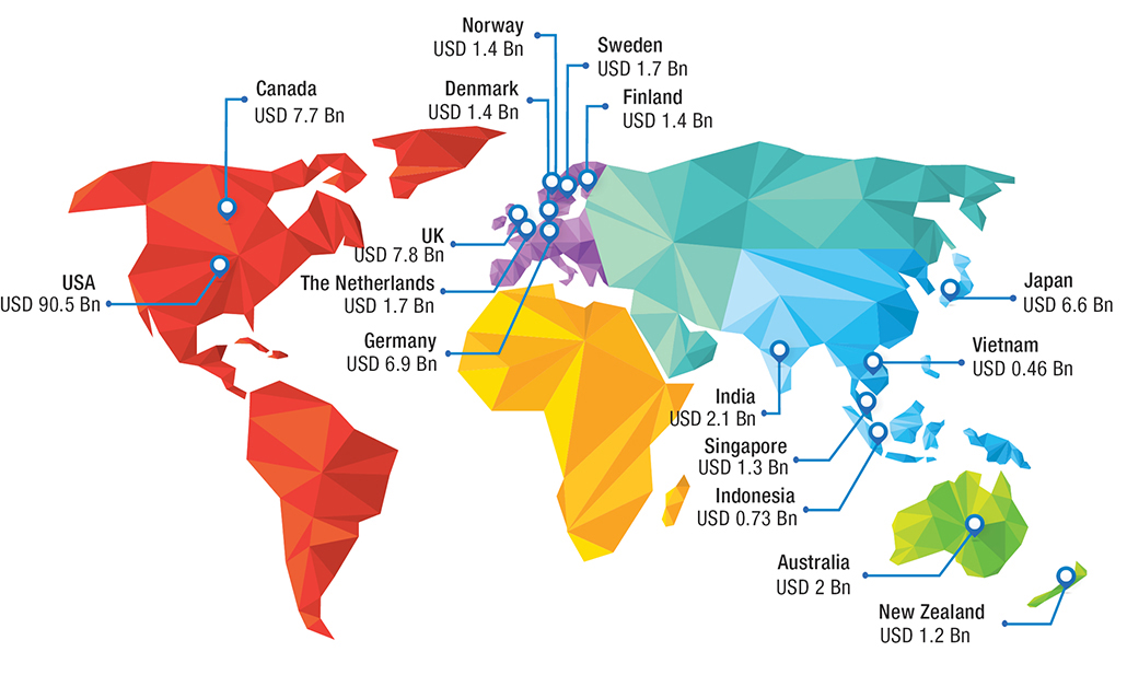 Countries Geospatial Market Size
Source: GEOBUIZ 2023 Report, GW Consulting
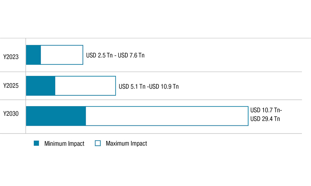 Direct Economic Impact of Geospatial Technologies
Source: GEOBUIZ 2023 Report, GW Consulting
GWF is a not-to-be-missed conference for the professionals engaged in geospatial and allied sectors. And for 4-days it becomes a global hub where geospatial executives, government representatives and academics from around the world meet to explore a better future.
Learn from the greatest experts. Discover the latest technologies from our exhibitors at the Expo. Go deep into key issues with theme specific deep-dive and special programs. Enjoy premier networking and get business done.

Policy Advocacy & Thought Leadership

Knowledge Sharing

Partnerships & Collaborations

Outreach & Business Developments

Networking & Socialization

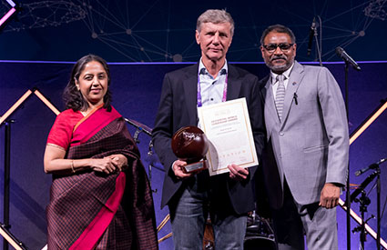
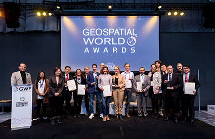
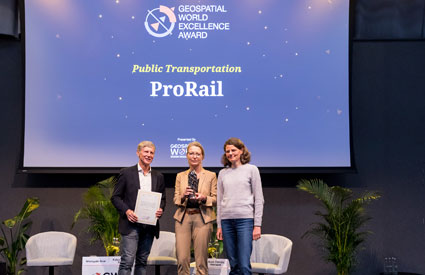
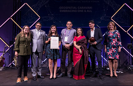
Leadership & Excellence Awards

Delegates

Organizations

Speakers

Countries

Sponsors & Partners

Exhibitors
Stay in the loop and groove with the latest buzz from GWF2024! Join our exclusive updates squad now!


Early registrations comes with many advantages so make up
your mind before it’s late.

Attending GWF 2023 was a great experience, due to the high level of presentations and their focus on the future of the geospatial industry. In addition, all attendees are open to creating global networking and collaboration.

Good event.

Great conference with current and very relevant themes. Excellent speakers.
GWF was once again a demonstration about how collaboration and innovation in the geospatial community will lead us to continue making a positive impact by solving real-world problems.

GWF 2023 was outstanding.

GWF always manages to pull in good and diverse delegates from across the industry and globe, which leads to excellent networking opportunities.
I was so thrilled to attend this reshaped edition. It was a wonderful opportunity to learn a lot and meet people!

Ideal place for networking.
It is time of actions and society need events like GWF more and more for confirm strategic orientation and actions in the area of geospatial data management.

Nice opportunity to share experiences and professional connections.

First GWF experience, glad to join the future ones.

GWF 2023 highlighted how the geospatial industry continues to grow and make impact all over the world, with a fantastic selection of speakers and networking opportunities, from startups to the big companies, a fantastic event.

It was a spectacular event. Very well organized and executed.
Overall, the content of the event, i.e., the topic presented, discussed, and shared, was good. To a certain extent, it serves as an eye-opening avenue where I hear a lot of good sharing from various domains.

The Geospatial World Forum has become the most relevant conference in our industry to hear about the latest developments in geospatial technology and data. The presenters and conference attendees are the strongest in our field, allowing for outstanding networking opportunities.

The GWF is a relatively small gathering, which makes it easier to meet new people and network with those in attendance. The meals, drinks and Gala Dinner are first class and make for an excellent event which facilitates networking.

This was an excellent forum to exit stealth mode.