Session Highlight
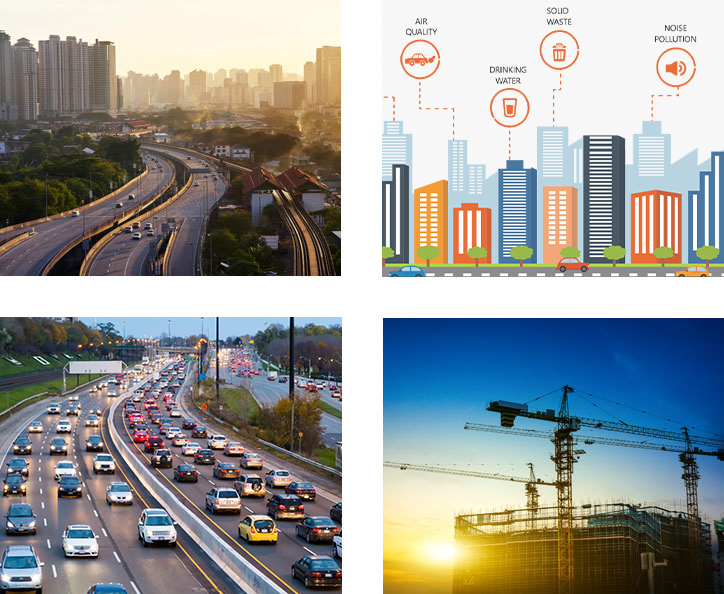
- Exploring why Digitalization is important in Infrastructure.
- Technological innovations Driving Digitalization in Infrastructure Sector.
- Promoting Resilience and Sustainability across the Infrastructure Value Chain.
- Economic Implications of Digital Transformation in Infrastructure Sector.

Moderator
Vaidas Ulenskas
GIS Team Leader
RB Rail AS
Lithuania
Vaidas Ulenskas is a GIS Team Leader at RB Rail AS. He graduated from Vilnius Gediminas Technical University (Vilnius Tech) in 2011 with M.Sc. degree in Civil Engineering. Vaidas joined Rail Baltica in 2019 meeting the new challenge - to lead GIS developments in the largest greenfield high speed rail transport infrastructure megaproject in Baltic states. Within 4 years, he assembled the solid GIS team, while the role of GIS in the project has changed dramatically - it turned into main source of information and the backbone of the currently developing Rail Baltica Digital Twin.
Topic
Digital Rail Baltica. Geospatial solutions for railway megaproject management

Amr Raafat
Chief Innovation Officer
Windover Construction
USA
As Chief Innovation Officer at Windover Construction, Amr leverages technology to optimize project delivery. He previously led the virtual design and construction team and the Innovations for Design, Engineering, and Automation, IDEA™ platform providing leading-edge technology services to streamline the construction process. With more than 20 years of experience combining architecture, construction, and engineering, he's a champion of pioneering construction technologies to streamline project procurement. Amr received the 'Innovator of the Year' award as part of the 2019 Autodesk AEC Excellence Awards. He received his master's degree in architecture from Boston Architectural College.
Topic
Redefining What is possible with Data, Generative AI and Digital Twins

David Tan
Assistant CEO
JTC Corporation
Singapore
Mr David Tan is the Assistant Chief Executive Officer (Development Group) of JTC, Singapore's lead government agency responsible for the planning and development of industrial infrastructure to support and catalyse the growth of new industries and transform existing enterprises. He oversees the land planning and redevelopment, architecture, procurement and contract management, as well as the planning and development of JTC's next generation estates like one-north, Jurong Innovation District, Punggol Digital District and Woodlands North Coast.
Mr Tan has professional experience in engineering and industry development; having been involved in the planning, design and construction of major infrastructure, building and reclamation projects. He was involved in the development of Jurong Island as the world's top ten chemical and energy hub, and Jurong Rock Caverns, South East Asia's first underground liquid hydrocarbon storage and terminalling facility. He was the Deputy Chief Executive of Energy Market Authority from 2007 to 2010 where he was involved in energy policy, planning and development.
Currently, Mr Tan serves on the boards of Jurong Port Pte Ltd and SLI Holdings Pte Ltd. He is also a member of the Development Projects Advisory Panel of the Ministry of Finance, and the MOH Holdings Pte Ltd's Healthcare Infrastructure and Planning Committee.
Mr Tan graduated with a BEng in Civil Engineering (First Class Honours) from the University of Adelaide and a MSc in Engineering from the National University of Singapore. In 2005, he was awarded the Public Administration Medal (Bronze) and in 2014, he was awarded the Public Administration Medal (Silver) in recognition of his contribution to the Public Service.
Topic
Digital Transformation: Redefining Infrastructure Sector

Harmen Van Sprang
Co-founder & CEO
Sharing Cities Alliance
The Netherlands
Harmen van Sprang, a visionary speaker, author, researcher, and lecturer, is foremost a pioneering social entrepreneur. As aptly described by his daughter, 'My father works in the future', Harmen has been instrumental in founding several forward-thinking organizations and initiatives.
Through his 'Sharing Cities Alliance' foundation, he has collaborated with global cities such as Copenhagen, Cape Town, New York City, Washington DC, Seoul, and Singapore, fostering a network of shared knowledge and sustainable practices. His creative studio, 'Sentience', is at the forefront of devising innovative concepts and projects that cater to a diverse clientele, pushing the boundaries of conventional thinking.
With his 'Next Reality' network, Harmen unites leaders from both the public and private sectors in the Netherlands, delving into the vast potential and addressing the intricate challenges posed by transformative technologies like Extended Reality (XR) and Artificial Intelligence (AI).
Harmen's global influence is marked by his significant contributions to the sharing economy, where he has guided cities and corporations towards embracing more social and sustainable frameworks. His expertise as a co-author of an award-winning business book on the sharing economy further emphasizes his status as a thought leader.
Topic
Advancing Infrastructure Resiliency Through Digital Transformation

Tobias Kraft
Co-Founder & CEO
Teren, Inc
USA
Tobias believes in market-based solutions for global sustainability and has built a career by analyzing environmental data that can solve real-world problems. He co-founded Teren to cultivate a company culture and mission to transform data into solutions that create a safer and more sustainable planet.
Topic
Digital innovation for resilience and sustainability across the infrastructure value chain

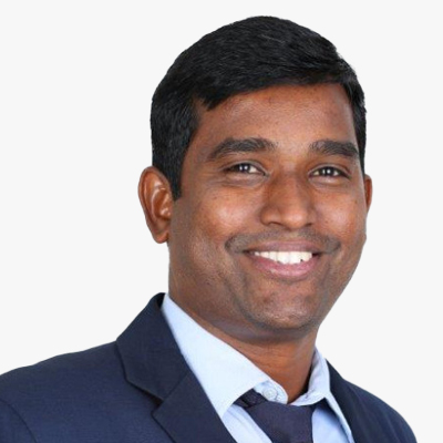
Session Highlight
- Streamlining Infrastructure Workflows through Federated Data Platforms.
- Leveraging Common Data Environment to Empower Built Environment Assets.
- Data Analytics and IoT Integration in Ensuring Built Environment Sustainability.

Moderator
Bonny McClain
Geospatial Analyst
Open-Source Solutions for Geospatial Analysis
USA
Bonny is a geospatial analyst and self described human geographer and social anthropologist primarily focused on the impact of the built infrastructure on global health outcomes. Exploring geographic properties that capture complex interactions, dynamic shifts in ecosystem balance and how activities influence eco-geomorphic conceptual frameworks across a wide variety of environments are the topics of popular public talks and panel discussions.
Deeper insights begin by accessing open-source tools like QGIS, PostgreSQL, and Python. As a sought after speaker, Bonny introduces the framework for learning to apply advanced data analytics, including data engineering and geo-enrichment, to big global questions and potential pathways to solution building.
Often we learn skills like coding in a particular language or enterprise solutions but are unable to bridge the gap between fundamental didactic awareness, and application of our newly acquired knowledge or frameworks. My goal is to help provide the base with a little more context, real world datasets and guidance to launch a new and independent beginning to your geospatial and open source journey.
Bonny is the author of the books Python for Geospatial Data Analysis: Theory, Tools, and Practice for Location Intelligence (publisher, O'Reilly Media) and Geospatial Analysis with SQL: A hands on guide to performing geospatial analysis by unlocking the syntax of spatial SQL published by Packt Press. Current projects include a new book in progress with Locate Press, Geospatial Data Science & the Art of Storytelling.
Topic
Natural Events, Human Systems and Why they Fail

Gerben Tiemens
Architect Geo-IT and BIM
Royal Schiphol Airport
The Netherlands
Gerben Tiemens, Solution Architect Asset Information at Schiphol Group. My background is a Master (MSc) in Geospatial information at Wageningen University. I worked as a consultant and it-architect at a lot of Dutch organizations, local government, water and ministry on GIS infrastructure for administering their assets. Currently I am working at Schiphol Airport, with the systems for administering, using and analysing Asset data. These systems include technologies like Linked Data, BIM, Geospatial and document management. We are working on an integrated assetinformation lifecycle system for handling assetdata from contractor to administration and connecting it to Event-driven data and incident/workorder based data.
Topic
Asset Information Lifecycle Management

Elly Perets
CEO
ASTERRA
Israel
Elly Perets is a dynamic CEO and executive leader with a stellar track record in enterprise software sales, marketing, and business development across diverse industries. A seasoned team builder, Elly excels in startup environments, driving cultural change, and fostering international operations. With expertise in software, SaaS, capital equipment, and fundraising, Elly is a visionary strategist. Known for establishing global sales forces, alliances, and partnerships, Elly is a developer and executor of go-to-market business models and pricing strategies. Their unique knowledge spans retail, finance, manufacturing, education, pharma, and more, coupled with a talent for translating customer needs into innovative solutions.
Topic
How to Safeguard Critical Infrastructure from Space

Helen Pickard
Group GIS Leader
Mott MacDonald
UK
Helen Pickard is the Group GIS Leader for Mott MacDonald based in the UK. Helen has 19 years of experience in applying GIS technology and adding the environmental context to infrastructure Projects worldwide; conscious of balancing development needs with a sustainable future through the use of Geospatial data and technology.
Helen is responsible for the strategic leadership of GIS to meet the business needs of the client sectors Mott MacDonald service. In her role she leads the GIS community of around 800 colleagues consisting of specialist consultants and users encouraging knowledge sharing and coordination to deliver GIS services.
Topic
Geospatial as Collaborative Platform
kalaiselvan Baskaran
Consultant - AEC / EPC / ER&UTL / BIM
Tata Consultancy Services
India
16+ years of global experience in BIM Consulting, Program, Design & Management of AEC / EPC / ER & UTL projects, Virtual Design & Construction, Digital Engineering and Sustainable Design & Development
Topic
Integrating the climate data to ensure the Industrial infrastructure is designed and operate to increase resilience to future hazards
Shaily Gandhi
Principal Researcher
Geo-Social Analytics Lab, University of Salzburg
Austria
Shaily is a Principal Researcher at Geo-Social Analytics Lab, Department of Geoinformatics - Z_GIS, University of Salzburg. She is a GIS expert with more than 12 years of experience. She has a PhD from CEPT University, India in Geospatial Technology and has expertise in bridging the gap between GIS & governance.
Shaily has been awarded the Geospatial World 50 Rising Star for the year 2023 by Geospatial World and ISC Fellow for 2024. She has been Deputy Center Head for Center for Applied Geomatics, CRDF, India till March 2024. She has also served as the Program Chair for the M.Tech program in Geomatics at the Faculty of Technology from March 2022 till October 2023. Shaily is an executive committee member for the Committee on Data of the International Science Council (ISC) and Joint Secretary of ISRS (2022-24) and ISG (2023-25), Ahmedabad Chapter. She was the student branch counsellor for the IEEE GRSS Student branch at CEPT University (2022-24). She has contributed to important research projects as a Data scientist and GIS expert with different centers at CRDF. She works closely on projects with IGSTC, DST, GIDB, ISRO, GIZ, CODATA, MHT and Nagoya.
Shaily is keen on exploring the implementation of GIS and data science in the domain of Urban Analytics. Her core interest lies in exploring spatial technology for better decision-making along with defining spatial data standards for data interoperability for building future cities. As Principal Researcher Shaily brings extensive experience to bear on GIS and data science.
Topic
GeoSocial Media and AI for Early Warning
Session Highlight
- BIM as a foundational platform for holistic facility planning and operations.
- Integration of BIM with facility management systems and other enterprise software tools.
- Use of BIM for sustainable design optimization, renewable energy integration, and carbon footprint reduction.
- Integrating AR/VR, AI/ML, and Blockchain with BIM for Enhanced Facility Management.

Moderator
Asmaa Abouleish
BIM Manager
Egis
Saudi Arabia
Asmaa carries solid experience in the field of BIM Management and digital construction, responsible for one of the giga projects in Saudi Arabia. She is PMP, Revit ACP, and BRE ISO19650 certified, and holds a certificate in AI/ML for Business from MIT. She also has a diploma in Innovation & Design Thinking from MIT Sloan School of Management and Columbia Business School. She has a strong foundation in artificial intelligence, and digital transformation in construction.
Moreover, Asmaa is a public speaker at many prestigious conferences in Europe and the Middle East.
Recently, Asmaa earned two Executive certificates from MIT Executive Education in Digital Business and in Management and Leadership.
Finally, Asmaa is the Rising Star of the Year 2023 at the Construction Week Middle East Awards in Dubai and has earned highly commended as Engineer of the Year 2023 at the Construction Week KSA Awards in Riyadh.
Indah Nurcahyani
BIM & Digitalization Engineer
PT. Waskita Karya (Persero), Tbk
Indonesia
Indah Nurcahyani has over five years of experience in Indonesia's BIM & digital construction industry, especially in BIM Infrastructure. As a member of the BIM & Digital Construction Development Team and Coordinator Team for all infrastructure projects in one of Indonesia's leading state-owned construction companies, Indah has been the driving force behind impressive innovations. The tangible proof of her dedication is the two prestigious Year In Infrastructure awards received in 2020 and 2023, which bring pride in participation from more than 40 countries. Through active communication with the Ministry of Public Works and Housing, Indah has been instrumental in establishing new standards for BIM development in Indonesia. Today, Indah remains passionate about BIM development and continues socializing the importance of collaboration with various parties to achieve even more significant progress.
Topic
Integrated Bim for Facility Management and Lifecycle Planning

Cristina Sanchez Jimenez
BIM Manager & Digital Engineer
Lendlease
UK
BIM Manager, ARB Architect and developing Data Scientist, always striving to find the best way to achieve the right goals. She was introduced to BIM through the first BIM project - Samson Pavilion - of the top UK architecture office - Foster + Partners. After a number of UK and international projects, she eventually shifted from tech-savvy architect to a BIM Manager role, her present position at Lendlease in London. Cristina is currently part of the Digital Engineering team and the Construction division, where she supports the digital delivery of construction projects but also leads initiatives to set standards, streamline processes and reduce risks through digitisation. Her current training as a data analyst has allowed her to extend the reach of these endeavours through the tools for a data-driven approach, but always aware of the key role that people play in generating change - with onboarding, training, and Health & Safety as a top focus. Cristina has a track record as a mentor and speaker in multiple industry events in the UK and internationally such as London Build, Digital Construction Week, AMI International, AIA Emerging Professionals, and judging for New Civil Engineer Techfest Awards and Digital Construction Awards.
Topic
BIM, a New Approach for Operations

Hesham Gamal Gaafar
Digital Twin - AEC Development Manager
Esri Saudi Arabia
KSA
Hesham, a Digital Twin expert and Spatial Computing innovator, holds a Master's degree in Engineering. As a Certified BIM professional and Industry Leader at Esri SA, he brings over a decade of experience in digitalizing the AEC sector. Specializing in leading complex digital twin systems worldwide, Hesham integrates GIS, BIM, and more for mega projects.
Topic
Indoor Maps for Facility Management

Ashish Kumar Mittal
General manager
ESRI
India
Topic
BIM Integration with Geospatial Technology
Session Highlight
- Harnessing IoT and Sensors for Developing Smart Construction Sites.
- Robotics and Automation for Safe and Sustainable Construction Sites.
- Mobile Mapping & Utilizing Drones for Site Surveying & Site Selection.
- AI and Cloud-Powered Predictive Analytics, and Simulation Modelling for Futureproofing Infrastructure.
- Modular and Prefab Construction - Transforming Construction projects into products.

Moderator
Abdelrahman AbouHadid
Digital Delivery Manager
Diriyah Gate Development Authority
UAE
Abdelrahman has 15 years of diverse digital construction experience (Steel Fabrication, Software Provider, Design, Environment/Energy, & Construction/handover) with 2 Masters's degrees and one scientific publication. Besides, he has strong experience in Computational Design, 4D, and Laser Scanning.
He was responsible for Dubai airports, DXB & AMI (40bn$) (Program BIM management) and was leading the digital transformation initiative & ISO 19650 certification prep at Dar. He is currently BIM Manager for the DGDA 1 portfolio in KSA. He is also an Advisory Council Member at the UAE Society of Engineers, Digital Engineering Chapter.
Abdelrahman has strong knowledge in AI/ML, Blockchain, Digital Platforms, etc. He obtained his Executive Certificate in Innovation & Strategy from MIT Sloan. He holds also several MIT certificates in Digital Business, Neuroscience for Business, Digital Platforms, Breakthrough CX Strategy, Design Thinking & Algorithmic Business Thinking.
Abdelrahman has also development and programming skills (Python, Django, HTML, CSS, JavaScript, ReactJS, & React Native) & holds PMP, LEED, RICS, & BRE certificates.

Marianna Kopsida
Market Development Manager
Trimble
UK
Dr Marianna Kopsida works for Trimble as Market Development Manager for the Field Systems sector. Her professional background is centered on digital-based workflows, with a keen interest in Augmented Reality, Digital Construction, Connected workflows and Digital Twins. Prior to joining Trimble, Marianna studied civil engineering at the Aristotle University of Thessaloniki, Greece before completing her PhD in Engineering at the University of Cambridge, UK. Her PhD research was focused on the automation of progress monitoring inspections using Mixed Reality. Part of her research was conducted at the Intelligent Vision and Automation Laboratory, School of Electrical and Computer Engineering at Georgia Institute of Technology in Atlanta.
Topic
Digital transformation trends in the construction industry and how Trimble's ecosystem and strategy enables workflows that connect key stakeholders

Antonio Mendes
Mobile Mapping Solutions Manager
Hexagon
UK
Antonio Mendes is a thought leader in the digital construction industry, driving innovation and pushing boundaries with his expertise in reality capture technology. As the Mobile Mapping Systems (MMS) Solutions Manager at Leica Geosystems, Antonio has spent more than two decades perfecting his his skills in geospatial engineering.
Antonio's wealth of experience as a Geomatic Engineer gives him a deep understanding of the industry, enabling him to specialise in mobile mapping systems since its inception in 2011. His work has played a significant role in the evolution of the mobile mapping industry.
Antonio is passionate about guiding new and established professionals towards the next revolution in mobile mapping. His vision and leadership have helped countless individuals reach new heights in their careers, and his impact on the industry is immeasurable. As a thought leader, Antonio Mendes is an inspiration to all those striving to push the boundaries of what is possible in the digital construction world.
Topic
Reality Capture Division
Ahmed AbouAlfa
Digital Delivery and Senior Innovation Manager
Diriyah Company
Saudi Arabia
Ahmed Aboualfa, a seasoned digital innovator and strategist, boasts over 13 years of experience leveraging data for actionable insights in billion-dollar organizations. Currently serving as the Head of Digital Delivery and Innovation at Diriyah Company, overseeing a nearly $60 billion historical and heritage project, Ahmed plays a central role in shaping digital strategy and business intelligence. With an architectural background and an MBA in strategic management, coupled with postgraduate qualifications from esteemed institutions, he brings a unique blend of technical and managerial acumen to his leadership. As a founder of the first BIM Association in the UAE and the Middle East, Ahmed actively contributes to the discourse on digital transformation. His commitment is further evident through being a finalist for the Engineer of the Year award, emphasizing his impactful role in the industry.
Javed Shaikh
Technical Director
Quantasip
India
With over a decade of dynamic experience in development, process optimization, and operations management, Javed Shaikh is a results-oriented professional known for driving bottom-line profitability through strategic resource utilization. As a skilled strategist, he excels in overseeing entire operations to enhance efficiency and meet organizational goals within stringent parameters of cost, time, and quality. Javed Shaikh has a proven track record in successfully ramping up projects, collaborating closely with clients to ensure exceptional service delivery, and finalizing technical specifications across diverse projects. Proficient in GIS, LBS, CAD, and application/system development, He brings a wealth of expertise to any team or organization.

Severin Alton
Head of IT
Rubner Holding
Italy
Severin Alton, Head of IT at Rubner Group, is a seasoned professional with a proven track record in digitalization and technology integration. Severin has a lot of expertise to offer, with a background in Information Systems and a lot of experience in IT consulting, manufacturing and construction.
For the past four years, Severin has led a dynamic team of 30 IT professionals at Rubner Group, driving digitalization efforts and implementing innovative solutions. His expertise lies in leveraging technology to streamline processes and enhance efficiency, particularly within sales, production, and supply chain management.
Severin has a skill for making complex ideas understandable and useful, and his presentations captivate audiences with information and motivation, preparing them to welcome the impact of technology in their own fields.
Topic
The Future is Build of Wood
Session Highlight
- Importance of thorough geotechnical investigations in mitigating infrastructure project risks.
- Application of advanced geo-physical imaging and sensing technologies (GPR/LiDAR) for geotechnical investigations.
- Advances in geotechnical software capabilities including BIM for holistic infrastructure project management.
- Lessons learned, challenges overcome, and key success factors in implementing sustainable geotechnical solutions.
Moderator
Archita Shaktawat
Industry Manager - Market and Economy
Geospatial World
India
Archita Shaktawat, Industry Manager at Geospatial World's consulting division, specializes in Market and Economy. With an engineering background and expertise in remote sensing, she's a driving force behind syndicate reports, business consulting, and Industry Profile Module enhancements. Archita's proactive analysis of market drivers reflects her commitment to fostering a vibrant and sustainable geospatial ecosystem.
Topic
Geotechnical Engineering Design and Software Market

Shawn Seah
Deputy General Manager
HSC Pipeline Engineering Pte Ltd
Singapore
I have over 20 years of experiences in underground infrastructure development including metro lines, cable tunnels, caverns and utilities. The involvement in various roles within the underground works industry have provided an understanding of its dynamics and complexities. Currently, I am dedicated to the advancement of underground detection and mapping technologies, with a keen focus on driving safety, efficiency, and sustainability initiatives.
Topic
Driving changes in Singapore using GPR for subsurface detection and mapping

Gareth Barker
Senior Geologist
Eiffage Kier Ferrovial BAM (EKFB)
UK
Dr Gareth Barker works for Kier, part of the EKFB JV responsible for the construction of the Central 2 and 3 sections of HS2 Phase One in the UK. His professional career has focussed on leveraging GIS and GNSS technology to optimise digital field data collection, with his latest focus on developing digital workflows to capture, deliver, and utilise digital geotechnical data.
Prior to his professional career he earned a Master's degree in Earth Science from The University of Manchester, UK. He further enhanced his academic credentials by completing a PhD in Geochemistry at University College Dublin, Ireland. His research employed advanced analytical techniques to explore ore genesis and mineral processing at the Navan Zn-Pb mine.
Topic
The Importance of Construction Stage GeoData on Infrastructure Projects

Niels Walrave
Consultant Flood Defences
Fugro
The Netherlands
Niels Walrave is a dynamic Civil Engineer with a master's degree from Delft University of Technology, specializing in geotechnical and hydraulic engineering. With over 2.5 years of experience, He has been deeply involved in consulting engineering, focusing primarily on flood defence projects across The Netherlands. From the tender phase to project realization, [Your Name] has contributed significantly to various projects, demonstrating expertise and commitment.
In January 2023, Neils embarked on a new professional journey at Fugro, a renowned global player in geotechnical and environmental services. Within just a year, [Your Name] has made strides by joining the sustainable geotechnical consulting team. Here, He is passionate about exploring the nexus between engineering design and sustainability, striving to deepen understanding and enhance practices for a more environmentally conscious approach.
Beyond the professional sphere, Neils, at 27 years old, resides in the picturesque city of Delft with their girlfriend. Outside of work, He finds joy in culinary adventures, hiking escapades, and recently completed an exhilarating ice skating course, dedicating time to refine their technique and revelling in the thrill of learning.
Topic
Geo-Risk Management Framework approach and related sustainable geotechnical solution for our innovative water infra project Hedwigepolder
Salvatore Amaduzzi
Professor
University of Udine
Italy
Salvatore Amaduzzi, an Associate Professor at the University of Udine, is a dedicated professional with a profound passion for Location Information and Spatial Technologies. Serving as the Deputy for Sustainability at the University of Udine, he is also a shareholder of AiperTech, a prominent Artificial Intelligence spinoff from the university. With a background as a Project Manager for industry and public administration initiatives, Salvatore possesses a broad skill set and extensive expertise in the integration of geospatial applications across various industry sectors. As a lecturer in numerous universities worldwide, he contributes significantly to the dissemination of knowledge. Currently, Salvatore is engaged in pioneering projects involving the utilization of wearable devices for field services activities, focusing on smart glass, watches, and more.
Topic
Frontiers of Learning: Advantages of AI-driven Training in the Metaverse