Speakers
Plenary
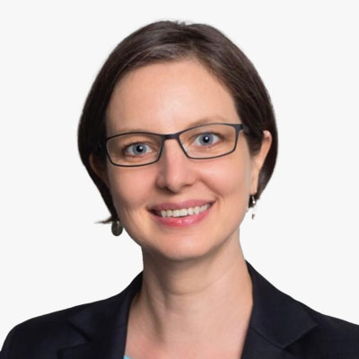
Adina Gillespie
VP-Strategic Initiatives - Geospatial Content
Hexagon
USA
Adina Gillespie is responsible for key strategic initiatives of the Geospatial Content Solutions business unit within Hexagon's Geosystems division. Her priority is establishing collaborative programs and partnerships for delivering large-scale geospatial initiatives. She has nearly 20 years of experience in the space sector, where she delivered innovative programs and strategic advice in the application of small satellite technology, including for governments and commercial users. Adina is a Fellow of the UK Royal Aeronautical Society, has served on various government and corporate committees and is a board member of the World Geospatial Industry Council (WGIC).

Allan Mbabani
Executive Director
OpenStreetMap Uganda
Uganda
Allan addresses data gaps in service delivery for refugees and host communities in Uganda, collaborating with NGOs and the Government on disaster preparedness projects. Specializing in mobile data collection, he designs questionnaires, codes for ODK Collect, sets up servers, and creates manuals for international NGOs. Additionally, Allan runs a daily map-making series, sharing topic-based maps on social media to enhance public information dissemination, showcasing his commitment to bridging information divides in the humanitarian sector.
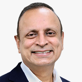
Anup Jindal
CEO
RMSI
India

Armin Hamidovic
Director
Google Maps
USA
Miriam Daniel is the Vice President and General Manager of Google Maps for consumers where she leads the teams responsible for Google's iconic Maps experiences, catalyzing positive social and environmental impact at scale using Google's geospatial technologies and understanding of the real world. Her team helps over 1B+ people around the world explore, navigate and get things done.
She was previously one of the creative minds leading the development of Amazon's Echo Devices and Alexa Assistant - innovations that changed the way we interact with the world around us. Miriam was also at the forefront of several consumer tech transformations at Intel Corporation, from the first unwired laptops to Intel's first mobile devices.
Over her career, her leadership across product, engineering, and building high-performing teams has been instrumental to inventing and scaling innovative technologies to meet emerging consumer needs. She strongly believes that when a talented, passionate, diverse team collaborates, they don't just invent - they touch people's lives in ways that haven't yet been imagined and will leave a lasting impact.

Beatrice Moulianitaki
Chief Commercial Officer
Meridia
The Netherlands
Beatrice Moulianitaki brings over two decades of extensive experience in the agriculture and food and beverage sectors, spanning commercial, sustainability, and social impact domains. Pioneering pre-competitive collaboration and innovation within the cocoa industry, she is a driving force in fostering positive change. She has worked with esteemed organisations, including Heineken, UTZ Certified, Solidaridad, and The Hershey Company.
Since September 2022, Beatrice has assumed the role of Chief Commercial Officer at Meridia, a leading agtech company specialising in smallholder data verification and compliance in cocoa, coffee, and palm oil. In her leadership, she continues to champion sustainable supply chains and propel meaningful transformation within the agricultural landscape.
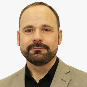
Bert Klaassens
VP - Europe
Geospatial World
The Netherlands
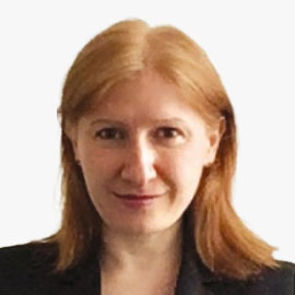
Claire Jolly
Head of Unit - STI Ocean Economy Group, Directorate for Science, Technology and Innovation
OECD
France
Claire Jolly is Head of the OECD Space Forum, in the Organisation for Economic Co-operation and Development (OECD)'s Directorate for Science, Technology and Industry. She has eighteen years of experience in policy and economic analysis, having worked for both public and private organisations in aerospace and defence in Europe and North America, before joining the OECD in 2003. Her background is in international relations / finance (MA. Versailles and Cornell University) and aerospace engineering (ENSTA), with an interest in technology transfers and space applications (MSc, ISU). She is also an alumna of the Institute for Higher National Defence Studies in Paris (Institut des Hautes Etudes de Defense Nationale, IHEDN). The Space Forum was established by OECD to assist governments, space-related administrations and the private sector to better identify the statistical contours of the space sector, while investigating the space infrastructure's economic significance, innovation role and potential impacts for the larger economy (e.g. publication: "The Space Economy at a Glance"). In 2015, the Space Forum's Steering Group includes ten members, nine national space agencies / official bodies in charge of space activities from OECD economies (NASA, CNES, DLR, ASI, KARI, UKSA) and the European Space Agency.

Colin Low
Chief Executive
Singapore Land Authority
Singapore

Cora Smelik
Board Member
Kadaster
The Netherlands
Cora Smelik is a Member of the Executive Board of the Netherlands' Cadastre, Land Registry and Mapping Agency, in short Kadaster. Cora is responsible for execution of the strategy of Kadaster including the key processes of Land Registration, Topography and Geo-Information. She has extensive experience in the world of diplomacy. Her focus on collaboration is a sound basis for bringing a range of partners together in further developing 3D modelling and its legal aspects.

Dean Angelides
International Corporate Director
Esri
USA
Over his 40-year professional career, Dean Angelides has worked with thousands of organizations to implement GIS for improving operations and decision-making. 35 years ago he co-founded a GIS services start-up. Dean joined Esri in 2005.
Dean has worked with organizations across dozens of industries. He has helped them devise strategies that leverage GIS in their business, and to successfully apply new methods that transform their organizations.
Dean is Corporate Director with responsibilities for overseeing all aspects of Esri's international business. Dean serves on the World Geospatial Industry Council Executive Board. He is dedicated to ensuring that the Geographic Approach is applied to successfully overcome our world's toughest challenges.
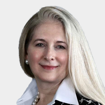
Deborah Davis
Board Member
USGIF and OGC
USA
Deb Davis is a Vice President & General Manager with General Dynamics Information Technology (GDIT) and a member of the Intelligence and Homeland Security Division Leadership Team. Ms. Davis is the P&L Executive responsible for the Mission Solutions Sector (MSS), to include Geospatial and IT Mission solutions and services. Deb is passionate about people, team and community development. She is the Chair of the GDIT Program Management Council, and is engaged in providing STEM opportunities for underserved students in the regions where her team lives and works.
Deb serves on the Board of Directors for both the United States Geospatial Intelligence Foundation (USGIF) and the Open Geospatial Consortium (OGC), and was recently selected as a 2023 Virginia Business Women in Leadership Award winner.
Prior to her selection as the Sector VP & GM, Ms. Davis was the Business Area Vice President of Geospatial Solutions and Services (GSS), responsible for P&L and portfolio performance across the Geospatial Mission and Enterprise. Ms. Davis was previously the NCE Active IT Program Manager under BRAC, responsible for cost, schedule, technical performance, and service enhancement throughout engineering, build out and transition to full-scale operations.
Before joining GDIT, Ms. Davis was a Principal with Booz Allen Hamilton, and she began her career as an educator, providing instruction in computer science, core subjects, and remedial mathematics.
General Dynamics Information Technology provides information technology (IT), systems engineering, and professional services to customers in defense, intelligence, homeland security, federal civil, international, and commercial sectors. The company provides leading edge expertise managing large scale, mission critical IT programs delivering IT services and enterprise solutions.
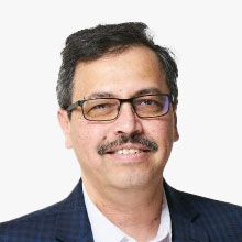
Dhananjay Deshmukh
VP
Tech Mahindra
USA
Dhananjay Deshmukh (DD) is a veteran with 30+ years of expertise in GIS, Engineering, AI, and Crowdsourcing Data Collection. He heads the GIS practice at Tech Mahindra based out of Troy, MI in the US and specializes in Aerial Photogrammetry, Map Digitization, and Geospatial Technologies.
DD has led a large global team for a significant AM/FM GIS project for a Global Telecommunication company, mapping the entire Telephony Network for North America. He has also collaborated with the government, public sector organizations, and multinational corporations like Caterpillar for their Digital Twin creation of manufacturing plants.
DD possesses extensive knowledge and expertise in GIS data acquisition, pre- and post-processing, building enterprise-grade, consumer-centric GIS applications and driving GIS adoption and policy creation for geospatial data usage.
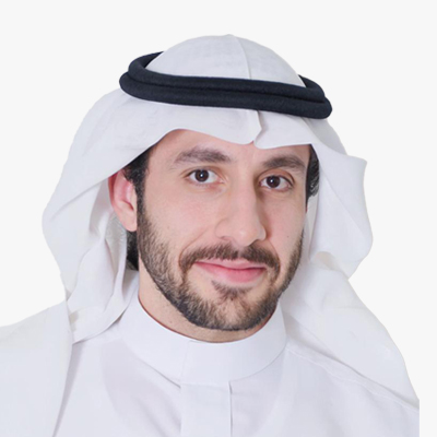
Eng. Ali AlAwaji
Executive Director- Geospatial Governance
GEOSA
Saudi Arabia
Eng. Ali AlAwaji is an accomplished Executive Director for Geospatial Governance at GEOSA, Saudi Arabia, specializing in integrating geospatial data and advanced technologies to advance resilient infrastructure and digital twins while developing and maintaining geospatial governance frameworks, policies, and standards.

Fatma Fahad
Spokes Person & Media consultant
GEOSA
Saudi Arabia

Feye Andal
Geospatial Analyst/Project Manager
YouthMappers Regional Ambassador
Philippines
Feye is dedicated to enhancing government and youth capacity in disaster risk reduction and management through GIS. Since 2013, she has championed FOSS4G tools like OpenStreetMap and QGIS, reaching over 2,000 participants across ages and sectors through training workshops. As one of the first GIS women in the Philippines promoting open mapping, Feye has established 12 YouthMappers chapters in Asia. She develops geospatial tools crucial for local governments in preparing and responding to hazardous events at the National Operational Assessment of Hazards (NOAH) Center.

Geert De Coensel
CEO
Merkator
Belgium
Geert De Coensel is the CEO of the Merkator Group, headquartered in Belgium, that includes operations in Europe and Middle-East. Geert is responsible for the execution of the Company's vision to serve diverse markets such as Governments and Private Sector with Software, Data and Expertise. Those 3 elements combined contribute in building true Digital Twins.
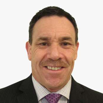
Greg Scott
Executive Director, SDG Data Alliance
PVBLIC Foundation
USA
Ingrid Vanden Berghe
Administrator General
National Geographic Institute (IGN)
Belgium
Ingrid Vanden Berghe holds an agricultural engineering degree specializing in soil sciences from KULeuven. After some years in advisory roles in politics, she was appointed General Administrator of the National Geographic Institute of Belgium in 2002, a function she still holds today. Ms. Vanden Berghe was President of EuroGeographics from 2012 to 2018, is visiting professor at KULeuven, board member of several research organizations, and chairs the board of technology research organization VITO. She has represented Belgium on the United Nations Committee of Experts on Global Geospatial Information Management (UN-GGIM) since its establishment in 2011 and was elected co-Chair at the 2020 session.

Josef Aschbacher
Director General
European Space Agency - ESA
France
Born in Austria, Josef Aschbacher studied at the University of Innsbruck, graduating with a Master's degree and a PhD in natural sciences. He has had an accomplished international career in space, combining more than 35 years' work experience at ESA, the European Commission, the Austrian Space Agency, the Asian Institute of Technology and the University of Innsbruck.
As Chief Executive Officer of ESA, Dr Aschbacher is responsible for the definition, implementation and development of Europe's space infrastructure and activities, which include launchers, satellites performing Earth observation, navigation, telecommunication and space science, together with robotic exploration and ESA astronauts working on the International Space Station. He is responsible for an annual budget of €7 billion and a workforce of 5500 distributed across several establishments, principally in Europe.
When taking up office as ESA Director General, Dr Aschbacher published a new strategy for space in Europe, called 'Agenda 2025', aimed at accelerating significantly the use of space in Europe through major new initiatives and programmes.
In 2021, Dr Aschbacher became 'Grande Ufficiale Ordine al Merito della Repubblica Italiana', the highest recognition accorded to non-Italian nationals.
Juan Tomas Hernani
CEO
Satlantis
Spain

Judith Pryor
First VP & Vice Chair
EXIM Bank
USA
Judith DelZoppo Pryor, appointed by President Biden, serves as First Vice President and Vice Chair of the Export-Import Bank (EXIM) Board until January 20, 2025. With over 25 years of leadership in multinational businesses, she specializes in corporate and marketing communications, public affairs, and business development. Pryor previously served on EXIM's Board and held roles in the Obama Administration at the U.S. International Development Finance Corporation. Her career spans from Fortune 500 companies to startups in broadcast, satellite communications, and international finance. A Cleveland native, Pryor holds a B.A. in Communications from Bowling Green State University and studied at the Universidad de Madrid.

Leendert Dorst
Deputy Hydrographer
Royal Netherlands Navy
The Netherlands
Lorant Czaran
Scientific Affairs Officer
United Nations Office for Outer Space Affairs (UNOOSA)
Austria

Mantas Vaskela
CEO
AISPECO
Lithuania
Mantas has founded a company that aims to make aerial mapping more affordable. AISPECO's business idea is to productize the integration by creating a geospatial platform where you can plug and play any sensor, resulting in precise and time-synchronized output. Five out of six AISPECO's clients are new to this business, with most coming from drone or ground survey backgrounds. All of them have mentioned that the ability to grow sensors as they grow their business, along with the ability to not own aircraft, has significantly reduced barriers to entry.

Marc Prioleau
Executive Director
Overture Maps Foundation
USA
Marc Prioleau, a seasoned business development executive with over two decades of experience in the mapping and location industry, is the new Executive Director of the recently launched Overture Maps Foundation (OMF). The OMF is an initiative launched by the Linux Foundation, focusing on creating high-quality, interoperable open map data for organizations that use the data to develop mapping and location services.
Prioleau's extensive experience in the industry includes his most recent role as Head of Business Development for Mapping at Meta. There he led Meta's involvement in founding OMF along with Microsoft, Amazon, and TomTom. Before Meta, Prioleau was the Head of Location Partnerships at Uber as well as VP of corporate and business development at Mapbox. Prioleau's passion for open map data has led him to promote its use across the mapping industry. He has been a contributor to the OpenStreetMap project since 2006.

Mark Heine
CEO
Fugro
The Netherlands

Mark Reichardt
Senior Consultant
Geospatial World
USA

Marryam Chaudhry
CEO
XR2Lead
USA
With a global footprint, XR 2 LEAD, Marryam Chaudhry stands at the forefront of defense and aerospace innovation, specializing in state-of-the-art training and mission-critical technology solutions. Renowned for their expertise in crafting AI-based Intelligent Simulated Solutions, they excel in adaptive training and rapid decision-making applications. Pioneering in mission-critical solutions such as Data Analytics, Modelling & Simulations, and Digital Twins, XR 2 LEAD ensures cutting-edge capabilities in Predictive & Preventive Maintenance and Model Based System Engineering. Their comprehensive training solutions encompass AR/VR/MR, Curriculum Design, Serious Game Concept-Design-Deployment, and AI-Powered Virtual Instructor, providing unparalleled support to the defense and aerospace sectors.
Massimo Claudio Comparini
Deputy CEO & ESVP
Thales Alenia Space
Italy
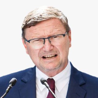
Mathias Jonas
Secretary General
IHO
France
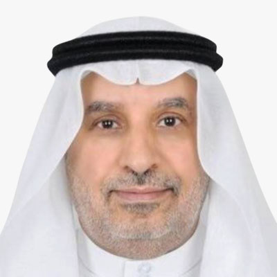
Mohammed Yahya Alsayel
President
General Authority for Survey and Geospatial Information (GEOSA)
Saudi Arabia
(Virtual)

Motoyuki Arai
Founder & CEO
Synspective
Japan
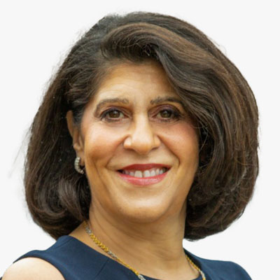
Nadine Alameh
Executive Director
Taylor Geospatial Institute (TGI)
USA

Ola Rollen
Chairman
Greenbridge
UK
Ola Rollen has served as the President and CEO of Hexagon, as well as a member of its Board of Directors, since 2000. As President and CEO, Rollen is responsible for driving the company's growth, both organically and through strategic acquisitions that continue to transform Hexagon into a leading global provider of information technologies. Prior to joining Hexagon, Rollen held the positions of President of Sandvik Materials Technology, Executive Vice President of Avesta-Sheffield and President of Kanthal. He also previously served as a board member of Vestas Wind Systems A/S. Rollen holds a Bachelor of Science degree in Economics.

Pacome Revillon
CEO
Novaspace
France

Paul Becker
President
Federal Agency for Cartography and Geodesy (BKG)
Germany
Prof. Dr. Paul Becker is a German meteorologist and President of the Federal Agency for Cartography and Geodesy. He is also a professor at the Goethe University in Frankfurt am Main and a reserve colonel in the German Bundeswehr. His main interests are the applications of digital twins for climate change adaptation and the further development of satellite positioning services.

Prateep Basu
Co-Founder & CEO
SatSure Ltd
India
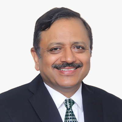
Rajeev Jyoti
Director Technical
IN-SPACe
India
Ramakrishna Mulukutla
AVP, GIS and LBS
Cognizant
India

Ron S. Jarmin
Deputy Director and Chief Operating Officer
U.S. Census Bureau
USA
Ronald Bisio
SVP
Trimble
USA

Ronda Schrenk
CEO
USGIF
USA
Ronda Schrenk is the Chief Executive Officer for the United States Geospatial Intelligence Foundation and leads the Foundation in its mission to promote the geospatial intelligence tradecraft and develop a stronger GEOINT community among government, industry, academia, professional organizations and individuals whose mission focus is the development and application of geospatial intelligence to address national security objectives. In this role, Ms. Schrenk sets the strategic direction for the Foundation to effectively enable each aspect of mission accomplishment. Previously serving as the Vice President of Programs of the Foundation, she led the content development for all events and programs, serving as the primary spokesperson for the Foundation.
Ms. Schrenk is a recognized leader in the field of Geospatial Intelligence and has been on the leading edge of the geospatial intelligence tradecraft for most of her career, including 25+ years in a variety of leadership and analytic positions at the National Geospatial-Intelligence Agency (NGA), the National Security Agency (NSA), the Central Intelligence Agency (CIA), private industry, non-profit, and even academia.
Before joining USGIF, Ms. Schrenk was the Senior Fellow for Public-Private Partnerships at the Intelligence and National Security Alliance (INSA). In this role, she advised the president on challenges the intelligence community faced and coordinated activities such as INSA's councils on Technology and Innovation, Acquisition Management, and Intelligence Champions (workforce of the future). As a career GEOINT professional, she has served in a variety of analytic leadership positions at NGA, including Mission Requirements Program Manager of NGA's Mission Talent Alignment office, Chief of the Counterterrorism Airborne Analysis Center, and Chief of the Time Dominant Operations Center, and while on a joint duty assignment to NSA, Deputy Chief of the International Affairs and Policy Office.

Samantha Dinning
Senior GIS Analyst
Pima County, AZ
USA
Samantha contributes to Pima County's comprehensive plan update for 2025 through interactive maps, dashboards, and storymaps. She is actively engaged in URISA's Vanguard Cabinet and volunteers with the Arizona Geographic Information Council, showcasing her commitment to mentoring and conference planning. Elected as the vice president of Women in GIS, Samantha plays a pivotal role in fostering a supportive community for women in the field, coordinating events and developing the organization's infrastructure.
Sandra Auchter
Director, NGA Denver
National Geospatial-Intelligence Agency
USA
Ms. Sandra Auchter serves as the Director, NGA-Denver (NGA-D) at the Aerospace Data Facility - Colorado (ADF-C). She leads a diverse team of over 500 personnel. As NGA's only senior executive at the ADF-C, she represents the interests of NGA-D as a member of the ADF-C's Denver Leadership Team (DLT), which includes the ADF-C site commander, NRO's senior representative, the Director, NSA Colorado (NSAC) and their deputy directors. As a DLT member, she concentrates on a range of issues that focus on exploring and improving how the three agencies integrate and collaborate across mission areas and across each agency's distinct personnel skill-sets.
Ms. Auchter received her Bachelors of Science Degree in Regional Studies, Africa, from the School of Foreign Service, Georgetown University and is an alumnus of the National Defense Intelligence College/National Intelligence University.
Sanjay Kumar
CEO
Geospatial World
India
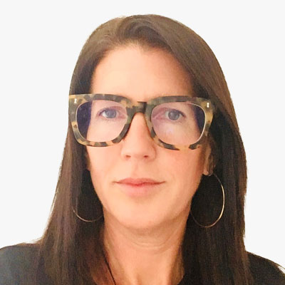
Sarah Hodgetts
Director
Geospatial Commission
UK
Sarah joined the Geospatial Commission after four years in science policy - including leading the creation of and setting up the Advanced Research and Invention Agency (ARIA), the sponsorship of UK Research and Innovation (UKRI) and developing the €14.8 billion Pioneer research and development programme.
Sarah has worked in policy and delivery roles for over 23 years across economic departments, HM Treasury and No 10. She has been responsible for the implementation and delivery of the government's Industrial Strategy, led on manufacturing policy and delivered the apprenticeship levy. Her educational background is in industrial economics; she holds a diploma in management accounting and is a trained work coach.

Sean Wiid
CEO
UP42
Germany
Sean Wiid is the CEO of UP42. Sean is a surveyor and computer scientist with over 20 years of experience solving real-world problems with geospatial data across multiple industries and countries. His current focus at UP42 is to build a platform that helps the earth observation industry reach its full downstream socio-economic potential by removing commercial and technical barriers to leveraging geospatial data at scale.
Siva Ravada
VP- Development
Oracle
USA

Stefan Schweinfest
Director
United Nations Statistics Division

Tan Boon Khai
CEO
JTC Corporation
Singapore
Mr Tan Boon Khai was appointed as the Chief Executive Officer of JTC Corporation on 1 Sep 2020. Prior to this, he was the Chief Executive of the Singapore Land Authority (SLA) from 1 May 2015 till 31 August 2020.
Mr Tan joined SLA from CapitaLand Limited, where he was with since 2010. In his time at CapitaLand, he held several portfolios, including as Regional General Manager (Singapore and Malaysia) for The Ascott Limited from April 2011 to 2014.
Before joining the private sector, Mr Tan served as Justice's Law Clerk and Assistant Registrar of the Supreme Court, as well as District Judge in the then Subordinate Courts of Singapore. He is also called as an advocate and solicitor in Singapore. In 2006, he was seconded to the Ministry of Health as General Counsel and Company Secretary for Ministry of Health Holdings Pte Ltd. His last appointment in the Public Service was as Deputy Senior State Counsel / Deputy Public Prosecutor in the Attorney-General's Chambers of Singapore.
Space, Hydrography, and Geospatial Agencies
Abigail Page
Head of Geospatial Market Policy
Geospatial Commission, Cabinet Office
UK

Brenda Alejandra MUNOZ De Luna
Head of Department of Geosystems
National Institute of Statistics and Geography (INEGI)
Mexico
Brenda has accumulated 17 years of experience specializing in the development of specific Geographic Information Systems (GIS) and their utilization with georeferenced statistical information at the INEGI. She played a pivotal role in leading the development of the MxSIG institutional platform, a significant accomplishment allowing the creation of Geomatics Solutions for the Web. The software within this platform is a combination of the best open-source or free geographic software and in-house developed software, released under free or open-source software licenses.
Brenda's efforts in this development have facilitated the technological transfer of MxSIG to several countries in the Caribbean, Central America, and South America. She also spearheaded the development of web applications under the MxSIG platform, focusing on the publication of geographic and georeferenced statistical information generated by INEGI. In this capacity, Brenda incorporated User Research and Design Thinking methodologies, resulting in applications such as the online Digital Map of Mexico, The System for the Consultation of Census Information 2020, The Gender Atlas, and the Analytical Viewer for COVID-19.
Additionally, Brenda took the lead in developing web applications under the MxSIG platform for the publication and consultation of the Statistical and Geospatial Framework for the Americas (MEGA) in collaboration with UN-GGIM: Americas.
Brig. Gen. Dato' Pahlawan Sr Dr Mohd Zambri bin Mohamad Rabab
Director, Defence Geospatial Division
Department of Survey and Mapping (JUPEM)
Malaysia

Chris Williams
Head of Digital Mapping
British Geological Survey
UK
At the British Geological Survey, Chris currently oversee the full digital transformation of the overall mapping system, coordinating and co-designing the projects that enable systems ready for field deployment and onward data integration.
Chris designs and implements cross-organisational frameworks and workflows to enable efficient, repeatable and transparent data related operations, with over 12 years' experience in the geo-environmental sector. These incorporate the different stages of the environmental data lifecycle, from data capture to data analysis and environmental modelling, through to data product development and delivery.
Bringing together experts from across areas including data architecture, data engineering, data analysis through to those applying systems as direct users, is core to his work. Understanding and orchestrating how these different skills and requirements align to ensure suitable data oriented solutions can be designed is what drives him.
Christian Hauglie-Hanssen
Director General
Norwegian Space Agency
Norway

Christian Thellufsen
Senior Consultant
Danish Geodata Agency
Denmark
Clinton Heimann
Deputy Director General Spatial Planning and Land Use Management
National Department of Agriculture Land Reform and Rural Development
South Africa
Clinton Heimann is the Deputy Director-General of Spatial Planning and Land Use Management at South Africa's National Department of Agriculture, Land Reform, and Rural Development. His role centres on strategic oversight for implementing key legislative frameworks, including the Spatial Planning and Land Use Management Act, the Planning Professions Act, and the Spatial Data Infrastructure Act, crucial for policy development and modernizing South Africa's geospatial frameworks. He also leads the South African delegation to the UN-GGIM and UN-GGIM Africa.
In the past three years, Heimann has driven initiatives to upgrade the country's geospatial infrastructure, fostering collaborative governance and strategic partnerships. His work ensures the alignment of South Africa's National Geospatial Strategies with the Integrated Geospatial Information Framework (IGIF), aiming to bring socio-economic benefits across the region and enhance South Africa's contribution to the Sustainable Development Goals (SDGs) and Africa Agenda 2063.
Coco Antonissen
Programme Manager Space Applications
Netherlands Space Office (NSO)
The Netherlands
David Henderson
Chief Geospatial Officer
Ordnance Survey
UK
David leads the strategy and roadmap to reinforce and extend Ordnance Survey's position, reputation and contribution as a leader in the national and international geospatial industry.
David joined OS in 2003 and has 25 years of geospatial industry experience across a variety of technical and leadership roles. He has been part of the OS Executive Team since 2015 where he has led both product strategy and customer facing teams.
He leads the UK's delegation to the UN's Committee of Experts on Global Geographic Information Management (UNGGIM) and is a Vice-Chair of the UNGGIM Europe Regional Group. David is a former Chair of the UK's Association for Geographic Information (2015 and 2016), member of the Management Board of Eurogeographics (from 2017) and from 2016-19 was the industry external examiner for the GeoSciences School at Edinburgh University.
In 2019 David was awarded an Honorary Fellowship from the Royal Scottish Geographical Society.

Emilio Lopez Romero
Director
National Center for Geographic Information (CNIG)
Spain
Emilio Lopez Romero is a computer engineer. He is the Director of the National Centre for Geographic Information of Spain, the National Contact Point for INSPIRE Directive and President of the Spain's Geographical Information Infrastructure Board of Directors. For more than 12 years Emilio Lopez has been working in the field of Spatial Data Infrastructures with main focus on governance and IT architecture both in a national and international context.

Eric Loubier
Director General
Canada Centre for Mapping and Earth Observation Canadian Mapping Agency
Canada
Eric Loubier, Director General of the Canada Centre for Mapping and Earth Observation, has worked for the Government of Canada for the last 20 years as a project manager, program manager and Director at the executive level.
He previously worked as Director of the Science Policy and Partnership Division of the Science and Technology Branch of Agriculture and AgriFood Canada (AAFC).
Prior to joining the public service, Eric worked for a consulting firm in the field of land management as well as a sub-contractor for the Canadian Space Agency.
Eric has significant experience in providing corporate leadership in planning, developing, and implementing complex national geomatics and earth observation programs and strategies. He holds a bachelor in Geography (B. Sc) and a master's degree in public administration (MPA).

Evert Flier
International Coordinator
Norwegian Mapping Authority
Norway
Grzegorz Wrochna
President
Polish Space Agency - POLSA
Poland
Gulin Dede
Copernicus Space Segment Engineering Coordinator
European Space Agency
The Netherlands

Gunter Schreier
Chair - ISPRS
International Policy Advisory Committee (IPAC)
Germany

Haico van der Vegt
Regiomanager
Kadaster
The Netherlands
As a regional manager within Kadaster International, the international branch of the Cadastre, Land Registry and Mapping Agency of the Netherlands, Haico is responsible for the business development in Eastern-Europe and Central Asia. As a spatial data infrastructure (SDI) expert, he is involved in many national and international SDI implementation projects. He has also been working on the design, implementation and further development of the national geoportal 'PDOK', as part of the Dutch SDI. He has led projects in a number of countries, focusing on developing a fit-for-purpose land administration. Haico has worked for nearly 5 years in France for EuroGeographics, the association of European national mapping and cadastral agencies, as a marketing communications and business manager. Haico is graduated as a Geographer and Cartographer at the University of Utrecht.

Jani Kylmaaho
Director, Development and Digitalization
National Land Survey of Finland
Finland
Jani Kylmaho has been working with geospatial data infrastructures, data production and distribution for 20+ years. He has been involved in national and international collaboration and projects, working both for the public and private sector. Currently Jani is the Chief Digital Officer at National Land Survey of Finland.
Jasmin Catic
Senior Expert, Spatial Data Infrastructure Geoportal
Federal Administration for Geodetic and Real Property Affairs
Bosnia & Herzegovina

Jeroen Zanen
Founder & CEO
AI-Infrasolutions
The Netherlands
Juliet Ezechie
Director OS International
Ordnance Survey
UK

Marc Serres
CEO
Luxembourg Space Agency
Luxembourg
Marc Serres is the Chief Executive Officer of the Luxembourg Space Agency. He heads the Luxembourg Delegation at the European Space Agency (ESA) and represents Luxembourg in the Council of ESA. He is Member of the International Academy of Astronautics.
He has been Director of Space Affairs at the Ministry of the Economy of Luxembourg since January 2014. Before joining the Ministry of the Economy, Marc Serres managed Luxembourg's relations with ESA at the Ministry of Higher Education and Research as an industrial policy officer for 8 years. Prior to becoming a civil servant, he spent 5 years in the satellite communications antenna manufacturing industry within the company HITEC Luxembourg S.A., first as a Project Engineer and finally as Chief Engineer for satcom products development. Marc Serres holds a PhD in optoelectronics and a Master in electrical engineering with specialty in microwave frequencies, both from the University catholique de Louvain in Belgium.
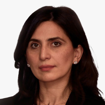
Mari Khardziani
Head of International Relations Service
National Agency of Public Registry
Georgia
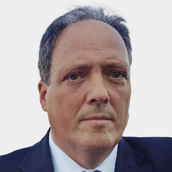
Markus Jobst
Chief Information Officer
Federal Office of Metrology and Surveying
Austria
As Chief Information Officer, Markus Jobst is responsible for the IT organisation, the strategic IT management and the IT knowledge infrastructure at the Austrian Federal Office of Metrology and Surveying (BEV).
Markus Jobst studied geodesy and geoinformation at the Vienna University of Technology and completed his studies with a thesis on the use of multimedia technologies in map-related representations in 2003. He then worked as a research assistant at the Institute of Geoinformation and Cartography at the Vienna University of Technology and finished his doctoral thesis with the focus on a semiotic model for cartographic communication with 3D in 2008. In his further scientific career, Jobst received a post-doctoral fellowship at the Hasso Plattner Institute at the University of Potsdam from 2008-2009. He joined the Federal Office of Metrology and Surveying for the implementation of the EU Directive 2007/2/EC (INSPIRE) and the extension of the IT architecture for the EU Directive (EU) 2019/1024 (Open Data Directive). Starting from 2014 he is active member and supporter of the United Nations Committee of Experts on Global Geospatial Information Management in Europe. In 2022 Markus Jobst was appointed Chief Information Officer (CIO) at BEV.
Markus Jobst's ongoing research interests lay in the fields of sustainable service-oriented architectures, efficient geo-communication and trustful geospatial knowledge infrastructures. Insights are taught in corresponding courses as a lecturer at the Vienna University of Technology, the Graz University of Technology and the Hasso Plattner Institute of the University of Potsdam.

Michael Scholz
Researcher
German Aerospace Center (DLR)
Germany
Michael Scholz studied geoinformatics in Munster, Germany, and works as a researcher at the Institute of Transportation Systems of the German Aerospace Center since 2012. His daily work involves taming of heterogeneous geodata to be used in applications of driving simulation and autonomous driving, making OpenDRIVE a core component of his personality. He calls himself an Open Geodata and Open Source Evangelist and is keen on bringing the domains of GIS and transportation engineering closer together. Apart from that he likes to be roaming around on boundary-less gravel roads of far and foreign countries.
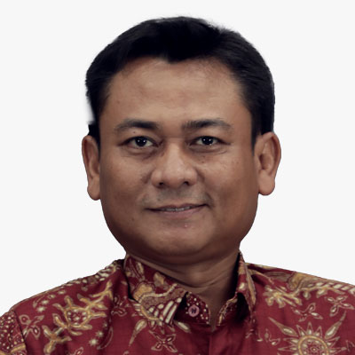
Muh Aris Marfai
Head
Badan Informasi Geospasial (BIG)
Indonesia
Aris Marfai is a geography professor who currently serves as the Head of the Geospatial Information Agency (BIG) of the Republic of Indonesia since January 27, 2021. He was the Dean of the Faculty of Geography at Gadjah Mada University from 2017 to 2021. He earned his doctoral degree in geography from Justus-Liebig University in Giessen, Germany, in 2008. He also holds a master's degree in earth system analysis from the Institute for Geo-Information Science and Earth Observation (ITC), University of Twente, Netherlands, in 2003, and a bachelor's degree from the Faculty of Geography at UGM in 1998. In September 2013, he was appointed as a full professor at the age of 37.
As the head of BIG, Aris serves as the leader of the Indonesian delegation in the annual meetings of the United Nations Global Geospatial Information Management (UN-GGIM) and the chair of the Indonesian delegation in the biennial meetings of the United Nations Group of Experts on Geographical Names (UNGEGN). In his role as the head of BIG, Aris is a member of the advisory board of Indonesia's one-data policy and serves as the chair of the implementation team for Indonesia's one-map policy. He continues to oversee mapping of the sea and coastal areas, including coastline mapping, hydrographic surveys, and national bathymetric mapping. BIG manages more than 230 tide gauge stations, and Aris advocates for the establishment of new tide gauge stations in various regions of Indonesia to support reference services for survey work and monitoring coastal and marine dynamics.
Aris Marfai, as the chair of the One Map Policy (OMP) Secretariat, is driving the accelerated implementation of the OMP for 158 thematic maps from 24 ministries and institutions in 34 provinces. OMP has successfully identified approximately 43 million hectares of land use overlaps. Resolution of these overlaps continues, taking into account geospatial data through instruments of the coordinating ministry for the economy's regulations. In 2023 and 2021, Aris was ranked in the top 2% of world scientists by Stanford University and was included in the top 100 engineering and technology scientists in Indonesia for 2023 by the AD Scientific Index.
Aris has authored more than 230 publications, including books, book chapters, articles, and papers, published in both national and international journals, indexed on Google Scholar [https://scholar.google.co.id/citations?user=ABAF8Q0AAAAJ&hl=id], with an H-index of 32. Over 100 international publications are indexed in Scopus [Scopus Author ID 22951320200; Link: https://www.scopus.com/authid/detail.uri?authorId=22951320200], with an H-index of 18.

Nazri Othman
Johor State Director, Survey and Mapping
Department of Survey and Mapping Malaysia (JUPEM)
Malaysia
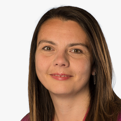
Nichola Smith
Senior Digital Specialist
British Geological Survey
UK
Nichola is a Digital Lead within the International Geoscience division of the British Geological Survey and has a focus on the design, development and implementation of custom spatial data capture and delivery systems, as well as the design and implementation of digital workflows. Nichola has led the development of the BGS bespoke digital geological field data capture system, BGS?SIGMA, since 2015 having previously been lead software developer on the project. She is now leading the redevelopment of this system to secure its use into the future and ensure it meets the needs of the new BGS strategy whilst also ensuring that it continues to be a valuable tool for geological surveys worldwide. Nichola also works extensively with international geological surveys as they aim to increase the use and delivery of geospatial data, and her work has taken her from Europe to Africa to Central and SE Asia. In addition, Nichola is the Vice-Chair for the Association for Geographic Information (Scotland) national group.

Piotr Perz
Manager, Geoportal Division- Department of Informatization
Head Office of Geodesy and Cartography
Poland
Piotr Perz is a Manager in the Geoportal Division in the Department of Informatization, Head Office of Geodesy and Cartography. Master of Science, University of Warmia and Mazury in Olszyn. Experienced in spatial data management, especially in terms of OGC services and API accessibility. The organization is responsible for the functioning of the national geoportal as a central access point to the national geodetic and cartographic resources.
Rodolfo Orozco-Galvez
Deputy General Director, Natural Resources and Environment
INEGI
Mexico
Rodolfo Orozco Galvez, an Agricultural Engineer specializing in soils, is a distinguished alumnus of the University of Guadalajara (Mexico). He furthered his academic journey by obtaining a Doctorate in Agronomy from the prestigious Universitat de Lleida (University of Lerida) in Spain.
Since 2020, Rodolfo has been serving as the Deputy General Director of Natural Resources and Environment, overseeing the generation, analysis, and dissemination of geographic and statistical information concerning the environment and natural resources. His responsibilities encompass projects and studies focusing on biodiversity, water resources, soil health, vegetation dynamics, and waste management. Prior to this role, he held a key position at INEGI as the Director of Competence Analysis and Environmental and Natural Resources Scenarios.
Rodolfo's career spans across diverse sectors, ranging from rural production to the private industry. In the public sector, he held significant roles such as Director of the National Forest Registry and Management System at the Ministry of Environment and Natural Resources. He also served as Director of the Documentation and Events Coordination Center Unit at the Ministry of Economy. His tenure as General Coordinator of Planning and Information at the National Forestry Commission, as well as the position of executive director of Sector Analysis at the National Financial Institution for Agricultural, Rural, Forestry and Fisheries Development, showcased his commitment to sustainable resource management.
In the private sphere, Rodolfo's leadership as General Director of PRODECISION, SC, a consulting firm specializing in rural development, environmental issues, and information systems, has been instrumental. Additionally, his pivotal role in establishing an automotive industrial company, underscores his versatility as a manager in Human Resources and General Affairs.
In academia, Rodolfo has excelled as a researcher focusing on hydroponics under controlled conditions as an alternative to traditional soil-based horticultural practices. His passion for knowledge sharing led him to teach at several private universities as ITESM (Tec de Monterrey), where he also served as director and consultant at the International Agribusiness Center, and at Universidad Panamericana (UP) covering a wide array of subjects including Physics, international agribusiness, leadership, business consulting, ecology, and sustainable development.
Sara Taibo
Client Manager
National Agency for Geospatial Development
Mozambique
I'm economist with MBA. I've been working for 30 years of which the last 10 in mainstreaming the use of Geospatial Information in socioeconomic development planning. The GIS methodology was initially brought to our country and our attention as the methodology used in Spatial Development Initiatives (SDI's) the one for planning the development of Corridors - that's the country areas with huge potential of natural resources that needed infrastructures to unlock them. The SDI's approach emphasizes the simultaneous planning of infrastructures and the productive sectors through identification of anchor projects supported with GI.
The introduction of GI in development planning in Moz. inititated 13 years ago as a Program (Spatial Development Program-SDP) with support of donnor's funds (WB, UK AID and Development Bank of South Africa) and in 2020 the Government created a public institute - The National Development Geo-spatial Agency where I'm still attached.
I also have been assigned the responsibility of preparing the National Coutry Plan for Integrated Management of GI with support of UNGGIM and SDG Alliance.
Sergio Albani
Head of RTDI Unit
European Union Satellite Centre
Spain
Sergio Albani is the Head of Research, Technology Development and Innovation (RTDI) Unit at the European Union Satellite Centre. He is in charge of implementing new operational solutions in the Space and Security domain looking at the whole EO and collateral data lifecycle; this is performed by exploiting new data sources, secure satcom, emerging technologies (e.g. Big Data, AI) and innovative EO based solutions. He is responsible for several H2020 projects as well as for cooperation with ESA and GEO. Mr. Albani holds a Masters Degree in Physics (Astrophysics and Space Physics branch) and a Master in Journalism and Scientific & Institutional Communication.

Sile Martin
Senior Policy Adviser
UK Geospatial Commission
UK
Sile Martin is currently the policy lead at the UK Geospatial Commission responsible for public sector use of EO data policy. For the last 3 years, Sile has been focused on developing and monitoring a portfolio of projects in a team whose ambition is to increase the UK public sector's capability to utilise geospatial data and deliver more effective and efficient public services. Prior to joining the UK Geospatial Commission, Sile worked for the Houses of Parliament measuring the benefits of a portfolio of building and infrastructure projects.

Siriluk Prukpitikul
Deputy Director
GISTDA
Thailand
Sophie Morel
Head of Institutional Law Division
European Space Agency
France

Todd Johanesen
Director, Foundation GEOINT
National Geospatial-Intelligence Agency
USA
Mr. Todd E. Johanesen serves as Director, Foundation GEOINT Group at the National Geospatial-Intelligence Agency (NGA), located in Springfield, Virginia, U.S.A. In this capacity, he leads an organization that provides assured, timely, relevant, and accurate foundation geospatial intelligence (GEOINT) data, products, and services in support of prioritized requirements of the warfighter, our national security objectives, and Safety of Navigation needs of the U.S. government. Mr. Johanesen earned a Bachelor of Arts degree in Geography from California State University, Long Beach, in 1989. In 2001, he received a Master of Science degree from Purdue University, West Lafayette, Indiana, where he studied Geomatics engineering. He is also a 2010 Director of National Intelligence Science and Technology Fellow.
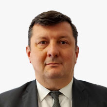
Tomaz Petek
General Manager
Surveying and Mapping Authority of the Republic of Slovenia
Slovenia

Vincent Caillard
Head of Space Imaging Department
IGN
France
User Organizations - Government

Abdelrahman AbouHadid
Digital Delivery Manager
Diriyah Gate Development Authority
UAE
Abdelrahman has 15 years of diverse digital construction experience (Steel Fabrication, Software Provider, Design, Environment/Energy, & Construction/handover) with 2 Masters's degrees and one scientific publication. Besides, he has strong experience in Computational Design, 4D, and Laser Scanning.
He was responsible for Dubai airports, DXB & AMI (40bn$) (Program BIM management) and was leading the digital transformation initiative & ISO 19650 certification prep at Dar. He is currently BIM Manager for the DGDA 1 portfolio in KSA. He is also an Advisory Council Member at the UAE Society of Engineers, Digital Engineering Chapter.
Abdelrahman has strong knowledge in AI/ML, Blockchain, Digital Platforms, etc. He obtained his Executive Certificate in Innovation & Strategy from MIT Sloan. He holds also several MIT certificates in Digital Business, Neuroscience for Business, Digital Platforms, Breakthrough CX Strategy, Design Thinking & Algorithmic Business Thinking.
Abdelrahman has also development and programming skills (Python, Django, HTML, CSS, JavaScript, ReactJS, & React Native) & holds PMP, LEED, RICS, & BRE certificates.
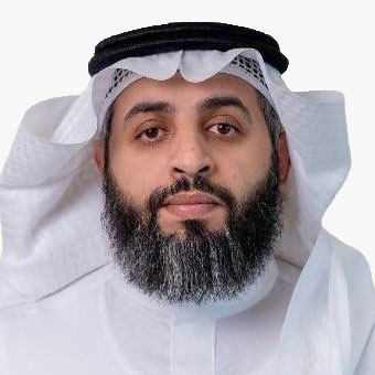
Adnan Abdulrahman Alalyani
Director for Environmental Technologies
NCEC
Saudi Arabia
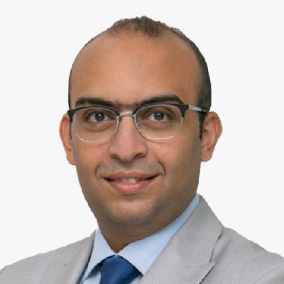
Ahmed AbouAlfa
Digital Delivery and Senior Innovation Manager
Diriyah Company
Saudi Arabia
Ahmed Aboualfa, a seasoned digital innovator and strategist, boasts over 13 years of experience leveraging data for actionable insights in billion-dollar organizations. Currently serving as the Head of Digital Delivery and Innovation at Diriyah Company, overseeing a nearly $60 billion historical and heritage project, Ahmed plays a central role in shaping digital strategy and business intelligence. With an architectural background and an MBA in strategic management, coupled with postgraduate qualifications from esteemed institutions, he brings a unique blend of technical and managerial acumen to his leadership. As a founder of the first BIM Association in the UAE and the Middle East, Ahmed actively contributes to the discourse on digital transformation. His commitment is further evident through being a finalist for the Engineer of the Year award, emphasizing his impactful role in the industry.
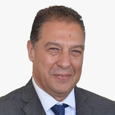
Ahmed Benlakhdim
Director of Geology
Ministry of Energy, Mines, Water and Environment
Morroco
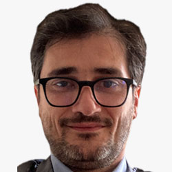
Andrea Manara
Senior System Analyst/Programmer, Focal Point for Geospatial Information Management
International Telecommunication Union
Switzerland
Andrea is a Senior System Analyst in the International Telecommunication Union (ITU) Radiocommunication Sector.
His current duties encompass software and radio communication engineering activities finalized to the design and implementation of software solutions and systems focused on the application of the provisions of the ITU Radio Regulations and Regional Agreements. He is also the ITU Focal Point for Geospatial Information Management, a Member of the Steering Committee of the UN Geospatial Network and a co-chair in the GeoAI Working Group of the UN Open GIS Initiative.
Since 2021 Andrea coordinates the GeoAI activities at the AI for Good. ?He holds a Ph.D. in Physics (Indiana University, 2000) and an Executive MBA (Geneva University, 2011) with a specialization in International Organizations.
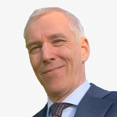
Arie Versluis
Manager Knowledge and (Geo) Information
Ministry of the Interior and Kingdom Relations
The Netherlands

Ashraf Abushady
Senior Advisor - Digital Transformation and AI
UNIDO
Belgium
Ashraf Abushady, originally from Alexandria Egypt and a graduate from Vienna Technical University, is currently serving as the Senior Advisor for Digital Transformation and AI at the Directorate of Technical Cooperation and Sustainable Industrial Development within the United Nations Industrial Development Organization (UNIDO).
Ashraf has an impressive career spanning over 26 years within the United Nations family organizations. Currently, in his role at UNIDO, he plays a crucial role in shaping and implementing innovative solutions and strategies to promote sustainable industrial development.

Brigadier General Friedrich Teichmann
Director, Geospatial Institute
Austrian Armed Forces
Austria
Current post: Director of the Geospatial Institute, Austrian Armed Forces and and POC MoD for Space Services Development
Current military rank: Brigadier General
MSc and PhD in Geo-Sciences at the University of Maine (USA), the University of Salzburg (Austria) and the University of Rochester (USA)
Post-graduate studies in Geo-Informatics at the University of Salzburg (Austria) , Telematics at the University of Krems (Austria) and Space Study Program at the International Space University (France)
Lecturer for Space Applications, GeoSciences, Information Technology and Geo-Informatics at several Austrian Universities.
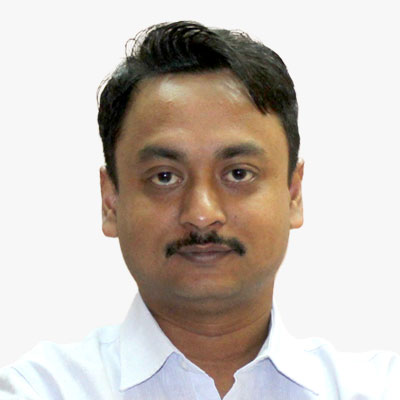
Chiranjit Guha
General Manager
Foundation for Ecological Security
India
I am an experienced Analyst (20 years) with a demonstrated history of working in the non-profit organization. Skilled in Environmental Awareness, Mining, Hydrogeology, Remote Sensing, and Geographic Information Systems (GIS). I am a professional with a post-graduation degree "Master of Technology" focused in Applied Geology from Indian Institute of Technology, Roorkee, India. I have created several user friendly tools for informed decision making on soil and water conservation measures, water budgeting, aquifer mapping, land mapping etc. and ensured uses of the tools and technology by the village community in more than 50K villages with field teams, NGO partners and Government departments in India by providing trainings, handhold supports and monitoring the usefulness of technology for natural resource management.

Christian Veldhuis
Advisor
Rotterdam Municipalty
The Netherlands
Mr. Christian Veldhuis has a background in GIS and has been working on the development of the 3D city model and the Digital Twin of Rotterdam for more than 10 years. With a preference for putting theory into practice, he tries to bridge the gap between vision and practice, technology and people.
He works at the department of GEO-information within the public works department of the municipality of Rotterdam. In order to carry out the development and management of the city in a future-proof manner, the Digital Twin plays an increasingly important role and this technology must be combined with processes and people to become successful.
As an senior advisor, he works on bringing together different disciplines and processes in the digital twin so that we work together on the city of tomorrow. Developments that are currently being worked on include conducting analyzes and simulations of the current and future city, automated granting of permits and an improved way of communicating with the city's residents.

Craig Sandy
Surveyor-General of Victoria
Department of Transport and Planning
Australia
Mr Sandy, a licensed surveyor, is the Surveyor-General of Victoria, and Chair of the Surveyors Registration Board of Victoria, as such is the primary government authority on surveying and the cadastre.
The Surveyor-General fulfils a range of statutory roles and responsibilities dealing with land and property boundaries.
Mr Sandy is also a member of the following Commissions and Committees:
• Registrar of Geographic Names
• Victorian Electoral Boundaries Commission
• Federal Redistribution Committee for Victoria
• Intergovernmental Committee on Surveying and Mapping - Chair
• Council of Reciprocating Surveyors Board of Australia and New Zealand - former Chair
Mr Sandy has a focus on engaging with the surveying profession to develop strategies for meeting the challenges that the current digital environment is creating.
In 2020, he was awarded the Asia Pacific Spatial Excellence Award for Spatial Professional of the Year for 2019 for his work in modernisation of the cadastre and in raising awareness for mental health issues in our profession.
Mr Sandy is the former Surveyor-General for the Northern Territory of Australia, the only person to have held this title in more than one Australian jurisdiction.
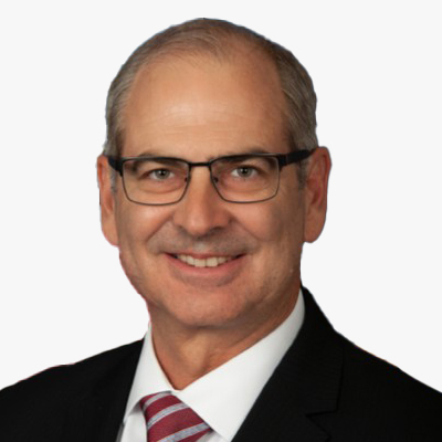
Daniel Gall
Deputy Chief Strategy Officer
U.S. Veterans Health Administration
USA
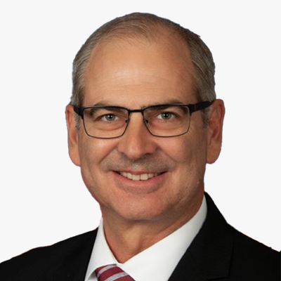
Daniel W. Gall, FACHE
Deputy Chief Strategy Officer
Veterans Health Administration (VHA)
USA
Serves as the Deputy Chief Strategy Officer in the VHA Chief Strategy Office responsible for the integration, information, and insight of strategic planning, strategic analysis, policy analysis, enrollment and forecasting, geospatial service support, and Medicare and Medicaid analysis that enables the VHA to provide leading healthcare to Veterans. Dan is a Co-chair of the VA Analytics Sub-council, the Chair of the VA Geospatial Workgroup, a member of the Federal Geospatial Data Committee, a Delegate on the United States Delegation to the United Nations Global Geospatial Information Management (GGIM) Committee of Experts and is a board-certified Fellow in the American College of Healthcare Executives (FACHE). Dan's education includes a Bachelor of Science in Chemistry, and Masters in Business Administration, Healthcare Administration, and in Resource Strategy.

David Tan
Assistant CEO
JTC Corporation
Singapore
Mr David Tan is the Assistant Chief Executive Officer (Development Group) of JTC, Singapore's lead government agency responsible for the planning and development of industrial infrastructure to support and catalyse the growth of new industries and transform existing enterprises. He oversees the land planning and redevelopment, architecture, procurement and contract management, as well as the planning and development of JTC's next generation estates like one-north, Jurong Innovation District, Punggol Digital District and Woodlands North Coast.
Mr Tan has professional experience in engineering and industry development; having been involved in the planning, design and construction of major infrastructure, building and reclamation projects. He was involved in the development of Jurong Island as the world's top ten chemical and energy hub, and Jurong Rock Caverns, South East Asia's first underground liquid hydrocarbon storage and terminalling facility. He was the Deputy Chief Executive of Energy Market Authority from 2007 to 2010 where he was involved in energy policy, planning and development.
Currently, Mr Tan serves on the boards of Jurong Port Pte Ltd and SLI Holdings Pte Ltd. He is also a member of the Development Projects Advisory Panel of the Ministry of Finance, and the MOH Holdings Pte Ltd's Healthcare Infrastructure and Planning Committee.
Mr Tan graduated with a BEng in Civil Engineering (First Class Honours) from the University of Adelaide and a MSc in Engineering from the National University of Singapore. In 2005, he was awarded the Public Administration Medal (Bronze) and in 2014, he was awarded the Public Administration Medal (Silver) in recognition of his contribution to the Public Service.
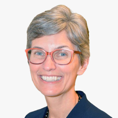
Deirdre Dalpiaz Bishop
Chief Geography Division
U.S. Census Bureau
USA

DERALD DUDLEY
Geographer, U.S. Bureau of Transportation Statistics
National Spatial Data Infrastructure, Transportation Theme Lead
USA
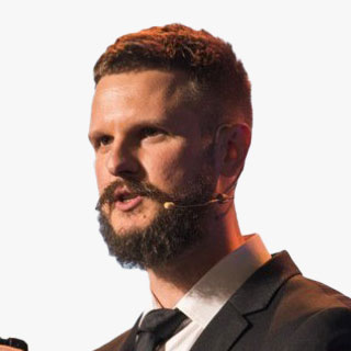
Dmitri Garbuzenko
BIM and AIM Coordinator
Rail Baltica
Estonia
Experienced BIM Specialist with a passion for data analytics, Python programming, and the implementation of cutting-edge technologies like ChatGPT and BingChat. Over the past 10 years, I have honed my expertise in the field of Building Information Modeling (BIM) and witnessed firsthand the transformative power of data-driven solutions.
He firmly believe that the true potential of BIM lies in its correct application and utilization of data. By leveraging advanced analytics techniques, He strive to extract valuable insights from BIM data, enabling informed decision-making and optimized project outcomes. His proficiency in Python programming empowers me to develop custom tools and scripts to streamline BIM workflows and enhance productivity.
In addition to his BIM background, He has developed a keen interest in water engineering, particularly within the context of overcoming future water crises. Currently pursuing his studies in TalTech's Water System and Sewer Engineering program, he is eager to explore how the convergence of BIM, AI, and water engineering can play a pivotal role in tackling these challenges.

Edward Steele
Science Manager
Met Office
UK

Geraldine Nolf
Product Owner Metadata, Data Publicatie & Teamcoach Data management
Digitaal Vlaanderen
Belgium
Expert, working in different domains of the Geo and Open Data Chain. Ranging from data management, data quality and metadata across services, metadata of services and bulk downloads to geoportal Geopunt, catalogue Datavindplaats and reporting under various regulatory frameworks such as INSPIRE and High-Value Datasets.
A leading lady of Digital Flanders, responsible for the Flemish SDI, has a degree in geography and has worked for more than 15 years in the Flemish government.

Gerben Tiemens
Architect Geo-IT and BIM
Royal Schiphol Airport
The Netherlands
Gerben Tiemens, Solution Architect Asset Information at Schiphol Group. My background is a Master (MSc) in Geospatial information at Wageningen University. I worked as a consultant and it-architect at a lot of Dutch organizations, local government, water and ministry on GIS infrastructure for administering their assets. Currently I am working at Schiphol Airport, with the systems for administering, using and analysing Asset data. These systems include technologies like Linked Data, BIM, Geospatial and document management. We are working on an integrated assetinformation lifecycle system for handling assetdata from contractor to administration and connecting it to Event-driven data and incident/workorder based data.

Gince Kuruvilla Mattam
Deputy Chief of Mission
Embassy of India
The Netherlands
Girish Kumar
Former Surveyor General of India
Survey of India
India
Hugo de Groof
Retired official European Commission DG ENV
European Commission
Belgium
Indah Nurcahyani
BIM & Digitalization Engineer
PT. Waskita Karya (Persero), Tbk
Indonesia
Indah Nurcahyani has over five years of experience in Indonesia's BIM & digital construction industry, especially in BIM Infrastructure. As a member of the BIM & Digital Construction Development Team and Coordinator Team for all infrastructure projects in one of Indonesia's leading state-owned construction companies, Indah has been the driving force behind impressive innovations. The tangible proof of her dedication is the two prestigious Year In Infrastructure awards received in 2020 and 2023, which bring pride in participation from more than 40 countries. Through active communication with the Ministry of Public Works and Housing, Indah has been instrumental in establishing new standards for BIM development in Indonesia. Today, Indah remains passionate about BIM development and continues socializing the importance of collaboration with various parties to achieve even more significant progress.
Jan Egbertsen
Manager, Strategy and Innovation
Port of Amsterdam
The Netherlands
Jan Egbertsen (1964) has studied management and logistics at the University of Twente in The Netherland. He works for Port of Amsterdam as Manager Strategy and Innovation. He has worked for Port of Amsterdam as Strategic Advisor, Deputy Director Marketing and Advisor for the Board. At the moment he is active in digital strategy, energy transition, transport strategy and clean shipping.
Jose M.S. Balsinhas
Senior Engineer
Joint Intelligence, Surveillance & Reconnaissance (JISR) Centre, NATO Communications & Information Agency (NCI Agency)
The Netherlands
Mr. Jose Balsinhas has an extensive working experience on both national and NATO environments. He retired from the Portuguese army active duty in 2005 and joined the former NATO C3 Agency, now the NATO Communications and Information Agency (NCI Agency). Currently, he serves as a Senior Engineer and Deputy in the Joint Intelligence Surveillance and Reconnaissance (JISR) Service Centre, GeoMetOc Services Branch.
With 20 years' professional experience in managing enterprise GIS projects, Mr. Balsinhas holds a Master degree in Military Sciences from the Portuguese Military Academy, and a Post-Graduate course on Geographic Information Systems.

Josette Vallentgoed-Udo
Team leader Zero Emission Mobility
Gemeente Amsterdam
The Netherlands
With over 20 years of experience in Telecommunications, Consumer Electronics, Automotive and Public affairs, Josette holds a long track record of various positions in Transition Management, Product Management, Engineering, Project Management and Finance. Currently in her role of Team Manager at the City of Amsterdam she leads a team of Policy Officers responsible for communication (education), stimulation (subsidies) facilitation (public charging infrastructure) and regulation (environmental and zero-emission zones) to transition all kinds of fossil transportation in Amsterdam to zero-emission transportation. Josette is interested in mobility, tech, sustainability,, agile, education, strategy and coaching.

Joshua J. Delmonico
Executive Director
Federal Geographic Data Committee, U.S. Geological Survey
USA
Josh serves as the Executive Director for the Federal Geographic Data Committee providing the leadership, coordination, and communication to promote the development, use, sharing, and dissemination of geospatial data nationwide. In this role he provides executive leadership for the coordination of U.S. federal geospatial activities in collaboration with the 32 FGDC member Federal Agencies and OMB to implement the Geospatial Data Act and conduct strategic planning and visioning for the implementation of National Spatial Data Infrastructure (NSDI) across Federal, State, Tribal and local government agencies, academic institutions, non-profit organizations and the private sector.
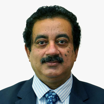
Kaustav Nag
Additional Director General (Exploration), Directorate General of Hydrocarbons
Ministry of Petroleum and Natural Gas
India
Dr. Nag holds the position of Additional Director General (Exploration) at Directorate General of Hydrocarbons, Ministry of Petroleum & Natural Gas.
He is a professional geologist with 34 years of experience in upstream oil and gas industry at ONGC and has worked in the entire gamut of upstream hydrocarbon exploration.
Dr. Nag has earned Doctorate in Applied Geology and has published / presented more than twenty research/technical papers in International and National journals & conferences. He is a life member and fellow of Geological Society of India and many Scientific Societies. He is also on the board of studies of several Indian Universities.

Laura D'heer
Product Owner Expert
Digitaal Vlaanderen
Belgium
Expert, working in different domains of the Geo and Open Data Chain. Ranging from data management, data quality and metadata across services, metadata of services and bulk downloads to geoportal Geopunt, catalogue Datavindplaats and reporting under various regulatory frameworks such as INSPIRE and High-Value Datasets.
A leading lady of Digital Flanders, responsible for the Flemish SDI, has a degree in geography and has worked for more than 15 years in the Flemish government.

Loes Deventer
Business Analyst
Digitaal Vlaanderen
Belgium
Expert, working in different domains of the Geo and Open Data Chain. Ranging from data management, data quality and metadata across services, metadata of services and bulk downloads to geoportal Geopunt, catalogue Datavindplaats and reporting under various regulatory frameworks such as INSPIRE and High-Value Datasets.
A leading lady of Digital Flanders, responsible for the Flemish SDI, has a degree in geography and has worked for more than 15 years in the Flemish government.

Luiza Saldanha Pena Costa
Legal Officer for Commercialisation
European Space Agency
France

Mani Dhingra
Smart City Digital Twin Manager
Dublin City Council
Ireland
Dr. Mani Dhingra is a prominent urban researcher, sustainability advocate, and social scientist with over a decade of experience. Passionate about fostering inclusive, sustainable, and smart urban futures, she specializes in strategic policymaking, decision support systems, and bridging academia-industry gaps. With expertise in urban sustainability, climate change, disaster resilience, and smart cities, Dr. Dhingra actively contributes to shaping resilient, socially inclusive urban environments. Her commitment to merging theoretical insights with practical solutions positions her as a transformative force in the pursuit of a better urban future.
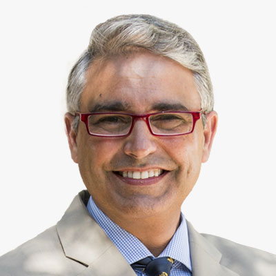
Martin Cauchi Inglott
Project Director
Critical Maritime Routes Indo-Pacific (CRIMARIO II)
Malta
Martin Cauchi Inglott is a retired Coast Guard officer, having served in the Armed Forces of Malta for 27 years. He began his career after having graduated from the German Naval Academy, and after serving in the flotilla in various positions, becoming Commandant of the Force in 2001. In 2008, Martin moved to Brussels and served as Maltese Military Representative to the EU and NATO Military Committees until 2012; he then established and led the External Relations Division, within the European Union's Military Staff, until his retirement from the Force in 2015. Martin received a Diploma in Diplomatic Studies, and Masters in International Law, from the University of Malta, and is graduate with distinction from the US Naval War College.
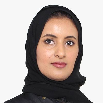
May Al Khalifa
Director, Geographic Information Systems Directorate
Information & eGovernment Authority
Bahrain

Michael Fischer
Head of Urban Data Analytics
Agency for Geoinformation and Surveying
Germany
Michael Fischer (Free and Hanseatic City of Hamburg) is the Head of Urban Data Analytics at the Urban Data Hub within the Agency of Geoinformation and Surveying. He holds a Ph.D. in polar sciences bringing a unique perspective to the field of urban data. He has been responsible for the development of the real time data infrastructure within the Urban Data Platform Hamburg. Michael Fischer and his team are now focusing on data driven decisions by applying methods of advanced analytics, artificial and business intelligence to unlock valuable insights from urban data. Throughout his career, he has earned a reputation as a leading expert in Urban Data Platforms, IoT (Internet of Things), and leveraging data to make informed decisions. He is deeply passionate about digital maps, spatial data, bringing data to life and using it as a driving force for positive change. Michael has been involved in numerous national and international projects with an emphasis on data, urban data platforms, real time and Urban Digital Twins. He voluntarily supports the association Code for Hamburg.

Mieke van Schaik
Strategic Information Adviser
Gemeente Eindhoven
The Netherlands
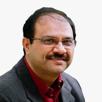
Raj Kumar Khatri
Former Additional Chief Secretary
Government of Karnataka, GoI
India

Rob Agelink
Director of Data, Governance & Innovation
Kadaster
The Netherlands

Robert Goldsmith
GIS and Mapping Manager
Devon & Cornwall Police
UK

Rudy Cambier
Chief of Innovation and Industrials Partnerships Department (France and International)
IGN France
France
Ruud Van Rossem
General Programme Manager ZoN Data Foundation / Policy Coordinator Geo-information
Ministry of Interior and Kingdom Affairs
The Netherlands
Ruud van Rossem studied Geodesy at the Technical University of Delft. After various functions at the Dutch Cadastre he moved to the national government (Ministry of Housing, Spatial Planning and the environment, Ministry of Infrastructure and the environment, Ministry of Interior and Kingdom Affairs) where he was responsible for the development op various so called Key Registers and other parts of the Spatial Data Infrastructure. He was general program manager for de Key Registers Cadastre and Topography (2004-2009), the Key Register Large Scale Topography (2008-2017) and the further development of the National Spatial Data Infrastructure (2017-now). The presentation is about the further development from these various Key Registers towards a much broader Data Foundation as a base for working on the various challenges that we currently meet in a data driven way.
Teo Hui Ying
Deputy Director, Geospatial & Survey Division
Singapore Land Authority
Singapore
Hui Ying serves as a Deputy Director in the Geospatial & Survey Division of the Singapore Land Authority (SLA), where she leads the strategic capture, creation, and maintenance of 3D digital geo-information. Together with her team, they drive the production of national fundamental map data that are instrumental in empowering government agencies with comprehensive support for their planning, risk management, operations, and policy formulation. With a rich background encompassing both the public and private sectors and as a Registered Surveyor in Singapore, Hui Ying has garnered extensive experience in cadastral, mapping tunnelling, and engineering surveys.

TNC Karthik
Scientist
INCOIS
India

Vaidas Ulenskas
GIS Team Leader
RB Rail AS
Lithuania
Vaidas Ulenskas is a GIS Team Leader at RB Rail AS. He graduated from Vilnius Gediminas Technical University (Vilnius Tech) in 2011 with M.Sc. degree in Civil Engineering. Vaidas joined Rail Baltica in 2019 meeting the new challenge - to lead GIS developments in the largest greenfield high speed rail transport infrastructure megaproject in Baltic states. Within 4 years, he assembled the solid GIS team, while the role of GIS in the project has changed dramatically - it turned into main source of information and the backbone of the currently developing Rail Baltica Digital Twin.

Yuri Tsubaki
Deputy Director, Urban Policy
Ministry of land Infrastructure Transport and Tourism
Japan
User Organizations - Business Enterprises
Ajay K. Gupta
CISSP, MBA, Founder & CEO
HSR Health
USA
With a distinguished 20-year career in cybersecurity and information technology, Ajay Kumar Gupta is a visionary leader committed to transforming American healthcare. As the founder of HSR.health, he harnesses technology to innovate healthcare delivery, driving improved quality, lower costs, and health equity. Ajay's leadership steered HSR.health to pivot and support global COVID response, providing valuable insights into health risks' impact on broader markets. Chairing the Health Domain Working Group for the Open Geospatial Consortium and serving on influential healthcare task forces, boards, and committees, Ajay is a driving force for positive change, spearheading initiatives to address healthcare inefficiencies and shape the future of healthcare resilience.

Amit Prabhu
AI Consultant, Author
Sweden

Amr Raafat
Chief Innovation Officer
Windover Construction
USA
As Chief Innovation Officer at Windover Construction, Amr leverages technology to optimize project delivery. He previously led the virtual design and construction team and the Innovations for Design, Engineering, and Automation, IDEA™ platform providing leading-edge technology services to streamline the construction process. With more than 20 years of experience combining architecture, construction, and engineering, he's a champion of pioneering construction technologies to streamline project procurement. Amr received the 'Innovator of the Year' award as part of the 2019 Autodesk AEC Excellence Awards. He received his master's degree in architecture from Boston Architectural College.

Anthony Tuffour
Director - GIS and Digital Twins
BuroHappold Engineering
UK
Anthony leads our Global Geographic Information Systems (GIS) and Digital Twin development and deployment. With over 17 years' experience, his role improves business efficiencies and revenue generation. Anthony also manages our Cities Computational Engineering Programme.
Anthony's expertise lie in digital twin and geospatial consulting services and solutions delivery to clients around the world. He enables smart and digital cities with geospatial data and information modelling management within the AEC industry, railway engineering, asset information management, local authority governance, urban / spatial planning, physical asset management, and disaster risk reduction and management for city resilience.
Anthony is an experienced leader, team manager and visionary who specialises in: programme and project management, digital asset information management, spatial data, systems integration, digital twin data standards, methods and procedures, enterprise spatial data infrastructure, semantic 3D web mapping, virtual cities, data science and geospatial data analytics, relationship building and stakeholder engagement.
Prior to joining Buro Happold, Anthony worked in various capacities as a Senior Engineering Leader (Digital Engineering). He was the GIS Programme Manager for the Transport for London Rail and Underground Engineering Information Directorate, and the GIS Technical Manager and GIS Development Officer for the London Borough of Hackney. Anthony was previously Head of Geospatial Data and Information for MapAction (voluntary capacity) - an international disaster mapping organisation.

Anzhelika Kamza
Geoscientific System & Data Specialist I
RioTinto Exploration
Kazakhstan
Asmaa Abouleish
BIM Manager
Egis
Saudi Arabia
Asmaa carries solid experience in the field of BIM Management and digital construction, responsible for one of the giga projects in Saudi Arabia. She is PMP, Revit ACP, and BRE ISO19650 certified, and holds a certificate in AI/ML for Business from MIT. She also has a diploma in Innovation & Design Thinking from MIT Sloan School of Management and Columbia Business School. She has a strong foundation in artificial intelligence, and digital transformation in construction.
Moreover, Asmaa is a public speaker at many prestigious conferences in Europe and the Middle East.
Recently, Asmaa earned two Executive certificates from MIT Executive Education in Digital Business and in Management and Leadership.
Finally, Asmaa is the Rising Star of the Year 2023 at the Construction Week Middle East Awards in Dubai and has earned highly commended as Engineer of the Year 2023 at the Construction Week KSA Awards in Riyadh.

Bonny McClain
Geospatial Analyst
Open-Source Solutions for Geospatial Analysis
USA
Bonny is a geospatial analyst and self described human geographer and social anthropologist primarily focused on the impact of the built infrastructure on global health outcomes. Exploring geographic properties that capture complex interactions, dynamic shifts in ecosystem balance and how activities influence eco-geomorphic conceptual frameworks across a wide variety of environments are the topics of popular public talks and panel discussions.
Deeper insights begin by accessing open-source tools like QGIS, PostgreSQL, and Python. As a sought after speaker, Bonny introduces the framework for learning to apply advanced data analytics, including data engineering and geo-enrichment, to big global questions and potential pathways to solution building.
Often we learn skills like coding in a particular language or enterprise solutions but are unable to bridge the gap between fundamental didactic awareness, and application of our newly acquired knowledge or frameworks. My goal is to help provide the base with a little more context, real world datasets and guidance to launch a new and independent beginning to your geospatial and open source journey.
Bonny is the author of the books Python for Geospatial Data Analysis: Theory, Tools, and Practice for Location Intelligence (publisher, O'Reilly Media) and Geospatial Analysis with SQL: A hands on guide to performing geospatial analysis by unlocking the syntax of spatial SQL published by Packt Press. Current projects include a new book in progress with Locate Press, Geospatial Data Science & the Art of Storytelling.

Cristina Sanchez Jimenez
BIM Manager & Digital Engineer
Lendlease
UK
BIM Manager, ARB Architect and developing Data Scientist, always striving to find the best way to achieve the right goals. She was introduced to BIM through the first BIM project - Samson Pavilion - of the top UK architecture office - Foster + Partners. After a number of UK and international projects, she eventually shifted from tech-savvy architect to a BIM Manager role, her present position at Lendlease in London. Cristina is currently part of the Digital Engineering team and the Construction division, where she supports the digital delivery of construction projects but also leads initiatives to set standards, streamline processes and reduce risks through digitisation. Her current training as a data analyst has allowed her to extend the reach of these endeavours through the tools for a data-driven approach, but always aware of the key role that people play in generating change - with onboarding, training, and Health & Safety as a top focus. Cristina has a track record as a mentor and speaker in multiple industry events in the UK and internationally such as London Build, Digital Construction Week, AMI International, AIA Emerging Professionals, and judging for New Civil Engineer Techfest Awards and Digital Construction Awards.
Elsa Pedro do Souto
Senior Manager, Data & Analytics
Mars
Denmark
Inherently curious and analytical, Elsa generates more effective ways to leverage data and analytics to provide answers to critical business questions and deliver sustainable value through improved decision making. With solid experience in FMCG, Energy Sector and Retail Banking, Elsa enjoys new challenges and successfully drives innovative solutions in Insights, Data & Analytics and Business Intelligence, by leveraging her knowledge of how organizations operate.
She is an active listener who enjoys building relationships and gathering information through different perspectives. Her leadership style is defined by empowerment and transparency.
Originally from Lisbon, she currently lives in Copenhagen with her husband, son, and two chihuahuas. As her legacy, Elsa hopes to contribute to drive more meaningful human connections and to making this a better world for pets everywhere.

Gareth Barker
Senior Geologist
Eiffage Kier Ferrovial BAM (EKFB)
UK
Dr Gareth Barker works for Kier, part of the EKFB JV responsible for the construction of the Central 2 and 3 sections of HS2 Phase One in the UK. His professional career has focussed on leveraging GIS and GNSS technology to optimise digital field data collection, with his latest focus on developing digital workflows to capture, deliver, and utilise digital geotechnical data.
Prior to his professional career he earned a Master's degree in Earth Science from The University of Manchester, UK. He further enhanced his academic credentials by completing a PhD in Geochemistry at University College Dublin, Ireland. His research employed advanced analytical techniques to explore ore genesis and mineral processing at the Navan Zn-Pb mine.

Gerhard Deiters
Lawyer and Partner
BHO Legal
Germany
Helen Pickard
Group GIS Leader
Mott MacDonald
UK
Helen Pickard is the Group GIS Leader for Mott MacDonald based in the UK. Helen has 19 years of experience in applying GIS technology and adding the environmental context to infrastructure Projects worldwide; conscious of balancing development needs with a sustainable future through the use of Geospatial data and technology.
Helen is responsible for the strategic leadership of GIS to meet the business needs of the client sectors Mott MacDonald service. In her role she leads the GIS community of around 800 colleagues consisting of specialist consultants and users encouraging knowledge sharing and coordination to deliver GIS services.
Jan Van de Steen
Geospatial Asset Management Expert
Belgium
Jan has more than 25 years experience in GIS (Geographical Information Systems) and asset management projects in utilities (water, electric, gas), telecom and the public sector (transportation, environment, cadastral services). He is a recognized expert and thought leader in his domain. In the utilities sector, he also gained experience in related subjects (Workforce Management, Project Management, Asset Lifecycle Management). As an enterprise architect, he has developed conceptual and logical system architectures for several clients and helped them formulate their integrated enterprise GIS-EAM vision. He demonstrated his ability to translate a vision in a feasible implementation plan. He also acted as programme manager, managing multiple implementation partners and took full project management responsibility of development and integration projects in larger organisations.
Strong in motivating and coaching people, he successfully acted as unit manager for many years with responsibilities ranging from presales to delivery and including recruitment and career management for his teams.
Kanti Kopalle
VP, Intuitive Operations and Automation
Cognizant
The Netherlands
Kanti Kopalle is Vice President and Market Leader for Location based services at Cognizant Technology Solutions, responsible for the practice strategy, investments, and ecosystem alliances. Kanti brings broad industry experience partnering with global technology platform companies, enterprise clients across industry segments and start-ups in the geospatial industry. In addition, Kanti is the P&L leader for Communications, Media and Technology industry segments, focused on Operations and Automation domains for Cognizant's global growth markets. Kanti has lived and worked across markets including Netherlands, US, India, Hong Kong and Singapore, and brings a global perspective to industry challenges and opportunities in the fast-evolving geospatial industry. Kanti holds an MBA from Indian Institute of Management (Mumbai) and BE in Computer Engineering, and currently lives in Amsterdam (Netherlands).
Kevin Bourne
Head of Markets
Vyzrd
UK
Kevin has more than 35 years' experience in financial markets across equity trading, sustainable finance & climate risk. He now focuses on how climate change & ESG processes will impact the cost of capital as well as the impairment to asset valuations that will be driven by the development of new regulatory & risk factors.
He is currently the Head of Markets at Vyzrd, an Australian based AI enabled analytics company that provides forward looking climate valuation solutions for corporates and financial institutions. He is also a Non-Executive Director for the Dutch ESG data company Sustainometrics.
Before joining the VYZRD team, Kevin was Managing Director and Head of S&P Sustainable One Investment Research. In this role, he was responsible for setting the firms Climate/ESG research agenda across markets and into investors.
Prior to S&P, Kevin was Managing Director and Head of Sustainable Finance at IHS Markit where he launched their groundbreaking, forward looking, Sovereign ESG data platform. This was the first in the industry to include multi variate climate scenarios in the quantitative assessment of short-term country risk. IHS Markit merged with S&P in early 2022.
Starting in 2011, he has also built a green transition data company, which modelled the changes in climate aligned industrial output for public companies. This resulted in him partnering with & subsequently joining FTSE Russell who acquired his business in 2018 having launched multiple indexes derived from his work. As part of this partnership, he was appointed Global Head of Sustainable Investment at FTSE Russell and a FTSE Exco member.
His journey into sustainable finance was preceded by 25 years in equity trading, latterly as Managing Director & Global Head of Electronic & Portfolio Trading at HSBC as well as time in electronic trading with Citigroup, Salomon Brothers & Fidelity Brokerage.
Kevin Pomfret
Attorney
Williams Mullen
Lawrence Samson
Global Head of Business Intelligence and Strategic data assets - Data Analytics & CRM - Group Wealth and Personal Banking
HSBC
UK
Lianne Sleebos
Program manager Network of (Local) Digital Twins (NLDT)
BZK
The Netherlands
Lianne is program manager Network of (Local) Digital Twins (NLDT) at the Dutch Ministry of Internal Affaire. The program aims to actively facilitate the development of Digital Twinning within existing 'triple helix' ecosystems to support policy- and decision-making processes of cross-sector social challenges in spatial planning. She works at the intersection between IT and Business, gets excited about challenging the 'status quo' and optimizing with a win-win-win mentality. Her strength lies in stakeholder management and coordinating (project) teams to realize IT products and services. Lianne studied innovation management and holds a MSc. Industrial Design Engineering at the Technical University of Delft. She has a range of valuable work experience in IT (program) management within the public and private sector including TU Delft, Schiphol Group, National Office for Identity Data (RvIG).
Luigi Scatteia
Partner & Space Practice Global Lead
PwC Advisory
France

Marc Carolus
SVP, Insights & Analytics Location Products
Mastercard
Germany
Marc Carolus is a Senior Vice President within Mastercard's Data & Services division, responsible for Location Insights Product Management globally. In this role Marc owns the product strategy, roadmaps and commercial success of Mastercard's location solutions. His focus on product innovation as well as global scaling to 20+ markets have advanced the business amongst key customers and stakeholders.
Prior to joining Mastercard, Marc was a senior project manager at Roland Berger Strategy Consultants in Europe, focused on the telecom and financial services practice, where he was responsible for developing growth and market strategies for a range of clients in the private and retail banking, loyalty and mobile payments industries.

Matthew Law
GIS Consultant
Mott MacDonald
UK
Matthew is a GIS Consultant at Mott MacDonald, a global engineering, management and development consultancy. In his role he helps domain specialists across a range of disciplines use technology to help deliver infrastructure projects through the collection, manipulation, analysis, and visualisation of spatial data. He has technical expertise in a variety of GIS and data transformation software, including the ArcGIS suite (desktop, online, mobile), QGIS, and FME, often in combination with programming languages such as R and Python.
Mayank Singh
CDO & VP - Marketing, Digital Business & Tech
Domino's Indonesia
Indonesia
Mayank Singh serves as Chief Digital Officer & Vice President - Marketing & Technology at Domino's Pizza Indonesia. He is a visionary, highly strategic, and result-driven leader having 15 years of career experience in leading, managing, and scaling businesses in Food Retail, Media, Entertainment, e-Commerce, and Startups. As a passionate and entrepreneurial business leader, he leverages his expertise in in-depth marketing, product development & business building to facilitate all 3Cs of the digital domain (Content, Community & Commerce) with P&L responsibility for fast-paced start-ups. Some of his distinguished achievements include scaling up business and operations, building next-generation products, and delivering data analytics and strategic partnerships. Having a love for technology and a passion for entrepreneurship, he has led innovative and strategic projects and products ahead of the curve.
Naveen Kondamudi
Consulting Partner leading the PLM Consulting Practice
TCS
India
Naveen Mehata Kondamudi PMP®, SAFe Agilist 5.0 - is a Consulting Partner leading the PLM Consulting Practice for Manufacturing Europe in TCS. He has more than 19 years of experience working with global manufacturing customers in the areas of product life cycle management and supply chain management. He is also a TCS workplace coach certified by the International Coach Federation. He has in the past spoken at conferences hosted by Program management Institute and Dassault systems. He has successfully completed the Growth and Transformation Leadership Program from SDA Bocconi ; Design led Strategy - The University of Sydney Business School ; bachelor's degree in mechanical engineering from the College of Engineering, Guindy.

Peter Coveliers
Senior Representative BeNeLux.
European Investment Fund
Luxembourg

Phil Bonds
Director - Urban Design
Broadway Malyan
UK
Phil has 30+years experience as a London-based Urban Planner and Designer and has worked for Broadway Malyan since 2002, focusing on its International projects such as regional and city scale urban planning strategies, development frameworks, master plans, design guides, urban codes and cultural heritage projects including statutory planning policy documents. His work extends to projects in Europe, Middle East, India, South East Asia, North & South America, North and Sub-Saharan Africa.
Phil applies evidence-based approach through incisive analysis to support innovative yet pragmatic value-generating solutions that operate at both local and wider holistic levels. He aims to optimise place value and social benefits while identifying revenue streams for public and private investment returns that result in sustainable outcomes with long-term resilience. He supports transit oriented development (TOD), the introduction of smart environmentally attuned systems devised through stakeholder participation articulating graphic messaging to attract support.
Phil Cottle
Founder and MD
ForestRe
UK
Phil Cottle, the Head of Forestry at ForestRe, the distinguished forest underwriting unit within Globe Underwriting Ltd. in the heart of London, is a seasoned expert with over 25 years of experience in assessing crop and forest risk. Renowned as the world's oldest forestry underwriter, he plays a pivotal role in de-risking investments into various forms of forestry, ranging from global institutions to community reforestation schemes. Phil, with a wealth of expertise in natural hazard impacts, excels in pricing risk, modeling worst-case scenarios, and designing innovative insurance products. A prominent figure in international reinsurance markets, he actively contributes to sustainable development through his comprehensive knowledge and impactful speaking engagements at forestry conferences worldwide. Phil holds an MSc in Agricultural Extension and Rural Development, along with a BSc in Agriculture and Tropical Crops from Reading University.

Rajesh Grover
Group VP - Digital & Omnichannel
Kanmo Group
Indonesia
Rajesh Grover, a dynamic entrepreneur with a two-decade-spanning career, has left an indelible mark across diverse industries from Retail and Edtech to Real Estate and Consumer Electronics. Renowned for leadership across the Indian Subcontinent, Middle East, and Southeast Asia, Rajesh excels in launching and scaling ventures, adeptly managing change, and revitalizing struggling business verticals. A thought leader and sought-after speaker, he shares insights on Digital Transformation, Business Turnaround, and Leadership. With a passion for sales and leadership coaching, Rajesh has mentored thousands of professionals and actively supports emerging Entrepreneurs. His innovative spirit is embodied in two technology patents, reflecting a commitment to boundary-pushing innovation.

Rimali Mitra
GIS Analyst/Modeller
Connected Places Catapult
UK
Dr. Rimali Mitra, a dedicated GIS Modeller at Connected Places Catapult, holds a PhD in deep learning applications in flood/tsunami modeling and GIS in Earth Science from Kyoto University, Japan. With over 6 years of hands-on experience in spatial data analysis across academia and industry, Rimali has become a recognized expert. Their contributions extend to publishing research papers in esteemed peer-reviewed Q1 scientific journals. Proficient in Python, SQL, and machine learning applications, Rimali is deeply passionate about technology, innovation, and tackling complex problem-solving tasks. Their interdisciplinary and collaborative research approach positions them as a valuable asset, contributing to the strengthening of both scientific and industrial communities.
Saeed Ullah Khan
Director GIS
Red sea global
KSA
Saeed Ullah Khan, serving as Director of GIS at Red Sea Global, possesses extensive expertise in Geographic Information Systems (GIS) and Remote Sensing, boasting a career spanning over two decades. With a diverse background, he has provided invaluable GIS and mapping support across various industry sectors, including large-scale construction developments, onshore and offshore renewables, environmental initiatives, archaeology endeavors, and land management projects.
Saeed is deeply committed to fostering innovation within large-scale developments and is dedicated to delivering robust GIS solutions and services. He champions the implementation of cutting-edge technologies to equip the workforce with enhanced location intelligence capabilities, thus driving efficiency and effectiveness in project execution.
Sandhya Nagaraju
Senior Transport Modeller
Connected Places Catapult
UK
Sandhya Nagaraju is a Technical Lead with over 14 years' experience in transport modelling post Master's specialising in demand modelling, economic appraisal, geospatial analysis and data analytics. Sandhya's experience includes a mix of public and private sectors in India, Middle East and the UK. She was responsible for delivering schemes as part of the London Mayor's transport strategy working along with various London boroughs. Her experience also includes working with OEMS like Nissan to introduce Connected Autonomous Vehicles in London, developing proof of concept and drone flight trails for Network Rail and helping Glasgow airport to improve their operations of their airport transport infrastructure along with achieving the carbon emissions targets. At Connected Places Catapult, her key responsibilities focus on developing tools and techniques to analyse the impact of introducing New Mobility Services, Business Development and Strategy, Technical Leadership and Project Delivery.

Severin Alton
Head of IT
Rubner Holding
Italy
Severin Alton, Head of IT at Rubner Group, is a seasoned professional with a proven track record in digitalization and technology integration. Severin has a lot of expertise to offer, with a background in Information Systems and a lot of experience in IT consulting, manufacturing and construction.
For the past four years, Severin has led a dynamic team of 30 IT professionals at Rubner Group, driving digitalization efforts and implementing innovative solutions. His expertise lies in leveraging technology to streamline processes and enhance efficiency, particularly within sales, production, and supply chain management.
Severin has a skill for making complex ideas understandable and useful, and his presentations captivate audiences with information and motivation, preparing them to welcome the impact of technology in their own fields.

Shawn Seah
Deputy General Manager
HSC Pipeline Engineering Pte Ltd
Singapore
I have over 20 years of experiences in underground infrastructure development including metro lines, cable tunnels, caverns and utilities. The involvement in various roles within the underground works industry have provided an understanding of its dynamics and complexities. Currently, I am dedicated to the advancement of underground detection and mapping technologies, with a keen focus on driving safety, efficiency, and sustainability initiatives.

Shravan Shah
Advisor
Emergi BV
The Netherlands
Shravan is an Advisor to the Emergi BV. He is also a director at TM Systems. In the past he has worked as a transportation planner and GIS specialist at Mapbox, MoveMobility and National Institute of Mathematics and Computer Science of the Netherlands in the past and brings a decade of experience in OpenSource Geospatial technology.
Emergi is a renewable energy technology start-up (BV) based in the Netherlands, and operating in West Africa. Its mission is to bring innovative renewable energy solutions into developing markets, while championing for internal integrity through fair business practices, a healthy and safe work environment and long-lasting, mutually beneficial partnerships.

Simon Colton
Business Development Director - Sustainable Solutions
SGS
The Netherlands
Simon's key role is working with sustainability, ecosystem and corporate sector specific teams for global banks and funds. With 10 years previous corporate banking experience his task is to bridge the current gap between the Testing Inspection Certification ("TIC") and the Financial Services industries acting as a trusted third party delivering a full suite of assurance and advisory services. As ESG advisor for corporate clients helping build core implementable sustainable business strategy around enterprise risk management; financial strategy; operations and supply chains.

Stefan Wunderlich
Chief Product Officer, Risk Data & Services
Swiss Re
Switzerland

Steve Brown
Head of Digital Twins
SWECO
Sweden
Steve has held CTO roles for global manufacturing and global consultancy companies, as well as high-tech start-ups. He is now Head of Digital Twins for Sweco Group and has his own investment company.
For the last 6 years, Steve has focused exclusively on the development and use of digital twin technology to transform the design, build, operations and maintenance processes within the manufacturing, energy and transport sectors.
Steve has practical experience of how the right Digital Twin technology is transforming the way organisations interact both internally and externally and believes that it will be a key element in Sweco's vision of 'Transforming Society Together.'

Taiwo Ogunwumi
Flood Advisor and Researcher
Deltares
The Netherlands

Vipin Gupta
CTO
Starbucks India
India

Walter Jongenotter
Associate Director, Commercial Data Strategy Lead
Coca-Cola European Partners
The Netherlands
Experienced FMCG enthusiast skilled in Business Strategy, Change Management, Digital Marketing and Sales. A strong business development leader passionate about growing a data mindset and adoption of data-driven solutions with significant business value.
Non-profit and Multilateral Agencies
Aaron Addison
Executive Director
World Geospatial Industry Council (WGIC)
USA
Aaron Addison serves as the Executive Director for the World Geospatial Industry Council (WGIC) Secretariat where his focus is geospatial industry outreach working with companies and organizations around the globe on challenges related to the policy, implementation and communication of geospatial data. His 30 years of international experience includes extensive work in the public and private sectors as well as NGOs and higher education institutions. In addition to leading the Secretariat, Addison currently provides leadership for WGICactivities in education, workforce development, digital twins and recently initiated GeoAction Africa project examining the contributions that geospatial tools and services may provide to countries in Africa. In addition to his operational and project management roles, he also staffs the WGIC Policy and IndustryAcademia committees working to bring education and research together with geospatial industry.?

Aldo Monaca
Managing Director
Oceans and Cables
Italy
Alejandro Guinea de Salas
President
EUROGI
Spain
Alejandro Guinea de Salas is the President of EUROGI, an organization that works to advance geographic information across Europe. He holds a degree in Surveying Engineering and a Master's in Cartographic Geotechnologies in Engineering and Architecture. Additionally, he is a member of the working group for the Spatial Data Infrastructure of Spain. Currently, he serves as the CEO of Geograma, a company specializing in geographic information services.
Alessandro Annoni
President
International Society for Digital Earth
Italy

Angela Baker
Head of Partnerships and Sustainability
EuroGeographics
Belgium
Angela Baker is Head of Partnerships and Sustainability for EuroGeographics, the membership organisation representing Europe's National Mapping, Cadastral and Land Registration Authorities. She has responsibility for the Data Pillar of activity within the association enabling access to member's data.
Previous positions include Data Assurance Programme Lead at the Open Data Institute, where she was working on a programme focussing on Trust in Data, and Data Access and Integration Programme Manager for EuroGeographics, leading the CEF-Funded Open Maps for Europe Project. She has a MA in Human Geography and an MSc in Cartography and Geo-information Technology and is a Fellow of the Royal Geographical Society and chartered geographer.
Anneke van Abbema
Manager IT & Information Management
WWF
The Netherlands
Anneke is the Head of IT and Information Management who has been working for WWF-Netherlands for over a year. In both her current and previous jobs (at ProRail and the Dutch Tax Administration) she was in the lead of several information driven transformations; working on the intersection where technology and innovation meet operationalization and implementation.
Within WWF she currently spearheads the AI transformation and implements a strong IT & Information change management process, setting WWF-NL up for future success. This spans from cyber security to collaboration with the international WWF network (migrating to a shared environment) to ensure an integral way of working, knowledge sharing and enabling data driven decision making.

Bart De Lathouwer
Senior Expert
Geonovum
The Netherlands
Bart helps public organizations with their Digital Twin architectures, so that they are future proof, interoperable and implementable by various players in the industry. He has developed Local Digital Twin architectures (large city level) as well as overarching architecture at a country level, combining the Digital Twins from various domains.
For Geonovum, Bart is a Senior Expert, known for his expertise in the geospatial industry and his leadership roles in various organizations. With a background in engineering and extensive experience in geospatial technology, Bart has contributed significantly to advancing the field's capabilities and applications. He has held key positions in organizations such as the Open Geospatial Consortium (OGC), where he served as the President. Through his work, De Lathouwer has been instrumental in promoting interoperability and standards in the Digital Twin community, fostering collaboration, and driving innovation in the field.
Benson Kenduiywo
Geospatial Scientist and East Africa Lead Climate Security
Alliance of Bioversity International and CIAT
Kenya
Benson Kenduiywo is a spatial data science specialist at the Alliance of Bioversity International and CIAT (Internal Center for Center for Tropical Agriculture). Benson is interested in developing Earth observation solutions that respond to pressing needs of thesociety for e.g. Quality Insurance Certification and now Climate, Peace and Security.

Brian Connon
Vice President-Ocean Mapping
Saildrone Inc
USA

Bruce McCormack
VP
EUROGI
Spain

Chris Bruntlett
International Relations Manager
Dutch Cycling Embassy
The Netherlands
Chris Bruntlett is International Relations Manager at the Dutch Cycling Embassy, a public-private partnership that represents the best knowledge, experience, and experts from the Netherlands. As a long-time campaigner in Vancouver, he fell in love with Dutch bike culture in 2016, inspiring him to author the book, "Building the Cycling City: The Dutch Blueprint for Urban Vitality". Chris uses his knowledge and passion to share lessons for global cities wishing to follow their footsteps, and become better places to live, work, and of course cycle. His latest book is "Curbing Traffic: The Human Case for Fewer Cars in our Lives".

Col. Dr. Josef Schroefl
Deputy Director, COI Strategy and Defence
European Centre of Excellence for Countering Hybrid Threats
Finland

David Vincentelli
President
IFHS
France
Denise McKenzie
Managing Partner
PLACE Trust
UK

Dimitrios Mentis
Lead, Energy Access Explorer
World Resources Institute
USA
Dimitris Mentis, Lead of the Energy Access Explorer at WRI, spearheads data-driven strategies for universal energy access. Specializing in open-source geospatial tools, he aids governments and institutions in identifying priority areas for energy expansion, ensuring socio-economic development. Formerly leading Sustainable Energy for All at KTH Royal Institute of Technology, Dimitris developed the Open Source Spatial Electrification Toolkit (OnSSET) in collaboration with global partners. With a PhD in Energy and Environmental Systems, he contributed to mapping renewable energy potential and assessing the climate-land-energy-water nexus. Beyond work, Dimitris enjoys family time, exploring new places, and engaging in sports like biking, football, and squash.
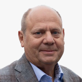
Ed Cesare
Venture Partner
SeaAhead
USA
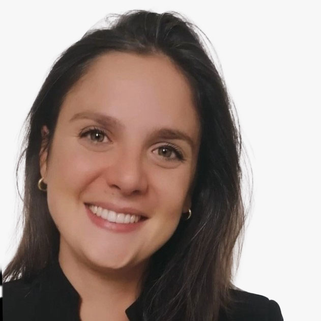
Francesca Piatto
Project Officer
EARSC
Belgium
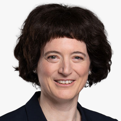
Gabriela Seiz
Senior Advisor
Seiz SG Advisory (on behalf of World Geospatial Industry Council WGIC)
Switzerland

Harmen Van Sprang
Co-founder & CEO
Sharing Cities Alliance
The Netherlands
Harmen van Sprang, a visionary speaker, author, researcher, and lecturer, is foremost a pioneering social entrepreneur. As aptly described by his daughter, 'My father works in the future', Harmen has been instrumental in founding several forward-thinking organizations and initiatives.
Through his 'Sharing Cities Alliance' foundation, he has collaborated with global cities such as Copenhagen, Cape Town, New York City, Washington DC, Seoul, and Singapore, fostering a network of shared knowledge and sustainable practices. His creative studio, 'Sentience', is at the forefront of devising innovative concepts and projects that cater to a diverse clientele, pushing the boundaries of conventional thinking.
With his 'Next Reality' network, Harmen unites leaders from both the public and private sectors in the Netherlands, delving into the vast potential and addressing the intricate challenges posed by transformative technologies like Extended Reality (XR) and Artificial Intelligence (AI).
Harmen's global influence is marked by his significant contributions to the sharing economy, where he has guided cities and corporations towards embracing more social and sustainable frameworks. His expertise as a co-author of an award-winning business book on the sharing economy further emphasizes his status as a thought leader.
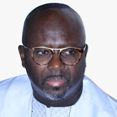
Ibrahima Cisse
Regional Director
Humanitarian OpenStreetMaps Team (HOT)- West Africa
Senegal
Dr Ibrahima Cisse is the Regional Director of HOT for the Open Mapping Hub in West and North Africa. He leads the team in the promotion, support and scaling up of Open Mapping work in 25 priority countries in the region. He has a wealth of experience and leadership in campaigning, research, engagement, communications and knowledge of the economic, political and socio-cultural context of the region. He is spreading the use of OSM tools throughout the region as a decision-making tool for better management of community and stakeholder issues.

John Nyberg
Director
IHO
Monaco
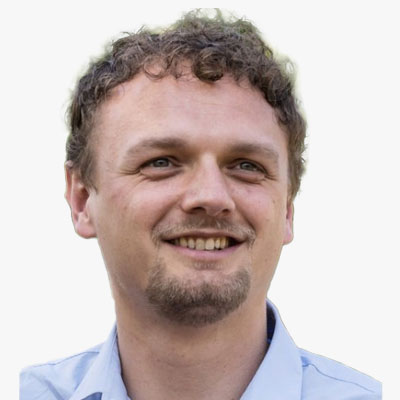
Jorn Dallinga
Program Manager
WWF
The Netherlands
Jorn is the Digital innovation lead and Forest Foresight program manager who has been working for WWF-Netherlands for almost 8 years. Over the last 4 years he has been working on data driven conservation and innovation projects within WWF and thereby leading the program 'Forest Foresight', where deforestation is predicted in order to tackle illegal deforestation. Within WWF, Jorn's focus is on exploring digital disruption solutions for complex conservation challenges with technical partners.
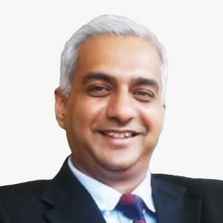
Jugal Makwana
Member
EFCA Digitalisation and BIM Committee
The Netherlands
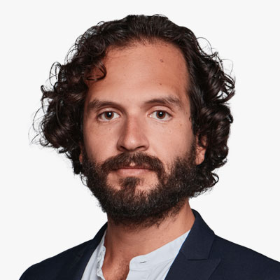
Karel van Oordt Montalvo
Project Coordinator
Eurocities
Spain
I am a strategic professional specialized in sustainable urban development, governance and infrastructure with more than 10 years of experience in the public and private sectors. Examples of my work include the operational, financial and innovation management of local and national urban development and infrastructure programs and policies. My passion is creating public value for global prosperity by working hand in hand with communities and their ecosystems.
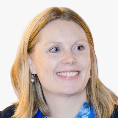
Kate Larkin
Head of EMODnet Secretariat
EMODnet
Belgium
With 15 years of expertise in marine science, Dr. Kate Larkin is a seasoned professional at the science-policy interface, specializing in marine data for evidence-based policy, Blue Economy operations, and conservation. Starting at the NOC, U.K., she earned her Ph.D. in deep-sea biogeochemistry and managed the EuroSITES open ocean observatories project. Later, as the Head of EMODnet Secretariat, Kate leads Seascape Belgium bvba's Marine Knowledge. Passionate about ocean literacy, she communicates complex issues through data and storytelling. In 2022, she contributed to citizen science in the Norwegian Arctic, showcasing her commitment to marine awareness and sustainability.
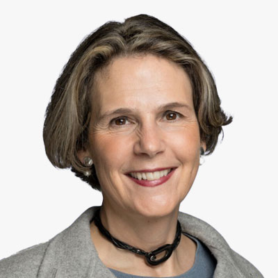
Laurence Janssens
COO
Hub Ocean
Belgium
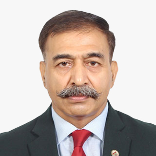
Lieutenant General Anil Kumar Bhatt, PVSM, UYSM, AVSM, SM, VSM
Director General
Indian Space Association (ISpA)
India

Lisa Simone de Grunt
Director of Programmes
World Ocean Council
USA

Lyndsey Hofmann
M.S., Education & Professional Development Coordinator
USGIF
USA
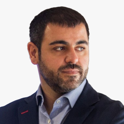
Marcos Martinez-Fernandez
Secretary General
EAASI (European Association of Aerial Surveying Industries)
Spain

N. Enkhjargal
Head of the Spatial Data Analysis Department
Center for Policy Research and Analysis
Mongolia
Dr. Enkhjargal Natsagdorj holds a Ph.D. degree in geoinformatics from Ghent University in Belgium. Prior degrees were earned at the National University of Mongolia (M.S.) for remote sensing and GIS and at the Mongolian University of Life Science (B.S.) for land management engineering in Mongolia. Currently, she is the director of the spatial data analysis department at the Centre for Policy Research and Analysis. Her organization serves on capital city government projects on geospatial data analysis. She is a board member and leader of the Technical Committee on GIS of the Mongolian Geospatial Association.

Nicholas Brown
Head of Office
United Nations Global Geodetic Centre of Excellence
Germany
Nicholas Brown is Head of Office at the United Nations Global Geodetic Centre of Excellence in Bonn, Germany. Nicholas works with Member States and organizations to strengthen their collective impact to enhance investment in the global geodesy supply chain, build capacity, and make geodesy and its benefit more visible and understandable to society.

Rosemarie Mijlhoff-Portier
Senior Consultant
Geonovum
The Netherlands
Rosemarie assists public and private organizations to initiate multi stakeholder partnerships or help them to break out of a deadlock. She accomplishes this through hands-on advice, on-the-job coaching and (scientific) research on organizational and collaboration issues.
For Geonovum she supports the learning processes of the use cases and the collaborating parties involved, on developing and embracing a Digital Twin as an instrument for policy and decision-making processes related to the spatial societal challenges the Netherlands faces. Therefor she developed a learning methodology which helps organizations to change to a digital twin-based way of working more easily. Rosemarie holds a PhD on public and private network collaborations, and a MSc. on governance and organizational sciences.

Sallie Payne Snell
Secretary General and Executive Director
Eurogeographics
Belgium
Sallie leads the EuroGeographics Head Office team and reports to the Management Board. She champions our members' data, services and expertise by building constructive partnerships with European and global stakeholders.
Sallie is also responsible for internal management and operational delivery, as well as coordinating membership and communications activities, and the Association's events programme, which includes the General Assembly.

Steve Hall
Head of Partnerships
Seabed 2030
UK
Steve Hall is an independent consultant working in the ocean science, technology, defence and policy fields. He is Chartered Marine Scientist & Fellow of the Institute of Marine Engineering, Science & Technology, a Fellow of the Society for Underwater Technology, and an elected Member of the Board of the Marine Technology Society. Steve has over three decades experience including being elected as vice-chair of the Intergovernmental Oceanographic Commission of UNESCO 2015-17 and helping develop the concept that led to the UN Decade of Ocean Science for Sustainable Development.
He worked 27 years for the UK Natural Environment Research Council mainly at the National Oceanography Centre, where his roles included seagoing tracer chemistry analysis, managing early Autosub AUV science missions, enhancing tsunami warning systems, leading the international office, and writing policy responses, position papers & drafting minister's responses on a wide range of ocean subjects from fisheries & marine spatial planning to nuclear submarine decommissioning and new marine legislation. Steve left the public sector in 2017 to become CEO of the Society for Underwater Technology, and later CEO at Pembrokeshire Coastal Forum & Marine Energy Wales, before moving into freelance consultancy. His main client is the Nippon Foundation-GEBCO Seabed 2030 project where he leads on partnerships with industry, and he also works on UN Ocean Decade-related projects, advice to industry clients, and pro-bono support for ocean Learned Societies, Charities and Professional Bodies.
Steve is also a podcaster, having established SUT's Underwater Technology Podcast and latterly the Seabed 2030 Podcast; and is a licensed drone operator providing video & stills footage for clients in the archaeological and environmental imaging sector.
Research and Academia

Arianna Vettorel
Adjunct Professor - New Space Law
University of Venice
Italy

Christophe Hoegaerts
Research Manager, Intelligent Imaging Department
TNO
The Netherlands

DAVID VAN RIPER
Director, Spatial Analysis
IPUMS, University of Minnesota
USA
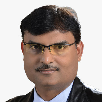
Dheeraj Kumar
Dy. Director and Project Director
IIT (ISM) DHANBAD
India
Prof. Dheeraj Kumar is the Project Director of TexMin Hub (Mining Innovation Hub set up by Govt. of India). He is also Deputy Director at IIT (ISM) Dhanbad. Prof. Kumar is the founding Director of TEXMiN Foundation and ACIC Foundation (Section 8 Companies set up with support from DST and NITI Aayog, respectively). Prof. Kumar is a Mine Surveying & Geomatics Professor at the Department of Mining Engineering, IIT (ISM) Dhanbad. He completed his M. Tech from IIT (ISM), Dhanbad, and PhD from IIT Kharagpur. He has more than 20 years of experience in teaching & research at various organizations. His areas of expertise include Surveying, Geomatics, Rock Excavation Engineering, and IT Application in different earth science domains. Dr Kumar has published more than 70 technical research papers in various international/national journals, including seminars/symposiums, and presented several papers at conferences in India and Abroad. Dr Kumar has authored several books and chapters in Advances in Mine Surveying and Application of IT in Mining. He has already completed more than 60 industrial consultancy projects sponsored by various mining & allied industries for solving their real-life mining projects. He has completed six research projects in different areas of Mining and Earth Science. Dr Kumar has conducted several Executive Development Programmes (EDP) and trained over 550 mining executives on various mining and allied disciplines for different organizations. NTPC Ltd., NHPC Ltd., Coal India Ltd., Oil India Ltd., Tata Steel, Atlas Copco, Infosys, Vedanta, IMFA, Indian Oil Corporation. He is a recipient of the National Merit Scholarship; Meritorious Scholar award at IIT Kharagpur in three consecutive years, i.e., 2000- 2001, 2001-2002 and 2002-2003; "CSIR Foreign travel Grant" and "Hindustan Zinc Limited Award" by the Institution of Engineers (INDIA). Dr Kumar has been a recipient of the SBI 2nd Best Researcher award for five consecutive years 2012-13, 2013-14, 2014-15, 2015-16, and 2016-17.
Dianah Rose Abeho
Researcher, Division of Geomatics, School of Architecture, Planning and Geomatics
University of Cape Town
South Africa
Dianah Abeho is a researcher and academic scholar at Makerere University Kampala in Uganda. She is also a managing partner at Scape and Surveys Associates (SSA), one of the leading land surveying firms in Uganda with all competencies in Geomatics and Land Management. Dianah holds a BSc (Geomatics and Land Surveying), MSc (Geodesy) and she is currently a PhD student at the University of Cape Town. Her research focuses on the use of Unmanned Aerial Vehicle (UAV) imagery and Machine Learning (ML) for cadastral surveying, with a focus on community-based approaches. She is a certified drone pilot and licenced surveyor in Uganda registered with the Surveyors Registration Board (SRB) and a professional member of the Institution of Surveyors of Uganda (ISU). Dianah is engaged in multidisciplinary research including the application of modern space-based positioning techniques for Geomatics and the built environment, fit for purpose technologies in capturing and managing land records for land registration and the application of advanced digital photogrammetry and ML for property boundary documentation.
Elnaz Neinavaz
Assistant professor
ITC, University of Twente
The Netherlands
Dr. Elnaz Neinavaz is an assistant professor at ITC/University of Twente. She has a background in thermal infrared remote sensing, focusing on biodiversity. She possesses practical expertise in using laboratory and field instruments for measuring vegetation biophysical and biochemical variables and investigating alterations in land surface temperature as a proxy for climate change-related extreme events affecting biodiversity and forest ecosystems.
Gp Cap Chamnan Kumsap
Director, Knowledge Management and Publication
Defence Technology Institute
Thailand
Group Captain Chamnan Kumsap graduated from the RTAFA and served the Armed Forces in the geo-spatial mission. He received MSc in GIS from the University of Edinburgh and completed his PhD in Remote Sensing and GIS from Asian Institute of Technology. Resigning from the Armed Forces, he applies geo-spatial techniques to research projects at Defence Technology Institute. His awards to endorse his contributions to the geo-spatial technology include the Best Paper Award at the International Defence and Homeland Security Simulation Workshop in 2016 and the Winner of The Call for Innovation at the Southeast Asia Water Security - IWRM Regional Conference in 2023.
Hamed Alemohammad
Director, Center for Geospatial Analytics, Associate Professor
Graduate School of Geography
Clark University
USA
Hamed Alemohammad is an Associate Professor in the Graduate School of Geography and Director of Clark Center for Geospatial Analytics at Clark University. He is an interdisciplinary scientist with expertise in remote sensing, earth science, and artificial intelligence (AI). Hamed has been the PI for several projects focused on developing novel AI models for multispectral, microwave and synthetic aperture radar (SAR) satellite observations. Prior to Clark University, Hamed was the Chief Data Scientist and Executive Director at Radiant Earth Foundation where he established and led the development of Radiant MLHub - the open-access repository for geospatial training data and AI models. He received his Ph.D. in Civil and Environmental Engineering from MIT.

Johanna Karvonen
Project Manager, Artificial Intelligence Based Virtual Control Room for the Arctic (AI-ARC)
Laurea University of Applied Sciences
Finland
Ms. Johanna Karvonen, Project Manager for the AI-ARC project, is currently working at Laurea University of Applied Sciences (FIN) coordinating Horizon Europe funded projects within the Civil Security for Society domain. Her expertise lies in Security research, with a primary focus on European Critical Infrastructure Resilience and Border Security in the Maritime domain. Additionally, she is involved in projects related to Hybrid Threats, Inter-authority Cooperation, and Cybersecurity. Ms. Karvonen has 15 years of experience working with international research projects in Higher Education Institutions. She has a MSc in Political Science and European studies from Abo Akademi University.

John P. Wilson
USC Professor and Founding Director
Spatial Sciences Institute, University of Southern California
USA
Josef Strobl
Department of geoinformatics
University of Salzburg
Austria
Katherine Cooke
Senior Technical Policy and Sustainability Consultant
Oxford Policy Management
UK

Laise Harris
Senior Researcher Informatics and Programme Lead Land Mapping
Manaaki Whenua Landcare Research
New Zealand

LEN KNE
U-Spatial Associate Director
University of Minnesota
USA

Meghna Sengupta
Postdoctoral Researcher
Leibniz Centre for Tropical Marine Research (ZMT)
Germany

Mila Koeva
Associate Professor
University of Twente
The Netherlands
Dr. Mila Koeva, an Associate Professor at the University Twente's International Institute of Geo-Information Science and Earth Observation (ITC) in The Netherlands, is a distinguished figure in the field of geospatial science. Holding a Ph.D. in "3D modelling in architectural photogrammetry" from the University of Architecture, Civil engineering, and Geodesy in Sofia, along with an MSc. degree in Engineering (Geodesy), she brings extensive expertise in 3D land information, Digital Twins, and 3D Cadastre.
With a career spanning a decade as a photogrammetric specialist and department head, and three years in a private organization leading EU projects, Dr. Koeva's focus lies in innovative geospatial and machine learning methods for 3D urban modeling and cadastral applications. Her leadership in the EU Horizon 2020 project its4land underscores her commitment to multidisciplinary collaboration.
Recognized for her scientific contributions, Dr. Koeva actively participates in international professional organizations, chairing working groups, and organizing scientific events. Her engagement extends to guest lectures, keynote speeches, and editorial roles for various publications, reflecting her dedication to advancing the field. As a teacher, she has been acknowledged as one of the top educators at ITC, further showcasing her commitment to education and mentorship in the geospatial domain.

Miriam Olivares GISP
GIS Librarian Computational Methods and Data, Yale University Library
Yale University
USA
With over two decades of geospatial expertise, Miriam Olivares, GISP leads the GIS support services at Yale University, instructing and advising on geospatial applications to promote cutting-edge teaching and research. Her interdisciplinary collaborations, scholarly, and consulting work touch upon geospatial data management, GIScience, supply chain, natural hazards, and marine conservation. Olivares geospatial service includes membership in the Leventhal Map & Education Center's Board of Review at the Boston Public Library, at the Advisory Board of the Academic Network of the United Nations initiative on Global Geospatial Information Management (UN-GGIM): Americas, and Connecticut GIO's GIS Strategic Plan and GIS Clearinghouse Workgroups. She co-founded and co-chairs GIS LATAM and served as a director on the University Consortium for Geographic Information Science board.
Peter Baumann
Professor & CEO
Constructor University
Germany
Peter Baumann, a distinguished figure in the field of Computer Science, is a Professor at Jacobs University Bremen and the visionary CEO & founder of rasdaman GmbH, based in Bremen. Renowned for pioneering Array Databases, his contributions span data models, query languages, storage optimization, and applications in diverse fields such as earth, space, and life sciences. Actively involved in standardization efforts for spatio-temporal geo services (OGC, INSPIRE, ISO) and Array SQL (ISO), Dr. Baumann's career balances scientific innovation with practical industrial applications. As the principal architect of the APRIL object-oriented database system during his PhD at Technical University Darmstadt, he laid the foundation for his groundbreaking work in large, multi-dimensional raster datasets and the development of rasdaman, the world's first operational Array Database System. Dr. Baumann's achievements extend to patenting his concepts globally and leading influential working groups in OGC, showcasing his commitment to advancing the field.

Refiz Duro
Scientist
AIT Austrian Institute of Technology GmbH
Austria

Salil Goel
PhD, Assistant Professor
Department of Civil Engineering (Geoinformatics), Department of Aerospace Engineering (Adjunct), IIT Kanpur
India
Salvatore Amaduzzi
Professor
University of Udine
Italy
Salvatore Amaduzzi, an Associate Professor at the University of Udine, is a dedicated professional with a profound passion for Location Information and Spatial Technologies. Serving as the Deputy for Sustainability at the University of Udine, he is also a shareholder of AiperTech, a prominent Artificial Intelligence spinoff from the university. With a background as a Project Manager for industry and public administration initiatives, Salvatore possesses a broad skill set and extensive expertise in the integration of geospatial applications across various industry sectors. As a lecturer in numerous universities worldwide, he contributes significantly to the dissemination of knowledge. Currently, Salvatore is engaged in pioneering projects involving the utilization of wearable devices for field services activities, focusing on smart glass, watches, and more.
Shaily Gandhi
Principal Researcher
Geo-Social Analytics Lab, University of Salzburg
Austria
Shaily is a Principal Researcher at Geo-Social Analytics Lab, Department of Geoinformatics - Z_GIS, University of Salzburg. She is a GIS expert with more than 12 years of experience. She has a PhD from CEPT University, India in Geospatial Technology and has expertise in bridging the gap between GIS & governance.
Shaily has been awarded the Geospatial World 50 Rising Star for the year 2023 by Geospatial World and ISC Fellow for 2024. She has been Deputy Center Head for Center for Applied Geomatics, CRDF, India till March 2024. She has also served as the Program Chair for the M.Tech program in Geomatics at the Faculty of Technology from March 2022 till October 2023. Shaily is an executive committee member for the Committee on Data of the International Science Council (ISC) and Joint Secretary of ISRS (2022-24) and ISG (2023-25), Ahmedabad Chapter. She was the student branch counsellor for the IEEE GRSS Student branch at CEPT University (2022-24). She has contributed to important research projects as a Data scientist and GIS expert with different centers at CRDF. She works closely on projects with IGSTC, DST, GIDB, ISRO, GIZ, CODATA, MHT and Nagoya.
Shaily is keen on exploring the implementation of GIS and data science in the domain of Urban Analytics. Her core interest lies in exploring spatial technology for better decision-making along with defining spatial data standards for data interoperability for building future cities. As Principal Researcher Shaily brings extensive experience to bear on GIS and data science.

Sheila Steinberg
Director Geospatial Institute
UMass Global
USA
Dr. Sheila Lakshmi Steinberg is an author, educator and advocate for the applied use of GIS across disciplines. Dr. Steinberg is President for the Southern California Chapter of URISA 2023. Sheila leads the integration of innovative geospatial concepts and curriculum design into micro-credentials, certificates and programs at UMass Global. She is a co-author of Resilient Communities Across Geographies Esri Press (2021) and GIS Research Methods for Esri Press (2015); Extreme Weather, Health and Communities: Interdisciplinary Engagement Strategies for Springer Press (Springer Press 2016). Steinberg is a keynote speaker at professional conferences and international meetings and creates partnerships for how to use GIS to solve problems. Her research focuses on the connection between people, places and environments considering local knowledge, networks and the power of community engagement using GIS.

Siqin (Sisi) Wang
Associate Professor (Teaching)
University of Southern California
USA
Siqin (Sisi) Wang, Ph.D., is an Associate Professor (Teaching) of Spatial Sciences with the Spatial Sciences Institute in the Dornsife College of Letters, Arts and Sciences at the University of Southern California.
Dr. Wang's research interests are in GIScience, spatiotemporal big data analytics, computational social science, digital health geography, human-centered GeoAI, human mobility and migration, smart cities and human-climate interactions and she has published extensively in these areas. Her co-first author 2021 paper on human mobility and COVID-19 transmission received the 2022 Best Paper Award and Most Downloaded Paper from the Annals of GIS in 2023.
Her professional roles include service as the Associated Chair for the Spatial Data Lab affiliated with Harvard University and as Vice Chair of the Young Scientist Innovation Network for Digital Earth of the International Society for Digital Earth.
Prior to joining the USC Spatial Sciences Institute, Dr. Wang was an Adjunct Senior Lecturer at the Royal Melbourne Institute of Technology, Australia, and an Honorary Lecturer/Research Fellow with the University of Queensland, Australia. From April 2022 to July 2023, she also was a JSPS Research Fellow with the University of Tokyo, Japan, researching healthcare access and social vulnerability in the post-COVID Japan.

Thomas Blaschke
Head of Department of Geoinformatics
University of Salzburg
Austria
Thomas Blaschke is a Professor at the University of Salzburg and Deputy Head of Department of Geoinformatics - Z_GIS. He also acts as the director of the Doctoral College GIScience and serves at various editorial boards and commissions including ISPRS and the ESA Earth Observation advisory board. His research interests include methodological issues of the integration of GIS, remote sensing and image processing also with aspects of citizen participation and human-environment interaction. Prior positions comprise several lecturer, senior lecturer and professor positions in Germany, Austria and the UK as well as temporary affiliations as guest professor and visiting scientist in Germany and the US including a Fulbright professorship. His academic record yields 370+ scientific publications including 130 journal publications.

Tracy Whelpley
SVP of Business Attraction
Greater St. Louis, Inc.
USA
Tracy Whelpley is Senior Vice President of Business Attraction at Greater St. Louis, Inc. -an alliance of business and civic leaders working together to create jobs, expand inclusive economic growth, and improve the St. Louis region's global competitiveness. Tracy is responsible for implementing highly targeted marketing initiatives that compel corporate executives and entrepreneurs to explore the advantages of investing and locating within the St. Louis metro.
Tracy is also a champion for the region's GeoFutures Strategic Roadmap, a 10-year action plan that channels the collective action of leaders across public, private, academic, and government spheres to establish St. Louis as a premier destination for geospatial innovators to collaboratively unlock industry opportunities and forge solutions to the world's most pressing challenges.
Before joining Greater St. Louis, Inc., Tracy held various agency roles, leading brand marketing communication teams to drive awareness and revenue objectives for multinational corporate clients, including Bayer Crop Science and Enterprise Mobility.
Ms. Whelpley earned her Bachelor of Journalism from the University of Missouri-Columbia and her Master of Business Administration from the University of Missouri-Kansas City.

William Gilles
Cofounder and President
IMODEV
France
Doctor of Laws, William Gilles is a tenured and senior associate professor (HDR) of Digital law and Open Government at the Sorbonne Law School (University Paris 1 Pantheon-Sorbonne) where he is the director of the 2-year master's degree in data law, eGov and open Gov. Qualified to direct research, he is also the supervisor of several PhD Students in data law, in artificial intelligence law and in open government issues.
He is the cofounder and President of IMODEV (the Institut du Monde et du Developpement pour la Bonne Gouvernance Publique), an international academic network that analyzes public policies in the digital society, especially regarding fundamental rights, data law and smart governance. He is a member of the Sorbonne Legal Research Institute (IRJS) and of the Sorbonne Observatory on Artificial Intelligence. He is a former member of the board of the Sorbonne Law School, and a former member of the Academic Board of the University Paris 1 Pantheon-Sorbonne, where he served on the Research Council of the University.
William Gilles is also attorney at Law at Paris Bar, and professional mediator accredited by the French National Center for Mediation by Attorneys at Law. He is founder and President of BeRecht Avocats. William Gilles is a former lawyer at the French Constitutional council (2009-2011). He is the director of the International Journal of Open Government, and of the International Journal of Digital and Data Law.
His research focuses on : 1. digital law (data law, ethic and law of artificial intelligence, right to privacy and data protection, cybercrime, fundamental rights in the digital society); 2. open government (open data, right of access to information, government transparency, citizen participation, government accountability, but also mediation and collaborative lawyering and contributive negotiation that he considers as a need for an open justice), and 3. smart government issues (eGovernement, smart cities and governments).
William Gilles has organized and delivered conferences in Europe (12 countries), in America (Brazil, Colombia, Mexico, USA), and in Asia (Vietnam). His last book has just been published and deals with the new right to open data (W. Gilles, I. Bouhadana, L'open data. Droit d'acces et de regulation dans la societe des donnees, LexisNexis, Nov. 2023, 490 pages).
Industry

Aditya Chaturvedi
Deputy Executive Editor
Geospatial World
India
Agendra Kumar
Managing Director
Esri India
India
An industry veteran with over three decades of experience in the IT industry, Agendra has been promoting the use of geospatial technologies in the country. Under his leadership, Esri India has partnered with numerous government and private organizations to execute critical and transformative projects using Esri's GIS (Geographic Information System) technology.
Before joining Esri India, Agendra held leadership positions at Silicon Graphics, Veritas Software, and Symantec.
He has also made significant contributions to the geospatial industry as President, Association of Geospatial Industries (AGI), and Chairman, FICCI Committee on Geospatial Technologies.
Agendra holds M.Sc. (Hons.) in Mathematics and Master of Management Studies (MMS) degrees from BITS, Pilani.

Alan Devenish
Solution Engineer
Esri
The Netherlands

Albert H. Anoubon Momo
Co-founder and CEO
GeoDEV International
USA
Alberto Meroni
Business Development Manager - Imagery and Remote Sensing
Esri
Italy

Alex Gow
Sales Director
SatelliteVu
UK

Alexander Deboutte
Global Account Manager & Business Development
Pozyx.io

Alexander Gunkel
Founder & Managing Director
Space4Good
The Netherlands

Alexis Conte
Manager
Novaspace
France
Ali Al Shehhi
Director
National Space Science and Technology Center
UAE
Ali Al Shehhi is a distinguished leader with over three decades of experience in aviation, geospatial, and space technology. Graduating with a Bachelor's degree in Aviation Science and a Master's degree in Management and Communications, Ali has demonstrated a remarkable aptitude for innovation and project management throughout his career.
As the former head of the Space Reconnaissance Center in Abu Dhabi and current Director of the National Space Science and Technology Center at UAE University, Ali is committed to advancing scientific discovery and technological innovation. An esteemed keynote speaker, his insights and expertise are sought after globally, making him a driving force in shaping the future of space-tech and space new economy strategies.

Amanda Markert
Associate Lead of Weather & Climate Resilience
SERVIR Global
USA
Amar Nayegandhi, CP, CMS, GISP
SVP
Dewberry
USA
As Senior Vice President, Amar Nayegandhi, CP, CMS, GISP leads the Geospatial and Technology Services group at Dewberry and provides program oversight for the execution of all remote sensing projects nationwide. An expert in topographic and topobathymetric lidar data acquisition and processing, Amar was the Director of the American Society for Photogrammetry and Remote Sensing (ASPRS) Lidar Division and was appointed as an ASPRS Fellow in 2024. He co-edited the ASPRS DEM User's Manual, 3rd Edition, and authored the chapters on Airborne Topographic Lidar and Airborne Lidar Bathymetry. Amar co-authored the USACE EM 1110-1-1000 Manual on Photogrammetric and Lidar Mapping.
Amar has presented his research and technological findings at 100+ international conferences and technical workshops, including an invitation from the USGS to present the industry perspective for the USGS 3D Elevation Program at the United Nations World Geospatial Information Congress (UNWGIC) in Deqing, China. Amar has authored 16 manuscripts in various international journals and 65+ data series and reports for the USGS. He has a Bachelor's in Electrical Engineering from the University of Mumbai and a Master's in Computer Science from the University of South Florida. He is an ASPRS Certified Photogrammetrist and Certified Mapping Scientist, and a GIS Professional.

Amy Rose
Technical Director
Overture Maps Foundation
USA
Amy Rose is technical director at Overture Maps Foundation. She had dedicated several decades to the geospatial domain designing, building, and deploying geospatial data and technology solutions for human health and security, environmental remediation, logistics, and transportation planning projects. She's worked in the academic and private sector, in government ecosystems, and most recently at Oak Ridge National Laboratory where she worked with interdisciplinary teams to model and map the built environment and highly resolved estimates of human population at global scale.
Amy received her PhD in Geography from The University of Tennessee and an MS in Geography with a graduate minor in Logistics and Transportation.

Anandi Mathur
Product Development Executive
Geospatial World
India

Ananyaa Narain
VP - Consultancy
Geospatial World
India
Currently employed as Vice President - Consulting at Geospatial World, Ananyaa Narain, an economist by education, is a leading thought leader in the socio-economic and market research space for geospatial, BIM, and frontier technologies worldwide. She was recognized as a 40U40 geospatial professional for 2020 by xyHt, and a Geospatial Rising Star 2022 by Geospatial World. Over her eight years of experience in the geospatial technology domain, she is recognized for her result-oriented approach to exploring the impact of the cross-linkage of technology, economics, and policy using varied qualitative and quantitative tools and frameworks. Her professional expertise includes working with cross-sectoral and interdisciplinary stakeholders across technology, academia, and government stakeholders for market size and forecast assessment, socio-economic impact evaluation, developing national policy and governance frameworks, and initiating and contributing to global technology and policy dialogue and debates through research reports and articles, and conference convening.

Antonio Mendes
Mobile Mapping Solutions Manager
Hexagon
UK
Antonio Mendes is a thought leader in the digital construction industry, driving innovation and pushing boundaries with his expertise in reality capture technology. As the Mobile Mapping Systems (MMS) Solutions Manager at Leica Geosystems, Antonio has spent more than two decades perfecting his his skills in geospatial engineering.
Antonio's wealth of experience as a Geomatic Engineer gives him a deep understanding of the industry, enabling him to specialise in mobile mapping systems since its inception in 2011. His work has played a significant role in the evolution of the mobile mapping industry.
Antonio is passionate about guiding new and established professionals towards the next revolution in mobile mapping. His vision and leadership have helped countless individuals reach new heights in their careers, and his impact on the industry is immeasurable. As a thought leader, Antonio Mendes is an inspiration to all those striving to push the boundaries of what is possible in the digital construction world.
Archita Shaktawat
Industry Manager - Market and Economy
Geospatial World
India
Archita Shaktawat, Industry Manager at Geospatial World's consulting division, specializes in Market and Economy. With an engineering background and expertise in remote sensing, she's a driving force behind syndicate reports, business consulting, and Industry Profile Module enhancements. Archita's proactive analysis of market drivers reflects her commitment to fostering a vibrant and sustainable geospatial ecosystem.

Arkadiusz Szadkowski
Senior Business Development Manager
Esri
Norway

Arpan Sahoo
Chief Operating Officer
KaleidEO
India

Ashish Kumar Mittal
General manager
ESRI
India
Avinash
Sr. Vice President
DSM SOFT
India

Begona Verdejo Herrreras
Senior Business Development Engineer EMEA Government, Transportation, and Defense Division
Hexagon
Spain
My name is Begona Verdejo Herreras, I have a degree in Geodesy and Cartography from the Polytechnic University of Madrid. I have been working in the Geospatial industry inside Hexagon for more than 30 years in different sectors for the EMEA region, managing projects in Defense, Government, Transportation and lately in Sustainable projects and urban digital twin's developments. My experience is mainly doing pre sales activities and also business development but had worked in other departments, such as support, product development and training. I collaborate very closely with R_Evolution, the green division of Hexagon that works in sustainable disruptive initiatives and specially I have lead the Green Cubes initiative.

Bharadwaj Pulugundla
Business Development Partner
Verizon Enterprise Solutions
The Netherlands

Brian Pendergast
Customer Success Manager
UP42
Germany
Brian has been a Customer Success Manager at UP42 for 2 years. With a background as a GIS analyst, he has experience in creating insights from geospatial data. While at UP42 his focus has shifted upstream to helping customers find the data they are looking for. This involves listening to, understanding and advocating for the customer needs both internally at UP42 and with the many UP42 data partners. In managing archive and tasking projects with customers, Brian is involved in the entire project lifecycle, helping them leverage the full potential of the UP42 ecosystem.

Cheng-Kai Wang
Senior Geo-ICT Software Developer
Royal HaskoningDHV
The Netherlands
Cheng-Kai collaborates closely with domain experts, creating digital solutions to address pressing issues like achieving a net-zero society, transitioning to sustainable energy, and climate adaptation. He seamlessly integrated geospatial expertise with urban building energy modelling by employing a pragmatic data-driven approach. Cheng-Kai plays a pivotal role in incubating geospatial web applications for real-world projects in energy transition and climate adaptation, with one solution contributing to 30 Dutch heat transition projects and facilitating over 70 feasibility quick scans for district heating systems.
Chris Andrews
COO
Rendered.ai
USA

Christian Sevcik
Manager, Strategic Software Alliances
RIEGL
Austria

Christian Williges
Lead Earth Observation Programs
Reflex Aerospace
Germany
Christian, a passionate space enthusiast and seasoned business development professional, has been a driving force in the NewSpace industry since 2018. As the founder of New Space start-ups, he translates visionary strategies into tangible market success. With a proven track record, Christian excels as a dynamic sales strategist, conducting thorough market assessments, developing robust product-market fit strategies, and orchestrating comprehensive marketing initiatives. His leadership at the German Aerospace Center (DLR) for over five years showcased exceptional managerial skills, where he led interdisciplinary teams in delivering international flagship projects with precision. Christian's enduring client relationships and successful sales campaigns underscore his commitment to space innovation.
Clinton G. Johnson
Racial Equity and Social Justice
Esri
USA

Colonel (Ret.) John Kedar FRGS, FInstRE, CGeog(GIS)
Director
John Kedar Geospatial Initiatives Ltd
UK
John Kedar is a strategic advisor to Governments on "The Power of Where?" He advises on strategy and policies to maximise national value from the rapidly developing location ecosystem and geospatial information. These countries are diverse, from Tonga to the Honduras, the Kingdom of Saudi Arabia to Ukraine, Burkina Faso to Jersey. This includes utilising the United Nations Integrated Geospatial Information Framework, in which he is considered a global expert.
Elsewhere, John led the partnership board developing the future geospatial concept 'Geospatial Knowledge Infrastructure', sits on the International Advisory Committee for the United Nations Global Geospatial Knowledge and Innovation Centre and chairs the Audit and Risk Committee of a major UK charity.
In his past life, John was Director International Engagement, Ordnance Survey, building key relationships with UK and international governments and international organisations. He also opened new international markets for Ordnance Survey across 3 Continents. Prior to this, John served 30 years in the British Army, spanning a range of engineer, geospatial, intelligence roles and frequently deployed on military operations. He commanded the Joint Aeronautical and Geospatial Organisation, UK Defence's premier geospatial intelligence organisation, developed Defence policy for geospatial information and represented UK on the European Union Satellite Centre Board.
Dato Gs Azhar Ismail
CEO
MAP2U SDN BHD
Malaysia
Denis Hains
President & CEO
H2i
Canada
Denis Hains is the founder, President & CEO of H2i. He is the former Director General of the Canadian Hydrographic Service, and Hydrographer General of Canada. Currently, he is the Community Co-Lead of the Global Hydrospatial Movement Club. He also contributes actively in a "Pro Bono" manner as Member of the Strategic Advisory Group of The Nippon Foundation-GEBCO Seabed 2030 Project, President, Board of Directors CIDCO, Special Senior Advisor Canadian Ocean Mapping Research & Education Network, etc.

Doyi Kim
Research Scientist
SI Analytics
South Korea
Doyi advances disaster management through satellite imagery and AI. Her expertise includes deploying deep learning techniques like video prediction, generation models, and weather observation datasets to enhance nowcasting skills for heavy precipitation events. Her work ensures swift processing of vast data, facilitating rapid weather predictions. Doyi has earned first prize in the GeoNet challenge at ICCV23 and a special prize in the Weather4cast challenge at NeurIPS22, showcasing domain adaptation, robust learning across geographies in computer vision, and rainfall prediction.

Elly Perets
CEO
ASTERRA
Israel
Elly Perets is a dynamic CEO and executive leader with a stellar track record in enterprise software sales, marketing, and business development across diverse industries. A seasoned team builder, Elly excels in startup environments, driving cultural change, and fostering international operations. With expertise in software, SaaS, capital equipment, and fundraising, Elly is a visionary strategist. Known for establishing global sales forces, alliances, and partnerships, Elly is a developer and executor of go-to-market business models and pricing strategies. Their unique knowledge spans retail, finance, manufacturing, education, pharma, and more, coupled with a talent for translating customer needs into innovative solutions.
Eng. Sultan AlShahrani
Assistant Executive Director of Geodesy
GEOSA
Saudi Arabia
Eng. Zeyad Ashanqity
Manager of Installing Tide Gauge Stations
GEOSA
Saudi Arabia

Fang Fang
Geoinformation and Earth Observation Specialist
NEO
The Netherlands

Filipe Pinto
Business Development
TopoDOT
Portugal
Filipe Pinto, a dedicated TopoDOT consultant and Sales Manager, brings a wealth of expertise and enthusiasm for geotechnology and geosciences. Holding a degree in Surveyor Engineering and a Master's Degree in Science and Geographic Information Systems, Filipe has accumulated 14 years of experience in laser scanning, mobile mapping, reality modeling, surveying, drones, LiDAR, 360° imagery, 3D mapping, and GIS. With a robust background collaborating with public organizations and AEC companies across Europe and Latin America, Filipe has played a pivotal role in diverse projects involving reality capture and modeling. In his current role at TopoDOT, Filipe is passionately dedicated to promoting and implementing TopoDOT solutions worldwide, helping AEC companies enhance their workflows and accelerate project delivery through the efficient management, analysis, and sharing of 3D data. Filipe is committed to assisting users in building accurate Digital Twins by leveraging the power of TopoDOT's comprehensive workflow and facilitating the integration of data from various sensors and systems.

Garrett Synnott
Senior Director
Cognizant
Ireland
Garrett Synnott has over 25 years expertise across Supply Chain & Field operations with 8 Years managing Field Operations and Location based Services globally.

Gastao De Figueiredo
SVP, GM Geospatial Intelligence
Blackshark.ai
USA
Gastao leads the geospatial intelligence product line for Blackshark.ai - the fist commercial company to detect every building on the planet using AI/ML applied to satellite and aerial imagery and construct a photorealistic 3D digital twin.
He previously held leadership positions at Microsoft, Apple and Sun Microsystems. Gastao is originally from Rio de Janeiro, Brazil and holds a BS in Electrical Engineering and an MSc in Computer Sciences.

Gopika Suresh
Chief Strategy Officer (CSO) and Co-Founder, Head of Products and Strategy
Marble Imaging
Germany
Dr. Gopika Suresh is an Earth Observation (EO) & Synthetic Aperture Radar (SAR) scientist with more than 14 years of experience developing algorithms and methods to exploit EO data for land, forest, marine, coastal and disaster response applications. Having discovered the gaps in present EO data & solutions, she co-founded Marble Imaging, which aims at becoming Europe's first provider of VHR data acquired from its small satellite constellation and is CSO and head of products where her Team develops cutting edge EO based analytics & solutions for real-world challenges.
Born in a coastal town in the south of India, she has a Bachelor of Technology in Electronics and Communications Engineering from the University of Kerala, India, a MSc in Satellite Applications engineering from the Technical University of Munich, Germany and a PhD in marine Geosciences from the University of Bremen. For her PhD, she developed the first automatic SAR based system to detect marine oil slicks in SAR images and estimate their source hydrocarbon seeps. Since then she has worked as a scientist for the German Federal Agency for Cartography and Geodesy, as a postgrad lecturer at the Frankfurt University of Applied Sciences, a postdoc at the Earth Observatory of Singapore and recently led the team for geospatial solutions at Unique Land use GmbH, where her team developed EO based solution for the forestry and land use sector She was selected as a Geospatial World's 50 rising stars in 2021, a leading woman in ML4EO by the Radiant foundation in 2021 and is the co-organiser of the Sisters of SAR initiative. And she does all this while bringing up a 3 year old toddler and her newborn 2024 baby.
Haitham Harras
CEO and Founder
Penta-b
Egypt
Eng. Haitham Harras is the Founder CEO of Penta-b, a GIS specialized company that focuses on GIS professional services provision and the owner of the first GIS products in middle-east.
Haitham was graduated from the faculty of computers & information sciences, Ain-Shams university , 2004 and started his career in ESRI until 2012; through his work in ESRI, Haitham has moved in different position starting from technical development, going through team leading, products management and projects management and moved for some time to work in the core team in ESRI US.
Haitham Founded Penta-b in 2013 with a vision to be the first GIS vendor in Middle-east and has succeeded to develop a clear foot print in the market with clear competitive edges, Penta-b owns a ready-made state-of-the-art off the shelf product from the technical and commercial perspectives. Penta-b was founded with 3,000 USD capital and now valued with more than 20 M USD with success track record in huge enterprise governmental accounts in Egypt & Gulf.
Hannah Brocke
CSO
PlanBlue
Germany
Hannah Brocke is co-founder and COO of the company planblue, which develops underwater satellites to build up a global seafloor database at high detail. Why the seafloor It plays a key role in tackling the main issues we face today: climate change, biodiversity loss and plastic waste pollution. Planblue combines AI with advanced imaging (incl. hyperspectral) and underwater navigation. Via its seafloor database, planblue enables the sustainable use and conservation of our oceans resources.
Henk Scholten
Director Research
Geodan
The Netherlands
From 1990 till 2021 he was professor at the Faculty of Economics and Business Administration, holding the chair of Spatial Informatics. From 2021 he is Guest Professor at the Vrije Universiteit. From 2017 till 2021 professor Scholten was Lead Scientist at the Joint Research Centre (JRC) to develop novel CAS (Centre for Advanced Studies) projects on Digital Transformation - Machine Intelligence and Human Behaviour. In this function, he established project plans contributing to high profile scientific results.
He was honoured in 2016 with the Lifetime Achievement Award by Geospatial Media and Communications for his contribution to the overall development of GIS/geospatial community worldwide. Together with his Research team he won the prestigious BIM World Digital Twin Award in Paris in 2023 and 2024.

Hermen Westerbeeke
Director
The Daria Group
Germany
Hesham Gamal Gaafar
Digital Twin - AEC Development Manager
Esri Saudi Arabia
KSA
Hesham, a Digital Twin expert and Spatial Computing innovator, holds a Master's degree in Engineering. As a Certified BIM professional and Industry Leader at Esri SA, he brings over a decade of experience in digitalizing the AEC sector. Specializing in leading complex digital twin systems worldwide, Hesham integrates GIS, BIM, and more for mega projects.

Jasper Habermehl
Manager Data & IoT
Allinq
The Netherlands
Javed Shaikh
Technical Director
Quantasip
India
With over a decade of dynamic experience in development, process optimization, and operations management, Javed Shaikh is a results-oriented professional known for driving bottom-line profitability through strategic resource utilization. As a skilled strategist, he excels in overseeing entire operations to enhance efficiency and meet organizational goals within stringent parameters of cost, time, and quality. Javed Shaikh has a proven track record in successfully ramping up projects, collaborating closely with clients to ensure exceptional service delivery, and finalizing technical specifications across diverse projects. Proficient in GIS, LBS, CAD, and application/system development, He brings a wealth of expertise to any team or organization.

Jimena Blanco
Chief Analyst
Verisk Maplecroft
Spain
Jimena is Verisk Maplecroft's Chief Analyst. She frequently provides advice to multinational companies and multilateral institutions on geopolitical and country-specific political risk. Jimena has undertaken numerous field projects, including Human Rights Impact Assessments for clients across the globe.
Jimena participates in diplomatic, academic and business forums, addressing issues of global, regional and country-specific concern. She is an experienced public speaker and is often invited to deliver analysis to some of the world's largest industry shows and conferences. Jimena also makes regular contributions to the British and foreign media.
Prior to working for Verisk Maplecroft, Jimena edited several publications at Latin News and wrote extensively on Latin America. She was also a contributor to the International Institute for Strategic Studies' special dossier, The Farc Files: Ecuador, Venezuela and the Secret Archive of 'Raul Reyes'.
Jimena studied History and Political Science at Randolph-Macon Woman's College and obtained a master's degree in Latin American Studies from the Institute for the Study of the Americas, University of London.
Joan Maso Pau
Principal Investigator
CREAF (OGC Member)
Barcelona
Dr. Joan Maso (m) is a Principal investigator of CREAF leading specialized group on geospatial interoperability, GIS, remote sensing. Developer in C, JavaScript, Python. Active member of the Open Geospatial Consortium (OGC) since 2003. Editor of OGC 07- 057r7 WMTS standard, the new OGC 20-057 OGC API Tiles, and OGC 21-026 Cloud Optimized GeoTIFF. OGC Gardels gold medal in 2018. Active member of GEO (participant in the Data Working group and Chair of the Citizen Science Initiative). Expert in Metadata, Data Quality documentation, Geospatial data visualization, Citizen Science, In-situ data requirements and Green Deal Data Space. Earth and Space Science Informatics (ESSI) former division president in the European Geosciences Union (EGU). Senior member of IEEE and council member of ISDE.
Jonathan Horn
Founder and CEO
Treefera
UK
Strategic thinker and problem solver with over 20 years experience in Investment Banking, AI, Data and Risk - driving digital innovation globally as well as established and scaled big data and AI groups at Citi and JPMC. Experience in implementing data mesh to support a distributed, data-driven organisation. Holds a PhD in fluid dynamics and 3 patents in AI. Most recently, becoming Founder & CEO of Treefera - an AI-enabled data platform on nature-based assets.

Jorg Amend
Regional Sales Manager
Trimble
Germany

Juan-Roman Martinez Arranz
R&D Manager in Defence and Security Systems, Smart Maritime and Underwater Guardian (SMAUG) Project Coordinator
Indra Sistemas SA
Spain
Juan-Roman is Engineer in Computer Science from the UPM. He has a degree in Business Administration and Management from UNED and has a Master's degree in Contract Management with Public Administration with application to Defense from the General Gutierrez Mellado University Institute of UNED. Finally, he has an Executive MBA from the IE Business School of the Instituto de Empresa. At work, after working for 10 years in the development of applications for NATO and the Spanish Ministry of Defense, for more than 3 years he was the Business Development Manager at FCC in the Defense, Cyberdefense, Cybersecurity, Smart Cities and IoT. He currently works at Indra, where he is Manager in R&D in Defense and Security, focusing on Cyber, Security and Defense areas, highlighting his role as coordinator of the VALKYRIES Project of the H2020 program, Project Coordinator of the SMAUG HEU Project, as well as his role as Indra coordination management in EDFs like EDOCC, FaRADAI and CASSATA.

Jurry De La Mar
Head of International Sales - Public Sector
T-Systems International
Germany
kalaiselvan Baskaran
Consultant - AEC / EPC / ER&UTL / BIM
Tata Consultancy Services
India
16+ years of global experience in BIM Consulting, Program, Design & Management of AEC / EPC / ER & UTL projects, Virtual Design & Construction, Digital Engineering and Sustainable Design & Development

KATHERINE KRAFT
Vice-President of Product Marketing
Teren, Inc.
USA

Keizo Fujiwara
General Manager, Solution Development Dept.
Synspective
Japan

Kris De Meester
VP Sales & Business Development
XenomatiX
Belgium
Kris De Meester has a solid background in sales and business development, primarily in high-tech and engineering companies. Kris is currently the Vice President of Sales and Business Development at XENOMATIX, where they focus on developing vision solutions for automotive applications. Prior to this role, they served as the Country Manager at XYLEM WATER SOLUTIONS BELGIUM, where they were responsible for strategic planning, sales operations, and market analysis. Kris also served as the Managing Director at ECHO ENGINEERING, spearheading commercialization, sales growth, and business development. Kris has a wide range of experience in various leadership roles, including Manager Eneria Business Unit & Engineering Manager at BERGERAT MONNOYEUR BELGIUM and Consulting Engineer & Sales Executive at SIEMENS INDUSTRY SOFTWARE. In these positions, they played instrumental roles in revenue growth, market share increases, efficiency improvement, and strategic partnerships.
Kris De Meester obtained a Master's degree in Industrial Engineering from the Georgia Institute of Technology from 1991 to 1992. Before that, they pursued a Master's degree in Mechanical Engineering at KU Leuven from 1985 to 1990.

Krishanu Acharya
Co-founder & CEO
Suhora
India
As the leader of a visionary team at Suhora, he has successfully delivered innovative products and services for asset monitoring and management across diverse domains, utilizing space technology, Al, big data, and open-source tools to create sustainable solutions worldwide.
* With prior international roles focused on developing earth observation businesses in Southeast and South Asian countries, he has demonstrated expertise in business development, client management, and revenue growth.
* Holding a DBA in Oracle, PI/SQL, and Linux from SQL Star International and an M.Sc in Remote Sensing & GIS from Vidyasagar University, he is a meticulous technical professional with a strong passion for technology, leveraging his expertise to empower customers and partners with location intelligence and data analytics.
Kumar Navulur
Founder & CEO
GeoCognition
USA

Kumar Pancholi
Business Development Team Lead- Commercial Markets
Esri
UK
Maaike Verbeek
Adviseur Environment Social Governance
Kadaster
The Netherlands

Marianna Kopsida
Market Development Manager
Trimble
UK
Dr Marianna Kopsida works for Trimble as Market Development Manager for the Field Systems sector. Her professional background is centered on digital-based workflows, with a keen interest in Augmented Reality, Digital Construction, Connected workflows and Digital Twins. Prior to joining Trimble, Marianna studied civil engineering at the Aristotle University of Thessaloniki, Greece before completing her PhD in Engineering at the University of Cambridge, UK. Her PhD research was focused on the automation of progress monitoring inspections using Mixed Reality. Part of her research was conducted at the Intelligent Vision and Automation Laboratory, School of Electrical and Computer Engineering at Georgia Institute of Technology in Atlanta.

Mark C. Abrams
Chief Scientific Officer
Exquisite Geolocation Systems LLC
USA
Dr. Abrams specializes in calibration and independent verification and validation of complex information systems. Examples include establishing absolute spectral calibration systems in the 1980s, establishing 3D geodetic networks with DGPS class stability and accuracy, and demonstrating and certifying 3D remote sensing systems with sub-meter absolute accuracy.
In 2004, Dr. Abrams demonstrated 11 cm (3DRMS) absolute geodetic calibration in the remote third world. In 2012, he led a USG team that certified a country-scale LIDAR survey with an absolute accuracy of 2 m CE90 and 1 m LE90, from which he developed a concept of 'vendor self-certification.' Most recently, he supported the certification of high-resolution 3D digital surface models and co-registered imagery covering 26 globally distributed international sites. He has deployed on four continents, most recently in Africa, and has delivered national-scale reference databases across the last three decades on each continent.
Dr. Abrams believes in hands-on science and engineering and actively mentors the next generation of technicals and field officers, sponsoring and teaching hundreds of government employees and deployers. He is the father of four adopted boys, each from a different continent. His oldest is now a cybersecurity engineer, number two has spent three years learning field operations and logistics, number three is fluent in multiple languages, and his youngest is both learning disabled and training to be a physicist.
Mark C. Hogsett
Head of Growth
Rendered.ai
USA
Mark Hogsett is the Rendered.ai Head of Growth. He is responsible for all business development and sales activities within commercial, international, and U.S. federal, state, local, tribal, and territorial government markets.
Mr. Hogsett joined Rendered.ai in 2023 and brings 30 years of National and Homeland Security experience. Prior to Rendered.ai he supported the geospatial intelligence community in delivering innovative geospatial solutions and generating year over year revenue growth for BlackSky, CNA, and General Dynamics Mission Systems. Before leaving federal government to join General Dynamics Mission Systems, Mr. Hogsett worked within the U.S. Department of Defense as a federal civilian responsible for developing intelligence analysis and policy for the U.S. Combatant Commands, Department of the Navy, and Department of the Army. He also served as a professional staff member on the U.S. House of Representatives Committee on Homeland Security and worked as an intelligence analyst for the U.S. Department of Homeland Security.
Mr. Hogsett served nine years in the U.S. Marine Corps Reserves as an intelligence specialist and mobilized to active duty during Operation Enduring Freedom. He is the recipient of two Department of the
Army Superior Civilian Awards for meritorious service, first for supporting combat operations in Afghanistan and the second for supporting the Office of the Secretary of Defense Joint Improvised
Explosive Device Defeat Organization.
Mr. Hogsett holds a Bachelor of Arts from Purdue University and a Master of Business Administration from George Mason University.
Mark Cygan
Director - National Mapping Solutions
Esri
USA
Mark has worked in GIS and mapping since 1984. As Esri's Director of National Mapping Solutions, since 2005, he has a passion for working with National Mapping, Maritime, Aviation and Geospatial Authorities to help them be successful. Mark previously worked with these same organizations for nearly 10 years as a Senior Consultant and Project Manager in Esri's Professional Services. Prior to Esri, Mark was on the management team at NAVTEQ (now HERE), as they were pioneering digital mapping for in-vehicle navigation, web and mobile uses. Mark participates on the United Nations Committee of Experts on Global Geospatial Information Management (UN-GGIM).

Markel Aramberri
Business Development Manager
Satlantis
Spain
Martin Pentier
Geospatial Sales Manager - Integrated Space Solutions
Airbus Defence and Space
France
Currently Geospatial Sales Manager at Airbus Defence and Space - Integrated Space Solutions, Martin Pentier supports end-users and channel partners across Europe with Earth Observation data and services. With close to 20 years of experience in the Defence and Space industry across various countries with responsibilities ranging from project management, strategy, sales, business development to innovation, Martin is always looking to bridge the gap between customer needs and relevant solutions. Martin holds a master of Politics and Defence business from Paris University (France), in addition to various trainings and certifications (PMI, Business Modelling, Space applications and soft skills).

Matthew Pennells
Director for Global Community Engagement
Esri
UAE
Matthew Pennells is a digital transformation professional, specialising in location intelligence, with an extensive international career in public, private and voluntary sectors. Currently Matthew leads Global Community Engagement for Esri.

Mykola Kozyr
Platform Product Lead
SatVu
Germany

Narendra Babu Vattem
CEO
iSpatial Techno Solutions Inc
USA
Narendra is a leading expert in the geospatial sector, adept at leveraging transformative technologies to deliver enterprise GIS solutions globally. His strategic leadership has been crucial in defining iSpatial's business approach, driving operational effectiveness, and spearheading innovation. Under his direction, IST has emerged as a frontrunner in providing cutting-edge GIS, AI, IoT, and Data Analytics solutions to a global clientele. Narendra's vision extends to crafting strategic alliances and pioneering new paths in the geospatial industry, with significant achievements in Smart Cities, Utilities, National Mapping, and Spatial Data Infrastructure projects. Known for cultivating an innovation-centric culture at iSpatial, he is committed to developing solutions that tackle complex challenges, enhancing both community and industry standards.

Naruo Kanemoto
CEO
Space Shift
Japan

Navaneeth Soori
Senior Product Marketing Manager
UP42
Germany

Nejc Dougan
CTO
FLAI d.o.o.
Slovenia
Nejc Dougan is the co-founder and CTO of Flai. He is an experienced software engineer with a demonstrated history of working in the geospatial and remote sensing industry. Currently, he is also enrolled in PhD at Faculty of computer and information science, University Ljubljana. With a research interest in the use of AI and deep learning convolutional neural networks for processing of aerial laser scanning point clouds.
Niels van der Graaf
Business Unit Manager Government - on behalf of CEO Wouter Brokx
Imagem
The Netherlands
Niels is Business Unit Manager Government at IMAGEM. His mission is to help the government to continuously work smarter and shorten decision making time by using smart digital reality solutions.
His primary focus is on delivering solutions, expertise, and knowledge to achieve the business goals of his relations. This entails providing software, consultancy, and professional services.

Niels Walrave
Consultant Flood Defences
Fugro
The Netherlands
Niels Walrave is a dynamic Civil Engineer with a master's degree from Delft University of Technology, specializing in geotechnical and hydraulic engineering. With over 2.5 years of experience, He has been deeply involved in consulting engineering, focusing primarily on flood defence projects across The Netherlands. From the tender phase to project realization, [Your Name] has contributed significantly to various projects, demonstrating expertise and commitment.
In January 2023, Neils embarked on a new professional journey at Fugro, a renowned global player in geotechnical and environmental services. Within just a year, [Your Name] has made strides by joining the sustainable geotechnical consulting team. Here, He is passionate about exploring the nexus between engineering design and sustainability, striving to deepen understanding and enhance practices for a more environmentally conscious approach.
Beyond the professional sphere, Neils, at 27 years old, resides in the picturesque city of Delft with their girlfriend. Outside of work, He finds joy in culinary adventures, hiking escapades, and recently completed an exhilarating ice skating course, dedicating time to refine their technique and revelling in the thrill of learning.

Nikolas Smilovsky
Geospatial Solutions Director
Bad Elf
USA
Dr. Smilovsky is the GIS Solutions Director for Bad Elf, a GNSS technologies company. Additionally, he is a faculty member and instructor at Arizona State University. Dr. Smilovsky is a certified Geographic Information Systems Professional, a certified Arborist, and a Part 107 certified UAV pilot. As a geospatial evangelist, custom geospatial solutions provider, and geographic researcher. Dr. S is widely versed in all things geodetic and is a Geoholic!
Ondrej Mirovsky
Senior Sustainability Expert
PowerHUB, Technology centre Prague
Czech Republic
Ondrej Mirovsky is a seasoned ESG and sustainability manager with expertise in advisory services, ESG reporting, strategy development, carbon footprint analysis, and sustainable mobility projects. He lectures on ESG and sustainability at Charles University and excels in project management, team coordination, and mentoring start-ups. Recently, he focuses on ESG consultancy services for start ups and SMEs especially in sector of mobility and remote sensing (agriculture applications) and also helps international teams to enter Horizon Europe project in the SPACE domain.

Oskari Hakkinen
CEO
Spatineo
Finland
Mr. Oskari Hakkinen is a partner and the CEO of Spatineo. He has extensive experience in leadership, information technology, distributed system design and implementation, and quality assurance.
In his early career, Oskari worked with embedded systems and autonomous vehicles for several multinational enterprises in the machinery, explosives, and forestry industries. Last 3 years, Oskari has influenced the geospatial sector in Spatineo. Oskari is also the chairman of the Geoforum Finland, an association responsible for the Geospatial Network in Finland.

Otto Ballintijn
MD
Reduct NV
The Netherlands
Otto Ballintijn is Managing Director and a founding partner of Reduct NV. Since its inception, Mr Ballintijn has managed the growth of Reduct from a start-up company to a global leader in the development of inertial measurement systems for pipes and ducts. Initially focused on providing solutions for the HDD and telecom markets, Reduct now offers a wide range of systems for virtually all utility pipes and other buried assets.
Prior to joining Reduct, Mr Ballintijn was Vice President Business Strategy for GTS, a pan-European telecom firm. Mr. Ballintijn started his professional career at KPMG.
Mr. Ballintijn holds an MBA degree from the Erasmus University in Rotterdam, The Netherlands.

Parya Pasha Zadeh
Director and Co-Founder
Marmoris
The Netherlands
Parya Pasha has a background in Geoinformation Science and Earth Observation and has work experience in academia, private sector, and government as GIS/RS consultant and as Programme Manager. She has co-founded Marmoris and attended the European Space Agency's Business Incubation Programme at SBIC Noordwijk with a goal of using Geospatial information for environmental impact through supporting conservation and restoration efforts by making data-driven decisions.

Paul Mooney
CEO
NCTech Ltd.
UK
Paul is the CEO of NCTech, a leading street-level geospatial data and analytics provider with operations across North America, Europe and Asia. Prior to joining NCTech in 2019, Paul qualified as a Chartered Accountant with PwC before gaining significant experience in Corporate Finance and Private Equity in the UK and US. This background has instilled a strong focus on customer ROI, which he believes is critically important when driving the adoption of new ways of working, particularly given the current economic climate.
Pavlo Yalovol
VP of Innovation
Intetics
Ukraine
Pavlo Yalovol is a forward-thinking executive with over two decades of expertise in automotive and geospatial technologies. His robust portfolio of designed and completed projects showcases Pavlo's ability to translate complex technological challenges into tangible business solutions.
As the Vice President of Innovation, he leads initiatives to integrate AI/ML power into Intetics clients' products, contribute to the design and implementation of geospatial solutions, and drive substantial process improvements within the company.

Pedro Llorens
Business Development Manager
SPASA Servicios Politecnicos Aereos S.A.
Spain
Pedro Llorens is an Earth Observation senior executive with +25 years of experience in sales, business development, strategy and technology; fostering innovation and digital transformation in the geospatial arena. Currently works as Business Development Manager at SPASA Servicios Politecnicos Aereos (Aerial surveying & LiDAR) and Board Member at EAASI (European Association of Aerial Surveying Industries).
MSc. Aerospace Engineer, Pedro started in geospatial as Leica Geosystems photogrammetry and airborne sensors sales director in Spain / Portugal; and later as Sales / Business Development Manager in the biggest Spanish mapping and aerial survey companies. Pedro has been promoting and supporting the biggest nationwide mapping projects in Europe, applied in areas like cadaster, flood risk mapping, EC Common Agricultural Policy, etc.; global mapping programs from the world's leading tech corporations (geospatial or not) and cutting-edge technologies like the first commercial project in Europe with Geiger mode/single photon LiDAR. He is presently working in the biggest aerial survey contract ever awarded in an open tender in Europe and the first Spatial Digital Twins in Spain.

Peter B. Boucher
Climate Data Scientist, Science & Infrastructure Operations (SIO)
Leidos
USA
Pooja Mahapatra
Principal Advisor - Climate & Nature
Fugro
The Netherlands
Pooja Mahapatra, a seasoned professional with 14 years of diverse experience spanning R&D, startups, space agencies, and multinational corporations, is dedicated to leveraging geospatial solutions for addressing climate and infrastructure challenges. Holding a PhD from TU Delft, Pooja's research focused on measuring millimetric ground subsidence using satellite EO, enhancing the applicability of InSAR, and connecting subsidence to phenomena such as sea-level rise. Renowned for her proactive, positive, and energetic approach, Pooja is recognized as a clear, open communicator with a talent for building networks swiftly. An excellent public speaker and presenter, she blends solid technical prowess with a keen business acumen. Pooja's creativity, combined with her ability to get things done autonomously or cooperatively, establishes her as a leader who influences effectively. Her consistent feedback highlights her capacity to lead with influence, making her a dynamic force in the geospatial and earth observation domain.
Raghu Babu
Vice President - Geospatial
RMSI
India
Raghu has over 30 years of experience providing geospatial-driven solutions across Electric, gas, and water Utilities. He is also an expert in developing navigation and imagery solutions using photogrammetry, remote sensing, and Lidar technologies. Over the years, Raghu Babu has handled large multi-year programs in these domains, covering operations and project management for global clients.
Raghu is an Engineering graduate from BITS, Pilani, and holds a Master's degree in Sales/Mktg.
Rajanikanth Muppalla
Delivery Head
Tech Mahindra
India
Rajanikanth Muppalla has experience spanning 28 years, during which he played multiple roles in business development, strategy, delivery and operations. Currently, he focusses on driving business growth. As a GIS Practice Delivery Head, he managed end-to-end geospatial solutions, playing a pivotal role in enabling major tech companies to offer precise maps, enhancing user experiences with features like voice-guided navigation and real-time traffic updates. Additionally, he has navigated complex regulatory landscapes, ensuring the creation of compliant contracts for global operations, particularly concerning data privacy laws, allowing clients to operate confidently worldwide.
Rajeev Saraf
CEO
Lepton Software
India
Rajy Wehbeh
VP Operations
GPC-GIS LLC
UAE
Rajy brings a wealth of experience in Energy Automation and IT Systems integration to the table. With a robust background in managing sophisticated IT projects and data centers, Rajy's expertise spans across various domains, including Power Systems Automation & Control, SCADA, Energy Management Systems (EMS), and Distribution Management Systems (DMS). As a certified Project Management Professional (PMP), Rajy is adept at overseeing the management of GPC-GIS projects portfolio, setting IT systems policies, and providing consultancy and implementation support. Currently serving as a Business Development Manager, Rajy is dedicated to formalizing alliances and streamlining proposals management. With a focus on advancing his career in business development and project management within the realm of IT projects, Rajy is keen on opportunities aligned with his extensive background and specialties, which also include Electrical Engineering, Geographic Information Systems (GIS), Spatial Data Infrastructures (SDI), and Automatic Meter Reading (AMR).

Ralph Vroegop
Regional Sales Manager
Trimble
The Netherlands
Ramesh Ananthakrishnan
CEO
DSM Soft
India

Richard Goodman
EMEA Defence Lead
Hexagon
UK
Richard Goodman has twenty-five years' experience in the geospatial industry. Starting in data capture, Richard now supports business development in defence, previously working in sales technical requirements, product certification and testing, customer installations, and acceptance testing. Richard helps customers with data management and delivery, product creation, and workflow capture.
Rob van der Velde
Executive Director
Geonovum
The Netherlands
Rob van de Velde founded Geonovum in 2007 and is currently executive director at Geonovum, the Dutch National SDI Executive Committee. Geonovum's mission is to realize better access to geo-information in the public sector and full integration of its services to public and industry. Geonovum's key task is coordinating the adoption and implementation of standards that ensure the functioning of the national spatial data infrastructure. In his current role he is strongly engaged in stimulating location awareness and organizing strategic cooperation amongst leaders in national and local government, academia and industry. Since 2008 he is member of the Board of Directors of the Open Geospatial Consortium.

Robert Hoddenbach
Global Director, Climate & Nature Markets
Fugro
The Netherlands
Ruban Jacob
Associate Director - GKI
Geospatial World
India

Ryan Burley
Director, Sales and Business Development
Geosolutions
USA
Ryan is based in Portland, Oregon USA and serves as the Director of Business Development for GeoSolutions in North America. Ryan holds a MS in Homeland Security - Geospatial Intelligence from Penn State University and BA in Geography/GIS from University of Washington. Ryan is an open-source geospatial professional supporting all levels of government and several industry sectors in their operational use of open-source geospatial, specifically for GeoServer, GeoNode, and MapStore.

Sanket Gupta
Group Product Manager
Google
USA
Saurabh Rai
CEO
Arahas Technologies
India
Sethu Saveda Suvanam
Founder & CEO
ReOrbit
Finland

Sid Hinrichs
Strategy & Sales
Pointly
Germany
Sid Hinrichs is an experienced professional managing business development efforts and customer success at Pointly, a pioneering firm in the field of 3D point cloud analysis. With a robust consulting background, Sid has managed a wide array of projects, particularly those integrating data science and business intelligence solutions across various sectors.
At Pointly, Sid has been instrumental in driving the adoption of the Pointly cloud platform, which is innovatively designed to enable automated object detection in point clouds and support the entire lifecycle of AI models. Their work primarily focuses on the application of AI in enhancing 3D point cloud analysis, which has set new standards in precision and efficiency within the industry
Siddharth Sinha
Geo and Climate Policy Lead
Google
India
Sreeramam GV
CEO
NeoGeoinfo Technologies
India

Stefan Wierda
Innovation Director
AI-InfraSolutions
The Netherlands
Stefan Wierda has a strong foundation in geospatial data and analyses, with a Master's of Human-Machine Communication degree from the University of Groningen. His journey in academia includes a Ph.D. in neuroscience, followed by a postdoctoral fellowship at the Artificial Intelligence Department of the University of Groningen.
Stefan transitioned into the geospatial industry, working at Fugro, a leading geodata company. There, he contributed to the offshore division, developing computer vision and remote sensing survey solutions, before moving into innovation management roles.
Later, Stefan joined Asset.Insight., part of the VolkerWessels family, where he led a data science team, managing technical and commercial aspects of projects. The team's focus was on analyzing infrastructure configuration and conditions using mobile mapping and predictive analytics, delivering tailored solutions to clients.
Recently, Stefan joined AI-InfraSolutions where he serves as Director Innovation, overseeing the company's R&D program. has a strong foundation in geospatial data and analyses, with a Master's of Human-Machine Communication degree from the University of Groningen. His journey in academia includes a Ph.D. in neuroscience, followed by a postdoctoral fellowship at the Artificial Intelligence Department of the University of Groningen.
Stefan transitioned into the geospatial industry, working at Fugro, a leading geodata company. There, he contributed to the offshore division, developing computer vision and remote sensing survey solutions, before moving into innovation management roles.
Later, Stefan joined Asset.Insight., part of the VolkerWessels family, where he led a data science team, managing technical and commercial aspects of projects. The team's focus was on analyzing infrastructure configuration and conditions using mobile mapping and predictive analytics, delivering tailored solutions to clients.
Recently, Stefan joined AI-InfraSolutions where he serves as Director Innovation, overseeing the company's R&D program.

Steve Spittle
CTO & Co-founder
GlobalTrust
UK
Tim Trainor
Former President
US Census Bureau
USA
Tim Trainor is Past President of the International Cartographic Association and is a current member of the ICA Executive Committee. He is a member of the National Geospatial Advisory Committee for the U.S. Federal Geographic Data Committee. He currently serves as a global strategic advisor and is a part-time consultant to the United Nations and the SDG Data Alliance. Tim is the former Chief Geospatial Scientist for the U.S. Census Bureau. He served as the Co-Chair for the United Nations Committee of Experts on Global Geospatial Information Management and was Head of the U.S. Delegation to the UN-GGIM. In 2022, he received the GWF Lifetime Achievement Award.
Tina Silovic
Market Development Officer
Mercator Ocean International
France

Tobias Kraft
Co-Founder & CEO
Teren, Inc
USA
Tobias believes in market-based solutions for global sustainability and has built a career by analyzing environmental data that can solve real-world problems. He co-founded Teren to cultivate a company culture and mission to transform data into solutions that create a safer and more sustainable planet.
Tony Wilby
Director, European National Government Team
Esri
UK
Tony served in the British Army for 27 years: initially as a combat engineer, and then as a specialist GEOINT officer. For his last military assignment, he was the Chief of Staff of the UK Joint Forces Intelligence Group and commander of all aspects of the British Army's GEOINT capability. He joined Esri in June 2017, and now leads their European National Government Team for business development; covering the National Security, Public Safety and Mapping, Statistics & Land Administration sectors.
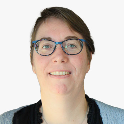
Veronique De Laet
Team Lead Innovation
GIM - Smart Geo Insights
Belgium
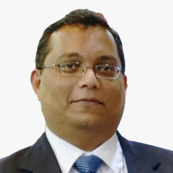
Vikrant Nashine
Global Delivery Head - GIS
Tech Mahindra
India
Vikrant has over 23 years of rich cross-functional experience in the geospatial industry. He has a proven track record of success in envisaging/designing/delivering enterprise geospatial products/solutions/services (GIS, Photogrammetry, Remote Sensing, Mapping) for the defense and private sector industries.

Vincent Kessler
General Manager, Synspective SG
Synspective
Singapore
Vincent joined Synspective in October 2021 as the General Manager of Synspective's Singapore branch. He oversees Synspective's activities in the Asia-Pacific and Eastern European regions.
After graduating from the National University of Singapore's Geography Department in 2005, Vincent began his career at CRISP, the national remote sensing ground station of Singapore. He spent over 15 years leading Asia sales and business development activities for various high-profile global companies in the geospatial industry.
Vincent received his MBA from the University of Birmingham, UK.

Wout Velthoven
Project Manager
PHOTOMAP
Slovakia
Wout Velthoven is a seasoned professional with a background in Hydrography from Amsterdam. With nearly two decades of experience at EUROSENSE Netherlands, a key player in the EUROSENSE group, Velthoven made significant contributions to the development of LIDAR and image coverages across the Netherlands.
In late 2023, Velthoven embarked on a new journey as Director of PHOTOMAP Netherlands, a division of the PHOTOMAP group. Leveraging his extensive expertise, he drives innovation in data acquisition and visualization. Velthoven's transition to PHOTOMAP marks a pivotal moment in his career, where he continues to push technological boundaries and spearhead the creation of cutting-edge datasets.

Xabier Erana
Senior Sales Support Manager
Terrasolid
Finland

Yeji Choi
SI Analytics
Head of Earth Intelligence Division
South Korea
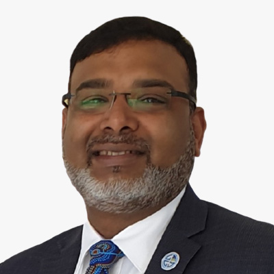
Zaffar Sadiq Mohamed-Ghouse
Director, Advisory and Innovation
Woolpert Asia-Pacific
Australia
Prof Dr Zaffar Sadiq Mohamed-Ghouse is a Director of Advisory & Innovation at Woolpert, a leading global architecture, engineering, and geospatial firm. He has over 25 years of experience in providing strategic advice and solutions to several governments and international organizations on geospatial and space-related matters, such as positioning networks, data policies, spatial digital twins, geospatial ecosystems, natural resources, and Geospatial master plans. He has led several multi-million-dollar national mapping projects for various countries and regions, including Australia, New Zealand, Malaysia, Indonesia, India, United Arab Emirates, and Saudi Arabia.
As a Fellow of the Institution of Engineers Australia, a Fellow of the Royal Geographical Society, and an Honorary Fellow of the Geospatial Council of Australia, Zaffar is recognized as one of the spatial leaders in Australia and globally. He is also the Chair of the United Nations Global Geospatial Information Management - Private Sector Network, where he facilitates collaboration and innovation between the private sector and the UN-GGIM community. He is passionate about advancing the spatial industry and its contribution to the sustainable development goals. He has published extensively in GIS, surveying, remote sensing, data management, and spatial data / knowledge infrastructures and Geospatial Ecosystems. He is the recipient of several prestigious awards, including the Professional of the Year 2022 by the Asia-Pacific Spatial Excellence Awards and University of Melbourne's Prestigious Thornton Smith Medal for outstanding service to Geospatial and Surveying Community. Zaffar has academic appointments at University of Melbourne, Anna University and National Institute of Advance Studies. He served on the Programme Board of Geospatial Knowledge Infrastructure since its inception. He is currently the Vice president of the International Society of Digital Earth and serves as Board of Directors of the Open Geospatial Consortium and Programme Board of Group on Earth Observation.