Geo4SDGs: Addressing Agenda 2030
The 2030 Agenda for Sustainable Development was adopted by the United Nations in September 2015 with an aim to reach the 'furthest behind first'. The 17 Sustainable Development Goals and the 169 associated targets have been decided to strike a balance and integrate the three core dimensions of sustainable development namely, social, economic and environmental.
The United Nations has corroborated the significance of leveraging geospatial data for policy making, programming and project operations to realize the SDGs and its associated targets. Continuous innovations in technologies such as UAVs, sensors, satellites, big data, etc. are further enabling the use of geospatial not only towards achieving the agenda, but more crucially in measuring, monitoring and reporting the progress as well.
Geo4SDGs, first introduced in Geospatial World Forum 2018, is a platform for stakeholders to discuss the integration of geospatial data into the sustainable development agenda in a holistic manner. With the aim to bridge the gap between geospatial community, development community, policy makers, and the implementers of the Sustainable Development Goals, Geo4SDGs 2019 shall discuss pressing sustainable development issues including climate change, food security, and urbanization; and how geospatial community can contribute.
Speakers

Megha Datta Director - Global Development Agenda
Geospatial Media and Communications
India
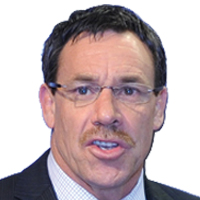
Greg Scott Inter Regional Advisor
Global Geospatial Information Management
United Nations

Kadaster International
The Netherlands

Radiant Earth Foundation
USA

National Geomatics Centre
China

Dr. Derek Clarke Chief Director
National Geospatial Information, Department of Rural Development and Land Reform
South Africa

GODAN
United Kingdom

Federal Geographic Data Committee
USA

Ministry of the Interior and Kingdom Relations
The Netherlands
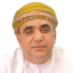
National Survey Authority
Oman

World Resources Institute (WRI)
USA

European Forum for Geography and Statistics
Poland

Foundation Center
USA

Tableau Software
USA
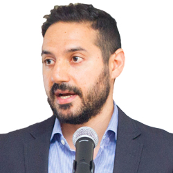
Esri Middle East & Africa
UAE

Public Affairs Centre
India

Barbara Ryan Policy Advisor
World Geospatial Industry Council
USA

European Space Agency
Italy

Japan Aerospace Exploration Agency (JAXA)
France

Secure World Foundation
USA

HCP International
The Netherlands

University of Westminster
United Kingdom

Cadasta Foundation
USA

Resilience Brokers
United Kingdom

Trimble
USA

University of Canterbury
New Zealand

Survey of India

National Sample Survey Office (NSSO)
Ministry of Statistics and Program Implementation
Government of India


SDG Watch Europe
Belgium

Department of Urban Planning and Municipalities
UAE

The Nature Conservancy
USA

Federal Agency for Cartography and Geodesy
Germany

Prof Dr Dieter Fritsch Research Professor and Professor Emeritus
University of Stuttgart
Germany

ML Infomap
India

eLEAF
The Netherlands

Clark University
USA

Humanitarian OpenStreetMap
Research Associate, Heidelberg Institute for Geoinformation Technology
Germany

ZOA
The Netherlands
SESSION THEMES
The SDGs, made up of 17 separate goals, targets a wide-range of global issues, from extreme poverty to climate change. Location and geography are significant to most of the issues, making geospatial data as equally important to SDGs as the demographic and statistical data. Understanding SDGs from spatial point of view is essential for governments in order to identify where the citizens are and where the root of the problem lies. Accordingly the right development strategies can be formulated. The session will feature 4 panels on the following topics:
• Geospatial Empowering the People
One key aspect of the SDG is to end poverty and hunger, in all their forms and dimensions, and to ensure that all human beings can fulfil their potential in dignity and equality and in a healthy environment. Geospatial data, paired with artificial intelligence and crowdsourcing, becomes a powerful tool to monitor and improve citizen wellbeing. The panel will discuss how geospatial technology plays a role in eradicating poverty, and in improving food security, healthcare, education quality and gender equality for the overall wellbeing of the people.
• Geospatial Insights for a Changing Planet
Another key aspect of the SDG is to protect the planet from degradation, including through sustainable consumption and production, sustainably managing its natural resources and taking urgent action on climate change. The panel will discuss geospatial contribution in evaluating impacts, monitor progress and improve accountability in natural resources management, including water, ocean, and biodiversity, as well as its role in climate adaptation.
• Geospatial for Economic Growth & Social Prosperity
The SDGs are determined to ensure that all human beings can enjoy prosperous and fulfilling lives and that economic, social and technological progress occurs in harmony with nature. Key economic areas such as energy, infrastructure, and cities rely on technology to increase efficiencies. Panel will discuss geospatial data and the critical role it plays in creating the prosperity and wellbeing of future generations.
• Policy-Data Integration for Bridging Data Gap
Geospatial technologies and services, strengthening data production and the use of better data in policymaking and monitoring, are becoming increasingly recognized as fundamental means for global development. Such data and services have the real potential of forming a new and emerging 'data ecosystem' for development with integrated information systems that are comprehensive and coordinated. With the enabling global mechanism of the 2030 Agenda, the challenge is how to most effectively transfer the available technology, data richness, and connectivity to the technology and data poor. Panel will discuss the needs for data to be more open, and platforms to be more usable and integrated, so they can reach even the poorest of the poor in the least developed countries.
When pursuing ambitious long-term targets like the SDGs, measuring progress at frequent intervals and documenting the successes and shortfalls is essential. Developing the adequate monitoring and reporting system is a challenge for many countries. Geospatial technologies offer attractive solutions in monitoring key areas in SDG such as urban development, agriculture and rural development, water resources management, climate resilience, disaster risk reduction, and more. Success stories and exemplary innovation of Geo4SDGs from various national, regional and global initiatives will be demonstrated.
A data ecosystem is crucial to the success of sustainable development goals. Integrating national statistical data along with geospatial data, earth observation data and citizen generated data and Big Data, will ensure more real-time data is available to address the SDGs. This will enable more agile, efficient and evidence-based decision-making and can better measure the SDG progress in a way that is both inclusive and fair. The session will hold 2 panels on the following topics:
• NewSpace and Data Revolution: Impact on SDGs
Geospatial marketplace is evolving rapidly due to data revolution and continuous innovations in cloud computing, machine learning and drone technology. On top of this, a number of companies and private ventures today are endeavoring the NewSpace movement, to develop faster, better, and cheaper access to space, including all its upstream and downstream technologies. The movement is largely driven by commercial values. How can SDG implementers leverage on this data revolution and NewSpace movement? Panel of experts will deliberate.
• Big Data and Analytics for Sustainable Development
Geospatial and earth observation data, if analyzed and modelled properly, can be visualized as a dynamic informative map. When layered with more attributions and information, complex issues can be understood within seconds and problem areas can be identified instantly. Insights derived from the integration of geospatial and non-geospatial data can help achieve the SDGs and help nations formulate the most effective strategic plans for action on national issues. Policy-makers, data providers and technology companies will discuss current adoption of big data and analytics in sustainable development.
TARGET AUDIENCE
- Agriculture & Food Security Organizations
- City & Urban Planning Authorities
- Climate & Meteorological Organizations
- Consultants
- Developmental Agencies
- Disaster Management Agencies
- Environment & Conservation Organizations
- Funding Agencies
- Geospatial Technology Companies
- Information Technology Companies
- Land & Natural Resources Organizations
- Multilateral Agencies
- National Geospatial Agencies
- National Statistical Agencies
- Non-governmental Organizations
- Oceanography & Coastal Zone Management Agencies
- Policy Makers
- Public & Private Geospatial Data Providers
- Research Institutions
- Water & Energy Organizations


