Speaker Bio & Abstract

Federal Agency for Cartography and Geodesy
Germany
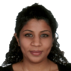
BiographyDr. Gopika Suresh is a remote sensing and Synthetic Aperture Radar (SAR) expert working at the German Federal Agency for Cartography and Geodesy since 2015. Her research interests include programming methods for land cover extraction from SAR images, fusion of Sentinel-1 and Sentinel-2 images, offshore oil slick detection from SAR data, ground-deformation analysis and the use of EO for SDGs.AbstractGopika Suresh, Michael Hovenbitzer | Federal Agency for Cartography and Geodesy Christian Schweitzer | German Environment Agency In Germany, the implementation of the SDGs is accompanied by its national strategy for sustainability and the German Federal statistical office (Destatis) is responsible for providing the data for monitoring the extent at which the various SDG goals and indicators have been implemented. The use of Earth observation (EO) data for monitoring and supporting the implementation of the SDGs, targets and indicators is being explored and encouraged by the UN and were reported in publications from the UN, GEO, CEOS, UNOOSA and Copernicus. On a national level, reports regarding the use of EO data for assisting the German strategy for Adaptation to climate change (DAS) and land degradation neutrality were published by the German Environment Agency in 2016 and 2018, respectively. The Cop4SDGs project at the Federal Agency for Cartography and Geodesy (BKG), conducted in collaboration with the German Environment Agency (UBA) and funded by the German federal ministry for the Environment, Nature Conservation and Nuclear safety (BMU) was initiated in July 2018. It aims at analysing the extent to which the national sustainability indicators (with respect to the SDGs) can be calculated, monitored and verified by means of Copernicus data and products.