Defence and National Security

Speakers
Keynote Session24 Jan 2017 0900 - 1030 hrs
ModeratorLT GEN AKS CHANDELE (RETD), President, Defence Security and Public Safety, Geospatial Media and Communications
ModeratorLT GEN AKS CHANDELE (RETD) President
Defence Security and Public Safety
Geospatial Media and Communications
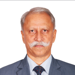
Lt Gen K T Parnaik (Retd), Joint Managing Director - Defence & Security, Rolta India Ltd, India
Lt Gen K T Parnaik (Retd) Joint Managing Director - Defence & Security
Rolta India Ltd
India
LT GEN J S MATHARU VSM, Commandant, MCEME, India
LT GEN J S MATHARU VSM Commandant
MCEME
India
JAYANT PATIL, Senior Vice President & Head Defence & Aerospace, Larsen & Toubro, India
JAYANT PATIL Senior Vice President & Head Defence & Aerospace
Larsen & Toubro
India
Mladen Stojic, President, Hexagon Geospatial, USA
Mladen Stojic President
Hexagon Geospatial
USA
LT GEN VINOD KHANDARE, AVSM, SM, Director General, Defence Intelligence Agency, India
LT GEN VINOD KHANDARE, AVSM, SM Director General
Defence Intelligence Agency
India
JOHN KEDAR, Director Strategic Relationships, Ordnance Survey, UK
JOHN KEDAR Director Strategic Relationships
Ordnance Survey
UK
Geospatial Situational Awareness for Border and Internal Security – I24 Jan 2017 1030 - 1115 hrs
LT GEN GOVIND CHANDEL, Director General, Rashtriya Rifles, India
LT GEN GOVIND CHANDEL Director General
Rashtriya Rifles
India
Dr. Aniruddha Roy, Chief Technology Officer (CTO),  Genesys International Corporation, India
Dr. Aniruddha Roy Chief Technology Officer (CTO)
Genesys International Corporation
India
Glyn Arthur, Vice President, Luciad, Belgium
Glyn Arthur Vice President
Luciad
Belgium
Col Richard Sundharam (Retired), Head - Defence and Homeland Security,  Esri Indi
Col Richard Sundharam (Retired) Head - Defence and Homeland Security
Esri Indi
Geospatial Situational Awareness for Border and Internal Security – II24 Jan 2017 1400 - 1530 hrs
LOKNATH BEHARA, Director General of Police, Kerala,
LOKNATH BEHARA Director General of Police
Kerala
M. Mahendar Reddy, IPS, Commissioner of Police Hyderabad, India
M. Mahendar Reddy, IPS Commissioner of Police Hyderabad
India
Dr. Rao S. Ramayanam, Vice President Sales, Middle East, Africa and South Asia, Urthecast,  Canada
Dr. Rao S. Ramayanam Vice President Sales, Middle East, Africa and South Asia
Urthecast
Canada
R. S Rathi, Vice President, Defense & Security, Rolta India Ltd.
R. S Rathi Vice President
Defense & Security
Rolta India Ltd.
MS KAVERI DEVI, Head - DDFD, National Remote Sensing Centre, India
MS KAVERI DEVI Head - DDFD
National Remote Sensing Centre
India
Dr. Siva Ravada, Sr. Director, Spatial and Graph Development, Oracle, USA
Dr. Siva Ravada Sr. Director, Spatial and Graph Development
Oracle
USA
Vinay Babu Adimulam, Senior Manager-Technical Services, Hexagon Geospatial, India
Vinay Babu Adimulam Senior Manager-Technical Services
Hexagon Geospatial
India
SESSION: Artificial Intelligence Transforming Defence & Security24 Jan 2017 1630 - 1800 hrs
ModeratorLT GEN ANIL KAPOOR, VSM, Director General of Information System, Indian Army,  India
ModeratorLT GEN ANIL KAPOOR, VSM Director General of Information System, Indian Army
India
DR NARAYAN PANIGRAHI, Scientist, Centre for Artificial Intelligence & Robotics, India
DR NARAYAN PANIGRAHI Scientist
Centre for Artificial Intelligence & Robotics
India
LT COL ASHUTOSH VERMA, Indian Army, India
LT COL ASHUTOSH VERMA Indian Army
India
ANIL GOSWAMI, Digital Terrain Research Laboratory, India
ANIL GOSWAMI Digital Terrain Research Laboratory
India
DR AMIT MUKHERJEE, Institute for Defence Studies and Analyses, India
DR AMIT MUKHERJEE Institute for Defence Studies and Analyses
India
Devang Karia, HP, India
Devang Karia HP
India

Tentative Structure

0900-1030 hrs

Keynote session

1030-1115 hrs

Geospatial Situational Awareness for Border and Internal Security – I

1115-1230 hrs

Networking Tea/Coffee Break & Visit to Exhibition

1230-1400 hrs

Networking Lunch

1400-1530 hrs

Geospatial Situational Awareness for Border and Internal Security – II

1530-1630 hrs

Networking Tea/Coffee Break

1630-1800 hrs

Artificial Intelligence Transforming Defence & Security

The changing nature of war, from conventional armed conflict between states, to modern war of terrorism and civil conflicts, calls for modernisation of military technologies and security reform globally. Today, nations are fighting against guerrilla and insurgency tactics, hi-tech weaponry and 'virtual' warfare, making intelligence of preventing and predicting such movements just as essential as on-the-ground combat operations.

Geospatial tools offer the capability of monitoring, predicting and countering threats, while helping to strategise and support field operations. The use of big data, advanced geospatial analytics software and sophisticated imaging technologies from (very) high-resolution remote sensing satellites, UAVs and other sensors enables seamless flow of information between intelligence and law enforcements agencies in pre-, real-time and post-combat operations.

Real-time views and insight of impacted regions is key to improving emergency response times, especially in vulnerable areas such as a country's border. Considering critical situations can occur at any time, situational awareness has never been more important. Geospatial data is invaluable to the border security operations, to deliver accurate situational awareness information, enabling quick and secure decision-making, while mitigating risks, and increase national security.

Geospatial World Forum 2017 shall be hosting a seminar on Defence & National Security, focusing on how geospatial intelligence can support the fight against emerging security situations across the globe.

Target Audience

  • Border Controls
  • Civil Defence Deparments
  • Consultants
  • Customs Officials
  • Defence Forces - Army, Navy, Air Force
  • Defence System Integrators
  • Disaster Management Authorities
  • Fire Services
  • Geospatial Technology Providers
  • Police Force
Industry Partner