|
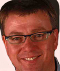
Tamme Van Der Wal
Partner
Aerovision
Netherlands
Biography
Tamme van der Wal studied land- and water management at Wageningen University. He has been working in agriculture since in activities concerning crop modelling, hydrological modelling and information systems. He has been active in agricultural policy related projects as well as in smart farming related projects. He joined AeroVision in 2009 to work on the use of geospatial data to improve business processes in agriculture. He has been working on Galileo and GNSS in several projects. The use of GNSS-R brings together his expertise on GNSS signals and remote sensing. He is active as innovation consultant and project coordinator for governments, businesses and research organisations. He gets his main energy from discussing with users about emerging technologies and helping them to make the best choice to fit their needs.
Abstract
Precise soil moisture measurements using GNSS-R: Helping farmers to make better decisions on irrigation water management
In a recent survey, 65% of the farmers indicated that they think water stress is one of the most important issues for the next decade. Also, 60% indicated that they lack sufficient tools to manage water for their crops and fields. Despite a suite of advisory services on water management, irrigation and water stress, one of the most important variables, the soil water content, is poorly estimated. At best at a single location that should be representative for a wide area. Soil water content is however a very critical variable to make sound decisions on when, where, and how much to irrigate. A new technique, called reflective GNSS, is a way of measuring soil water content. The technology uses the already available GNSS signals from space, whose surface reflectance is depending on the surface proporties. Wet and dry surfaces have different reflections. Mounting a GNSS-R system on a UAV provides the opportunity to map soil water content for a whole area. Tamme will report on recent developments in R-GNSS and in particular on the EU funded project MISTRALE dedicated to the use of GNSS/Galileo for GNSS-R measurement.
|

