|
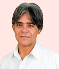
Luiz Roberto Arueira
Director
Pereira Passos Institute - City of Rio de Janeiro
Brazil
Biography
Luiz Roberto Arueira is civil engineer (Universidade Federal Fluminense, Rio de Janeiro - Brazil) with experience in GIS and public policies. Has over 20 years of experience in the public sector, working in the Municipality of Rio de Janeiro. He is currently Director of City Information from Pereira Passos Institute, department responsible for municipal data and knowledge management and its geoprocessing system.
Abstract
Participatory Map of the City of Rio de Janeiro
Co-Author: Leandro Souza, Geographer, Instituto Pereira Passos - City of Rio de Janeiro
Instituto Pereira Passos (IPP) is the department from Rio de Janeiro's City Hall responsible for GIS and management of municipal geoprocessing system. IPP performs the production, analysis and dissemination of geographical information, in the form of tables, maps, studies and web application. One of the missions of the IPP is to promote the integration and consolidation of information from several sources, aiming the production of knowledge for more efficiency in the planning, implementing and monitoring of public policies, and also for the dissemination of information for better knowledge of the city by citizens. Usual sources of data area the municipal administration and other technical and academic institutions. Aiming to receive the contribution and provide a diagnosis of the city by the citizens themselves, IPP developed the Participatory Map of the City of Rio de Janeiro. The idea of a collaborative map has emerged from the need to design a tool for the public, where the citizens could not only customize maps and include information from the locality, but also find information according to their own interests. The work was initiated in poor communities, with the provision of cartographic databases of the city on an ArcGIS Online platform, on which the citizens include information of interest collected on mobile or desktop. Examples of information collect by the dwellers are urban equipment (schools, cultural spaces), shopping areas and other points of interest, like the ones related with sports and leisure events. The map facilitate access to information and allow citizens to identify information from where they live, integrating it into the city.
|

