|
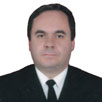
Dr. Recai Ogur
Assoc.Professor - Department of Public Health
Center for Education and Research on Environment – Gene Interaction
Turkey
Biography
Dr. Recai is a medical doctor and associate professor at the Department of Public Health and Division of Environmental Health at the Gulhane Medical Faculty in Ankara, Turkey. His specialty is about public health and also he holds a PhD degree about Environmental Health. His studies are especially about environment-gene interactions and water related issues. He believes that GIS applications would be a corner-stone in the area of water supply and maintenance of water safety, especially in countries and populations with water scarcity around the world. Also he studies to provide new ecological approaches for the environmental related health problems by using GIS applications.
Abstract
Environmental Impacts of Using Geospatial Applications in Energy Industry
There is a strong positive correlation between energy and development for the countries. While the countries want to consume more energy, environmental issues resulting from using fossil related fuels have been increasing. There is an increase in energy-related CO2 emissions through the world, and it is speculated that this may change the climate of the earth. Although there are some controversial findings about climate change, it is clear that energy industry related emissions are one of the most dangerous pollutants for environment.
Because we could not find an alternate for development-energy consumption synergy, it looks like that the only thing that we could do is the improving of management of energy production and consumption. One of the most effective and promising tool for this purpose is geospatial technology. Among the benefits of geospatial applications, the followings could be considered as the main gains for energy industry: (a) Increase in effectiveness (b) cost savings (c) better decision making (d) better communication (e) improved data collection and analysis and improved disaster management. We may divide geospatial technology usage in energy industry in main three areas: management of energy resources, transmission of energy and consumption management. Today, energy could be produced from different sources and by using weather oriented geographic information systems we could use energy sources (i.e. wind, solar, water, fuel etc.) more effectively, and there are a lot of examples of these applications even in small cities. Transmission of energy and energy resources are also a critical step in energy industry. Experiences show that one of the most effective uses of geospatial technologies is designing and management of transmission or transfer of energy and energy resources. Geospatial technologies give the opportunity to control all line more effectively, and failures and accidents may be corrected more quickly. Consumption of energy may also be an effective area for geospatial technologies; especially energy performance analysis may help also policy makers, architects and engineers for building better communities.
It is clear that more effective energy management would cause healthier environment and healthier populations. Introducing GIS into our daily life more effectively, we may build more habitable surroundings for us and future.
|

