|
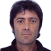
Olivier Senegas
UNOSAT
Switzerland
Biography
Olivier Senegas is graduated in Agronomy from the National Polytechnic Institute of Toulouse and University Technological Institute of Perpignan, France. He worked in the French space industry for more than 10 years before to join the UN.
He co-founded UNOSAT in 2001 and joined the programme in February 2002 as UNOSAT Service Manager. During UNOSAT preparation, he was Spot Image focal point, as part of his activities as sales manager. He managed a number of projects resulting from the activation of the International Charter Space and Major Disasters signed in 1999 at UNISPACE III Conference. He has developed HumaNav, the humanitarian navigation system, through a public-private partnership, allowing real time tracking of humanitarian transport missions, based on integrated space applications. Since 2012, he manages ResEAU programme, water resources mapping of Chad, aiming to strengthen Chadian capacities in the field of geology, hydrogeology and mapping.
Abstract
ResEAU
Since early 2012 UNITAR/UNOSAT and the Swiss Development Cooperation are engaged in implementing a water management and capacity development project in Chad. This project, also known with its francophone name of ResEAU, is hosted by the Ministry of Hydraulics of Chad. It has the ambitious aim of strengthening national capacity in the area of water resources management tailored to the local requirements and designed together with Chadian and Swiss partners.
In Chad, activities are organized around two main priorities: 1) collection of geographical information and establishment of a scientific documentary database, and 2) building national capacity in partnership with the Ministry of Higher Education of Chad and the University and University of Neuchatel, through establishment of a Master in hydrogeology and GIS hosted by University of N'Djamena
In Switzerland, UNOSAT experts work together with Swisstopo, the Swiss Federal Office of Topography. Through this collaboration, hydrogeological maps at 1:500000 and 1:200000 scale will be produced from Chad water resources information system (SIRE), compiling all GIS layers that will be accessible through a web mapping platform.
The challenge is firstly to integrate existing heterogeneous information into a GIS, to improve this information based space observation technics, and to disseminate the results using Web mapping technologies, as well as hydrogeological paper maps, and secondly to strengthen national capacities for the usage of these technologies with the aim to improve water resources management at national, regional and local levels.
|

