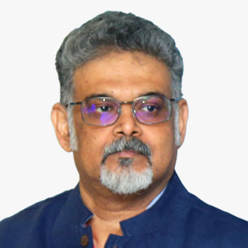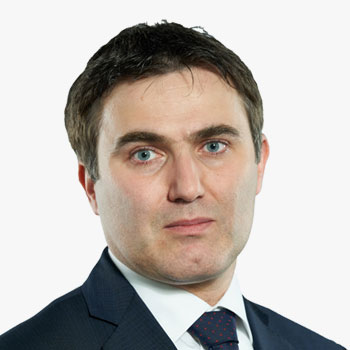

Luigi is a Partner in PwC Advisory France. Within PwC he leads the Space Practice worldwide, and core space strategy consulting team based in Paris and Toulouse, focused on serving institutional and commercial stakeholders in the space sector, as well as non-space companies with specific commercial interest in space products and applications. He has 22 years of experience in the space sector and he has extensively supported the Space Industry, Space Agencies, intergovernmental organizations, and governments in Europe and Worldwide. He is a member of the International Astronautical Federation Technical Committee (chair of the IAF Space Economy Committee), and a regular keynote and panel speaker at space-related events worldwide.
Luigi Scatteia
 Luigi Scatteia
Partner - Space Practice Leader , PwC Advisory , France
Luigi is a Partner in PwC Advisory France. Within PwC he leads the Space Practice worldwide, and core space strategy consulting team based in Paris and Toulouse, focused on serving institutional and commercial stakeholders in the space sector, as well as non-space companies with specific commercial interest in space products and applications. He has 22 years of experience in the space sector and he has extensively supported the Space Industry, Space Agencies, intergovernmental organizations, and governments in Europe and Worldwide. He is a member of the International Astronautical Federation Technical Committee (chair of the IAF Space Economy Committee), and a regular keynote and panel speaker at space-related events worldwide.

Luigi is a Partner in PwC Advisory France. Within PwC he leads the Space Practice worldwide, and core space strategy consulting team based in Paris and Toulouse, focused on serving institutional and commercial stakeholders in the space sector, as well as non-space companies with specific commercial interest in space products and applications. He has 22 years of experience in the space sector and he has extensively supported the Space Industry, Space Agencies, intergovernmental organizations, and governments in Europe and Worldwide. He is a member of the International Astronautical Federation Technical Committee (chair of the IAF Space Economy Committee), and a regular keynote and panel speaker at space-related events worldwide.
Partner - Space Practice Leader | PwC Advisory | France


Kandasri is the Deputy Executive Director at GISTDA, where she supervises and provides advice and counsel to the management in the strategic planning and the development and innovation of GISTDA's Geo-Informatics products & services.
Kandasri Limpakom
 Kandasri Limpakom
Deputy Executive Director , GISTDA , Thailand
Kandasri is the Deputy Executive Director at GISTDA, where she supervises and provides advice and counsel to the management in the strategic planning and the development and innovation of GISTDA's Geo-Informatics products & services.

Kandasri is the Deputy Executive Director at GISTDA, where she supervises and provides advice and counsel to the management in the strategic planning and the development and innovation of GISTDA's Geo-Informatics products & services.
Deputy Executive Director | GISTDA | Thailand


Nicolaus Hanowski holds a Ph.D. in Earth and Planetary Sciences. He started as a researcher in the US and then transferred to Mission Operations at the German Space Operations Centre. In 2009 he joined ESA and became responsible for the development of Science Ground Segments for missions, such Rosetta, Gaia, JWST, Solar Orbiter and Euclid in the Science Directorate. Since 2014 he is responsible for the Operations and Ground Segments of the ESA Earth Observation Missions and the Copernicus Sentinel satellites and the corresponding data management aspects at ESA. He is coordinating the Copernicus Long Term Scenario of Copernicus and the Destination Earth activities within ESA.
Nicolaus Hanowski
 Nicolaus Hanowski
Head, Mission Management & Ground Segments Department , Directorate of Earth Observation Programmes, European Space Agency , Italy
Nicolaus Hanowski holds a Ph.D. in Earth and Planetary Sciences. He started as a researcher in the US and then transferred to Mission Operations at the German Space Operations Centre. In 2009 he joined ESA and became responsible for the development of Science Ground Segments for missions, such Rosetta, Gaia, JWST, Solar Orbiter and Euclid in the Science Directorate. Since 2014 he is responsible for the Operations and Ground Segments of the ESA Earth Observation Missions and the Copernicus Sentinel satellites and the corresponding data management aspects at ESA. He is coordinating the Copernicus Long Term Scenario of Copernicus and the Destination Earth activities within ESA.

Nicolaus Hanowski holds a Ph.D. in Earth and Planetary Sciences. He started as a researcher in the US and then transferred to Mission Operations at the German Space Operations Centre. In 2009 he joined ESA and became responsible for the development of Science Ground Segments for missions, such Rosetta, Gaia, JWST, Solar Orbiter and Euclid in the Science Directorate. Since 2014 he is responsible for the Operations and Ground Segments of the ESA Earth Observation Missions and the Copernicus Sentinel satellites and the corresponding data management aspects at ESA. He is coordinating the Copernicus Long Term Scenario of Copernicus and the Destination Earth activities within ESA.
Head, Mission Management & Ground Segments Department | Directorate of Earth Observation Programmes, European Space Agency | Italy


Donna Lyndsay is the Strategic Market Lead for Environment & Sustainability at Ordnance Survey. She supports Ordnance Survey's mission to be a world leader in geospatial services; delivering location insight for positive impact with colleagues, partners and customers. Donna is also Vice Chair of the Space4Climate group who aim to put the UK at the forefront of global efforts to create and use trusted satellite data for climate action for all.
Abstract
Using geospatial information to unlock value from Earth observation data
Ordnance Survey, as a National Mapping Agency, has a track record of utilising aerial imagery and ground based survey methods to maintain our national geographic database. We are now seeing advantages from combining these traditional survey techniques with more frequent time series EO data from satellites providing high fidelity data. This combination of Earth observation data with accurate, up to date geospatial data provides the context and provenance that is key to unlocking the actionable information needed by organisations to monitor asset level change over time that enable net zero targets to be met. NMAs now need to consider how they can create new products and serves that are relevant to our changing environment to meet both the SDG's and customer demands.
Donna Lyndsay
 Donna Lyndsay
Strategic Market Lead - Environment and Sustainability , Ordnance Survey , UK
Donna Lyndsay is the Strategic Market Lead for Environment & Sustainability at Ordnance Survey. She supports Ordnance Survey's mission to be a world leader in geospatial services; delivering location insight for positive impact with colleagues, partners and customers. Donna is also Vice Chair of the Space4Climate group who aim to put the UK at the forefront of global efforts to create and use trusted satellite data for climate action for all.
Abstract
Using geospatial information to unlock value from Earth observation data
Ordnance Survey, as a National Mapping Agency, has a track record of utilising aerial imagery and ground based survey methods to maintain our national geographic database. We are now seeing advantages from combining these traditional survey techniques with more frequent time series EO data from satellites providing high fidelity data. This combination of Earth observation data with accurate, up to date geospatial data provides the context and provenance that is key to unlocking the actionable information needed by organisations to monitor asset level change over time that enable net zero targets to be met. NMAs now need to consider how they can create new products and serves that are relevant to our changing environment to meet both the SDG's and customer demands.
Strategic Market Lead - Environment and Sustainability | Ordnance Survey | UK


Mr. Azlikamil Napiah started his professional career in the private sector as a Senior Geologist in 1993. He joined Malaysian government sector as Research Officer in 1994. He gained formal knowledge through certified training in Remote Sensing in Australia, United Kingdom and The Netherlands. With the vast experience in R&D and technical management, he was then appointed to lead corporate and strategic section in Malaysian Remote Sensing Agency (MRSA) and later promoted as Deputy Director General (Technical Service) in 2011. Now, he is the Director General of Malaysian Space Agency (MYSA).
Azlikamil Napiah
 Azlikamil Napiah
Director General , Malaysian Space Agency (MYSA) , Malaysia
Mr. Azlikamil Napiah started his professional career in the private sector as a Senior Geologist in 1993. He joined Malaysian government sector as Research Officer in 1994. He gained formal knowledge through certified training in Remote Sensing in Australia, United Kingdom and The Netherlands. With the vast experience in R&D and technical management, he was then appointed to lead corporate and strategic section in Malaysian Remote Sensing Agency (MRSA) and later promoted as Deputy Director General (Technical Service) in 2011. Now, he is the Director General of Malaysian Space Agency (MYSA).

Mr. Azlikamil Napiah started his professional career in the private sector as a Senior Geologist in 1993. He joined Malaysian government sector as Research Officer in 1994. He gained formal knowledge through certified training in Remote Sensing in Australia, United Kingdom and The Netherlands. With the vast experience in R&D and technical management, he was then appointed to lead corporate and strategic section in Malaysian Remote Sensing Agency (MRSA) and later promoted as Deputy Director General (Technical Service) in 2011. Now, he is the Director General of Malaysian Space Agency (MYSA).
Director General | Malaysian Space Agency (MYSA) | Malaysia


Glenn has been an active supporter of the geospatial information industry throughout his career. Glenn has served multiple terms as a Board member of the Spatial Industries Business Association (SIBA), including as Chair during 2015 and 2016. Glenn is co-Chair of the leadership group that was responsible for the highly regarded 2026 Spatial Industry Transformation and Growth Agenda launched in April 2017. Glenn is currently Deputy Chair for the 2030 Space and Spatial Industry Growth Roadmap. Glenn also serves on the board of Locate Conferences Australia Pty Ltd, the entity established to deliver the industry's annual "Locate" conference series. Glenn is the Chair of the Industry Advisory Committee for the Department of Geospatial Sciences at RMIT, and a member of the Department of Infrastructure Engineering Industry Advisory Board at the University of Melbourne. Glenn was a member of the Victorian Spatial Council for over four and half years, and the recipient of the Surveying and Spatial Science Institute's Victorian Spatial Professional of the Year Award in 2007.
Glenn is a recognised leader in the geospatial information technology industry. Glenn is strategic thinker, advocate and advisor regarding how geospatial and related systems, data and analysis can be utilised to improve organisational decision-making and efficiency, and address some of our most pressing environmental, economic and resource issues. He has over 35 years of experience, gained working in Australia and internationally, both with the private sector and all levels of government.
Glenn Cockerton
 Glenn Cockerton
Managing Director , Spatial Vision , Australia
Glenn has been an active supporter of the geospatial information industry throughout his career. Glenn has served multiple terms as a Board member of the Spatial Industries Business Association (SIBA), including as Chair during 2015 and 2016. Glenn is co-Chair of the leadership group that was responsible for the highly regarded 2026 Spatial Industry Transformation and Growth Agenda launched in April 2017. Glenn is currently Deputy Chair for the 2030 Space and Spatial Industry Growth Roadmap. Glenn also serves on the board of Locate Conferences Australia Pty Ltd, the entity established to deliver the industry's annual "Locate" conference series. Glenn is the Chair of the Industry Advisory Committee for the Department of Geospatial Sciences at RMIT, and a member of the Department of Infrastructure Engineering Industry Advisory Board at the University of Melbourne. Glenn was a member of the Victorian Spatial Council for over four and half years, and the recipient of the Surveying and Spatial Science Institute's Victorian Spatial Professional of the Year Award in 2007.
Glenn is a recognised leader in the geospatial information technology industry. Glenn is strategic thinker, advocate and advisor regarding how geospatial and related systems, data and analysis can be utilised to improve organisational decision-making and efficiency, and address some of our most pressing environmental, economic and resource issues. He has over 35 years of experience, gained working in Australia and internationally, both with the private sector and all levels of government.
Managing Director | Spatial Vision | Australia
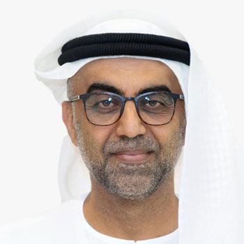
Brig. Ali Al Shehhi
Director National Space Science & Technology Centre | Board Member, Federal GIS Centre | UAE
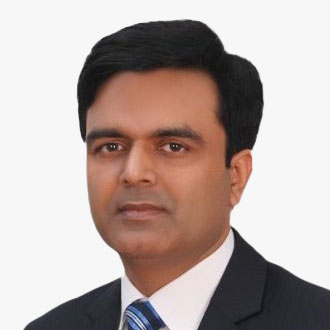

Saurabh is an industry-recognized professional & a thought leader in Geospatial Technology, Process Initiatives, Data Science, Artificial Intelligence, Machine Learning, User Experience, Data-driven businesses, and Consumer Insights.
He possesses strong entrepreneurial, digital, analytical, and cross-industry skills and has led some of the largest Geospatial surveys & systems deployment across the globe. The projects have won multiple awards including the first Edison award in India.
A career built on a passion for Startups and Innovation; he has incubated Greenfield businesses, set up practices, and seen them through growth. Saurabh is passionate about Artificial Intelligence, Machine Learning, and related technologies in solving problems and bringing automation and efficiency to complex workflows.
Saurabh is the global leader for GIS, Analytics & AI Verticals for Tech Mahindra BPS.
Saurabh Rai
 Saurabh Rai
Global Head Analytics, Business Process Services , Tech Mahindra , India
Saurabh is an industry-recognized professional & a thought leader in Geospatial Technology, Process Initiatives, Data Science, Artificial Intelligence, Machine Learning, User Experience, Data-driven businesses, and Consumer Insights.
He possesses strong entrepreneurial, digital, analytical, and cross-industry skills and has led some of the largest Geospatial surveys & systems deployment across the globe. The projects have won multiple awards including the first Edison award in India.
A career built on a passion for Startups and Innovation; he has incubated Greenfield businesses, set up practices, and seen them through growth. Saurabh is passionate about Artificial Intelligence, Machine Learning, and related technologies in solving problems and bringing automation and efficiency to complex workflows.
Saurabh is the global leader for GIS, Analytics & AI Verticals for Tech Mahindra BPS.
Global Head Analytics, Business Process Services | Tech Mahindra | India


As Sales Director for Commercial Space at Telespazio Germany, Srinath is responsible for providing space businesses with innovative ground segment solutions for constellation management. Srinath has a strong background in the satellite industry with more than 20 years of experience across EMEA. As a space enthusiast, he is energized by the positive impact space enables in our day-to-day lives. Additionally, Srinath has acted as a key advocate in overcoming the digital divide and has been instrumental in connecting schools across Africa.
Srinath Logasubramanian
 Srinath Logasubramanian
Director - Commercial Space , Telespazio Germany , UK
As Sales Director for Commercial Space at Telespazio Germany, Srinath is responsible for providing space businesses with innovative ground segment solutions for constellation management. Srinath has a strong background in the satellite industry with more than 20 years of experience across EMEA. As a space enthusiast, he is energized by the positive impact space enables in our day-to-day lives. Additionally, Srinath has acted as a key advocate in overcoming the digital divide and has been instrumental in connecting schools across Africa.

As Sales Director for Commercial Space at Telespazio Germany, Srinath is responsible for providing space businesses with innovative ground segment solutions for constellation management. Srinath has a strong background in the satellite industry with more than 20 years of experience across EMEA. As a space enthusiast, he is energized by the positive impact space enables in our day-to-day lives. Additionally, Srinath has acted as a key advocate in overcoming the digital divide and has been instrumental in connecting schools across Africa.
Director - Commercial Space | Telespazio Germany | UK


Eiman has 11 years of experience starting as a researcher working with scintillating crystals for high energy particles detectors which was part of the Crystal Clear Collaboration project at CERN. She worked as science curriculum and labs developer in Abu Dhabi Education Council. In 2017 Eiman decided to take a new direction in her career and discover the world of Space science and technology, when she joined the National Space Science and Technology as a space mission analyst of cubesat missions. In addition to her engineering role at the center, Eiman engaged in many managerial and strategy development roles in the center. She is currently managing the Arab Satellite 813 program, an earth observation nanosatellite focusing on education and knowledge transfer.
Eiman had her bachelor's degree in applied physics from UAEU and and her Master's degree in industrial engineering at Khalifa University.
Abstract
Satellite 813: A "New" Space Platform
- Introduction of the National Space Science and Technology Center, The United Arab Emirates University
- Introduction of the Satellite 813 program initiative
- Satellite 813: from the Idea to the Implementation
- A New Space Approach
- The Strategy: Connection, Collaboration, Continuity
Eiman AlShamsi
 Eiman AlShamsi
Program Manager , National Space Science and Technology , UAE
Eiman has 11 years of experience starting as a researcher working with scintillating crystals for high energy particles detectors which was part of the Crystal Clear Collaboration project at CERN. She worked as science curriculum and labs developer in Abu Dhabi Education Council. In 2017 Eiman decided to take a new direction in her career and discover the world of Space science and technology, when she joined the National Space Science and Technology as a space mission analyst of cubesat missions. In addition to her engineering role at the center, Eiman engaged in many managerial and strategy development roles in the center. She is currently managing the Arab Satellite 813 program, an earth observation nanosatellite focusing on education and knowledge transfer.
Eiman had her bachelor's degree in applied physics from UAEU and and her Master's degree in industrial engineering at Khalifa University.
Abstract
Satellite 813: A "New" Space Platform
- Introduction of the National Space Science and Technology Center, The United Arab Emirates University
- Introduction of the Satellite 813 program initiative
- Satellite 813: from the Idea to the Implementation
- A New Space Approach
- The Strategy: Connection, Collaboration, Continuity
Program Manager | National Space Science and Technology | UAE
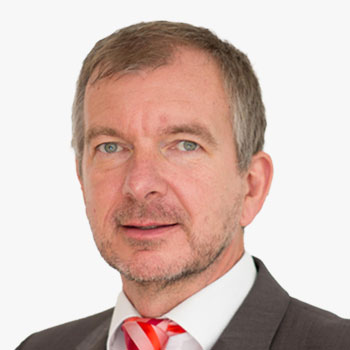
Gunter Schreier
Deputy Director | German Remote Sensing Data Center, DLR

Lena Halounova
President | ISPRS
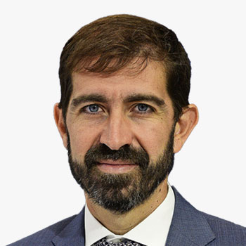
Gianluigi Baldesi
Senior Commercialisation Officer | European Space Agency | France


Alex is an experienced technical sales professional specialising in enabling geospatial applications using satellite imagery. With previous experience at Maxar supporting international clients, he joined Satellite Vu in 2021 heading the sales team as the company progresses towards launching the first commercial constellation of high-resolution thermal imaging satellites.
Alex Gow
 Alex Gow
Sales Director , SatelliteVu , UK
Alex is an experienced technical sales professional specialising in enabling geospatial applications using satellite imagery. With previous experience at Maxar supporting international clients, he joined Satellite Vu in 2021 heading the sales team as the company progresses towards launching the first commercial constellation of high-resolution thermal imaging satellites.

Alex is an experienced technical sales professional specialising in enabling geospatial applications using satellite imagery. With previous experience at Maxar supporting international clients, he joined Satellite Vu in 2021 heading the sales team as the company progresses towards launching the first commercial constellation of high-resolution thermal imaging satellites.
Sales Director | SatelliteVu | UK

Motoyuki Arai
CEO | Synspective | Japan

Suyash Singh
Co-Founder & CEO | GalaxEye


Dr. Christian Beilschmidt is co-founder and core developer of Geo Engine. He received his doctoral degree in computer science at the University of Marburg, Germany. His research interests are spatio-temporal data processing, database systems development, and machine learning. Before his work as a research assistant, he studied computer science at the University of Bonn, Germany.Dr. Christian Beilschmidt is co-founder and core developer of Geo Engine. He received his doctoral degree in computer science at the University of Marburg, Germany. His research interests are spatio-temporal data processing, database systems development, and machine learning. Before his work as a research assistant, he studied computer science at the University of Bonn, Germany.
Abstract
Geo Engine: Harmonized data access for data analysis pipelines
Geo Engine is a cloud-ready geospatial data analysis platform that provides low-threshold access to geospatial data and workflow processing. Users can access data and workflows via programming interfaces, e.g. from Python, as well as via a browser using a web GIS. This forms the foundation for creating spatio-temporal data pipelines for processing data and feeding it into frameworks for machine learning. Geo Engine GmbH is a start-up of computer scientists and geographers from the University of Marburg. The core of Geo Engine is developed as an open-source project, which is well suited for research projects. In addition, Geo Engine as a service is offered under a commercial license. Geo Engine is used in various research and infrastructure projects such as NFDI4BioDiversity, FAIR Data Spaces, and GEO BON as well as in commercial applications. Geo Engine provides cloud-based processing of spatio-temporal datasets and supports both raster and vector data. Processing is described by workflows that define virtual layers. When multiple data sources are combined within a workflow, automated data harmonization occurs on-the-fly. A USP is that each dataset is treated as a time series. This makes it easy to apply existing workflows to new areas or points in time.
Christian Beilschmidt
 Christian Beilschmidt
Co-Founder , Geo Engine GmbH , Germany
Dr. Christian Beilschmidt is co-founder and core developer of Geo Engine. He received his doctoral degree in computer science at the University of Marburg, Germany. His research interests are spatio-temporal data processing, database systems development, and machine learning. Before his work as a research assistant, he studied computer science at the University of Bonn, Germany.Dr. Christian Beilschmidt is co-founder and core developer of Geo Engine. He received his doctoral degree in computer science at the University of Marburg, Germany. His research interests are spatio-temporal data processing, database systems development, and machine learning. Before his work as a research assistant, he studied computer science at the University of Bonn, Germany.
Abstract
Geo Engine: Harmonized data access for data analysis pipelines
Geo Engine is a cloud-ready geospatial data analysis platform that provides low-threshold access to geospatial data and workflow processing. Users can access data and workflows via programming interfaces, e.g. from Python, as well as via a browser using a web GIS. This forms the foundation for creating spatio-temporal data pipelines for processing data and feeding it into frameworks for machine learning. Geo Engine GmbH is a start-up of computer scientists and geographers from the University of Marburg. The core of Geo Engine is developed as an open-source project, which is well suited for research projects. In addition, Geo Engine as a service is offered under a commercial license. Geo Engine is used in various research and infrastructure projects such as NFDI4BioDiversity, FAIR Data Spaces, and GEO BON as well as in commercial applications. Geo Engine provides cloud-based processing of spatio-temporal datasets and supports both raster and vector data. Processing is described by workflows that define virtual layers. When multiple data sources are combined within a workflow, automated data harmonization occurs on-the-fly. A USP is that each dataset is treated as a time series. This makes it easy to apply existing workflows to new areas or points in time.
Co-Founder | Geo Engine GmbH | Germany

Edward Anderson
Digital Earth Partnership Program Lead | The World Bank


Alex Chunet is the European Space Agency Representative to the World Bank, hosted at GFDRR, and supports the coordination of collaborative activities under the ESA partnership and the Global Development Assistance program across the World Bank. He previously worked for the World Bank from 2017 to 2020 as a geospatial data scientist and contributed to the deployment of earth observation technologies and their application and adoption within World Bank operations and analytical pieces. Subsequently, he also led the development of the first geospatial strategy of the Agence Francaise de Developpement (AFD). He holds a Master of Science from the London School of Economics, a Masters in Public Management from Sciences Po Paris, and has completed trainings from the MIT, the French Space Agency, and EUMETSAT in Data Science and Earth Observation technologies.
Alex Chunet
 Alex Chunet
ESA Representative to the World Bank , European Space Agency , USA
Alex Chunet is the European Space Agency Representative to the World Bank, hosted at GFDRR, and supports the coordination of collaborative activities under the ESA partnership and the Global Development Assistance program across the World Bank. He previously worked for the World Bank from 2017 to 2020 as a geospatial data scientist and contributed to the deployment of earth observation technologies and their application and adoption within World Bank operations and analytical pieces. Subsequently, he also led the development of the first geospatial strategy of the Agence Francaise de Developpement (AFD). He holds a Master of Science from the London School of Economics, a Masters in Public Management from Sciences Po Paris, and has completed trainings from the MIT, the French Space Agency, and EUMETSAT in Data Science and Earth Observation technologies.

Alex Chunet is the European Space Agency Representative to the World Bank, hosted at GFDRR, and supports the coordination of collaborative activities under the ESA partnership and the Global Development Assistance program across the World Bank. He previously worked for the World Bank from 2017 to 2020 as a geospatial data scientist and contributed to the deployment of earth observation technologies and their application and adoption within World Bank operations and analytical pieces. Subsequently, he also led the development of the first geospatial strategy of the Agence Francaise de Developpement (AFD). He holds a Master of Science from the London School of Economics, a Masters in Public Management from Sciences Po Paris, and has completed trainings from the MIT, the French Space Agency, and EUMETSAT in Data Science and Earth Observation technologies.
ESA Representative to the World Bank | European Space Agency | USA


Emmanuel Pajot is the Secretary General of the European Association of Remote Sensing Companies (EARSC). Geologist, he is a remote sensing specialist with over 19 years of experience in projects and research studies. He joined EARSC in 2017 as a Senior project manager to lead the eoMALL initiative to help companies promote solutions delivered online. He is conducting activities to support SMEs in developing new services and engaging with institutions or communities of users. From 2003 to 2010, he worked as a consultant for the energy company TOTAL, where he implemented numerous projects to map geological features, identify risks for field operations and monitor assets. From 2011 to 2017, he created an Earth Observation team at SPIE Oil & Gas. He performed Business Development for international companies in Europe and US, developing innovative solutions to monitor offshore activities.
Emmanuel Pajot
 Emmanuel Pajot
Secretary General , EARSC
Emmanuel Pajot is the Secretary General of the European Association of Remote Sensing Companies (EARSC). Geologist, he is a remote sensing specialist with over 19 years of experience in projects and research studies. He joined EARSC in 2017 as a Senior project manager to lead the eoMALL initiative to help companies promote solutions delivered online. He is conducting activities to support SMEs in developing new services and engaging with institutions or communities of users. From 2003 to 2010, he worked as a consultant for the energy company TOTAL, where he implemented numerous projects to map geological features, identify risks for field operations and monitor assets. From 2011 to 2017, he created an Earth Observation team at SPIE Oil & Gas. He performed Business Development for international companies in Europe and US, developing innovative solutions to monitor offshore activities.

Emmanuel Pajot is the Secretary General of the European Association of Remote Sensing Companies (EARSC). Geologist, he is a remote sensing specialist with over 19 years of experience in projects and research studies. He joined EARSC in 2017 as a Senior project manager to lead the eoMALL initiative to help companies promote solutions delivered online. He is conducting activities to support SMEs in developing new services and engaging with institutions or communities of users. From 2003 to 2010, he worked as a consultant for the energy company TOTAL, where he implemented numerous projects to map geological features, identify risks for field operations and monitor assets. From 2011 to 2017, he created an Earth Observation team at SPIE Oil & Gas. He performed Business Development for international companies in Europe and US, developing innovative solutions to monitor offshore activities.
Secretary General | EARSC


Mahsa Taheran is leading the development of mission operations and operational infrastructure at Constellr, for the first-generation of constellation to be launched in 2024 and 2025. Constellr aims to deliver daily LST imagery optimized for high-precision agriculture. She is a PhD candidate at the Institute of Space Systems in University of Stuttgart, and recipient of Amelia Earhart fellowship in 2022.
Abstract
HiVE: Thermal infrared Earth observation for food security and water supply management
HiVE (High Precision Versatile Ecosphere Monitoring Mission) is a microsatellite constellation for thermal infrared (TIR) land surface temperature (LST) monitoring, with the goal of providing global land surface temperature imagery optimised for high-precision agriculture, water management, temperature-derived crop health management, yield forecasting and sustainable resource management. Sub-field crop monitoring calls for high resolution imagery, day-to-day planning requires high revisit frequencies and operational use demand low latencies for data and analytics.
The HiVE Mission aims at delivering LST and derived ET data to users at a 1-day global temporal resolution, 30 meters spatial resolution and 1K temperature resolution. The constellation consists of microsatellites in 100kg class, flying in the same sun synchronous orbital plane at an altitude of 550 kilometres, carrying a cryo-cooled thermal imager covering the longwave infrared spectral region between 8 and 12 microns in 4 bands, as well as a Visible and Near Infrared sensor covering the same spectral bands as the Sentinel-2 MultiSpectral Imager in this spectral region (10 bands). The current planning foresees a launch of the first two constellation satellites in 2024.
Mahsa Taheran
 Mahsa Taheran
Satellite Ground Segment Systems Engineer , ConstellR , Germany
Mahsa Taheran is leading the development of mission operations and operational infrastructure at Constellr, for the first-generation of constellation to be launched in 2024 and 2025. Constellr aims to deliver daily LST imagery optimized for high-precision agriculture. She is a PhD candidate at the Institute of Space Systems in University of Stuttgart, and recipient of Amelia Earhart fellowship in 2022.
Abstract
HiVE: Thermal infrared Earth observation for food security and water supply management
HiVE (High Precision Versatile Ecosphere Monitoring Mission) is a microsatellite constellation for thermal infrared (TIR) land surface temperature (LST) monitoring, with the goal of providing global land surface temperature imagery optimised for high-precision agriculture, water management, temperature-derived crop health management, yield forecasting and sustainable resource management. Sub-field crop monitoring calls for high resolution imagery, day-to-day planning requires high revisit frequencies and operational use demand low latencies for data and analytics.
The HiVE Mission aims at delivering LST and derived ET data to users at a 1-day global temporal resolution, 30 meters spatial resolution and 1K temperature resolution. The constellation consists of microsatellites in 100kg class, flying in the same sun synchronous orbital plane at an altitude of 550 kilometres, carrying a cryo-cooled thermal imager covering the longwave infrared spectral region between 8 and 12 microns in 4 bands, as well as a Visible and Near Infrared sensor covering the same spectral bands as the Sentinel-2 MultiSpectral Imager in this spectral region (10 bands). The current planning foresees a launch of the first two constellation satellites in 2024.
Satellite Ground Segment Systems Engineer | ConstellR | Germany


Federico has a background in environmental science and a master's degree in GIS from the University of Wageningen. During his academic career, he deeply explored machine learning-based methods to detect deforestation using radar satellite images. In 2020 he joined Space4Good, a dutch social enterprise, as GIS and Remote Sensing expert. Within the company, his passion for graphics lends to his inspiring UI and UX design, focusing his attention on mock-ups and prototypes of geospatial-related projects, and to lead project-based solutions. 'Always ready to embark on innovative journeys, working with space data for impact on the earth.'
Abstract
Forest beyond borders - Protecting Europe's primary and old-growth forests in the Western Balkans
We have been mapping Primary and old-growth forests in the Western Balkans (for 7 countries, namely Kosovo, Albania, Serbia, Croatia, Bosnia and Herzegovina, Montenegro and Macedonia), using satellite-based data, GIS techniques, and in-situ validation processes. Furthermore, we conducted studies on deforestation rates for the same areas. Mayor project's goals: 1) analyzing their conservation status and strengthening their legal protection; 2 creating a network of conservationists and NGOs for the protection of these super valuable and fragile ecosystems. Main partners of the project: EuroNatur (german organization) and 7 local entities from the Western Balkans.
Federico Franciamore
 Federico Franciamore
GIS & Remote Sensing Specialist/Project Leader , Space4Good B.V , Netherlands
Federico has a background in environmental science and a master's degree in GIS from the University of Wageningen. During his academic career, he deeply explored machine learning-based methods to detect deforestation using radar satellite images. In 2020 he joined Space4Good, a dutch social enterprise, as GIS and Remote Sensing expert. Within the company, his passion for graphics lends to his inspiring UI and UX design, focusing his attention on mock-ups and prototypes of geospatial-related projects, and to lead project-based solutions. 'Always ready to embark on innovative journeys, working with space data for impact on the earth.'
Abstract
Forest beyond borders - Protecting Europe's primary and old-growth forests in the Western Balkans
We have been mapping Primary and old-growth forests in the Western Balkans (for 7 countries, namely Kosovo, Albania, Serbia, Croatia, Bosnia and Herzegovina, Montenegro and Macedonia), using satellite-based data, GIS techniques, and in-situ validation processes. Furthermore, we conducted studies on deforestation rates for the same areas. Mayor project's goals: 1) analyzing their conservation status and strengthening their legal protection; 2 creating a network of conservationists and NGOs for the protection of these super valuable and fragile ecosystems. Main partners of the project: EuroNatur (german organization) and 7 local entities from the Western Balkans.
GIS & Remote Sensing Specialist/Project Leader | Space4Good B.V | Netherlands


Luisa is covering the role of Project Manager within the Program division at e-GEOS. She has recently started coordinating the CENTAUR project led by e-GEOS (Horizon Europe calls for space 2021-2022 managed by HaDEA) in the framework of the Copernicus Security and Emergency services evolution; coordinating the project management and technical activities within the ESA-GDA-Fragility, Conflicts and Security program led by e-GEOS. Luisa previously covered the role of Technical Manager within the Emergency Services and Operations division at e-GEOS, coordinating on-duty technical operations and performing periodical reporting. Luisa held a Ph.D in Civil/Environmental Engineering at the University of Roma Tre and in collaboration with FAO (United Nations), towards a knowledge-based Decision Support System for water resources management in developing contexts of Uganda, Burkina Faso, Tajikistan.
Abstract
Blending EO and OSINT data to address fragile and conflict-affected contexts
ESA-Global Development Assistance programme focuses on the targeted Agile EO Information Development applied to 11 thematic priority sectors. The Fragility, Conflict and Security (FCS) programme, led by e-GEOS, engages with IFIs partners to co-design innovative tools through a multidisciplinary approach, blending Earth-Observation based products with OSINT data to improve decision making processes, within FCS affected contexts.
Luisa Bettili
 Luisa Bettili
Project Manager , e-geos , Italy
Luisa is covering the role of Project Manager within the Program division at e-GEOS. She has recently started coordinating the CENTAUR project led by e-GEOS (Horizon Europe calls for space 2021-2022 managed by HaDEA) in the framework of the Copernicus Security and Emergency services evolution; coordinating the project management and technical activities within the ESA-GDA-Fragility, Conflicts and Security program led by e-GEOS. Luisa previously covered the role of Technical Manager within the Emergency Services and Operations division at e-GEOS, coordinating on-duty technical operations and performing periodical reporting. Luisa held a Ph.D in Civil/Environmental Engineering at the University of Roma Tre and in collaboration with FAO (United Nations), towards a knowledge-based Decision Support System for water resources management in developing contexts of Uganda, Burkina Faso, Tajikistan.
Abstract
Blending EO and OSINT data to address fragile and conflict-affected contexts
ESA-Global Development Assistance programme focuses on the targeted Agile EO Information Development applied to 11 thematic priority sectors. The Fragility, Conflict and Security (FCS) programme, led by e-GEOS, engages with IFIs partners to co-design innovative tools through a multidisciplinary approach, blending Earth-Observation based products with OSINT data to improve decision making processes, within FCS affected contexts.
Project Manager | e-geos | Italy


Established Business and Technical Professional in the technology sector supporting growth of and use of satellite, space and cloud technology in both large aerospace industry whilst at Airbus but also went on to build a dedicated earth observation and geospatial business 'SterlingGeo' over 8 years.
With a 23 year history in the Earth Observation and Geospatial industry Phil has witnessed the change from research and development within EO, into daily operational exploitation of this rich and rapidly expanding data source. Phil has worked across platforms and in different environments witnessing the value and importance of accurate, reliable and repeatable geospatial data. His work includes projects with World Bank, Inmarsat, Rural Payments Agency and National Infrastructure Survey programmes. As well as advocating for the value of Geographical data services in our everyday lives.
Today Phil is the Geospatial Global Lead for the Aerospace and Satellite Division of AWS for EMEA, having worked at AWS for nearly 4 years in the Ground Station team and then the EMEA A&S team, Phil now supports our Geospatial customers globally building on cloud, across the space domain with Earth Observation and Geospatial data creation accelerating with the new customers and partners and bringing an understanding of what AWS has to offer to the Geospatial community.
Phil holds a Masters Degree in Earth Observation Science and MBA in Business Administration building commercial offerings, developing business strategy and growing customers now on AWS.
Phil Cooper
 Phil Cooper
Geospatial Global Lead, Aerospace and Satellite - EMEA , Amazon Web Services (AWS) , UK
Established Business and Technical Professional in the technology sector supporting growth of and use of satellite, space and cloud technology in both large aerospace industry whilst at Airbus but also went on to build a dedicated earth observation and geospatial business 'SterlingGeo' over 8 years.
With a 23 year history in the Earth Observation and Geospatial industry Phil has witnessed the change from research and development within EO, into daily operational exploitation of this rich and rapidly expanding data source. Phil has worked across platforms and in different environments witnessing the value and importance of accurate, reliable and repeatable geospatial data. His work includes projects with World Bank, Inmarsat, Rural Payments Agency and National Infrastructure Survey programmes. As well as advocating for the value of Geographical data services in our everyday lives.
Today Phil is the Geospatial Global Lead for the Aerospace and Satellite Division of AWS for EMEA, having worked at AWS for nearly 4 years in the Ground Station team and then the EMEA A&S team, Phil now supports our Geospatial customers globally building on cloud, across the space domain with Earth Observation and Geospatial data creation accelerating with the new customers and partners and bringing an understanding of what AWS has to offer to the Geospatial community.
Phil holds a Masters Degree in Earth Observation Science and MBA in Business Administration building commercial offerings, developing business strategy and growing customers now on AWS.
Geospatial Global Lead, Aerospace and Satellite - EMEA | Amazon Web Services (AWS) | UK


Dobrina Laleva is a Senior Product Marketing Manager at UP42. With over ten years of experience in business development and product marketing for highly technical products, she has worked for companies like Novartis, Deliveroo, and HERE Technologies. At UP42, Dobrina leads full-cycle go-to-market strategies for new features, products, verticals, and partnerships. She also contributes platform-focused content to UP42's blog and other geospatial publications. Dobrina graduated from Imperial College London and is currently living in Berlin.
Dobrina Laleva
 Dobrina Laleva
Senior Product Marketing Manager , UP42 , Germany
Dobrina Laleva is a Senior Product Marketing Manager at UP42. With over ten years of experience in business development and product marketing for highly technical products, she has worked for companies like Novartis, Deliveroo, and HERE Technologies. At UP42, Dobrina leads full-cycle go-to-market strategies for new features, products, verticals, and partnerships. She also contributes platform-focused content to UP42's blog and other geospatial publications. Dobrina graduated from Imperial College London and is currently living in Berlin.

Dobrina Laleva is a Senior Product Marketing Manager at UP42. With over ten years of experience in business development and product marketing for highly technical products, she has worked for companies like Novartis, Deliveroo, and HERE Technologies. At UP42, Dobrina leads full-cycle go-to-market strategies for new features, products, verticals, and partnerships. She also contributes platform-focused content to UP42's blog and other geospatial publications. Dobrina graduated from Imperial College London and is currently living in Berlin.
Senior Product Marketing Manager | UP42 | Germany


