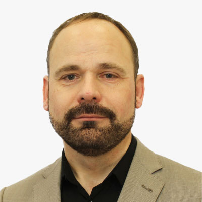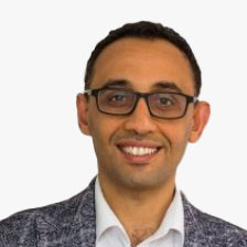

Bert Klaassens is an economist with the Netherlands Authority for Consumers and Markets (ACM). He has almost 25 years of work experience in the public sector, with a great part in telecommunication regulation. On behalf of ACM he is co-chair of the Planning & Future Trends working group of BEREC, the body of European telecom regulators. Besides drafting the strategy documents, his team also explores new technological developments and relates this to regulation. You can always find his interest where economics (competition), legal and technology come together. Topics that have is interest are a.o. 5G/6G, AI, IoT, MEC.
Bert Klaassens
 Bert Klaassens
Senior Economic Advisor , Authority for Consumers and Markets , The Netherlands
Bert Klaassens is an economist with the Netherlands Authority for Consumers and Markets (ACM). He has almost 25 years of work experience in the public sector, with a great part in telecommunication regulation. On behalf of ACM he is co-chair of the Planning & Future Trends working group of BEREC, the body of European telecom regulators. Besides drafting the strategy documents, his team also explores new technological developments and relates this to regulation. You can always find his interest where economics (competition), legal and technology come together. Topics that have is interest are a.o. 5G/6G, AI, IoT, MEC.

Bert Klaassens is an economist with the Netherlands Authority for Consumers and Markets (ACM). He has almost 25 years of work experience in the public sector, with a great part in telecommunication regulation. On behalf of ACM he is co-chair of the Planning & Future Trends working group of BEREC, the body of European telecom regulators. Besides drafting the strategy documents, his team also explores new technological developments and relates this to regulation. You can always find his interest where economics (competition), legal and technology come together. Topics that have is interest are a.o. 5G/6G, AI, IoT, MEC.
Senior Economic Advisor | Authority for Consumers and Markets | The Netherlands


Dr. Tomaz Sturm is a GIS expert with more than 20 years of experience in working with spatial data and analyses. He joined the Agency for communication netowrks and services of the Republic of Slovenia in 2018 as an undersecretary. He is responsible for agency public geoportal with data focused on electronic communications, network coverages, drive tests and related spatial layers. His daily work consists of analysis on fixed and mobile network data. Tomaz is a big fan of open source software for GIS and shares his enthusiasm and knowledge in his country.
Tomaz Sturm
 Tomaz Sturm
Undersecretary, Telecommunications , Agency for Communication Networks and Services , Slovenia
Dr. Tomaz Sturm is a GIS expert with more than 20 years of experience in working with spatial data and analyses. He joined the Agency for communication netowrks and services of the Republic of Slovenia in 2018 as an undersecretary. He is responsible for agency public geoportal with data focused on electronic communications, network coverages, drive tests and related spatial layers. His daily work consists of analysis on fixed and mobile network data. Tomaz is a big fan of open source software for GIS and shares his enthusiasm and knowledge in his country.

Dr. Tomaz Sturm is a GIS expert with more than 20 years of experience in working with spatial data and analyses. He joined the Agency for communication netowrks and services of the Republic of Slovenia in 2018 as an undersecretary. He is responsible for agency public geoportal with data focused on electronic communications, network coverages, drive tests and related spatial layers. His daily work consists of analysis on fixed and mobile network data. Tomaz is a big fan of open source software for GIS and shares his enthusiasm and knowledge in his country.
Undersecretary, Telecommunications | Agency for Communication Networks and Services | Slovenia


Ronald van Coevorden is a Senior Key Account Manager at Trimble. He has a geodesy background from Delft University of Technology and almost 30 years experience in the geospatial industry. The last 20 years Ronald spend with Trimble in a variety of sales related positions in locations in Asia (Bangkok), USA (Denver) and Europe. Since returning to Europe, Ronald van Coevorden manages a team that focuses on driving Trimble's geospatial solutions into specific vertical markets throughout the EMEA region.
Abstract
In all phases of the planning, design, construction and maintenance of a telecommunication network (e.g. fiber, 5G) geospatial technologies play a key role. To plan networks it is key to bring information about the demand and the build-up environment together to allow for an efficient and cost-effective roll-out of the network. During the design and construction augmented reality (AR) technologies can assist field workers to e.g. locate existing underground utilities and/or verify the proposed design. During the operational phase geospatial solutions can help predict maintenance needs.
Ronald van Coevorden
 Ronald van Coevorden
Senior Key Account Manager , Trimble , The Netherlands
Ronald van Coevorden is a Senior Key Account Manager at Trimble. He has a geodesy background from Delft University of Technology and almost 30 years experience in the geospatial industry. The last 20 years Ronald spend with Trimble in a variety of sales related positions in locations in Asia (Bangkok), USA (Denver) and Europe. Since returning to Europe, Ronald van Coevorden manages a team that focuses on driving Trimble's geospatial solutions into specific vertical markets throughout the EMEA region.
Abstract
In all phases of the planning, design, construction and maintenance of a telecommunication network (e.g. fiber, 5G) geospatial technologies play a key role. To plan networks it is key to bring information about the demand and the build-up environment together to allow for an efficient and cost-effective roll-out of the network. During the design and construction augmented reality (AR) technologies can assist field workers to e.g. locate existing underground utilities and/or verify the proposed design. During the operational phase geospatial solutions can help predict maintenance needs.
Senior Key Account Manager | Trimble | The Netherlands

Fourat Haider
Network Strategy and Architecture Manager | Three UK | UK

Bharadwaj Pulugundla
Business Development Partner | Verizon Business Group | Netherlands


Andrie Singh is currently working as a Product Manager (Jio Fiber Planning) at Reliance-Jio (India's biggest telecom company). Previously she worked at HERE Technologies for 6 years as Process Design Engineer and GIS Data Analyst. She has done Masters in Science in Geoinformatics from Symbiosis Institute of Geoinformatics (Pune, India) and was awarded the Chancellor's Certificate of Academic Excellence for scoring the highest marks. She passed her undergrad in Physics from Patna Women's College (Patna, India) with 2nd rank and was awarded with Post Graduation Scholarship by Govt of India. She is also a Fellow of the Royal Geographical Society. She has published five research papers and three white papers. Two research papers on Nanotechnology won the Best Paper award from the University Grants Commission (a Statutory Body of Govt of India). Her paper on 'Geo-simulative Approach to Road Accident Analysis' wherein she developed a geostatistical Model (RAYSIM - Road Accident Analysis Simulative Model) won the Best Presentation award at IIT Bombay. Another paper on 'GIS in Rural Marketing' won the Best presentation award at a premier B School in India. During her tenure at HERE Technologies, she published three white papers on 'Defining Cities' (developed model for ranking cities based on their complexities), 'CityEngine' (improving the efficiency of building 3D cities models), 'LiDAR data - Method and Data' (effective usage of LiDAR data for enhanced 3D City modeling).
Andrie Singh
 Andrie Singh
Product Manager , Jio Platforms Limited , India
Andrie Singh is currently working as a Product Manager (Jio Fiber Planning) at Reliance-Jio (India's biggest telecom company). Previously she worked at HERE Technologies for 6 years as Process Design Engineer and GIS Data Analyst. She has done Masters in Science in Geoinformatics from Symbiosis Institute of Geoinformatics (Pune, India) and was awarded the Chancellor's Certificate of Academic Excellence for scoring the highest marks. She passed her undergrad in Physics from Patna Women's College (Patna, India) with 2nd rank and was awarded with Post Graduation Scholarship by Govt of India. She is also a Fellow of the Royal Geographical Society. She has published five research papers and three white papers. Two research papers on Nanotechnology won the Best Paper award from the University Grants Commission (a Statutory Body of Govt of India). Her paper on 'Geo-simulative Approach to Road Accident Analysis' wherein she developed a geostatistical Model (RAYSIM - Road Accident Analysis Simulative Model) won the Best Presentation award at IIT Bombay. Another paper on 'GIS in Rural Marketing' won the Best presentation award at a premier B School in India. During her tenure at HERE Technologies, she published three white papers on 'Defining Cities' (developed model for ranking cities based on their complexities), 'CityEngine' (improving the efficiency of building 3D cities models), 'LiDAR data - Method and Data' (effective usage of LiDAR data for enhanced 3D City modeling).

Andrie Singh is currently working as a Product Manager (Jio Fiber Planning) at Reliance-Jio (India's biggest telecom company). Previously she worked at HERE Technologies for 6 years as Process Design Engineer and GIS Data Analyst. She has done Masters in Science in Geoinformatics from Symbiosis Institute of Geoinformatics (Pune, India) and was awarded the Chancellor's Certificate of Academic Excellence for scoring the highest marks. She passed her undergrad in Physics from Patna Women's College (Patna, India) with 2nd rank and was awarded with Post Graduation Scholarship by Govt of India. She is also a Fellow of the Royal Geographical Society. She has published five research papers and three white papers. Two research papers on Nanotechnology won the Best Paper award from the University Grants Commission (a Statutory Body of Govt of India). Her paper on 'Geo-simulative Approach to Road Accident Analysis' wherein she developed a geostatistical Model (RAYSIM - Road Accident Analysis Simulative Model) won the Best Presentation award at IIT Bombay. Another paper on 'GIS in Rural Marketing' won the Best presentation award at a premier B School in India. During her tenure at HERE Technologies, she published three white papers on 'Defining Cities' (developed model for ranking cities based on their complexities), 'CityEngine' (improving the efficiency of building 3D cities models), 'LiDAR data - Method and Data' (effective usage of LiDAR data for enhanced 3D City modeling).
Product Manager | Jio Platforms Limited | India


Colin Newman is the Global Director of Antenna Business Development at global IoT solutions provider Quectel. Although starting his career as an electronics engineer, Colin has spent the last 35 years in various Global Sales and Marketing roles for telecoms components with the last 14 years holding senior positions in companies specialising in the Radio Frequency (RF) Antenna industry working with leading companies like Mircosoft, Samsung, LG, Nokia and many more. In this time Colin has worked on thousands of different IoT customer projects, pushing the boundaries of antenna technology, materials and working with operators on the many global network requirements.
Abstract
5G Brings a Whole New Improvement to Cellular Based Positioning
The applications for GNSS technology today range across drone delivery, self-driving vehicles, cargo logistics, augmented reality, Internet of Things, remote education, telemedicine solutions, environmental monitoring, smart cities and many more. With 5G as the backbone, it will deliver high-speed, low-latency broadband connectivity that will open the door to a whole new generation of GNSS applications with enhanced parameters for positioning accuracy down to the meter and even centimeter accuracy. We explore the many benefits this brings to us.
Colin Newman
 Colin Newman
Director of Antenna Business Development , Quectel , UK
Colin Newman is the Global Director of Antenna Business Development at global IoT solutions provider Quectel. Although starting his career as an electronics engineer, Colin has spent the last 35 years in various Global Sales and Marketing roles for telecoms components with the last 14 years holding senior positions in companies specialising in the Radio Frequency (RF) Antenna industry working with leading companies like Mircosoft, Samsung, LG, Nokia and many more. In this time Colin has worked on thousands of different IoT customer projects, pushing the boundaries of antenna technology, materials and working with operators on the many global network requirements.
Abstract
5G Brings a Whole New Improvement to Cellular Based Positioning
The applications for GNSS technology today range across drone delivery, self-driving vehicles, cargo logistics, augmented reality, Internet of Things, remote education, telemedicine solutions, environmental monitoring, smart cities and many more. With 5G as the backbone, it will deliver high-speed, low-latency broadband connectivity that will open the door to a whole new generation of GNSS applications with enhanced parameters for positioning accuracy down to the meter and even centimeter accuracy. We explore the many benefits this brings to us.
Director of Antenna Business Development | Quectel | UK


Matt has nearly two decades of experience in building and selling technology solutions. Starting his career in finanical services he worked on everything from mainframes through to real time payments systems. In 2013 Matt worked for his first startup in the Hadoop space and he developed a love of everything data and analytics. After spending a decade managing global teams acrosss pre and post sales, he took the position of CTO at CaryRx where he works to build the best digital pharmacy and analytics experience for patients and health care professionals.
Matt Hawkins
 Matt Hawkins
Principal Solution Engineer , Kinetica , USA
Matt has nearly two decades of experience in building and selling technology solutions. Starting his career in finanical services he worked on everything from mainframes through to real time payments systems. In 2013 Matt worked for his first startup in the Hadoop space and he developed a love of everything data and analytics. After spending a decade managing global teams acrosss pre and post sales, he took the position of CTO at CaryRx where he works to build the best digital pharmacy and analytics experience for patients and health care professionals.

Matt has nearly two decades of experience in building and selling technology solutions. Starting his career in finanical services he worked on everything from mainframes through to real time payments systems. In 2013 Matt worked for his first startup in the Hadoop space and he developed a love of everything data and analytics. After spending a decade managing global teams acrosss pre and post sales, he took the position of CTO at CaryRx where he works to build the best digital pharmacy and analytics experience for patients and health care professionals.
Principal Solution Engineer | Kinetica | USA