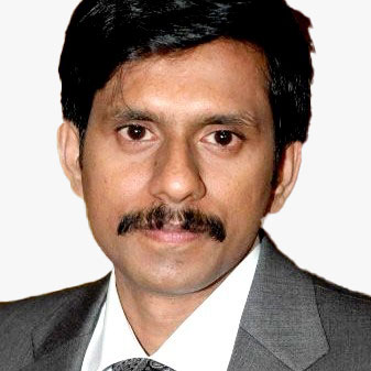
V.S. Subrahmanian
Walter P. Murphy Professor of Computer Science | Buffett Faculty Fellow at Northwestern University Evanston, Illinois | USA
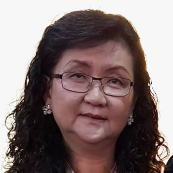
Amy Coughenour Betancourt
CEO | CADASTA Foundation | USA

V.S. Subrahmanian
Walter P. Murphy Professor of Computer Science | Buffett Faculty Fellow at Northwestern University Evanston, Illinois | USA
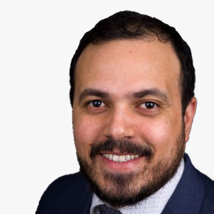
Guillermo Rosello
Director of International Expansion | Satlantis

Under Barbara's leadership, millions of satellite images have been made available to the general public at no charge, allowing scientists, planners and policy makers to make better-informed decisions on environmental problems. Barbara's career began in 1974 at the USGS. From 2008 to 2012, she was Director of the WMO Space Programme, and from 2012 to 2018, Ryan was the Secretariat Director of GEO in Geneva, Switzerland. In January 2021, Barbara became Executive Director of the World Geospatial Industry Council (WGIC), a global not-for-profit trade association of private-sector companies working in the geospatial and Earth observation ecosystem.
Barbara Ryan
 Barbara Ryan
Executive Director , World Geospatial Industry Council (WGIC) , USA
Under Barbara's leadership, millions of satellite images have been made available to the general public at no charge, allowing scientists, planners and policy makers to make better-informed decisions on environmental problems. Barbara's career began in 1974 at the USGS. From 2008 to 2012, she was Director of the WMO Space Programme, and from 2012 to 2018, Ryan was the Secretariat Director of GEO in Geneva, Switzerland. In January 2021, Barbara became Executive Director of the World Geospatial Industry Council (WGIC), a global not-for-profit trade association of private-sector companies working in the geospatial and Earth observation ecosystem.

Under Barbara's leadership, millions of satellite images have been made available to the general public at no charge, allowing scientists, planners and policy makers to make better-informed decisions on environmental problems. Barbara's career began in 1974 at the USGS. From 2008 to 2012, she was Director of the WMO Space Programme, and from 2012 to 2018, Ryan was the Secretariat Director of GEO in Geneva, Switzerland. In January 2021, Barbara became Executive Director of the World Geospatial Industry Council (WGIC), a global not-for-profit trade association of private-sector companies working in the geospatial and Earth observation ecosystem.
Executive Director | World Geospatial Industry Council (WGIC) | USA

Timothy Fella
Team Lead, Geospatial Authorities | Esri


Abstract
WaPOR - Monitoring Water Productivity through Open access of remotely sensed derived data
Boudewijn Van Silfhout
 Boudewijn Van Silfhout
CEO , eLEAF , The Netherlands
Abstract
WaPOR - Monitoring Water Productivity through Open access of remotely sensed derived data

Abstract
WaPOR - Monitoring Water Productivity through Open access of remotely sensed derived data
CEO | eLEAF | The Netherlands


'Andreas Littkopf holds a degree in agriculture (terrestrial ecology) from the Humboldt University in Berlin (1986) and a degree in business management (2000). After working as head of the department in a local environmental agency, he acted as Pre-Accession Adviser and residential Twinning Adviser in Poland and Slovenia implementing environment related EU directives. From 2007 he led the European Topic Centre for Land Use and Spatial Information (ETC/LUSI, 2007-2010) and the European Topic Centre for Spatial Information and Analysis (ETC/SIA) during 2011-2012. He also co-ordinated research activities of the University teams and was task manager in several FP7 projects related to earth observation and environmental information management. In July 2012 he started working at the Environment Agency Austria, where he was responsible for project development with European and international financial institutions and coordinated a Central Asian project on environmental monitoring. From 2015 he has been leading the European Topic Centre on Urban, Land and Soil systems and since 2022 the new ETC data integration and digitisation, which supports the EEA among others in implementing the Copernicus land monitoring program. Furthermore, he supports the development of remote sensing expertise in the European Neighbourhood East and participates as a data expert for monitoring Nature based solutions in H2020 projects.'
Abstract
SDGs has become omnipresent in the last years of our societal discussions as well as governmental strategies, plans and justifications. The European Green Deal (EGD) as the political framework and driver of further development of environmental monitoring in Europe has a lot in common with the SDGs. Although we can't use 1:1 EGD indicators for SDG targets, a substantial number of EGD assessments are directly linked to SDGs.
The EGD is focused primarily on Europe and the European Union (EU) and includes several targets and initiatives, like climate neutrality, where firstly GHG emissions shall be reduced by 55% by 2030 and achieving a climate-neutral Europe by 2050. The EGD has a stronger focus on climate change and energy transition and is embedded in a political framework with the European Climate Law, the Renovation Wave, and the Offshore Renewable Energy Strategy.
The Copernicus Land Monitoring Service (CLMS), implemented by the European Environment Agency (EEA) plays a crucial role in monitoring progress, inter alia towards SDG 13 (Climate Action), since it provides data and information, specifically on GHG emissions from land use, land-use change, and forestry (LULUCF), which is central for understanding the sources and trends of GHG emissions in this sector.
Furthermore, several High Resolution Layers (HRLs) including forest cover, grassland and imperviousness are provided, which are essential for the monitoring of SDG 15 (Life on Land) and the Urban Atlas, done for around 800 cities in Europe, contributes among other things with data on land use changes, which are indispensable for assessing SDG 11 (Sustainable Cities and Communities)
While CLMS is providing data for Europe, national governmental institutions do further detailed assessments on national and regional level.
Looking to SDG 7, which calls for access to affordable, reliable, sustainable and modern energy for all, Earth observation in Austria contributes to the creation of energy plans and strategies by providing data on energy demand, energy efficiency and the use of renewable energy sources. This information will help to promote investment in clean energy sources and accelerate the expansion of renewable energy in Austria.
More examples from Europe and Austria will be shown.
Andreas Littkopf
 Andreas Littkopf
Manager - The European Topic Center Data integration and digitalization , European Environment Agency , Austria
'Andreas Littkopf holds a degree in agriculture (terrestrial ecology) from the Humboldt University in Berlin (1986) and a degree in business management (2000). After working as head of the department in a local environmental agency, he acted as Pre-Accession Adviser and residential Twinning Adviser in Poland and Slovenia implementing environment related EU directives. From 2007 he led the European Topic Centre for Land Use and Spatial Information (ETC/LUSI, 2007-2010) and the European Topic Centre for Spatial Information and Analysis (ETC/SIA) during 2011-2012. He also co-ordinated research activities of the University teams and was task manager in several FP7 projects related to earth observation and environmental information management.
In July 2012 he started working at the Environment Agency Austria, where he was responsible for project development with European and international financial institutions and coordinated a Central Asian project on environmental monitoring. From 2015 he has been leading the European Topic Centre on Urban, Land and Soil systems and since 2022 the new ETC data integration and digitisation, which supports the EEA among others in implementing the Copernicus land monitoring program. Furthermore, he supports the development of remote sensing expertise in the European Neighbourhood East and participates as a data expert for monitoring Nature based solutions in H2020 projects.'
Abstract
SDGs has become omnipresent in the last years of our societal discussions as well as governmental strategies, plans and justifications. The European Green Deal (EGD) as the political framework and driver of further development of environmental monitoring in Europe has a lot in common with the SDGs. Although we can't use 1:1 EGD indicators for SDG targets, a substantial number of EGD assessments are directly linked to SDGs.
The EGD is focused primarily on Europe and the European Union (EU) and includes several targets and initiatives, like climate neutrality, where firstly GHG emissions shall be reduced by 55% by 2030 and achieving a climate-neutral Europe by 2050. The EGD has a stronger focus on climate change and energy transition and is embedded in a political framework with the European Climate Law, the Renovation Wave, and the Offshore Renewable Energy Strategy.
The Copernicus Land Monitoring Service (CLMS), implemented by the European Environment Agency (EEA) plays a crucial role in monitoring progress, inter alia towards SDG 13 (Climate Action), since it provides data and information, specifically on GHG emissions from land use, land-use change, and forestry (LULUCF), which is central for understanding the sources and trends of GHG emissions in this sector.
Furthermore, several High Resolution Layers (HRLs) including forest cover, grassland and imperviousness are provided, which are essential for the monitoring of SDG 15 (Life on Land) and the Urban Atlas, done for around 800 cities in Europe, contributes among other things with data on land use changes, which are indispensable for assessing SDG 11 (Sustainable Cities and Communities)
While CLMS is providing data for Europe, national governmental institutions do further detailed assessments on national and regional level.
Looking to SDG 7, which calls for access to affordable, reliable, sustainable and modern energy for all, Earth observation in Austria contributes to the creation of energy plans and strategies by providing data on energy demand, energy efficiency and the use of renewable energy sources. This information will help to promote investment in clean energy sources and accelerate the expansion of renewable energy in Austria.
More examples from Europe and Austria will be shown.

'Andreas Littkopf holds a degree in agriculture (terrestrial ecology) from the Humboldt University in Berlin (1986) and a degree in business management (2000). After working as head of the department in a local environmental agency, he acted as Pre-Accession Adviser and residential Twinning Adviser in Poland and Slovenia implementing environment related EU directives. From 2007 he led the European Topic Centre for Land Use and Spatial Information (ETC/LUSI, 2007-2010) and the European Topic Centre for Spatial Information and Analysis (ETC/SIA) during 2011-2012. He also co-ordinated research activities of the University teams and was task manager in several FP7 projects related to earth observation and environmental information management. In July 2012 he started working at the Environment Agency Austria, where he was responsible for project development with European and international financial institutions and coordinated a Central Asian project on environmental monitoring. From 2015 he has been leading the European Topic Centre on Urban, Land and Soil systems and since 2022 the new ETC data integration and digitisation, which supports the EEA among others in implementing the Copernicus land monitoring program. Furthermore, he supports the development of remote sensing expertise in the European Neighbourhood East and participates as a data expert for monitoring Nature based solutions in H2020 projects.'
Abstract
SDGs has become omnipresent in the last years of our societal discussions as well as governmental strategies, plans and justifications. The European Green Deal (EGD) as the political framework and driver of further development of environmental monitoring in Europe has a lot in common with the SDGs. Although we can't use 1:1 EGD indicators for SDG targets, a substantial number of EGD assessments are directly linked to SDGs.
The EGD is focused primarily on Europe and the European Union (EU) and includes several targets and initiatives, like climate neutrality, where firstly GHG emissions shall be reduced by 55% by 2030 and achieving a climate-neutral Europe by 2050. The EGD has a stronger focus on climate change and energy transition and is embedded in a political framework with the European Climate Law, the Renovation Wave, and the Offshore Renewable Energy Strategy.
The Copernicus Land Monitoring Service (CLMS), implemented by the European Environment Agency (EEA) plays a crucial role in monitoring progress, inter alia towards SDG 13 (Climate Action), since it provides data and information, specifically on GHG emissions from land use, land-use change, and forestry (LULUCF), which is central for understanding the sources and trends of GHG emissions in this sector.
Furthermore, several High Resolution Layers (HRLs) including forest cover, grassland and imperviousness are provided, which are essential for the monitoring of SDG 15 (Life on Land) and the Urban Atlas, done for around 800 cities in Europe, contributes among other things with data on land use changes, which are indispensable for assessing SDG 11 (Sustainable Cities and Communities)
While CLMS is providing data for Europe, national governmental institutions do further detailed assessments on national and regional level.
Looking to SDG 7, which calls for access to affordable, reliable, sustainable and modern energy for all, Earth observation in Austria contributes to the creation of energy plans and strategies by providing data on energy demand, energy efficiency and the use of renewable energy sources. This information will help to promote investment in clean energy sources and accelerate the expansion of renewable energy in Austria.
More examples from Europe and Austria will be shown.
Manager - The European Topic Center Data integration and digitalization | European Environment Agency | Austria

Yury Sakovich
Business Development Manager | Trimble | Germany


Under Barbara's leadership, millions of satellite images have been made available to the general public at no charge, allowing scientists, planners and policy makers to make better-informed decisions on environmental problems. Barbara's career began in 1974 at the USGS. From 2008 to 2012, she was Director of the WMO Space Programme, and from 2012 to 2018, Ryan was the Secretariat Director of GEO in Geneva, Switzerland. In January 2021, Barbara became Executive Director of the World Geospatial Industry Council (WGIC), a global not-for-profit trade association of private-sector companies working in the geospatial and Earth observation ecosystem.
Barbara Ryan
 Barbara Ryan
Executive Director , World Geospatial Industry Council (WGIC) , USA
Under Barbara's leadership, millions of satellite images have been made available to the general public at no charge, allowing scientists, planners and policy makers to make better-informed decisions on environmental problems. Barbara's career began in 1974 at the USGS. From 2008 to 2012, she was Director of the WMO Space Programme, and from 2012 to 2018, Ryan was the Secretariat Director of GEO in Geneva, Switzerland. In January 2021, Barbara became Executive Director of the World Geospatial Industry Council (WGIC), a global not-for-profit trade association of private-sector companies working in the geospatial and Earth observation ecosystem.

Under Barbara's leadership, millions of satellite images have been made available to the general public at no charge, allowing scientists, planners and policy makers to make better-informed decisions on environmental problems. Barbara's career began in 1974 at the USGS. From 2008 to 2012, she was Director of the WMO Space Programme, and from 2012 to 2018, Ryan was the Secretariat Director of GEO in Geneva, Switzerland. In January 2021, Barbara became Executive Director of the World Geospatial Industry Council (WGIC), a global not-for-profit trade association of private-sector companies working in the geospatial and Earth observation ecosystem.
Executive Director | World Geospatial Industry Council (WGIC) | USA

Shin-ichi Sobue got a master degree of engineering from Toyohashi university of Technology in Japan in 1989 and got a philosophical doctor of engineering from Kennedy-Western University in USA in 2000. His major is image data analysis of earth observation data. He joined JAXA in 1989 and had been work for earth observation satellite ground system development and data research management. From January 2017 to 2021, he served Advanced Land Observing Satellite-2 (ALOS-2) project manager. From 2022, he serves deputy chief officer of Earth Observation missions and ALOS-2 mission manager in JAXA. He also plays a role of co-lead of GEOGLAM Asia-RiCE team, ISPRS commission I workgroup 1 co-chair and vice president of remote sensing society of Japan.
Abstract
JAXA's Earth Observation Satellites and SDGs
Shinichi Sobue
 Shinichi Sobue
Deputy Chief Officer of Earth Observation Applications , Japan Aerospace Exploration Agency (JAXA) , Japan
Shin-ichi Sobue got a master degree of engineering from Toyohashi university of Technology in Japan in 1989 and got a philosophical doctor of engineering from Kennedy-Western University in USA in 2000. His major is image data analysis of earth observation data. He joined JAXA in 1989 and had been work for earth observation satellite ground system development and data research management. From January 2017 to 2021, he served Advanced Land Observing Satellite-2 (ALOS-2) project manager. From 2022, he serves deputy chief officer of Earth Observation missions and ALOS-2 mission manager in JAXA. He also plays a role of co-lead of GEOGLAM Asia-RiCE team, ISPRS commission I workgroup 1 co-chair and vice president of remote sensing society of Japan.
Abstract
JAXA's Earth Observation Satellites and SDGs
Deputy Chief Officer of Earth Observation Applications | Japan Aerospace Exploration Agency (JAXA) | Japan

Dr. Pooja Mahapatra is responsible for geospatial and remote sensing solutions at Fugro. Since 2019, she has worked on commercializing a variety of cutting-edge Fugro innovations, with applications ranging from coastal resilience to railway track maintenance. Through Fugro, she is an active member of the Disaster Resilience Working Group of the WGIC. From 2016 to 2019, she led the global technology deployment and replication efforts in the geospatial domain at Shell, and provided internal consultancy on remote sensing, geospatial analytics and geodesy to various parts of the business. Prior to this, she was a senior InSAR engineer at SkyGeo. Pooja holds a PhD from Delft University of Technology on satellite remote sensing (InSAR) for ground deformation monitoring. Her passion lies in applying geospatial to real-world challenges, and was honoured to be selected as one of "Geospatial World's 50 Rising Stars" in 2022.
Abstract
Geo-data for making better decisions on climate change adaptation - focus on small islands
Pooja Mahapatra
 Pooja Mahapatra
Global Lead - Geospatial for Climate , Fugro , The Netherlands
Dr. Pooja Mahapatra is responsible for geospatial and remote sensing solutions at Fugro. Since 2019, she has worked on commercializing a variety of cutting-edge Fugro innovations, with applications ranging from coastal resilience to railway track maintenance. Through Fugro, she is an active member of the Disaster Resilience Working Group of the WGIC. From 2016 to 2019, she led the global technology deployment and replication efforts in the geospatial domain at Shell, and provided internal consultancy on remote sensing, geospatial analytics and geodesy to various parts of the business. Prior to this, she was a senior InSAR engineer at SkyGeo. Pooja holds a PhD from Delft University of Technology on satellite remote sensing (InSAR) for ground deformation monitoring. Her passion lies in applying geospatial to real-world challenges, and was honoured to be selected as one of "Geospatial World's 50 Rising Stars" in 2022.
Abstract
Geo-data for making better decisions on climate change adaptation - focus on small islands
Global Lead - Geospatial for Climate | Fugro | The Netherlands


Mikael J.A. Maes is an Environmental Data Scientist at the Environment Directorate of the Organisation for Economic Co-operation and Development (OECD). He specialises in using geospatial data and statistical programming to understand better environmental processes and the impact of climate change around the world. At the OECD, he supports countries by developing data and indicators on the amount of protected areas and by studying the impact and vulnerability of countries to air pollution and climate hazards, amongst other themes. Mikael has more than eight years of experience in climate change and environment research in academia, public, private and international spheres. During his Ph.D., he studied the relationship between mental health, cognition and nature exposure and how these ecosystem benefits can be better integrated into SEEA accounting. He holds two M.Sc. degrees and a B.Sc. in Environmental Science and Biology.
Mikael J.A. Maes
 Mikael J.A. Maes
Environmental Data Scientist at the Environment Directorate , Organisation for Economic Co-operation and Development (OECD)
Mikael J.A. Maes is an Environmental Data Scientist at the Environment Directorate of the Organisation for Economic Co-operation and Development (OECD). He specialises in using geospatial data and statistical programming to understand better environmental processes and the impact of climate change around the world. At the OECD, he supports countries by developing data and indicators on the amount of protected areas and by studying the impact and vulnerability of countries to air pollution and climate hazards, amongst other themes. Mikael has more than eight years of experience in climate change and environment research in academia, public, private and international spheres. During his Ph.D., he studied the relationship between mental health, cognition and nature exposure and how these ecosystem benefits can be better integrated into SEEA accounting. He holds two M.Sc. degrees and a B.Sc. in Environmental Science and Biology.

Mikael J.A. Maes is an Environmental Data Scientist at the Environment Directorate of the Organisation for Economic Co-operation and Development (OECD). He specialises in using geospatial data and statistical programming to understand better environmental processes and the impact of climate change around the world. At the OECD, he supports countries by developing data and indicators on the amount of protected areas and by studying the impact and vulnerability of countries to air pollution and climate hazards, amongst other themes. Mikael has more than eight years of experience in climate change and environment research in academia, public, private and international spheres. During his Ph.D., he studied the relationship between mental health, cognition and nature exposure and how these ecosystem benefits can be better integrated into SEEA accounting. He holds two M.Sc. degrees and a B.Sc. in Environmental Science and Biology.
Environmental Data Scientist at the Environment Directorate | Organisation for Economic Co-operation and Development (OECD)


Abstract
GoldenEye H2020 project
We give human analysts superhuman powers with our proven and awards winning suite of AI platforms.
OPT/NET team is solving the most challenging real-time geo analytical and telemetry analysis problems.
Two of our flagship projects are funded under EC Health and Digital Executive Agency (HaDEA) funding. These two Horizon 2020 projects are GoldenEye and CENTURION. These advanced AI projects demonstrate the advanced EoD and Big Data processing platforms that we developed over the years through collaboration with ESA, Copernicus, European Commission and the industry.
The most successful and commercially attractive use cases for which OPT/NET has solutions are in mining, agriculture, forestry, maritime and emergency management sectors.
Our mission ready platforms are available today, offering unparalleled capabilities for near real time processing of all types of sensor data at the lowest cost and minimum effort from the operators.
Our mission is to improve the lives of more than 1 billion people in the next 5 years by applying powerful AI to processing of the Earth observations data and systems telemetry.
Taras Matselyukh
 Taras Matselyukh
CEO and Founder , OPT / NET BV , The Netherlands
Abstract
GoldenEye H2020 project
We give human analysts superhuman powers with our proven and awards winning suite of AI platforms.
OPT/NET team is solving the most challenging real-time geo analytical and telemetry analysis problems.
Two of our flagship projects are funded under EC Health and Digital Executive Agency (HaDEA) funding. These two Horizon 2020 projects are GoldenEye and CENTURION. These advanced AI projects demonstrate the advanced EoD and Big Data processing platforms that we developed over the years through collaboration with ESA, Copernicus, European Commission and the industry.
The most successful and commercially attractive use cases for which OPT/NET has solutions are in mining, agriculture, forestry, maritime and emergency management sectors.
Our mission ready platforms are available today, offering unparalleled capabilities for near real time processing of all types of sensor data at the lowest cost and minimum effort from the operators.
Our mission is to improve the lives of more than 1 billion people in the next 5 years by applying powerful AI to processing of the Earth observations data and systems telemetry.
CEO and Founder | OPT / NET BV | The Netherlands


Abstract
During the last decades we have seen a great effort from the scientific community, governments and organizations to bring awareness of the real threat that climate change is for humanity. Many industries are investing in their transition towards sustainability, and many others are seeing how they can support the fight against climate change and the energy transition.
Space is one of these industries, and specifically, the ability to monitor our Earth from space, in order to provide information to policy makers and organizations worldwide in a timely manner.
GEOSAT is a European Earth Observation satellite operator and data and services provider, which is also contributing to Earth monitoring, energy transition and to the fight against climate change.
GEOSAT has developed tools, such as a Lithium detection algorithm, in order to identify key resources for the energy transition. We also contribute with the monitoring of land usage, environmental impact assessments, tracking of renewal energy projects, as well as carbon mapping. Thanks to LEO satellites, large areas can be monitored in a short period of time, providing biomass area calculation, and tracking carbon credit initiatives.
Javier Alexander Santos
 Javier Alexander Santos
Business Development Director , GeoSAT , Spain
Abstract
During the last decades we have seen a great effort from the scientific community, governments and organizations to bring awareness of the real threat that climate change is for humanity. Many industries are investing in their transition towards sustainability, and many others are seeing how they can support the fight against climate change and the energy transition.
Space is one of these industries, and specifically, the ability to monitor our Earth from space, in order to provide information to policy makers and organizations worldwide in a timely manner.
GEOSAT is a European Earth Observation satellite operator and data and services provider, which is also contributing to Earth monitoring, energy transition and to the fight against climate change.
GEOSAT has developed tools, such as a Lithium detection algorithm, in order to identify key resources for the energy transition. We also contribute with the monitoring of land usage, environmental impact assessments, tracking of renewal energy projects, as well as carbon mapping. Thanks to LEO satellites, large areas can be monitored in a short period of time, providing biomass area calculation, and tracking carbon credit initiatives.
Business Development Director | GeoSAT | Spain


Alex Sweeney is a Senior Geospatial Data Analyst at Locana with a decade of experience in the climate, environmental remote sensing, and GIS fields. Her experience includes working with multivariate geospatial data ranging from satellite derived products, climate models, and ground-based observational data. She utilizes both open source and proprietary software for the acquisition, management, processing, and delivery of data. Her interdisciplinary background and foundation in climate science (B.S. Earth and Space Exploration, M.A. Climate and Society) affords her the ability to leverage different geospatial techniques to draw meaningful insights and publish sector-specific outputs.
Abstract
Open-Source Climate Adaptation Decision Support Tools: Why they're imperative and tales from the field
It is extraordinarily clear that climate change is accelerating, the time to act is dwindling, and climate policies are underperforming in their ability to reduce emissions and prohibit unabated climate change. It is equally clear that Geospatial Data and Technology will play a vital and central role in identifying responses to the array of climate related challenges. In this scenario, the most vulnerable populations often lack tools and information necessary to mitigate the disastrous impacts of climate hazards on their lives and livelihoods and develop fact-based strategies for long-term adaptation. As the world experiences increasing extreme weather events and changes in climatic patterns, already vulnerable agrarian and agropastoral communities will bear the brunt of the impacts. Agricultural producers are confronting the climate crisis in real time, and individuals, communities and governments need reliable information to support decision making - farmers and farmer-cooperatives need to understand what adaptation options exist for their specific location and crop/livestock mix, businesses need support in understanding how changes in climate may impact their entire value chain, and governments and international cooperation actors must have a multidimensional view into the impacts of and countermeasures for the deepening climate crisis in their areas of interest. Open-source Climate Adaptation Decision Support Tools can provide much needed data points to help answer user specific questions. These Tools not only foster education and collaboration, they also allow users the agency to make data driven decisions. Locana has recently formed partnerships to build out two unique decision support tools. Our presentation will demonstrate how together we brought their ideas to life - the rationale behind the tools, what open-source solutions we used, as well as where the future lies for these types of tools. Within this, we'll deep-dive into what data is needed, how to automate data pipelines, the critical need for tailored analyses, and tech stacks for optimal reusability.
Alex Sweeney
 Alex Sweeney
Senior Geospatial Data Analyst , Locana , USA
Alex Sweeney is a Senior Geospatial Data Analyst at Locana with a decade of experience in the climate, environmental remote sensing, and GIS fields. Her experience includes working with multivariate geospatial data ranging from satellite derived products, climate models, and ground-based observational data. She utilizes both open source and proprietary software for the acquisition, management, processing, and delivery of data. Her interdisciplinary background and foundation in climate science (B.S. Earth and Space Exploration, M.A. Climate and Society) affords her the ability to leverage different geospatial techniques to draw meaningful insights and publish sector-specific outputs.
Abstract
Open-Source Climate Adaptation Decision Support Tools: Why they're imperative and tales from the field
It is extraordinarily clear that climate change is accelerating, the time to act is dwindling, and climate policies are underperforming in their ability to reduce emissions and prohibit unabated climate change. It is equally clear that Geospatial Data and Technology will play a vital and central role in identifying responses to the array of climate related challenges. In this scenario, the most vulnerable populations often lack tools and information necessary to mitigate the disastrous impacts of climate hazards on their lives and livelihoods and develop fact-based strategies for long-term adaptation. As the world experiences increasing extreme weather events and changes in climatic patterns, already vulnerable agrarian and agropastoral communities will bear the brunt of the impacts. Agricultural producers are confronting the climate crisis in real time, and individuals, communities and governments need reliable information to support decision making - farmers and farmer-cooperatives need to understand what adaptation options exist for their specific location and crop/livestock mix, businesses need support in understanding how changes in climate may impact their entire value chain, and governments and international cooperation actors must have a multidimensional view into the impacts of and countermeasures for the deepening climate crisis in their areas of interest. Open-source Climate Adaptation Decision Support Tools can provide much needed data points to help answer user specific questions. These Tools not only foster education and collaboration, they also allow users the agency to make data driven decisions. Locana has recently formed partnerships to build out two unique decision support tools. Our presentation will demonstrate how together we brought their ideas to life - the rationale behind the tools, what open-source solutions we used, as well as where the future lies for these types of tools. Within this, we'll deep-dive into what data is needed, how to automate data pipelines, the critical need for tailored analyses, and tech stacks for optimal reusability.
Senior Geospatial Data Analyst | Locana | USA

Tomaz Petek
General Manager | Surveying and Mapping Authority | Republic of Slovenia
Francisco Vala
Director for the Coordination of Territorial Statistics | Statistics Portugal
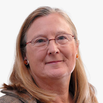

Until 2016, she has been production manager of pan-European geographical dataset EuroRegionalMap and is now managing the implementation of the federal geospatial platform geo.be according to INSPIRE compliancy. In the past 3 years, she has been acting as a technical adviser for the Open Map for Europe platform hold by the EuroGeographics association. She is currently deeply involved in the working group on data integration of UNGGIM-Europe as co-chair. She has followed with warm interest the GSW training sessions on geospatial knowledge infrastructure of the past 2 years.
Nathalie Delattre
 Nathalie Delattre
Senior Manager , National Geographic Institute , Belgium
Until 2016, she has been production manager of pan-European geographical dataset EuroRegionalMap and is now managing the implementation of the federal geospatial platform geo.be according to INSPIRE compliancy. In the past 3 years, she has been acting as a technical adviser for the Open Map for Europe platform hold by the EuroGeographics association. She is currently deeply involved in the working group on data integration of UNGGIM-Europe as co-chair. She has followed with warm interest the GSW training sessions on geospatial knowledge infrastructure of the past 2 years.

Until 2016, she has been production manager of pan-European geographical dataset EuroRegionalMap and is now managing the implementation of the federal geospatial platform geo.be according to INSPIRE compliancy. In the past 3 years, she has been acting as a technical adviser for the Open Map for Europe platform hold by the EuroGeographics association. She is currently deeply involved in the working group on data integration of UNGGIM-Europe as co-chair. She has followed with warm interest the GSW training sessions on geospatial knowledge infrastructure of the past 2 years.
Senior Manager | National Geographic Institute | Belgium

Janusz Dygaszewicz
Director of the ICT Systems | Geostatistics and Census Department | Statistics Poland
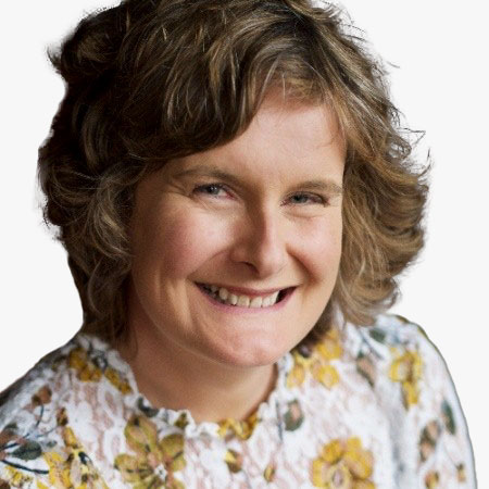
Rhian French
Director | Three Trees and a Map PR | UK

James Norris
International Policy Lead | OSGB


