Session Highlight
- What are knowledge-focused national geospatial infrastructures, and how can countries move up the knowledge value chain?
- Role of knowledge-focused geospatial infrastructures in meeting national development mandates.
- Adoption and integration of geospatial knowledge in critical economic sectors.
- Socio-economic impact of knowledge-focused national geospatial infrastructures, and geospatial knowledge integration in critical economic sectors.

Moderator
Mark Reichardt
Senior Consultant
Geospatial World
USA
Keynote Address
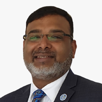
Zaffar Sadiq Mohamed-Ghouse
Director, Advisory and Innovation
Woolpert Asia-Pacific
Australia
Prof Dr Zaffar Sadiq Mohamed-Ghouse is a Director of Advisory & Innovation at Woolpert, a leading global architecture, engineering, and geospatial firm. He has over 25 years of experience in providing strategic advice and solutions to several governments and international organizations on geospatial and space-related matters, such as positioning networks, data policies, spatial digital twins, geospatial ecosystems, natural resources, and Geospatial master plans. He has led several multi-million-dollar national mapping projects for various countries and regions, including Australia, New Zealand, Malaysia, Indonesia, India, United Arab Emirates, and Saudi Arabia.
As a Fellow of the Institution of Engineers Australia, a Fellow of the Royal Geographical Society, and an Honorary Fellow of the Geospatial Council of Australia, Zaffar is recognized as one of the spatial leaders in Australia and globally. He is also the Chair of the United Nations Global Geospatial Information Management - Private Sector Network, where he facilitates collaboration and innovation between the private sector and the UN-GGIM community. He is passionate about advancing the spatial industry and its contribution to the sustainable development goals. He has published extensively in GIS, surveying, remote sensing, data management, and spatial data / knowledge infrastructures and Geospatial Ecosystems. He is the recipient of several prestigious awards, including the Professional of the Year 2022 by the Asia-Pacific Spatial Excellence Awards and University of Melbourne's Prestigious Thornton Smith Medal for outstanding service to Geospatial and Surveying Community. Zaffar has academic appointments at University of Melbourne, Anna University and National Institute of Advance Studies. He served on the Programme Board of Geospatial Knowledge Infrastructure since its inception. He is currently the Vice president of the International Society of Digital Earth and serves as Board of Directors of the Open Geospatial Consortium and Programme Board of Group on Earth Observation.
Topic
Role and Relevance of Geospatial Knowledge Infrastructure (GKI) in National Development

N. Enkhjargal
Head of the Spatial Data Analysis Department
Center for Policy Research and Analysis
Mongolia
Dr. Enkhjargal Natsagdorj holds a Ph.D. degree in geoinformatics from Ghent University in Belgium. Prior degrees were earned at the National University of Mongolia (M.S.) for remote sensing and GIS and at the Mongolian University of Life Science (B.S.) for land management engineering in Mongolia. Currently, she is the director of the spatial data analysis department at the Centre for Policy Research and Analysis. Her organization serves on capital city government projects on geospatial data analysis. She is a board member and leader of the Technical Committee on GIS of the Mongolian Geospatial Association.
Topic
Applications of Geospatial Knowledge Infrastructure in Urban Policy and Planning

Sile Martin
Senior Policy Adviser
UK Geospatial Commission
UK
Sile Martin is currently the policy lead at the UK Geospatial Commission responsible for public sector use of EO data policy. For the last 3 years, Sile has been focused on developing and monitoring a portfolio of projects in a team whose ambition is to increase the UK public sector's capability to utilise geospatial data and deliver more effective and efficient public services. Prior to joining the UK Geospatial Commission, Sile worked for the Houses of Parliament measuring the benefits of a portfolio of building and infrastructure projects.
Topic
Harnessing the geospatial market and technology advancements to grow the UK economy and geospatial capability

Markus Jobst
Chief Information Officer
Federal Office of Metrology and Surveying
Austria
As Chief Information Officer, Markus Jobst is responsible for the IT organisation, the strategic IT management and the IT knowledge infrastructure at the Austrian Federal Office of Metrology and Surveying (BEV).
Markus Jobst studied geodesy and geoinformation at the Vienna University of Technology and completed his studies with a thesis on the use of multimedia technologies in map-related representations in 2003. He then worked as a research assistant at the Institute of Geoinformation and Cartography at the Vienna University of Technology and finished his doctoral thesis with the focus on a semiotic model for cartographic communication with 3D in 2008. In his further scientific career, Jobst received a post-doctoral fellowship at the Hasso Plattner Institute at the University of Potsdam from 2008-2009. He joined the Federal Office of Metrology and Surveying for the implementation of the EU Directive 2007/2/EC (INSPIRE) and the extension of the IT architecture for the EU Directive (EU) 2019/1024 (Open Data Directive). Starting from 2014 he is active member and supporter of the United Nations Committee of Experts on Global Geospatial Information Management in Europe. In 2022 Markus Jobst was appointed Chief Information Officer (CIO) at BEV.
Markus Jobst's ongoing research interests lay in the fields of sustainable service-oriented architectures, efficient geo-communication and trustful geospatial knowledge infrastructures. Insights are taught in corresponding courses as a lecturer at the Vienna University of Technology, the Graz University of Technology and the Hasso Plattner Institute of the University of Potsdam.
Topic
Observable impacts on socio-economic values by high value geospatial infrastructure
David Henderson
Chief Geospatial Officer
Ordnance Survey
UK
David leads the strategy and roadmap to reinforce and extend Ordnance Survey's position, reputation and contribution as a leader in the national and international geospatial industry.
David joined OS in 2003 and has 25 years of geospatial industry experience across a variety of technical and leadership roles. He has been part of the OS Executive Team since 2015 where he has led both product strategy and customer facing teams.
He leads the UK's delegation to the UN's Committee of Experts on Global Geographic Information Management (UNGGIM) and is a Vice-Chair of the UNGGIM Europe Regional Group. David is a former Chair of the UK's Association for Geographic Information (2015 and 2016), member of the Management Board of Eurogeographics (from 2017) and from 2016-19 was the industry external examiner for the GeoSciences School at Edinburgh University.
In 2019 David was awarded an Honorary Fellowship from the Royal Scottish Geographical Society.
Topic
The Foundations of Geospatial Knowledge Infrastructure
Alejandro Guinea de Salas
President
EUROGI
Spain
Alejandro Guinea de Salas is the President of EUROGI, an organization that works to advance geographic information across Europe. He holds a degree in Surveying Engineering and a Master's in Cartographic Geotechnologies in Engineering and Architecture. Additionally, he is a member of the working group for the Spatial Data Infrastructure of Spain. Currently, he serves as the CEO of Geograma, a company specializing in geographic information services.
Topic
Spatial is Special... It Really is
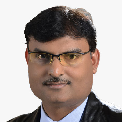
Dheeraj Kumar
Dy. Director and Project Director
IIT (ISM) DHANBAD
India
Prof. Dheeraj Kumar is the Project Director of TexMin Hub (Mining Innovation Hub set up by Govt. of India). He is also Deputy Director at IIT (ISM) Dhanbad. Prof. Kumar is the founding Director of TEXMiN Foundation and ACIC Foundation (Section 8 Companies set up with support from DST and NITI Aayog, respectively). Prof. Kumar is a Mine Surveying & Geomatics Professor at the Department of Mining Engineering, IIT (ISM) Dhanbad. He completed his M. Tech from IIT (ISM), Dhanbad, and PhD from IIT Kharagpur. He has more than 20 years of experience in teaching & research at various organizations. His areas of expertise include Surveying, Geomatics, Rock Excavation Engineering, and IT Application in different earth science domains. Dr Kumar has published more than 70 technical research papers in various international/national journals, including seminars/symposiums, and presented several papers at conferences in India and Abroad. Dr Kumar has authored several books and chapters in Advances in Mine Surveying and Application of IT in Mining. He has already completed more than 60 industrial consultancy projects sponsored by various mining & allied industries for solving their real-life mining projects. He has completed six research projects in different areas of Mining and Earth Science. Dr Kumar has conducted several Executive Development Programmes (EDP) and trained over 550 mining executives on various mining and allied disciplines for different organizations. NTPC Ltd., NHPC Ltd., Coal India Ltd., Oil India Ltd., Tata Steel, Atlas Copco, Infosys, Vedanta, IMFA, Indian Oil Corporation. He is a recipient of the National Merit Scholarship; Meritorious Scholar award at IIT Kharagpur in three consecutive years, i.e., 2000- 2001, 2001-2002 and 2002-2003; "CSIR Foreign travel Grant" and "Hindustan Zinc Limited Award" by the Institution of Engineers (INDIA). Dr Kumar has been a recipient of the SBI 2nd Best Researcher award for five consecutive years 2012-13, 2013-14, 2014-15, 2015-16, and 2016-17.
Topic
Geospatial Knowledge Infrastructure for Mining 5.0
Session Highlight
- Implications of emerging technologies on data processing and knowledge generation.
- Cutting edge technologies (AI, ML, IoT etc.) and their integration into national mapping operations.
- IT strategies for NGAs enabling development of enhanced knowledge products and services through adoption of emerging technologies.
- Stakeholders of the future geospatial ecosystem and knowledge creation value chain.

Moderator & Presentation
Mark Cygan
Director - National Mapping Solutions
Esri
USA
Mark has worked in GIS and mapping since 1984. As Esri's Director of National Mapping Solutions, since 2005, he has a passion for working with National Mapping, Maritime, Aviation and Geospatial Authorities to help them be successful. Mark previously worked with these same organizations for nearly 10 years as a Senior Consultant and Project Manager in Esri's Professional Services. Prior to Esri, Mark was on the management team at NAVTEQ (now HERE), as they were pioneering digital mapping for in-vehicle navigation, web and mobile uses. Mark participates on the United Nations Committee of Experts on Global Geospatial Information Management (UN-GGIM).
Topic
4IR Transforming Geospatial Knowledge Creation & Mgmt

Keynote Address
Jeroen Zanen
Founder & CEO
AI-Infrasolutions
The Netherlands
Topic
The Future is Now

Chris Williams
Head of Digital Mapping
British Geological Survey
UK
At the British Geological Survey, Chris currently oversee the full digital transformation of the overall mapping system, coordinating and co-designing the projects that enable systems ready for field deployment and onward data integration.
Chris designs and implements cross-organisational frameworks and workflows to enable efficient, repeatable and transparent data related operations, with over 12 years' experience in the geo-environmental sector. These incorporate the different stages of the environmental data lifecycle, from data capture to data analysis and environmental modelling, through to data product development and delivery.
Bringing together experts from across areas including data architecture, data engineering, data analysis through to those applying systems as direct users, is core to his work. Understanding and orchestrating how these different skills and requirements align to ensure suitable data oriented solutions can be designed is what drives him.
Topic
Digital transformation of the British Geological Surveys mapping system
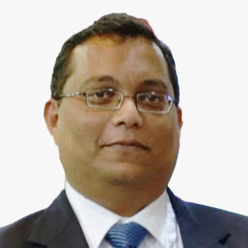
Vikrant Nashine
Global Delivery Head - GIS
Tech Mahindra
India
Vikrant has over 23 years of rich cross-functional experience in the geospatial industry. He has a proven track record of success in envisaging/designing/delivering enterprise geospatial products/solutions/services (GIS, Photogrammetry, Remote Sensing, Mapping) for the defense and private sector industries.

Brenda Alejandra MUNOZ De Luna
Head of Department of Geosystems
National Institute of Statistics and Geography (INEGI)
Mexico
Brenda has accumulated 17 years of experience specializing in the development of specific Geographic Information Systems (GIS) and their utilization with georeferenced statistical information at the INEGI. She played a pivotal role in leading the development of the MxSIG institutional platform, a significant accomplishment allowing the creation of Geomatics Solutions for the Web. The software within this platform is a combination of the best open-source or free geographic software and in-house developed software, released under free or open-source software licenses.
Brenda's efforts in this development have facilitated the technological transfer of MxSIG to several countries in the Caribbean, Central America, and South America. She also spearheaded the development of web applications under the MxSIG platform, focusing on the publication of geographic and georeferenced statistical information generated by INEGI. In this capacity, Brenda incorporated User Research and Design Thinking methodologies, resulting in applications such as the online Digital Map of Mexico, The System for the Consultation of Census Information 2020, The Gender Atlas, and the Analytical Viewer for COVID-19.
Additionally, Brenda took the lead in developing web applications under the MxSIG platform for the publication and consultation of the Statistical and Geospatial Framework for the Americas (MEGA) in collaboration with UN-GGIM: Americas.
Topic
Leading-edge Technology in Inegi's Geographic Work
Jasmin Catic
Senior Expert, Spatial Data Infrastructure Geoportal
Federal Administration for Geodetic and Real Property Affairs
Bosnia & Herzegovina
Topic
Land sector FBiH digital transformation and future prospects
Session Highlight
- Trusted and authoritative foundation data and its importance in development of geospatial knowledge products and services.
- Development of future-ready geodetic infrastructure to meet diverse user needs.
- Positioning infrastructure for the future digital and autonomous society.
- User demand identification and development of demand-driven knowledge.
- Beyond data collection - Evolving mandates of NGAs.
- Digital transformation and modernization of NGAs.

Moderator
Sallie Payne Snell
Secretary General and Executive Director
Eurogeographics
Belgium
Sallie leads the EuroGeographics Head Office team and reports to the Management Board. She champions our members' data, services and expertise by building constructive partnerships with European and global stakeholders.
Sallie is also responsible for internal management and operational delivery, as well as coordinating membership and communications activities, and the Association's events programme, which includes the General Assembly.

Keynote Address
Nicholas Brown
Head of Office
United Nations Global Geodetic Centre of Excellence
Germany
Nicholas Brown is Head of Office at the United Nations Global Geodetic Centre of Excellence in Bonn, Germany. Nicholas works with Member States and organizations to strengthen their collective impact to enhance investment in the global geodesy supply chain, build capacity, and make geodesy and its benefit more visible and understandable to society.
Topic
How strong are the geodetic foundations of the geospatial industry?

Eric Loubier
Director General
Canada Centre for Mapping and Earth Observation Canadian Mapping Agency
Canada
Eric Loubier, Director General of the Canada Centre for Mapping and Earth Observation, has worked for the Government of Canada for the last 20 years as a project manager, program manager and Director at the executive level.
He previously worked as Director of the Science Policy and Partnership Division of the Science and Technology Branch of Agriculture and AgriFood Canada (AAFC).
Prior to joining the public service, Eric worked for a consulting firm in the field of land management as well as a sub-contractor for the Canadian Space Agency.
Eric has significant experience in providing corporate leadership in planning, developing, and implementing complex national geomatics and earth observation programs and strategies. He holds a bachelor in Geography (B. Sc) and a master's degree in public administration (MPA).
Topic
Redefining the Role of Mapping Agencies: Data in the Era of AI and Real-time Insights
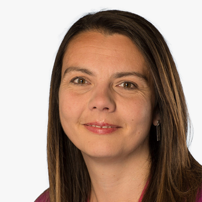
Nichola Smith
Senior Digital Specialist
British Geological Survey
UK
Nichola is a Digital Lead within the International Geoscience division of the British Geological Survey and has a focus on the design, development and implementation of custom spatial data capture and delivery systems, as well as the design and implementation of digital workflows. Nichola has led the development of the BGS bespoke digital geological field data capture system, BGS?SIGMA, since 2015 having previously been lead software developer on the project. She is now leading the redevelopment of this system to secure its use into the future and ensure it meets the needs of the new BGS strategy whilst also ensuring that it continues to be a valuable tool for geological surveys worldwide. Nichola also works extensively with international geological surveys as they aim to increase the use and delivery of geospatial data, and her work has taken her from Europe to Africa to Central and SE Asia. In addition, Nichola is the Vice-Chair for the Association for Geographic Information (Scotland) national group.
Topic
Maps and Models for the 21st Century - British Geological Survey's field data capture system moves to Open Source
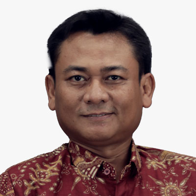
Muh Aris Marfai
Head
Badan Informasi Geospasial (BIG)
Indonesia
Aris Marfai is a geography professor who currently serves as the Head of the Geospatial Information Agency (BIG) of the Republic of Indonesia since January 27, 2021. He was the Dean of the Faculty of Geography at Gadjah Mada University from 2017 to 2021. He earned his doctoral degree in geography from Justus-Liebig University in Giessen, Germany, in 2008. He also holds a master's degree in earth system analysis from the Institute for Geo-Information Science and Earth Observation (ITC), University of Twente, Netherlands, in 2003, and a bachelor's degree from the Faculty of Geography at UGM in 1998. In September 2013, he was appointed as a full professor at the age of 37.
As the head of BIG, Aris serves as the leader of the Indonesian delegation in the annual meetings of the United Nations Global Geospatial Information Management (UN-GGIM) and the chair of the Indonesian delegation in the biennial meetings of the United Nations Group of Experts on Geographical Names (UNGEGN). In his role as the head of BIG, Aris is a member of the advisory board of Indonesia's one-data policy and serves as the chair of the implementation team for Indonesia's one-map policy. He continues to oversee mapping of the sea and coastal areas, including coastline mapping, hydrographic surveys, and national bathymetric mapping. BIG manages more than 230 tide gauge stations, and Aris advocates for the establishment of new tide gauge stations in various regions of Indonesia to support reference services for survey work and monitoring coastal and marine dynamics.
Aris Marfai, as the chair of the One Map Policy (OMP) Secretariat, is driving the accelerated implementation of the OMP for 158 thematic maps from 24 ministries and institutions in 34 provinces. OMP has successfully identified approximately 43 million hectares of land use overlaps. Resolution of these overlaps continues, taking into account geospatial data through instruments of the coordinating ministry for the economy's regulations. In 2023 and 2021, Aris was ranked in the top 2% of world scientists by Stanford University and was included in the top 100 engineering and technology scientists in Indonesia for 2023 by the AD Scientific Index.
Aris has authored more than 230 publications, including books, book chapters, articles, and papers, published in both national and international journals, indexed on Google Scholar [https://scholar.google.co.id/citations?user=ABAF8Q0AAAAJ&hl=id], with an H-index of 32. Over 100 international publications are indexed in Scopus [Scopus Author ID 22951320200; Link: https://www.scopus.com/authid/detail.uri?authorId=22951320200], with an H-index of 18.
Topic
Large-scale national mapping and its significant contributions to city planning, investment, and economic growth in Indonesia

Eng. Sultan AlShahrani
Assistant Executive Director of Geodesy
GEOSA
Saudi Arabia
Topic
Saudi Arabia National Geodetic Infrastructure (NGI)
Session Highlight
- National Mapping Agencies as users of earth observation - business and collaboration models.
- Earth Observation enabling enhanced national mapping operations.
- Earth observation augmenting national geospatial infrastructures.
- Space imaging aiding development of geospatial knowledge products to support national development mandates.
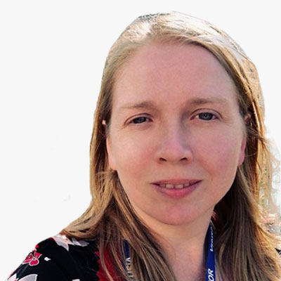
Moderator
Abigail Page
Head of Geospatial Market Policy
Geospatial Commission, Cabinet Office
UK
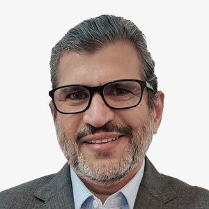
Agendra Kumar
Managing Director
Esri India
India
An industry veteran with over three decades of experience in the IT industry, Agendra has been promoting the use of geospatial technologies in the country. Under his leadership, Esri India has partnered with numerous government and private organizations to execute critical and transformative projects using Esri's GIS (Geographic Information System) technology.
Before joining Esri India, Agendra held leadership positions at Silicon Graphics, Veritas Software, and Symantec.
He has also made significant contributions to the geospatial industry as President, Association of Geospatial Industries (AGI), and Chairman, FICCI Committee on Geospatial Technologies.
Agendra holds M.Sc. (Hons.) in Mathematics and Master of Management Studies (MMS) degrees from BITS, Pilani.
Topic
Earth Observation as a Service for National Mapping
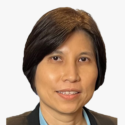
Teo Hui Ying
Deputy Director, Geospatial & Survey Division
Singapore Land Authority
Singapore
Hui Ying serves as a Deputy Director in the Geospatial & Survey Division of the Singapore Land Authority (SLA), where she leads the strategic capture, creation, and maintenance of 3D digital geo-information. Together with her team, they drive the production of national fundamental map data that are instrumental in empowering government agencies with comprehensive support for their planning, risk management, operations, and policy formulation. With a rich background encompassing both the public and private sectors and as a Registered Surveyor in Singapore, Hui Ying has garnered extensive experience in cadastral, mapping tunnelling, and engineering surveys.
Topic
National 3D Mapping Programme

Piotr Perz
Manager, Geoportal Division- Department of Informatization
Head Office of Geodesy and Cartography
Poland
Piotr Perz is a Manager in the Geoportal Division in the Department of Informatization, Head Office of Geodesy and Cartography. Master of Science, University of Warmia and Mazury in Olszyn. Experienced in spatial data management, especially in terms of OGC services and API accessibility. The organization is responsible for the functioning of the national geoportal as a central access point to the national geodetic and cartographic resources.
Topic
The Next Step in the Liberation of Spatial Data

Gopika Suresh
Chief Strategy Officer (CSO) and Co-Founder, Head of Products and Strategy
Marble Imaging
Germany
Dr. Gopika Suresh is an Earth Observation (EO) & Synthetic Aperture Radar (SAR) scientist with more than 14 years of experience developing algorithms and methods to exploit EO data for land, forest, marine, coastal and disaster response applications. Having discovered the gaps in present EO data & solutions, she co-founded Marble Imaging, which aims at becoming Europe's first provider of VHR data acquired from its small satellite constellation and is CSO and head of products where her Team develops cutting edge EO based analytics & solutions for real-world challenges.
Born in a coastal town in the south of India, she has a Bachelor of Technology in Electronics and Communications Engineering from the University of Kerala, India, a MSc in Satellite Applications engineering from the Technical University of Munich, Germany and a PhD in marine Geosciences from the University of Bremen. For her PhD, she developed the first automatic SAR based system to detect marine oil slicks in SAR images and estimate their source hydrocarbon seeps. Since then she has worked as a scientist for the German Federal Agency for Cartography and Geodesy, as a postgrad lecturer at the Frankfurt University of Applied Sciences, a postdoc at the Earth Observatory of Singapore and recently led the team for geospatial solutions at Unique Land use GmbH, where her team developed EO based solution for the forestry and land use sector She was selected as a Geospatial World's 50 rising stars in 2021, a leading woman in ML4EO by the Radiant foundation in 2021 and is the co-organiser of the Sisters of SAR initiative. And she does all this while bringing up a 3 year old toddler and her newborn 2024 baby.
Topic
EO as a Service for National Mapping: Marble Imaging - A European VHR Solution

Haico van der Vegt
Regiomanager
Kadaster
The Netherlands
As a regional manager within Kadaster International, the international branch of the Cadastre, Land Registry and Mapping Agency of the Netherlands, Haico is responsible for the business development in Eastern-Europe and Central Asia. As a spatial data infrastructure (SDI) expert, he is involved in many national and international SDI implementation projects. He has also been working on the design, implementation and further development of the national geoportal 'PDOK', as part of the Dutch SDI. He has led projects in a number of countries, focusing on developing a fit-for-purpose land administration. Haico has worked for nearly 5 years in France for EuroGeographics, the association of European national mapping and cadastral agencies, as a marketing communications and business manager. Haico is graduated as a Geographer and Cartographer at the University of Utrecht.
Topic
Cadastre Land Registry and Mapping Agency of the Netherlands
Mari Khardziani
Head of International Relations Service
National Agency of Public Registry
Georgia
Topic
Enhancing National Development through EO and Remote Sensing Data


