Session Highlight
- Evolution of warfare towards unconventional threats and tactics.
- Geospatial data and analysis enhancing defense and security forces capabilities to address evolving challenges.
- The role of GeoIntelligence to support situational awareness, enables precise targeting, identifies cyber threats, supports counterinsurgency operations, counters information warfare, and facilitates humanitarian assistance and disaster response.

Moderator
Colonel (Ret.) John Kedar FRGS, FInstRE, CGeog(GIS)
Director
John Kedar Geospatial Initiatives Ltd
UK
John Kedar is a strategic advisor to Governments on "The Power of Where?" He advises on strategy and policies to maximise national value from the rapidly developing location ecosystem and geospatial information. These countries are diverse, from Tonga to the Honduras, the Kingdom of Saudi Arabia to Ukraine, Burkina Faso to Jersey. This includes utilising the United Nations Integrated Geospatial Information Framework, in which he is considered a global expert.
Elsewhere, John led the partnership board developing the future geospatial concept 'Geospatial Knowledge Infrastructure', sits on the International Advisory Committee for the United Nations Global Geospatial Knowledge and Innovation Centre and chairs the Audit and Risk Committee of a major UK charity.
In his past life, John was Director International Engagement, Ordnance Survey, building key relationships with UK and international governments and international organisations. He also opened new international markets for Ordnance Survey across 3 Continents. Prior to this, John served 30 years in the British Army, spanning a range of engineer, geospatial, intelligence roles and frequently deployed on military operations. He commanded the Joint Aeronautical and Geospatial Organisation, UK Defence's premier geospatial intelligence organisation, developed Defence policy for geospatial information and represented UK on the European Union Satellite Centre Board.

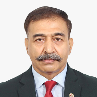
Nigel Clifford
President
Royal Geographical Society
UK
Topic
The Evolution of Data and Its Management in Security Domains

Keynote Address
Brigadier General Friedrich Teichmann
Director, Geospatial Institute
Austrian Armed Forces
Austria
Current post: Director of the Geospatial Institute, Austrian Armed Forces and and POC MoD for Space Services Development
Current military rank: Brigadier General
MSc and PhD in Geo-Sciences at the University of Maine (USA), the University of Salzburg (Austria) and the University of Rochester (USA)
Post-graduate studies in Geo-Informatics at the University of Salzburg (Austria) , Telematics at the University of Krems (Austria) and Space Study Program at the International Space University (France)
Lecturer for Space Applications, GeoSciences, Information Technology and Geo-Informatics at several Austrian Universities.
Topic
GeoIntelligence and the Changing Security Landscape

Todd Johanesen
Director, Foundation GEOINT
National Geospatial-Intelligence Agency
USA
Mr. Todd E. Johanesen serves as Director, Foundation GEOINT Group at the National Geospatial-Intelligence Agency (NGA), located in Springfield, Virginia, U.S.A. In this capacity, he leads an organization that provides assured, timely, relevant, and accurate foundation geospatial intelligence (GEOINT) data, products, and services in support of prioritized requirements of the warfighter, our national security objectives, and Safety of Navigation needs of the U.S. government. Mr. Johanesen earned a Bachelor of Arts degree in Geography from California State University, Long Beach, in 1989. In 2001, he received a Master of Science degree from Purdue University, West Lafayette, Indiana, where he studied Geomatics engineering. He is also a 2010 Director of National Intelligence Science and Technology Fellow.
Topic
Foundation GEOINT from Seabed to Space Brief

Tony Wilby
Director, European National Government Team
Esri
UK
Tony served in the British Army for 27 years: initially as a combat engineer, and then as a specialist GEOINT officer. For his last military assignment, he was the Chief of Staff of the UK Joint Forces Intelligence Group and commander of all aspects of the British Army's GEOINT capability. He joined Esri in June 2017, and now leads their European National Government Team for business development; covering the National Security, Public Safety and Mapping, Statistics & Land Administration sectors.
Topic
Understanding the Security Implications of Climate Change
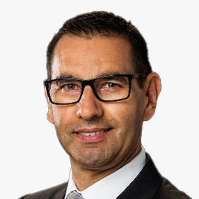
Jose M.S. Balsinhas
Senior Engineer
Joint Intelligence, Surveillance & Reconnaissance (JISR) Centre, NATO Communications & Information Agency (NCI Agency)
The Netherlands
Mr. Jose Balsinhas has an extensive working experience on both national and NATO environments. He retired from the Portuguese army active duty in 2005 and joined the former NATO C3 Agency, now the NATO Communications and Information Agency (NCI Agency). Currently, he serves as a Senior Engineer and Deputy in the Joint Intelligence Surveillance and Reconnaissance (JISR) Service Centre, GeoMetOc Services Branch.
With 20 years' professional experience in managing enterprise GIS projects, Mr. Balsinhas holds a Master degree in Military Sciences from the Portuguese Military Academy, and a Post-Graduate course on Geographic Information Systems.
Topic
The NATO Core GIS
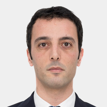
Sergio Albani
Head of RTDI Unit
European Union Satellite Centre
Spain
Sergio Albani is the Head of Research, Technology Development and Innovation (RTDI) Unit at the European Union Satellite Centre. He is in charge of implementing new operational solutions in the Space and Security domain looking at the whole EO and collateral data lifecycle; this is performed by exploiting new data sources, secure satcom, emerging technologies (e.g. Big Data, AI) and innovative EO based solutions. He is responsible for several H2020 projects as well as for cooperation with ESA and GEO. Mr. Albani holds a Masters Degree in Physics (Astrophysics and Space Physics branch) and a Master in Journalism and Scientific & Institutional Communication.
Topic
R&I initiatives to address complex security scenarios
Session Highlight
- Combination of geospatial data, real-time analytics, and advanced mapping in providing precise and comprehensive understanding of emergency situations.
- GeoIntelligence empowering emergency responders with actionable insights, optimizing resource allocation, and expediting life-saving measures.
Moderator
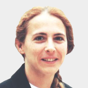
Ingrid Vanden Berghe
Administrator General
National Geographic Institute (IGN)
Belgium
Ingrid Vanden Berghe holds an agricultural engineering degree specializing in soil sciences from KULeuven. After some years in advisory roles in politics, she was appointed General Administrator of the National Geographic Institute of Belgium in 2002, a function she still holds today. Ms. Vanden Berghe was President of EuroGeographics from 2012 to 2018, is visiting professor at KULeuven, board member of several research organizations, and chairs the board of technology research organization VITO. She has represented Belgium on the United Nations Committee of Experts on Global Geospatial Information Management (UN-GGIM) since its establishment in 2011 and was elected co-Chair at the 2020 session.
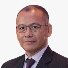
Brig. Gen. Dato' Pahlawan Sr Dr Mohd Zambri bin Mohamad Rabab
Director, Defence Geospatial Division
Department of Survey and Mapping (JUPEM)
Malaysia
Topic
Disaster Through Collaborative Geospatial Support

Gp Cap Chamnan Kumsap
Director, Knowledge Management and Publication
Defence Technology Institute
Thailand
Group Captain Chamnan Kumsap graduated from the RTAFA and served the Armed Forces in the geo-spatial mission. He received MSc in GIS from the University of Edinburgh and completed his PhD in Remote Sensing and GIS from Asian Institute of Technology. Resigning from the Armed Forces, he applies geo-spatial techniques to research projects at Defence Technology Institute. His awards to endorse his contributions to the geo-spatial technology include the Best Paper Award at the International Defence and Homeland Security Simulation Workshop in 2016 and the Winner of The Call for Innovation at the Southeast Asia Water Security - IWRM Regional Conference in 2023.
Topic
Transfer of Knowledge and Technology from the Flood Simulation System for the People of Tha Wang Pha District, Nan Province

Robert Goldsmith
GIS and Mapping Manager
Devon & Cornwall Police
UK
Topic
Digital Twins for Emergency Services

Rajanikanth Muppalla
Delivery Head
Tech Mahindra
India
Rajanikanth Muppalla has experience spanning 28 years, during which he played multiple roles in business development, strategy, delivery and operations. Currently, he focusses on driving business growth. As a GIS Practice Delivery Head, he managed end-to-end geospatial solutions, playing a pivotal role in enabling major tech companies to offer precise maps, enhancing user experiences with features like voice-guided navigation and real-time traffic updates. Additionally, he has navigated complex regulatory landscapes, ensuring the creation of compliant contracts for global operations, particularly concerning data privacy laws, allowing clients to operate confidently worldwide.
Topic
Counterterrorism Strategies with GIS

Christophe Hoegaerts
Research Manager, Intelligent Imaging Department
TNO
The Netherlands
Topic
Situational Understanding as a Geospatial Capability
Session Highlight
- How data from commercial synthetic aperture radar (SAR), radio-frequency (RF) and hyperspectral satellites can deliver crucial intelligence.

Moderator
Aditya Chaturvedi
Deputy Executive Editor
Geospatial World
India

Gastao De Figueiredo
SVP, GM Geospatial Intelligence
Blackshark.ai
USA
Gastao leads the geospatial intelligence product line for Blackshark.ai - the fist commercial company to detect every building on the planet using AI/ML applied to satellite and aerial imagery and construct a photorealistic 3D digital twin.
He previously held leadership positions at Microsoft, Apple and Sun Microsystems. Gastao is originally from Rio de Janeiro, Brazil and holds a BS in Electrical Engineering and an MSc in Computer Sciences.
Topic
In-Mission Exploitation of Extraordinary Volumes of Imagery for Real-time Actionable Intelligence

Vincent Kessler
General Manager, Synspective SG
Synspective
Singapore
Vincent joined Synspective in October 2021 as the General Manager of Synspective's Singapore branch. He oversees Synspective's activities in the Asia-Pacific and Eastern European regions.
After graduating from the National University of Singapore's Geography Department in 2005, Vincent began his career at CRISP, the national remote sensing ground station of Singapore. He spent over 15 years leading Asia sales and business development activities for various high-profile global companies in the geospatial industry.
Vincent received his MBA from the University of Birmingham, UK.

Martin Pentier
Geospatial Sales Manager - Integrated Space Solutions
Airbus Defence and Space
France
Currently Geospatial Sales Manager at Airbus Defence and Space - Integrated Space Solutions, Martin Pentier supports end-users and channel partners across Europe with Earth Observation data and services. With close to 20 years of experience in the Defence and Space industry across various countries with responsibilities ranging from project management, strategy, sales, business development to innovation, Martin is always looking to bridge the gap between customer needs and relevant solutions. Martin holds a master of Politics and Defence business from Paris University (France), in addition to various trainings and certifications (PMI, Business Modelling, Space applications and soft skills).
Topic
OneAtlas digital platform

Krishanu Acharya
Co-founder & CEO
Suhora
India
As the leader of a visionary team at Suhora, he has successfully delivered innovative products and services for asset monitoring and management across diverse domains, utilizing space technology, Al, big data, and open-source tools to create sustainable solutions worldwide.
* With prior international roles focused on developing earth observation businesses in Southeast and South Asian countries, he has demonstrated expertise in business development, client management, and revenue growth.
* Holding a DBA in Oracle, PI/SQL, and Linux from SQL Star International and an M.Sc in Remote Sensing & GIS from Vidyasagar University, he is a meticulous technical professional with a strong passion for technology, leveraging his expertise to empower customers and partners with location intelligence and data analytics.
Topic
Excellence in Image & Intelligence


