Session Highlight
- The importance of satellite derived data and insights for monitoring Earth.
- Satellite data and analytics for climate change quantification.
- Capturing pertinent data from space and their applications and trends.
- Recording risks for environmentally sustainable growth.
- Exploring the transformative journey of Earth Observation (EO) data from its traditional applications to the forefront of Climate Resilience.
- Emphasize the need for a shift towards leveraging EO for building resilient economies.
Keynote Address
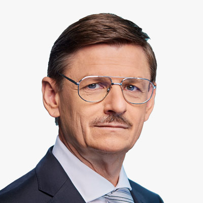
Grzegorz Wrochna
President
Polish Space Agency - POLSA
Poland

Pooja Mahapatra
Principal Advisor - Climate & Nature
Fugro
The Netherlands
Pooja Mahapatra, a seasoned professional with 14 years of diverse experience spanning R&D, startups, space agencies, and multinational corporations, is dedicated to leveraging geospatial solutions for addressing climate and infrastructure challenges. Holding a PhD from TU Delft, Pooja's research focused on measuring millimetric ground subsidence using satellite EO, enhancing the applicability of InSAR, and connecting subsidence to phenomena such as sea-level rise. Renowned for her proactive, positive, and energetic approach, Pooja is recognized as a clear, open communicator with a talent for building networks swiftly. An excellent public speaker and presenter, she blends solid technical prowess with a keen business acumen. Pooja's creativity, combined with her ability to get things done autonomously or cooperatively, establishes her as a leader who influences effectively. Her consistent feedback highlights her capacity to lead with influence, making her a dynamic force in the geospatial and earth observation domain.

John P. Wilson
USC Professor and Founding Director
Spatial Sciences Institute, University of Southern California
USA

Gabriela Seiz
Senior Advisor
Seiz SG Advisory (on behalf of World Geospatial Industry Council WGIC)
Switzerland

Yeji Choi
SI Analytics
Head of Earth Intelligence Division
South Korea

Benson Kenduiywo
Geospatial Scientist and East Africa Lead Climate Security
Alliance of Bioversity International and CIAT
Kenya
Benson Kenduiywo is a spatial data science specialist at the Alliance of Bioversity International and CIAT (Internal Center for Center for Tropical Agriculture). Benson is interested in developing Earth observation solutions that respond to pressing needs of thesociety for e.g. Quality Insurance Certification and now Climate, Peace and Security.
Session Highlight
- Introduction to sustainability and ESG and their differentiating factors.
- Sustainability standards, SDGs and ESG Standards.
- Overlapping Sustainability and ESG ideas.
- Delineated Sustainability and ESG processes.
- Theirs structures and manifestations for corporate functioning and re-orientation.
- The requirement of ESG adoption with available strategies and moving ahead & beyond.
- A light on overlap of Geospatial data for Sustainability and ESG.

Moderator
Anandi Mathur
Product Development Executive
Geospatial World
India

Tim Trainor
Former President
US Census Bureau
USA
Tim Trainor is Past President of the International Cartographic Association and is a current member of the ICA Executive Committee. He is a member of the National Geospatial Advisory Committee for the U.S. Federal Geographic Data Committee. He currently serves as a global strategic advisor and is a part-time consultant to the United Nations and the SDG Data Alliance. Tim is the former Chief Geospatial Scientist for the U.S. Census Bureau. He served as the Co-Chair for the United Nations Committee of Experts on Global Geospatial Information Management and was Head of the U.S. Delegation to the UN-GGIM. In 2022, he received the GWF Lifetime Achievement Award.
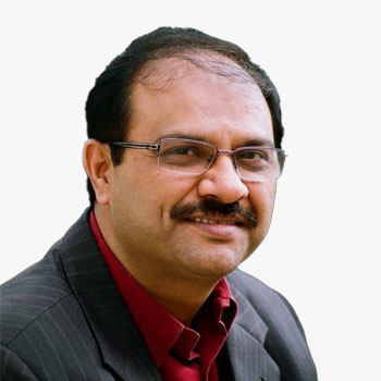
Raj Kumar Khatri
Former Additional Chief Secretary
Government of Karnataka, GoI
India

Ondrej Mirovsky
Senior Sustainability Expert
PowerHUB, Technology centre Prague
Czech Republic
Ondrej Mirovsky is a seasoned ESG and sustainability manager with expertise in advisory services, ESG reporting, strategy development, carbon footprint analysis, and sustainable mobility projects. He lectures on ESG and sustainability at Charles University and excels in project management, team coordination, and mentoring start-ups. Recently, he focuses on ESG consultancy services for start ups and SMEs especially in sector of mobility and remote sensing (agriculture applications) and also helps international teams to enter Horizon Europe project in the SPACE domain.

Francesca Piatto
Project Officer
EARSC
Belgium
Session Highlight
- Decarbonisation and attaining net-zero emissions for mitigating climate risks and a.
- Discover opportunities with Geospatial technologies for the E pillar.
- Climate Risks are Business Risks, assessing them with climate risk modelling.
- Data Collection technology and tools to approaching environmental impact assessment.
- Monitoring and disclosing resource utilisation, waste and negative impact generation on environment.
- Utilising existing data and newer satellite data for improved reporting.
- Environmental scoring by addressing physical, liability and transitional risks due to climate change.
- Intensifying efforts for improved business leadership on ESG and its specific skills.
- Addressing business risks from governance impacts from compliance of international and local laws.
- Business strategy assessments for securing physical assets and operations of a company to mitigate social and governance risks.
- Possibility of geospatial data usage in tracking social impacts on supply chain transparency, community engagement, and health and safety.

Sheila Steinberg
Director Geospatial Institute
UMass Global
USA
Dr. Sheila Lakshmi Steinberg is an author, educator and advocate for the applied use of GIS across disciplines. Dr. Steinberg is President for the Southern California Chapter of URISA 2023. Sheila leads the integration of innovative geospatial concepts and curriculum design into micro-credentials, certificates and programs at UMass Global. She is a co-author of Resilient Communities Across Geographies Esri Press (2021) and GIS Research Methods for Esri Press (2015); Extreme Weather, Health and Communities: Interdisciplinary Engagement Strategies for Springer Press (Springer Press 2016). Steinberg is a keynote speaker at professional conferences and international meetings and creates partnerships for how to use GIS to solve problems. Her research focuses on the connection between people, places and environments considering local knowledge, networks and the power of community engagement using GIS.

Alberto Meroni
Business Development Manager - Imagery and Remote Sensing
Esri
Italy

Jimena Blanco
Chief Analyst
Verisk Maplecroft
Spain
Jimena is Verisk Maplecroft's Chief Analyst. She frequently provides advice to multinational companies and multilateral institutions on geopolitical and country-specific political risk. Jimena has undertaken numerous field projects, including Human Rights Impact Assessments for clients across the globe.
Jimena participates in diplomatic, academic and business forums, addressing issues of global, regional and country-specific concern. She is an experienced public speaker and is often invited to deliver analysis to some of the world's largest industry shows and conferences. Jimena also makes regular contributions to the British and foreign media.
Prior to working for Verisk Maplecroft, Jimena edited several publications at Latin News and wrote extensively on Latin America. She was also a contributor to the International Institute for Strategic Studies' special dossier, The Farc Files: Ecuador, Venezuela and the Secret Archive of 'Raul Reyes'.
Jimena studied History and Political Science at Randolph-Macon Woman's College and obtained a master's degree in Latin American Studies from the Institute for the Study of the Americas, University of London.

Markel Aramberri
Business Development Manager
Satlantis
Spain

Katarzyna Derkowska
Senior Ore and Economy Geology Specialist
Polish Geological Institute - National Research Institute (PGI-NRI)
Poland

Anna Januszewska
Junior Ore and Economy Geology Specialist
Polish Geological Institute - National Research Institute (PGI-NRI)
Poland
Session Highlight
- Risk assessments from AI predictive analytics powered models.
- Trend and forecasts on ESG data for the future via AI.
- The potential of AI and digital transformation in any sector, especially for socio-ecological transition.
- Geospatial intelligence and AI forming a package for ESG Reporting implementation.
- Blockchain's automated ESG reporting advantage and credibility of traceability.
- Eliminating data irregularities and inaccuracies through intelligent data supplied by Earth Observation.
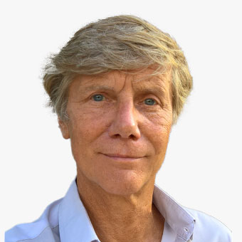
Hugo de Groof
Retired official European Commission DG ENV
European Commission
Belgium

Jonathan Horn
Founder and CEO
Treefera
UK
Strategic thinker and problem solver with over 20 years experience in Investment Banking, AI, Data and Risk - driving digital innovation globally as well as established and scaled big data and AI groups at Citi and JPMC. Experience in implementing data mesh to support a distributed, data-driven organisation. Holds a PhD in fluid dynamics and 3 patents in AI. Most recently, becoming Founder & CEO of Treefera - an AI-enabled data platform on nature-based assets.

Thomas Blaschke
Head of Department of Geoinformatics
University of Salzburg
Austria
Thomas Blaschke is a Professor at the University of Salzburg and Deputy Head of Department of Geoinformatics - Z_GIS. He also acts as the director of the Doctoral College GIScience and serves at various editorial boards and commissions including ISPRS and the ESA Earth Observation advisory board. His research interests include methodological issues of the integration of GIS, remote sensing and image processing also with aspects of citizen participation and human-environment interaction. Prior positions comprise several lecturer, senior lecturer and professor positions in Germany, Austria and the UK as well as temporary affiliations as guest professor and visiting scientist in Germany and the US including a Fulbright professorship. His academic record yields 370+ scientific publications including 130 journal publications.

Naveen Kondamudi
Consulting Partner leading the PLM Consulting Practice
TCS
India
Naveen Mehata Kondamudi PMP®, SAFe Agilist 5.0 - is a Consulting Partner leading the PLM Consulting Practice for Manufacturing Europe in TCS. He has more than 19 years of experience working with global manufacturing customers in the areas of product life cycle management and supply chain management. He is also a TCS workplace coach certified by the International Coach Federation. He has in the past spoken at conferences hosted by Program management Institute and Dassault systems. He has successfully completed the Growth and Transformation Leadership Program from SDA Bocconi ; Design led Strategy - The University of Sydney Business School ; bachelor's degree in mechanical engineering from the College of Engineering, Guindy.

Matthew Law
GIS Consultant
Mott MacDonald
UK
Matthew is a GIS Consultant at Mott MacDonald, a global engineering, management and development consultancy. In his role he helps domain specialists across a range of disciplines use technology to help deliver infrastructure projects through the collection, manipulation, analysis, and visualisation of spatial data. He has technical expertise in a variety of GIS and data transformation software, including the ArcGIS suite (desktop, online, mobile), QGIS, and FME, often in combination with programming languages such as R and Python.


