Session Highlight
- Pioneering the development of policies, regulations, and standards that shape the future geospatial ecosystem and geospatial data use and dissemination
- Spearheading investments in cutting-edge infrastructure to collect, manage, and share geospatial information
- Harnessing the power of geospatial technologies to address critical national priorities, from climate resilience and national security to emergency management and public health

Joshua J. Delmonico
Executive Director
Federal Geographic Data Committee, U.S. Geological Survey
USA
Josh serves as the Executive Director for the Federal Geographic Data Committee providing the leadership, coordination, and communication to promote the development, use, sharing, and dissemination of geospatial data nationwide. In this role he provides executive leadership for the coordination of U.S. federal geospatial activities in collaboration with the 32 FGDC member Federal Agencies and OMB to implement the Geospatial Data Act and conduct strategic planning and visioning for the implementation of National Spatial Data Infrastructure (NSDI) across Federal, State, Tribal and local government agencies, academic institutions, non-profit organizations and the private sector.

Deirdre Dalpiaz Bishop
Chief Geography Division
U.S. Census Bureau
USA
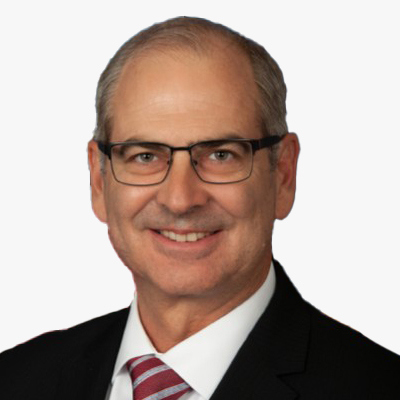
Daniel Gall
Deputy Chief Strategy Officer
U.S. Veterans Health Administration
USA

Todd Johanesen
Director, Foundation GEOINT
National Geospatial-Intelligence Agency
USA
Mr. Todd E. Johanesen serves as Director, Foundation GEOINT Group at the National Geospatial-Intelligence Agency (NGA), located in Springfield, Virginia, U.S.A. In this capacity, he leads an organization that provides assured, timely, relevant, and accurate foundation geospatial intelligence (GEOINT) data, products, and services in support of prioritized requirements of the warfighter, our national security objectives, and Safety of Navigation needs of the U.S. government. Mr. Johanesen earned a Bachelor of Arts degree in Geography from California State University, Long Beach, in 1989. In 2001, he received a Master of Science degree from Purdue University, West Lafayette, Indiana, where he studied Geomatics engineering. He is also a 2010 Director of National Intelligence Science and Technology Fellow.

DERALD DUDLEY
Geographer, U.S. Bureau of Transportation Statistics
National Spatial Data Infrastructure, Transportation Theme Lead
USA
Session Highlight
- Cutting-edge research and breakthroughs in geospatial technologies and methodologies
- Innovative education and training programs, nurturing the next generation of geospatial experts and problem solvers
- Dynamic partnerships and collaborations across sectors, harnessing the power of geospatial techniques to tackle complex challenges

Hamed Alemohammad
Director, Center for Geospatial Analytics, Associate Professor
Graduate School of Geography
Clark University
USA
Hamed Alemohammad is an Associate Professor in the Graduate School of Geography and Director of Clark Center for Geospatial Analytics at Clark University. He is an interdisciplinary scientist with expertise in remote sensing, earth science, and artificial intelligence (AI). Hamed has been the PI for several projects focused on developing novel AI models for multispectral, microwave and synthetic aperture radar (SAR) satellite observations. Prior to Clark University, Hamed was the Chief Data Scientist and Executive Director at Radiant Earth Foundation where he established and led the development of Radiant MLHub - the open-access repository for geospatial training data and AI models. He received his Ph.D. in Civil and Environmental Engineering from MIT.

John P. Wilson
USC Professor and Founding Director
Spatial Sciences Institute, University of Southern California
USA

LEN KNE
U-Spatial Associate Director
University of Minnesota
USA

DAVID VAN RIPER
Director, Spatial Analysis
IPUMS, University of Minnesota
USA

Miriam Olivares GISP
GIS Librarian Computational Methods and Data, Yale University Library
Yale University
USA
With over two decades of geospatial expertise, Miriam Olivares, GISP leads the GIS support services at Yale University, instructing and advising on geospatial applications to promote cutting-edge teaching and research. Her interdisciplinary collaborations, scholarly, and consulting work touch upon geospatial data management, GIScience, supply chain, natural hazards, and marine conservation. Olivares geospatial service includes membership in the Leventhal Map & Education Center's Board of Review at the Boston Public Library, at the Advisory Board of the Academic Network of the United Nations initiative on Global Geospatial Information Management (UN-GGIM): Americas, and Connecticut GIO's GIS Strategic Plan and GIS Clearinghouse Workgroups. She co-founded and co-chairs GIS LATAM and served as a director on the University Consortium for Geographic Information Science board.
Session Highlight
Non-profit organizations are leading geospatial innovation, advocating for open access to geospatial data and promoting data transparency and accountability to ensure geospatial data is freely available and used responsibly. Additionally, non-profits implement geospatial projects that address pressing social, environmental, and humanitarian challenges, leveraging the power of geospatial technologies for positive change.
- Championing open access to geospatial data and advocating for data transparency and accountability
- Leading the charge in implementing geospatial projects that tackle pressing social, environmental, and humanitarian challenges
- Providing comprehensive training and support to unlock the potential of geospatial technologies for sustainable development, empowering individuals, and communities
The private sector is a driving force behind geospatial innovation, consistently pushing the limits of what's achievable through research and development. By investing in state-of-the-art technologies, the private sector pioneers new solutions and products, revolutionizing industries and enhancing lives. The private sector actively collaborates with government, academia, and non-profit organizations to tackle specific challenges or opportunities using geospatial solutions, fostering a culture of innovation and collaboration that expedites the development and adoption of geospatial technologies.
- Driving innovation in geospatial technologies through cutting-edge research and development
- Revolutionizing commercial products and services with geospatial data, from mapping software, artificial intelligence/machine learning, synthetic data, GPS devices, and satellites
- Collaborating with government, academia, and non-profit organizations to address specific challenges or opportunities using geospatial solutions

Nadine Alameh
Executive Director
Taylor Geospatial Institute (TGI)
USA

Tracy Whelpley
SVP of Business Attraction
Greater St. Louis, Inc.
USA
Tracy Whelpley is Senior Vice President of Business Attraction at Greater St. Louis, Inc. -an alliance of business and civic leaders working together to create jobs, expand inclusive economic growth, and improve the St. Louis region's global competitiveness. Tracy is responsible for implementing highly targeted marketing initiatives that compel corporate executives and entrepreneurs to explore the advantages of investing and locating within the St. Louis metro.
Tracy is also a champion for the region's GeoFutures Strategic Roadmap, a 10-year action plan that channels the collective action of leaders across public, private, academic, and government spheres to establish St. Louis as a premier destination for geospatial innovators to collaboratively unlock industry opportunities and forge solutions to the world's most pressing challenges.
Before joining Greater St. Louis, Inc., Tracy held various agency roles, leading brand marketing communication teams to drive awareness and revenue objectives for multinational corporate clients, including Bayer Crop Science and Enterprise Mobility.
Ms. Whelpley earned her Bachelor of Journalism from the University of Missouri-Columbia and her Master of Business Administration from the University of Missouri-Kansas City.

Amar Nayegandhi, CP, CMS, GISP
SVP
Dewberry
USA
As Senior Vice President, Amar Nayegandhi, CP, CMS, GISP leads the Geospatial and Technology Services group at Dewberry and provides program oversight for the execution of all remote sensing projects nationwide. An expert in topographic and topobathymetric lidar data acquisition and processing, Amar was the Director of the American Society for Photogrammetry and Remote Sensing (ASPRS) Lidar Division and was appointed as an ASPRS Fellow in 2024. He co-edited the ASPRS DEM User's Manual, 3rd Edition, and authored the chapters on Airborne Topographic Lidar and Airborne Lidar Bathymetry. Amar co-authored the USACE EM 1110-1-1000 Manual on Photogrammetric and Lidar Mapping.
Amar has presented his research and technological findings at 100+ international conferences and technical workshops, including an invitation from the USGS to present the industry perspective for the USGS 3D Elevation Program at the United Nations World Geospatial Information Congress (UNWGIC) in Deqing, China. Amar has authored 16 manuscripts in various international journals and 65+ data series and reports for the USGS. He has a Bachelor's in Electrical Engineering from the University of Mumbai and a Master's in Computer Science from the University of South Florida. He is an ASPRS Certified Photogrammetrist and Certified Mapping Scientist, and a GIS Professional.
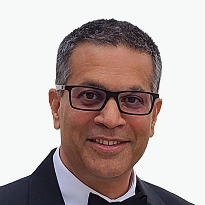
Chris Andrews
COO
Rendered.ai
USA

Mark Cygan
Director - National Mapping Solutions
Esri
USA
Mark has worked in GIS and mapping since 1984. As Esri's Director of National Mapping Solutions, since 2005, he has a passion for working with National Mapping, Maritime, Aviation and Geospatial Authorities to help them be successful. Mark previously worked with these same organizations for nearly 10 years as a Senior Consultant and Project Manager in Esri's Professional Services. Prior to Esri, Mark was on the management team at NAVTEQ (now HERE), as they were pioneering digital mapping for in-vehicle navigation, web and mobile uses. Mark participates on the United Nations Committee of Experts on Global Geospatial Information Management (UN-GGIM).

KATHERINE KRAFT
Vice-President of Product Marketing
Teren, Inc.
USA

