Disha Dwivedi
Industry Manager - National Mapping and Sustainability | Geospatial World | India

The speaker is presently the Director of Lands and Surveys Department of Sabah, Malaysia responsible for the land administration, cadastral survey, mapping, land valuation and the geospatial development for the State of Sabah in Malaysia. He is also the Chairman of the Sabah Surveyors Board and a council members of the ASEAN Federation of Land Surveying and Geomatics (AFlag).
Abstract
Application of geospatial technologies for good land governance in sabah, malaysia
The Sabah Lands and Surveys Department has applied latest geospatial technologies to integrate various digital land related data such as cadastral parcels, land ownerships, land valuation, land-use zoning, property registration, land dealings and revenue collection are integrated for efficient and effective land governance to support UN Sustainable Development Goals.
Bernard Liew Chau Min
 Bernard Liew Chau Min
Director , Sabah Lands And Surveys Department , Malaysia
The speaker is presently the Director of Lands and Surveys Department of Sabah, Malaysia responsible for the land administration, cadastral survey, mapping, land valuation and the geospatial development for the State of Sabah in Malaysia. He is also the Chairman of the Sabah Surveyors Board and a council members of the ASEAN Federation of Land Surveying and Geomatics (AFlag).
Abstract
Application of geospatial technologies for good land governance in sabah, malaysia
The Sabah Lands and Surveys Department has applied latest geospatial technologies to integrate various digital land related data such as cadastral parcels, land ownerships, land valuation, land-use zoning, property registration, land dealings and revenue collection are integrated for efficient and effective land governance to support UN Sustainable Development Goals.
Director | Sabah Lands And Surveys Department | Malaysia
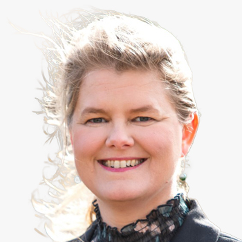
Paula Dijkstra
Director | Kadaster International | The Netherlands

Brent Jones
Global Manager | Land Records/Cadastre, Esri | USA
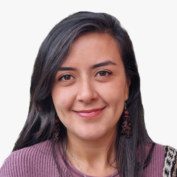

MSc Geomatics from the Universidad Distrital in Colombia. She is director of Kadaster's land administration projects in Colombia. Her fields of interest cover land administration, community empowerment, remote sensing, and geographic information systems.
Laura Becerra
 Laura Becerra
Local Project Director , Kadaster International , Colombia
MSc Geomatics from the Universidad Distrital in Colombia. She is director of Kadaster's land administration projects in Colombia. Her fields of interest cover land administration, community empowerment, remote sensing, and geographic information systems.

MSc Geomatics from the Universidad Distrital in Colombia. She is director of Kadaster's land administration projects in Colombia. Her fields of interest cover land administration, community empowerment, remote sensing, and geographic information systems.
Local Project Director | Kadaster International | Colombia

She has experience in Geospatial world in different areas, from GIS to Remote Sensing, including Photogrammetry and specific applications such UAVs, Transportation, Lidar, and Cataloging and managing big data. Her 30 years of experience in the same company has allowed her to specialize in pre-sales and post-sales, as well as in specific consultancies in special projects, even on customer's site, including the Defense environment) and training.
Begona Verdejo
 Begona Verdejo
Senior Consultant for EMEA Government, Transportation and Defense Division , Hexagon , Spain
She has experience in Geospatial world in different areas, from GIS to Remote Sensing, including Photogrammetry and specific applications such UAVs, Transportation, Lidar, and Cataloging and managing big data. Her 30 years of experience in the same company has allowed her to specialize in pre-sales and post-sales, as well as in specific consultancies in special projects, even on customer's site, including the Defense environment) and training.

She has experience in Geospatial world in different areas, from GIS to Remote Sensing, including Photogrammetry and specific applications such UAVs, Transportation, Lidar, and Cataloging and managing big data. Her 30 years of experience in the same company has allowed her to specialize in pre-sales and post-sales, as well as in specific consultancies in special projects, even on customer's site, including the Defense environment) and training.
Senior Consultant for EMEA Government, Transportation and Defense Division | Hexagon | Spain
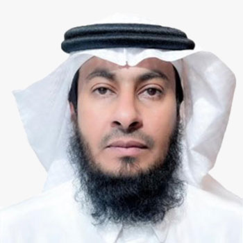
Eng. Naif Saeed Al-Juhany
Executive Director of Geospatial Products | General Authority for Survey and Geospatial Information


Dynamic and innovative Technology executive with expertise in remote sensing and computational intelligence, Mr. Abhinandan is an AI professional with industry experience in telecommunication, satellite remote sensing, and product design & development. Graduated from India's Ivy League, Indian Institute of Technology (IIT), Guwahati in Electronics and Electrical with Computer Science and Engineering, He has worked in Research and Development with leading universities and MNCs in India, South Korea, and Japan.
Mr. Abhinandan has demonstrated research, and professional excellence throughout his career working with large corporations, like Vodafone Group, Tech Mahindra as an Engineering Leader, and Technology Specialist. He also holds a PGP degree in Artificial Intelligence and Machine Learning: Business Applications from the University of Texas at Austin.
Currently, Mr. Abhinandan is the Head of Technology for Solutions at Synspective and is leading the core solution research and development using our SAR satellite constellations.
Abstract
Enabling persistent land monitoring through SAR satellites and more
Land is a dynamic subject, and so is the land economy. Insight, precursor, and response are key requirements for organizations and authorities to enhance decision-making, strengthen the world economy, and improve the quality of life for all.
Satellite constellations, notably SAR sensors, are becoming indispensable in enabling decision-making and response for companies and governments focusing on infrastructure, mining, forest and environment, national security, and maritime. From alerting authorities of slope and ground instability to saving lives, estimating carbon credits to boost sustainable farming, monitoring floods to assist people in disaster-hit areas, to estimating wind to better plan wind farms to support renewable energy and the economy, SAR satellite constellations through persistent monitoring and intelligent analytics are becoming the go-to tool. This talk introduces two diverse SAR application use-cases from infrastructure monitoring and forest biodiversity.
Geotechnical land-deformation events such as slope failures associated with landslides often occur without much apparent warning, thus causing loss of lives and property. A methodology for detecting salient precursors of ground instability through SAR satellite persistent scatterer point, robust to spatio-temporal noise is developed to improve the applicability of ToF in the operational monitoring of infrastructure, land subsidence, and mine slopes.
Furthermore, with the growing importance of decarbonization, forest preservation, and management face critical challenges. SAR satellite constellations with their persistent monitoring capabilities offer a comprehensive solution for forest owners and governments enabling them to monitor biodiversity, carbon estimation, forest degradation, and logging monitoring. The talk encourages the audience to explore the gaps in their organization which can be plugged with SAR constellations and analytics.
Abhinandan Arya
 Abhinandan Arya
VP, Head of Technology - Solutions , Synspective , Japan
Dynamic and innovative Technology executive with expertise in remote sensing and computational intelligence, Mr. Abhinandan is an AI professional with industry experience in telecommunication, satellite remote sensing, and product design & development. Graduated from India's Ivy League, Indian Institute of Technology (IIT), Guwahati in Electronics and Electrical with Computer Science and Engineering, He has worked in Research and Development with leading universities and MNCs in India, South Korea, and Japan.
Mr. Abhinandan has demonstrated research, and professional excellence throughout his career working with large corporations, like Vodafone Group, Tech Mahindra as an Engineering Leader, and Technology Specialist. He also holds a PGP degree in Artificial Intelligence and Machine Learning: Business Applications from the University of Texas at Austin.
Currently, Mr. Abhinandan is the Head of Technology for Solutions at Synspective and is leading the core solution research and development using our SAR satellite constellations.
Abstract
Enabling persistent land monitoring through SAR satellites and more
Land is a dynamic subject, and so is the land economy. Insight, precursor, and response are key requirements for organizations and authorities to enhance decision-making, strengthen the world economy, and improve the quality of life for all.
Satellite constellations, notably SAR sensors, are becoming indispensable in enabling decision-making and response for companies and governments focusing on infrastructure, mining, forest and environment, national security, and maritime. From alerting authorities of slope and ground instability to saving lives, estimating carbon credits to boost sustainable farming, monitoring floods to assist people in disaster-hit areas, to estimating wind to better plan wind farms to support renewable energy and the economy, SAR satellite constellations through persistent monitoring and intelligent analytics are becoming the go-to tool. This talk introduces two diverse SAR application use-cases from infrastructure monitoring and forest biodiversity.
Geotechnical land-deformation events such as slope failures associated with landslides often occur without much apparent warning, thus causing loss of lives and property. A methodology for detecting salient precursors of ground instability through SAR satellite persistent scatterer point, robust to spatio-temporal noise is developed to improve the applicability of ToF in the operational monitoring of infrastructure, land subsidence, and mine slopes.
Furthermore, with the growing importance of decarbonization, forest preservation, and management face critical challenges. SAR satellite constellations with their persistent monitoring capabilities offer a comprehensive solution for forest owners and governments enabling them to monitor biodiversity, carbon estimation, forest degradation, and logging monitoring. The talk encourages the audience to explore the gaps in their organization which can be plugged with SAR constellations and analytics.
VP, Head of Technology - Solutions | Synspective | Japan
Pier Francesco Cardillo
Head of Commercial Development - RPAS e UTM | Telespazio | Italy

Dr. Simon Musaeus
VP, Geospatial Content Solutions | Hexagon | President | EAASI | Spain
Simon Kay
Dep Head of Unit | European Commission, DG Climate Action | Belgium
Rachel Tidmarsh
Managing Director | Bluesky
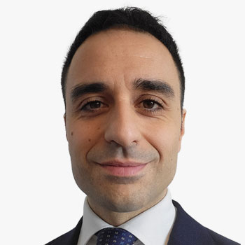

Nicola De Quattro is the head of Innovation and Technology Governance at Telespazio Belgium and Innovation Domain Manager for PNT Infrastructure and Solutions at Telespazio Group. Before joining Telespazio Belgium in 2014, he has been working as space systems engineer for Earth Observation, science, satellite communications and navigation missions, dealing with aspects related to space and ground segment. He manages all innovative programs in the company and defines the R&D and investments roadmap.
Abstract
Driving Decarbonization with Integrated Satellite-based Monitoring Solutions
Solutions based on satellite data and space technology can support the transition to a low-carbon economy. We are investing our know-how to develop an integrated solution that uses satellite data to monitor CO2 emissions, integrate whole supply chain pollution monitoring and simulate good practices in near real time . Our focus is on creating an integrated system that uses artificial intelligence and satellite data to analyse satellite imagery and sensor data to provide accurate estimates of emissions and estimates of relative soil sequestration, organic matter uptake and storage times. The aim of this cross-sectoral system is to combine satellite data with artificial intelligence to create a complete and detailed picture of the environmental situation, making it possible to accurately assess the impacts of human activities on the land and integrate any best practices to mitigate them.Our approach moves beyond the concept of just monitoring data, and we transform satellite data into a decision support tool for decarbonization and carbon sequestration. In particular, we will analyse the Road Map of the SA4D project, supported by the MaxICS artificial intelligence platform. We will showcase the results of our analysis in the Food Production and Buildings - Energy and Utilities supply chains, highlighting the added value of our solution and its integration within the green geo-information context.
Nicola De Quattro
 Nicola De Quattro
Head of Innovation and Technology Governance , Telespazio Belgium , Belgium
Nicola De Quattro is the head of Innovation and Technology Governance at Telespazio Belgium and Innovation Domain Manager for PNT Infrastructure and Solutions at Telespazio Group. Before joining Telespazio Belgium in 2014, he has been working as space systems engineer for Earth Observation, science, satellite communications and navigation missions, dealing with aspects related to space and ground segment. He manages all innovative programs in the company and defines the R&D and investments roadmap.
Abstract
Driving Decarbonization with Integrated Satellite-based Monitoring Solutions
Solutions based on satellite data and space technology can support the transition to a low-carbon economy. We are investing our know-how to develop an integrated solution that uses satellite data to monitor CO2 emissions, integrate whole supply chain pollution monitoring and simulate good practices in near real time . Our focus is on creating an integrated system that uses artificial intelligence and satellite data to analyse satellite imagery and sensor data to provide accurate estimates of emissions and estimates of relative soil sequestration, organic matter uptake and storage times. The aim of this cross-sectoral system is to combine satellite data with artificial intelligence to create a complete and detailed picture of the environmental situation, making it possible to accurately assess the impacts of human activities on the land and integrate any best practices to mitigate them.Our approach moves beyond the concept of just monitoring data, and we transform satellite data into a decision support tool for decarbonization and carbon sequestration. In particular, we will analyse the Road Map of the SA4D project, supported by the MaxICS artificial intelligence platform. We will showcase the results of our analysis in the Food Production and Buildings - Energy and Utilities supply chains, highlighting the added value of our solution and its integration within the green geo-information context.
Head of Innovation and Technology Governance | Telespazio Belgium | Belgium
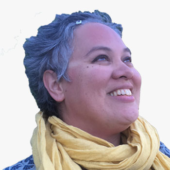

Caroline has been in defence, governmental, transport, energy, planning and the environmental geospatial sectors with a keen interest in agricultural policy. She is Founder and Lead Cartographer at Clear Mapping Co. She is a Journalist for Maplines, the membership magazine, for the British Cartographic Society. Caroline is Unite Lead at Women+ In Geospatial, covering Diversity, equity, and inclusion. She is a member and Middle Manager with the Chartered Management Institute. Caroline is a Fellow and Chartered Geographer with the Royal Geographical Society. She has a keen interest in sustainability, resilience and supporting the United Nations' Sustainable Development Goals (SDGs).
Caroline Robinson
 Caroline Robinson
Journalist, Maplines , British Cartographic Society , UK
Caroline has been in defence, governmental, transport, energy, planning and the environmental geospatial sectors with a keen interest in agricultural policy. She is Founder and Lead Cartographer at Clear Mapping Co. She is a Journalist for Maplines, the membership magazine, for the British Cartographic Society. Caroline is Unite Lead at Women+ In Geospatial, covering Diversity, equity, and inclusion. She is a member and Middle Manager with the Chartered Management Institute. Caroline is a Fellow and Chartered Geographer with the Royal Geographical Society. She has a keen interest in sustainability, resilience and supporting the United Nations' Sustainable Development Goals (SDGs).

Caroline has been in defence, governmental, transport, energy, planning and the environmental geospatial sectors with a keen interest in agricultural policy. She is Founder and Lead Cartographer at Clear Mapping Co. She is a Journalist for Maplines, the membership magazine, for the British Cartographic Society. Caroline is Unite Lead at Women+ In Geospatial, covering Diversity, equity, and inclusion. She is a member and Middle Manager with the Chartered Management Institute. Caroline is a Fellow and Chartered Geographer with the Royal Geographical Society. She has a keen interest in sustainability, resilience and supporting the United Nations' Sustainable Development Goals (SDGs).
Journalist, Maplines | British Cartographic Society | UK
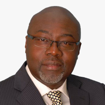
Jones Ofori-Boadu
Deputy Executive Secretary - Corporate Services | Land Commissions | Ghana
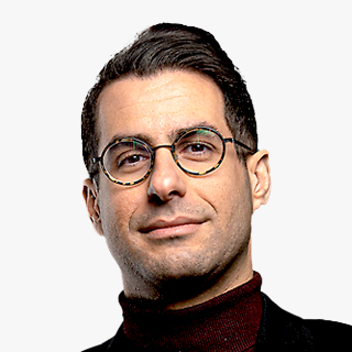

Remy is a tech professional on a mission to make people's life easier, provide solutions to everyday problems, help the environment, and make the world a better place. He holds a Ph.D. in geophysics from Sorbonne Universite and have work for many years as a data scientist in the energy industry. Today working as a CTO at GLOBHE, where we provide earth observation with drones to make the world a better place, help the environment, and contribute to solving the climate crisis with high-resolution imagery.
Remy Ghalayini
 Remy Ghalayini
Chief Technology Officer , GLOBHE , Sweden
Remy is a tech professional on a mission to make people's life easier, provide solutions to everyday problems, help the environment, and make the world a better place. He holds a Ph.D. in geophysics from Sorbonne Universite and have work for many years as a data scientist in the energy industry. Today working as a CTO at GLOBHE, where we provide earth observation with drones to make the world a better place, help the environment, and contribute to solving the climate crisis with high-resolution imagery.

Remy is a tech professional on a mission to make people's life easier, provide solutions to everyday problems, help the environment, and make the world a better place. He holds a Ph.D. in geophysics from Sorbonne Universite and have work for many years as a data scientist in the energy industry. Today working as a CTO at GLOBHE, where we provide earth observation with drones to make the world a better place, help the environment, and contribute to solving the climate crisis with high-resolution imagery.
Chief Technology Officer | GLOBHE | Sweden
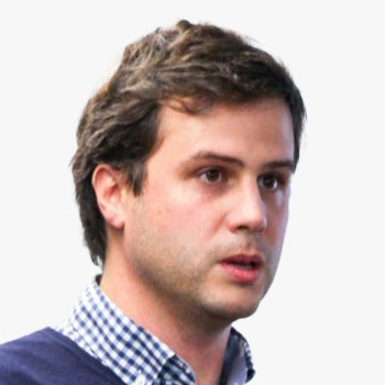

Antoine Lefebvre, 39, Co-founder and CEO of KERMAP: Graduated with a PhD in Geography-Signal Processing (2011), Antoine is specialized in image processing and geographic information. He has several years of experience in public research (CNRS, CNES) and abroad (China). He also has more than 3 years of experience as R&D project manager in the private sector. Antoine is in charge of innovation and R&D at Kermap.
Abstract
Enabling land cover changes monitoring at global scale
Monitoring changes in land use is essential for monitoring climate change and initiatives to counter it. Today, many global mapping projects exist (ESA WorldCover, Global Forest Watch, World Settlement Footprint) and they all show their advantages and weaknesses in terms of quality, update frequency, and thematic precision. One of the main keys to success is related to input data and especially, their access and structuration for the implementation in machine learning algorithms. It is necessary that the data be homogeneous spatially and continuous in time. In this context, KERMAP has developed basemaps on a global scale, updated on a monthly basis. This data provides seamless, cloud-free and artifact-free coverage of the Copernicus Sentinel-1 and Sentinel-2 products. More than a simple basemap, it is continuously updated every month and allows monitoring tasks and training models based on time series. The first use-cases have in particular shown relevant applications for the monitoring of urbanization, forests, crop monitoring in the context of compliance with good environmental practices.
Antoine Lefebvre
 Antoine Lefebvre
CEO , KERMAP , France
Antoine Lefebvre, 39, Co-founder and CEO of KERMAP: Graduated with a PhD in Geography-Signal Processing (2011), Antoine is specialized in image processing and geographic information. He has several years of experience in public research (CNRS, CNES) and abroad (China). He also has more than 3 years of experience as R&D project manager in the private sector. Antoine is in charge of innovation and R&D at Kermap.
Abstract
Enabling land cover changes monitoring at global scale
Monitoring changes in land use is essential for monitoring climate change and initiatives to counter it. Today, many global mapping projects exist (ESA WorldCover, Global Forest Watch, World Settlement Footprint) and they all show their advantages and weaknesses in terms of quality, update frequency, and thematic precision. One of the main keys to success is related to input data and especially, their access and structuration for the implementation in machine learning algorithms. It is necessary that the data be homogeneous spatially and continuous in time. In this context, KERMAP has developed basemaps on a global scale, updated on a monthly basis. This data provides seamless, cloud-free and artifact-free coverage of the Copernicus Sentinel-1 and Sentinel-2 products. More than a simple basemap, it is continuously updated every month and allows monitoring tasks and training models based on time series. The first use-cases have in particular shown relevant applications for the monitoring of urbanization, forests, crop monitoring in the context of compliance with good environmental practices.
CEO | KERMAP | France
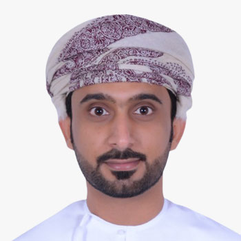

Abstract
Land selection e-service for investors in Special Economic Zone at Duqm (SEZAD) in the sultanate of Oman
The Title: Land selection e-service for investors in Special Economic Zone at Duqm (SEZAD) in the sultanate of Oman The presentation will show the following: - Introduction - Aims and methodology implemented - Result and outcomes - feedback idea about this service: This service allows investors to select the plot of land directly as soon as an investor determines the type of project and the required space of the plot. Based on the application's details, the system displays the vacant plots in the masterplan for investors via the Geographic Information System (GIS), which has become one of the modern technologies used in achieving governance of procedures. The new service assists the investor to easily make the investment decision by selecting the appropriate location of the land while providing a spatial description that reinforces the decision. Moreover, the service is distinguished by allowing investors to select the plot of land in interactive maps for more than 800 different economic activities. It also brings other features, including: the possibility of measuring the distance between the selected land and the key landmarks in the Special Economic Zone at Duqm, providing accurate information about the level of land's altitude above sea level, merging joint lands, getting full measurements of lengths and spaces, determining the geographical location coordinates, and sharing the approximate distance of the land from the nearby utilities such as electricity, water, telecommunications, and roads.
Ahmed Al Fazari
 Ahmed Al Fazari
GIS Specialist , Public Authority for Special Economic Zones and Free Zone , Sultanate of Oman
Abstract
Land selection e-service for investors in Special Economic Zone at Duqm (SEZAD) in the sultanate of Oman
The Title: Land selection e-service for investors in Special Economic Zone at Duqm (SEZAD) in the sultanate of Oman The presentation will show the following: - Introduction - Aims and methodology implemented - Result and outcomes - feedback idea about this service: This service allows investors to select the plot of land directly as soon as an investor determines the type of project and the required space of the plot. Based on the application's details, the system displays the vacant plots in the masterplan for investors via the Geographic Information System (GIS), which has become one of the modern technologies used in achieving governance of procedures. The new service assists the investor to easily make the investment decision by selecting the appropriate location of the land while providing a spatial description that reinforces the decision. Moreover, the service is distinguished by allowing investors to select the plot of land in interactive maps for more than 800 different economic activities. It also brings other features, including: the possibility of measuring the distance between the selected land and the key landmarks in the Special Economic Zone at Duqm, providing accurate information about the level of land's altitude above sea level, merging joint lands, getting full measurements of lengths and spaces, determining the geographical location coordinates, and sharing the approximate distance of the land from the nearby utilities such as electricity, water, telecommunications, and roads.
GIS Specialist | Public Authority for Special Economic Zones and Free Zone | Sultanate of Oman
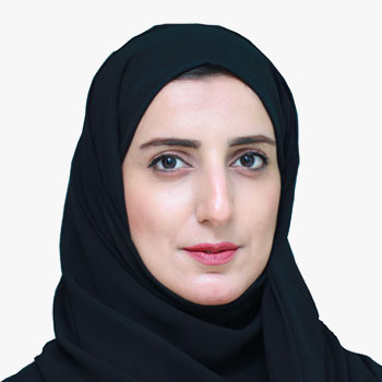
Najya Sultan AlHajri
GIS Specialist | Public Authority for Special Economic Zones and Free Zone | Sultanate of Oman
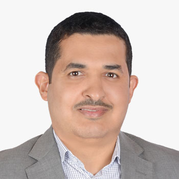

Adel Alqulaiti is a group leader of Encroachment Analysis Group within Saudi Aramco Land Affairs Department, Land Protection Division. He joined the company back in 2013. Within his 10 years of experience in Land Management and GIS, he led to a number of successful implementation in modernizing land management strategies and GIS aspects for protecting Company's surface rights.
Abstract
Geospatial Methods of Protecting Saudi Aramco Lands
Saudi Aramco has massive reserved lands that need to be monitored and protected from unauthorized use, known as Encroachments. Land Affairs Department of Saudi Aramco applied geospatial methods to classify lands into two zones: Critical
Adel Alqulaiti
 Adel Alqulaiti
Land Affairs Rep , Saudi Aramco , Saudi Arabia
Adel Alqulaiti is a group leader of Encroachment Analysis Group within Saudi Aramco Land Affairs Department, Land Protection Division. He joined the company back in 2013. Within his 10 years of experience in Land Management and GIS, he led to a number of successful implementation in modernizing land management strategies and GIS aspects for protecting Company's surface rights.
Abstract
Geospatial Methods of Protecting Saudi Aramco Lands
Saudi Aramco has massive reserved lands that need to be monitored and protected from unauthorized use, known as Encroachments. Land Affairs Department of Saudi Aramco applied geospatial methods to classify lands into two zones: Critical
Land Affairs Rep | Saudi Aramco | Saudi Arabia
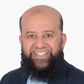

Yousef recently completed 30 years of service with Aramco, and he is currently acting as Land Protection Division Manager. His team is focused on protecting company surface rights from unauthorized users using latest GIS tools and technologies.
Yousef Al-Ghassab
 Yousef Al-Ghassab
Land Affairs Rep , Saudi Aramco , Saudi Arabia
Yousef recently completed 30 years of service with Aramco, and he is currently acting as Land Protection Division Manager. His team is focused on protecting company surface rights from unauthorized users using latest GIS tools and technologies.

Yousef recently completed 30 years of service with Aramco, and he is currently acting as Land Protection Division Manager. His team is focused on protecting company surface rights from unauthorized users using latest GIS tools and technologies.
Land Affairs Rep | Saudi Aramco | Saudi Arabia

