Akanksha Tyagi
Regional Director - EMEA | Geospatial World | UAE

Hazel is Director of People at OS and has over 20 years' experience of leading and developing people initiatives. Hazel has a particular interest in helping OS build and maintain a resilient workforce in a fast-moving business environment and champions inclusion, diversity and wellbeing at OS. She is passionate about making OS a great place to work.
Abstract
Building a resilient workforce by investing in our people.
Ordnance Survey is committed to being an inclusive place to work. Encouraging diversity, equality and inclusion is not only the right thing to do, we know that diverse teams create more value and bring huge value to our business. Through a series of networks such as LGBT+, Women's Development Network, Christian Fellowship, Religion and Belief Network, Neurodiversity Network, and Ethnic Minorities Network, OS encourages our people to be themselves at work, share experiences, support one another be active allies and to make OS a great place to work for all.
Hazel Hendley
 Hazel Hendley
Director of People , Ordnance Survey , UK
Hazel is Director of People at OS and has over 20 years' experience of leading and developing people initiatives. Hazel has a particular interest in helping OS build and maintain a resilient workforce in a fast-moving business environment and champions inclusion, diversity and wellbeing at OS. She is passionate about making OS a great place to work.
Abstract
Building a resilient workforce by investing in our people.
Ordnance Survey is committed to being an inclusive place to work. Encouraging diversity, equality and inclusion is not only the right thing to do, we know that diverse teams create more value and bring huge value to our business. Through a series of networks such as LGBT+, Women's Development Network, Christian Fellowship, Religion and Belief Network, Neurodiversity Network, and Ethnic Minorities Network, OS encourages our people to be themselves at work, share experiences, support one another be active allies and to make OS a great place to work for all.
Director of People | Ordnance Survey | UK

Miriam has built a career in Geospatial startups. Currently, she is doing Partnerships at UP42. She is Geochicas co-founder, participates in the FIRE Forum as Earth Observation Evangelist in the Energy sector and former President of the Board in HOTOSM. Miriam is passionate about how Geospatial data and Earth Observation technologies can change the world.
Miriam Gonzalez
 Miriam Gonzalez
Partnerships & Outreach | UP42 , Co-Founder | GeoChicas , Germany
Miriam has built a career in Geospatial startups. Currently, she is doing Partnerships at UP42. She is Geochicas co-founder, participates in the FIRE Forum as Earth Observation Evangelist in the Energy sector and former President of the Board in HOTOSM. Miriam is passionate about how Geospatial data and Earth Observation technologies can change the world.

Miriam has built a career in Geospatial startups. Currently, she is doing Partnerships at UP42. She is Geochicas co-founder, participates in the FIRE Forum as Earth Observation Evangelist in the Energy sector and former President of the Board in HOTOSM. Miriam is passionate about how Geospatial data and Earth Observation technologies can change the world.
Partnerships & Outreach | UP42 | Co-Founder | GeoChicas | Germany


Stella is passionate about the use of Earth observation for enhancing capacity in food security and helping farmers increase their yield. She has received various accolades for her exemplary work in promoting the use of EO data and tools to deliver meaningful impact across Africa. At WFP, she provides support with spatial analysis on natural hazards, environmental degradation and other datasets through the development and implementation of EO-based solutions.
Stella Chelangat Mutai
 Stella Chelangat Mutai
Geospatial Consultant , UN World Food Programme , Italy
Stella is passionate about the use of Earth observation for enhancing capacity in food security and helping farmers increase their yield. She has received various accolades for her exemplary work in promoting the use of EO data and tools to deliver meaningful impact across Africa. At WFP, she provides support with spatial analysis on natural hazards, environmental
degradation and other datasets through the development and implementation of EO-based solutions.

Stella is passionate about the use of Earth observation for enhancing capacity in food security and helping farmers increase their yield. She has received various accolades for her exemplary work in promoting the use of EO data and tools to deliver meaningful impact across Africa. At WFP, she provides support with spatial analysis on natural hazards, environmental degradation and other datasets through the development and implementation of EO-based solutions.
Geospatial Consultant | UN World Food Programme | Italy

Simon Navin MRICS MCInstCES is the Geospatial Lead at Jacobs in Europe. He leads on strategy development and implementation for the UK and European geospatial team. Simon is an experienced built environment industry professional with more than 30 years of service within geospatial, engineering, architecture, mobility, transportation, environment and innovation. He has a broad range of professional interests that include smart cities, intelligent mobility, digital infrastructure, Building Information Modelling (BIM) and intelligent mobility. He is Chair of the Chartered Institution of Civil Engineering Surveyors EDI Council.
Abstract
Enabling diversity and inclusion through geospatial
The geospatial industry will be at the heart of digital transformation in the built and natural environment sector for many years to come. This will create opportunities for new entrants in to geospatial as well as a need to democratise geospatial skills across many other disciplines. But what can we do as a profession to ensure we are creating open, accessible inclusive and flexible working environments and practices, so we don't exclude anyone from contributing and succeeding? What technologies and development swill promote inclusion and diversity across our profession? How will we recognise bias in data collection and management activities to ensure fair and equitable outputs? And how can we be allies and actors for change in our industry to ensure the places and spaces of tomorrow are suitably diverse, inclusive, and welcoming for all?
Simon Navin
 Simon Navin
EDI Council Chair , Chartered Institution of Civil Engineering Surveyors , UK
Simon Navin MRICS MCInstCES is the Geospatial Lead at Jacobs in Europe. He leads on strategy development and implementation for the UK and European geospatial team. Simon is an experienced built environment industry professional with more than 30 years of service within geospatial, engineering, architecture, mobility, transportation, environment and innovation. He has a broad range of professional interests that include smart cities, intelligent mobility, digital infrastructure, Building Information Modelling (BIM) and intelligent mobility. He is Chair of the Chartered Institution of Civil Engineering Surveyors EDI Council.
Abstract
Enabling diversity and inclusion through geospatial
The geospatial industry will be at the heart of digital transformation in the built and natural environment sector for many years to come. This will create opportunities for new entrants in to geospatial as well as a need to democratise geospatial skills across many other disciplines. But what can we do as a profession to ensure we are creating open, accessible inclusive and flexible working environments and practices, so we don't exclude anyone from contributing and succeeding? What technologies and development swill promote inclusion and diversity across our profession? How will we recognise bias in data collection and management activities to ensure fair and equitable outputs? And how can we be allies and actors for change in our industry to ensure the places and spaces of tomorrow are suitably diverse, inclusive, and welcoming for all?
EDI Council Chair | Chartered Institution of Civil Engineering Surveyors | UK


Maarit Kahila has a background in planning geography from the University of Helsinki and urban planning from Aalto University, where she received her Ph.D. Her research focuses on new methods for enabling and encouraging wider public participation. In her dissertation, she studied the opportunities for urban planners to take advantage of map-based PPGIS tools like Maptionnaire to get ideas and insights from residents. Currently, she is the CEO and co-founder of Mapita, the company behind Maptionnaire. She continues to work in the domain of community engagement tools for urban planners and city developers. Maptionnaire is a powerful community engagement tool that helps urban planners and city developers to create map-based tools to get ideas and insights from residents - thus enabling and encouraging public participation. Maptionnaire is a SaaS service used in over 40 countries.
Abstract
Transforming Community Engagement into a Digital Ecosystem of Place-based Data: Experiences from Finland
Although participatory mapping and community engagement are now widely accepted methods of enhancing community and urban development, certain challenges remain. Foremost, the quality and utilization of the knowledge acquired with community engagement are unsystematic and siloed. The presentation will cover several case studies where public participation GIS (PPGIS) tools are employed to build smarter communication and community engagement strategies in cities where the demand for interaction among people and various stakeholders is growing. The speaker will share their knowledge and data insights gained through academic research and practical projects implemented with a PPGIS tool Maptionnaire during the past decade. With the help of Maptionnaire tools, residents' experiences have been gathered to inform and support decision-making that might include areas also beyond city planning - for example, health and well-being, nature's diversity, energy transition, and nature preserves. Maptionnaire reimagines community engagement as an ecosystem of place-based data that provides actionable insights for city development and democratizes participation processes.
Maarit Kahila
 Maarit Kahila
CEO , Maptionnaire , Finland
Maarit Kahila has a background in planning geography from the University of Helsinki and urban planning from Aalto University, where she received her Ph.D. Her research focuses on new methods for enabling and encouraging wider public participation. In her dissertation, she studied the opportunities for urban planners to take advantage of map-based PPGIS tools like Maptionnaire to get ideas and insights from residents. Currently, she is the CEO and co-founder of Mapita, the company behind Maptionnaire. She continues to work in the domain of community engagement tools for urban planners and city developers. Maptionnaire is a powerful community engagement tool that helps urban planners and city developers to create map-based tools to get ideas and insights from residents - thus enabling and encouraging public participation. Maptionnaire is a SaaS service used in over 40 countries.
Abstract
Transforming Community Engagement into a Digital Ecosystem of Place-based Data: Experiences from Finland
Although participatory mapping and community engagement are now widely accepted methods of enhancing community and urban development, certain challenges remain. Foremost, the quality and utilization of the knowledge acquired with community engagement are unsystematic and siloed. The presentation will cover several case studies where public participation GIS (PPGIS) tools are employed to build smarter communication and community engagement strategies in cities where the demand for interaction among people and various stakeholders is growing. The speaker will share their knowledge and data insights gained through academic research and practical projects implemented with a PPGIS tool Maptionnaire during the past decade. With the help of Maptionnaire tools, residents' experiences have been gathered to inform and support decision-making that might include areas also beyond city planning - for example, health and well-being, nature's diversity, energy transition, and nature preserves. Maptionnaire reimagines community engagement as an ecosystem of place-based data that provides actionable insights for city development and democratizes participation processes.
CEO | Maptionnaire | Finland


Philipp Meschenmoser is a research associate at the data visualization group, Lucerne University of Applied Sciences & Arts. His expertise lies in conceptualizing and developing interactive data visualizations, first and foremost of geospatial data. He has completed his M.Sc. in Computer and Information Science at the chair for data analysis and visualization of Professor Daniel A. Keim, University of Konstanz. Philipp Meschenmoser has gained practical experience in various projects from research and industry. Now he is a full-stack developer in LUASA's Smart Region Lab and loves using tailored visualization and interaction techniques to extract knowledge from big data.
Abstract
Social Planning with Tangible Visualization Tools
Cities and municipalities require tools for demand-actuated social planning and communicating with various stakeholders. Why are elderly people moving away from certain quarters? In which quarters should the offers for young families be expanded? We present tools that bring various stakeholders to one multitouch table and show social indicators by custom map visualizations. By means of tangible objects that can be placed on the map, we strongly support participative and collaborative processes, planning, and solution-finding. In this presentation, we would like to elaborate on our motivation, technology stack, use cases and show our tools in interactive live demos. Please find more information about the surrounding project Smart Region Central Switzerland where we want to support digital transformation through intelligent data analytics and tailored visualizations & interactions: hslu.ch/smartregion
Philipp Meschenmoser
 Philipp Meschenmoser
Research Associate , Lucerne University of Applied Sciences and Arts , Switzerland
Philipp Meschenmoser is a research associate at the data visualization group, Lucerne University of Applied Sciences & Arts. His expertise lies in conceptualizing and developing interactive data visualizations, first and foremost of geospatial data. He has completed his M.Sc. in Computer and Information Science at the chair for data analysis and visualization of Professor Daniel A. Keim, University of Konstanz. Philipp Meschenmoser has gained practical experience in various projects from research and industry. Now he is a full-stack developer in LUASA's Smart Region Lab and loves using tailored visualization and interaction techniques to extract knowledge from big data.
Abstract
Social Planning with Tangible Visualization Tools
Cities and municipalities require tools for demand-actuated social planning and communicating with various stakeholders. Why are elderly people moving away from certain quarters? In which quarters should the offers for young families be expanded? We present tools that bring various stakeholders to one multitouch table and show social indicators by custom map visualizations. By means of tangible objects that can be placed on the map, we strongly support participative and collaborative processes, planning, and solution-finding. In this presentation, we would like to elaborate on our motivation, technology stack, use cases and show our tools in interactive live demos. Please find more information about the surrounding project Smart Region Central Switzerland where we want to support digital transformation through intelligent data analytics and tailored visualizations & interactions: hslu.ch/smartregion
Research Associate | Lucerne University of Applied Sciences and Arts | Switzerland
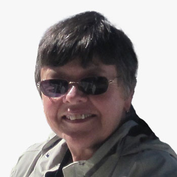

While teaching Earth Sciences, she became interested in how Geographic Information Systems can be used as a tool in geology and education. In 1997 she joined ESRI as Higher Education Manager helping colleges and universities develop GIS programs. She has been Co-PI on several NSF Grants related to GIS and is a co-editor for the UCGIS Body of Knowledge and a lead on the development of the Geospatial Technology Competency Model curriculum outlines for Model Courses. She earned her GIS Professional Certification 7 years ago. Currently she is Associate Director of the GeoTech Center NSF grant to support community college geospatial programs.
Abstract
Defining What the Geospatial Workforce Needs to Know?
To successfully participate in the Geospatial Caravan a worker must possess specific geospatial technology skills and competencies. This presentation will provide a framework for defining the needed skills and competencies for workers in different career pathways and workforce domains. The list of competencies have been vetted by industry and are part of the Geospatial Technology Competency Model from the USA Department of Labor.
Ann Johnson
 Ann Johnson
Associate Director, GeoTech Center , Jefferson Community and Technical College , USA
While teaching Earth Sciences, she became interested in how Geographic Information Systems can be used as a tool in geology and education. In 1997 she joined ESRI as Higher Education Manager helping colleges and universities develop GIS programs. She has been Co-PI on several NSF Grants related to GIS and is a co-editor for the UCGIS Body of Knowledge and a lead on the development of the Geospatial Technology Competency Model curriculum outlines for Model Courses. She earned her GIS Professional Certification 7 years ago. Currently she is Associate Director of the GeoTech Center NSF grant to support community college geospatial programs.
Abstract
Defining What the Geospatial Workforce Needs to Know?
To successfully participate in the Geospatial Caravan a worker must possess specific geospatial technology skills and competencies. This presentation will provide a framework for defining the needed skills and competencies for workers in different career pathways and workforce domains. The list of competencies have been vetted by industry and are part of the Geospatial Technology Competency Model from the USA Department of Labor.
Associate Director, GeoTech Center | Jefferson Community and Technical College | USA

Keith Masback
Advisor | Geospatial World | USA
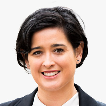

In 2021, Andrea Krupa was appointed President of PhotoSat, a Vancouver-based technology company that produces geospatial data from satellite imagery. With a global clientele of engineers and geologists, PhotoSat forms a unique link between the satellite technology industry and the resource development sector. In her time as General Manager and now President, she has strategically built a multi-disciplinary team of skilled professionals and fostered a culture of trust, transparency, and collaboration where employees thrive personally and professionally. On the business side, she has driven operational efficiency, supported new research and design, and formed new partnerships with emerging and existing satellite technology providers. The global demand for satellite-based data insights is on the rise. Andrea is committed to supporting the company's continued innovation and growth as a leading satellite-technology company.
Andrea Krupa
 Andrea Krupa
President , PhotoSat , Canada
In 2021, Andrea Krupa was appointed President of PhotoSat, a Vancouver-based technology company that produces geospatial data from satellite imagery. With a global clientele of engineers and geologists, PhotoSat forms a unique link between the satellite technology industry and the resource development sector. In her time as General Manager and now President, she has strategically built a multi-disciplinary team of skilled professionals and fostered a culture of trust, transparency, and collaboration where employees thrive personally and professionally. On the business side, she has driven operational efficiency, supported new research and design, and formed new partnerships with emerging and existing satellite technology providers. The global demand for satellite-based data insights is on the rise. Andrea is committed to supporting the company's continued innovation and growth as a leading satellite-technology company.

In 2021, Andrea Krupa was appointed President of PhotoSat, a Vancouver-based technology company that produces geospatial data from satellite imagery. With a global clientele of engineers and geologists, PhotoSat forms a unique link between the satellite technology industry and the resource development sector. In her time as General Manager and now President, she has strategically built a multi-disciplinary team of skilled professionals and fostered a culture of trust, transparency, and collaboration where employees thrive personally and professionally. On the business side, she has driven operational efficiency, supported new research and design, and formed new partnerships with emerging and existing satellite technology providers. The global demand for satellite-based data insights is on the rise. Andrea is committed to supporting the company's continued innovation and growth as a leading satellite-technology company.
President | PhotoSat | Canada

Mariam Crichton
CEO & Co-founder | 7 Satya | UK

Rachel Tidmarsh
Managing Director | Bluesky