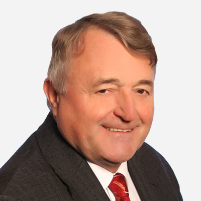
Speaker Bio & Abstract

Masaryk University
Czech Republic
BiographyProf. Dr. Milan Konecny is a professor of Cartography and Geoinformatics, Masaryk University, Brno, Czech Republic. He was/is a Professor in CUHK, and universities in Kaifeng, Shenzhen, Nanjing, Vienna University, Austria, Constantine the Philosopher University in Nitra, Slovakia, SSGUT Novosibirsk, Russia, etc.
He was/is a President, Acting or Vice President of International Cartographic Association, International Society for Digital Earth, and International Eurasian Academy of Science.
The Author of the first textbook of GIS in the World (1985) (with Karel Rais), leaded many research projects, like EU- China DRM (EC and Chinese State Bureau) or Dynamic mapping for risk management with NJNU, or HORIZON 2020 EU-China SieuSoil one with CAS.
He is an author of more than 130 research papers and 7 books from GIS, RS, cartography, EW and disaster risk management, Big Data, Geo-info connected with U.N. efforts like Agenda 2030, Sendai Framework, and Digital Belt and Roads ideas, marketization of space technology and concepts of services of regional commercialization needs.AbstractDisaster Risk Management towards Healthier Soils in Crisis SituationsIntensive farming on land represents an increased burden on the environment due to, among other reasons, the usage of agrochemicals or heavy machinery. Precision farming can reduce the environmental burden by employing site specific crop management practices which implement advanced geospatial technologies for respecting soil heterogeneity. We present the frontier approaches of geospatial (Big) data processing based on satellite and sensor data which both aim at the prevention and mitigation phases of disaster risk reduction in agriculture. Two techniques are presented in order to demonstrate the possibilities of geospatial (Big) data collection in agriculture: (1) farm machinery telemetry for providing data about machinery operations on fields; (2) remote sensing for monitoring field spatial variability and crop status by means of freely-available high resolution satellite imagery. The benefits of re-using the techniques in disaster risk reduction processes are discussed, as well as the transferability of agricultural techniques to crisis/emergency management domains.
This study is part of a project that has received funding from the European Union’s Horizon 2020 research and innovation programme under grant agreement No 818346 called “Sino-EU Soil Observatory for intelligent Land Use Management” (SIEUSOIL).