Speakers Bio & Abstract

Urthecast - Deimos Imaging
Canada
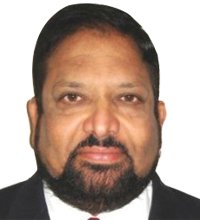
BiographyDr. Rao S. Ramayanam, is currently working as Vice President Sales, Middle East,
Africa and South Asia for UrtheCast, a Canadian Space company. He is an
accomplished senior executive in international sales, business development and
marketing with more than 25 years of working experience in international companies
and organizations including UrtheCast, DigitalGlobe, GeoEye, Space Imaging, The
World Bank, APSRAC (India) and National Remote Sensing Center (India).
He achieved amazing success in the sales of High Resolution Satellite Imagery,
Access, Ground Station to International Defense & Intelligence and Commercial
Markets. He has extensive experience in cloud based and onsite large enterprise
system sales and turn-key project management in Remote Sensing (RS) and GIS
applications. His interpersonal skills and team building on a global level helped in
establishing 40 member channel partner network in Middle East and Africa and
establishing business relationships in 50+ countries world wide.
He has developed several remote sensing applications and got the recommendations
implemented at the grass root level for micro level planning, disaster management,
drought management, irrigation using surface water resources, ground water mapping
and management, etc. in the State of Andhra Pradesh where successive Chief
Ministers have utilized his services to develop the state. He has been awarded the
Astronautical Society of India award for his contributions to remote sensing
applications. He has been supporting several customers including the government
customers, oil & gas industry customers, construction & real estate industry and
environmental industries spread across Middle East, Africa and South Asia.Abstract UrtheCast's High-Resolution Imagery, HD video and Synthetic Aperture Radar from Space for Defence & Intelligence and National Security Applications UrtheCast Corp. is a Vancouver-based technology company that serves the rapidly evolving geospatial and geoanalytics markets with a wide range of information-rich products and services. The Company operates Earth Observation (EO) sensors in space, through its subsidiary Deimos Imaging, including two satellites, Deimos-1 and Deimos-2, to produce imagery data for partners and customers in multiple markets.
Deimos-2 is an agile satellite for cost-effective, dependable very-high-resolution for EO applications. It provides 75-cm pan-sharpened imagery and 3-m multi-spectral images. Its multi-spectral capability includes 4 channels (red, green, blue, NIR), plus the panchromatic band. Deimos-2 has a swath of 12 km, and it is able to acquire imagery in strip mode (up to 1500 km long), or in spot mode, shifting between various targets. In addition, it has a wide-area acquisition mode, which can acquire in a single pass a 24-km wide strip, up to 200 km long. It is also capable of same-pass stereo imaging.
With the objective of advancing its global Earth Observation capability, UrtheCast is developing the OptiSAR constellation consisting of 16-satellite, 8 Dual Band (X and L) Synthetic Aperture Radar (SAR) satellites and 8 Dual Mode (Video and Pushbroom) Optical satellites. OptiSAR is designed to be the worlds first fully-integrated, multispectral optical and Synthetic Aperture Radar (SAR) constellation of Earth Observation satellites. Providing unprecedented capabilities, OptiSAR is aimed at solving real-world problems and creating tools for world change. Its built for researchers, developers, and analysts to gain unprecedented and extremely valuable data and information products at high revisit rates over their areas of interest regardless of obstacles like tree cover and weather phenomena. The OptiSAR constellation is expected to provide a unique OptiSAR product to produce the SAR Imagery to look like optical imagery for the ease of interpretation and applications.
UrtheCast is also planning to launch a constellation called UrtheDaily aiming to acquire high-quality, multispectral imagery of the Earths entire landmass, at 5-m GSD, taken at the same time, from the same altitude, every day. With its exceptional capabilities, it is expected to present a disruptive and problem-solving technology that will transform the way we observe our planet. The spacecraft, constellation and operations approach aims to enable ultra-high sensor spectral calibration targeted specifically at geoanalytics applications to optimize the ability to reliably extract information from the imagery and to detect even subtle changes on the planet.
This paper presents several applications including but not limited to the Land Use / Land Cover change detection, with the unique combination of Optical and SAR sensors from the OptiSAR constellation for Military intelligence, reconnaissance and surveillance (ISR), Maritime Surveillance providing wide area surveillance and also near realtime object identification, SAR interferometry to obtain difference in height measurements in the order of millimeters, DEM generation, Land Cover Classification, Emergency response to man made and natural Disaster Rescue and Relief operations etc.