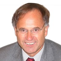
Speakers Bio & Abstract

Research Professor and Professor Emeritus
University of Stuttgart
Germany
BiographyBorn: May 19, 1950, in Gemuenden, Westerwald. Married with wife Karin, 2 children: Serena and Sebastian.
Apprentice in Surveying (1964-67), Professional Cadastral Surveyor (1967-79), Military Surveyor (1969-71), Studies of Surveying: Univ. Applied Science Mainz (1971-74 & Univ. Bonn (1974-77); PhD in Signal Processing, Univ. Bonn (1982); Habilitation Geographical Information Systems (GIS), Techn. Univ. Munich (1990). 1992-2016: Full Professor and Director of the Institute for Photogrammetry, Univ. Stuttgart, 2016-now Research Professor
Professional Activities (Selection): 1994-1996 Dean Faculty Civil Engineering and Surveying, University of Stuttgart, 1996-2000: President ISPRS Technical Commission IV Mapping and GIS; 1998-2000: Vice President Univ. Stuttgart, Section Higher Education and Life Long Learning; 2000-2006: President Univ. Stuttgart; 2000-now: Academic Co-Founder of the German University in Cairo (GUC), Egypt, and Member GUC Board of Trustees; 2002-2006: Member Board of Directors, Leica Geosystems, Heerbrugg, Switzerland, 2006-16: Chairman Board of Trustees The ISPRS Foundation (TIF); 2006-11: Member of Apples University Education Forum (UEF), Apple, Cupertino, USA; 2009-13 EuroSDR Vice President Research; 2013-now: Visiting Professor in Architecture and Urban Planning of the German University in Cairo (GUC), Lectures in Surveying, 2014-19: Member Advisory Board Center of Excellence Laser Scanning, Academy of Finland, 2014-now: Visiting Professor in Computer Science at the Sudan University of Science and Technology (SUSTECH), Lectures in Geoinformatics, 2017-now Vice Chair Board of Trustees German University in Cairo, 2017-now Vice Chair UN-GGIM PSN WG Land Administration.
Awards: IAG Fellow (1987), MeDiDaPrix Winner (2005) with eLearning Concept Univ Stuttgart, Honorary Professor Wuhan University, Wuhan, China (2007), ISPRS Fellow (2012), Honorary Member ESNC Jury Baden Wuerttemberg (2016).
R&D: 1992-2015 Organizer of the biennial symposium The Photogrammetric Week Series; Research Areas: Photogrammetry, GIS, Computer Vision, Statistical Inference, Signal Processing, Laser Scanning, More than 420 publications, thereof 30 Textbooks/proceedings; Supervisor of 37 PhDs (finished), 12 are still under supervision, Co-Supervisor of more than 60 PhDs.Abstract Photogrammetry 4.0 - Integrating Computer Vision, Computer Graphics, Photogrammetry and Serious Gaming for 3D and 4D App DevelopmentsAfter analog photogrammetrie (Photogrammetry 1.0, 1840-1970), analytical photogrammetry (Photogrammetry 2.0, 1950-2000), digital photogrammetry (Photogrammetry 3.0, 1980-today) we are heading towards embedded photogrammetry (Photogrammetry 4.0, 2010 onwards). With the evolutions in geometric computer vision using Structure-from-Motion (SfM) and Dense Image Matching (DIM), the ongoing developments in computer graphics visualizing big data and providing 3D and 4D reconstructions integrating the past, the efficient methods of photogrammetry using laser scanning and imagery from space, airborne, UAVs, and close-range the resulting 3D and time-dependent 4D models can be integrated in game platforms to provide Apps for smart cities in Android, iOS and Windows Operating Systems.
The European Project "Four Dimensional Cultural Heritage World (4D CH World)" offers 3D and 4D Apps for the Testbed Calw, a medieval town 35km southwest of Stuttgart, Germany. The reference surface is a 1m Airborne LiDAR DSM which was filtered to get the bare earth surface. In addition airborne imagery of GSD 20cm was used for DIM to get more details, in particular for the street surfaces and the river Nagold. About 200 buildings have been modeled in 3D using terrestrial laser scanning, close range photogrammetry, and vanishing point geometry of computer graphics. The latter method reconstructed the 3D models of the past using old b/w imagery of the Calw city archive. All models have been homogenbized in Autodesk 3ds Max and exported to the game engine Unity 3d, for virtual reality modeling and app output. Two apps will be demonstrated offering not only 3D and 4D models of the present and the past but also animations and walk-throughs. The workflows are discussed, pros and cons will be given.