Speakers Bio & Abstract

|
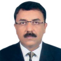
DR. ANIRUDDHA ROY
Sr. Vice President & CTO Genesys International India BiographyDr. Aniruddha Roy is currently Chief Technology Officer (CTO) in Genesys International Corporation Ltd., India. Prior to his present assignment, he was Vice President - (Strategic Business Group -GIS) in Navayuga Engineering Company Ltd. wherein he spearheaded and successfully completed the prestigious Delhi State Spatial Data Infrastructure ( DSSDI) Project which won National e-Gov award for innovative use of GIS from Govt. of India. Additionally, he was also responsible for the business operations for Navayuga Group in GIS. He served in ESRI India as Head, Technology Services besides Business Development, Project Management, Product Management, Training services etc. spanning more than 13 years. He has worked in several scientific projects in IIT Bombay and ISM Dhanbad and published over 50 technical papers on GIS and Remote Sensing in various conferences/ journals. He has over 27 years of experience in spatial technologies. He has a sound technology knowledge in industry standard GIS platforms and provides technology solutions on various vertical domains as applicable for rendering governance and citizen centric services. He is active member of FICCI (Geospatial Technology Committee and UAV policy formulation committee), member of Bureau Indian Standards (BIS) Geospatial Standards Committee and also represents Genesys in Association of Geospatial Industries (AGI). Dr. Roy has done his M.Tech from IIT Roorkee, PhD from IIT (ISM), Dhanbad, CERG from University of Geneva, Switzerland and MBA in Disaster Management from IP University, Delhi.Abstract Essential Geospatial Data Inputs for Designing Roads and HighwaysRoads and highways are designed based on road function, type and volume of expected traffic, potential traffic hazards and safety standards, capital cost, maintenance costs, vehicle operating costs, environment impacts, aesthetics as well as convenience of the road users. Specific processes and guidelines are laid by the Indian Road Congress (IRC) , Bureau of Indian Standards ( BIS) and International Standards Organization (ISO) for the same. The design engineers also takes into consideration local community needs. Geometric features needs to be accurately measured and mapped. The principal features are road classification, horizontal alignment, vertical alignment, road cross-section, drainage factors and various elements of proposed structures on the roads like culverts, bridges etc. Proper drainage of road surface, pavement and the foundation layers is basic requirement for maintaining the structural soundness and functional efficiency of a road. Conventionally, various surveying techniques are being used for the topographic surveys like Electronic Distance Measurement (Total Station) and GPS. While these equipment provides accurate results but the data collection in the field is time-consuming and often the projects are delayed thereby resulting in delay in submitting the DPR by the consultants. Engineering grade LiDAR equipment mounted in the vehicles are now being deployed to execute the job faster in the field for brownfield projects specifically for road expansion. Usage of Aerial LiDAR mapping system complemented with Terrestrial LiDAR and ETS are increasingly being used for the Greenfield projects. Specifications of the LiDAR scanners, operating procedures adopted in the field, climatic conditions prevalent during the survey etc. determines the quality of input data. Processing techniques of input datasets from various systems and skillsets of the technical resources also determines the output data quality. Genesys International pioneered the use of LiDAR in various infrastructure projects in India. Essential geospatial data required for designing the roads and highways and a structured data model is pre-requisite for planning and designing of roads. A case study on LiDAR based road survey and processing project undertaken by Genesys International from Uttarakhand state of India will also be presented. |