|
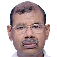
KeynoteDR. R.C. JAIN
Ex-Chairman
CGWB and Advisor (Groundwater) Gujarat Water Resources Development Corporation
India
BiographyDr. R.C. Jain is a former Chairman of Central Ground Water Board & Central Ground Water Authority, Ministry of Water Resources, Government of India.
He is presently Advisor (Ground Water), GWRDC Ltd., Govt. of Gujarat.
He was Project Coordinator for Implementation of “National Project on Aquifer Mapping and Management in India” for three-dimensional mapping of aquifers using advanced tools and technologies including heliborne geophysical surveys.
He was also the National Coordinator for World Bank assisted Hydrology Project-II.
His specialisations include Aquifer mapping, Integrated water resources management, Artificial recharge, Ground water modelling and database management, Remote sensing applications, Conjunctive use of ground water and surface water, Ground water resource estimation and Regional hydrogeological surveys.
Abstract Groundwater Mapping and Management : An Approach in Indian PerspectiveGroundwater is the backbone of India’s agriculture and drinking water security. However, the development activities over the years have adversely affected the ground water regime in many parts of the country. There is a need for scientific planning in development of ground water under different hydrogeological situations and to evolve effective and sustainable management practices for better ground water governance. Since it is common pool resource the need is felt a community participation for its resource management in a befitting manner incorporating the ecology, sustainability as well as livelihood issues.
The National Aquifer Mapping and Management Programme taken up during XII Plan period by Central Ground Water Board is a pioneering effort at the appropriate scale for devising scientifically based, aquifer–wise sustainable management plans for this common-pool resource. The methodology being followed is an amalgamation of both top-down and bottoms-up approach which includes the use of advanced tools and techniques including remote sensing, GIS, geophysical techniques, environmental isotope techniques, ground water modelling etc. for the study as well as the process of participatory data collection and management of ground water. The programme is designed to make a significant step forward in groundwater resource management by identifying and mapping aquifers in three dimensions, determining aquifer characteristics, quantifying available groundwater resources potential, proposing plans incorporating supply as well as demand side interventions as appropriate to the scale of demand, and the institutional arrangements for its management. This programme will help achieve drinking water security, improved irrigation facility and sustainability of ground water resources in India.
|
