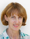
 Prof. Jacqueline McGlade Prof. Jacqueline McGlade
Executive Director
European Environment Agency
Denmark
Bio
Jacqueline Myriam McGlade is a British-born Canadian leading marine
biologist and environmental informatics professor. Her research
focusses on the spatial and nonlinear dynamics of ecosystems, climate
change and scenario development. She is the current Executive
Director of the European Environment Agency in Copenhagen,
Denmark. Following this appointment, she took leave from her post as
Professor of Environmental Informatics in the Department of
Mathematics at University College London. She obtained her PhD
degree in 1980 on aquatic sciences and zoology from the University of
Guelph in Canada. McGlade’s PhD research on the mathematical and
statistical analysis of the phenotypic and genotypic variability showed
the critical importance of spatial dynamics in determining evolutionary
divergence and ecological sustainability in freshwater and marine fish
populations. This work led to her establishing the first population
dynamics and genetics laboratory in Fisheries and Oceans Canada.
|
 Prof. Henk Scholten Prof. Henk Scholten
University of Amsterdam and
CEO,
Geodan
The Netherland
Bio
Henk J. Scholten studied Mathematics and Geography at the Vrije
Universiteit Amsterdam and obtained his Ph.D. on the subject of
models for housing allocation at the Faculty of Geography of the
University of Utrecht (NL) in 1988. Since 1990 he is professor in
Spatial Informatics at the Faculty of Economics of the Vrije
Universiteit Amsterdam and Director of the Spinlab
(www.spinlab.vu.nl). Prof. Scholten is founder and CEO of Geodan,
one of the largest European companies specialised in Geospatial
Information Technology.On Friday April 29th, 2005, Prof. Scholten
received a Royal Decoration for his significant contribution to geoinformation,
both on a national and international level. In July 2009
Prof. Scholten has received the ‘Lifetime Achievement Award’ by
Jack Dangermond, founder of ESRI. This award is given to a person
who has contributed significantly to advancing the science and
technology of GIS throughout his career.
|
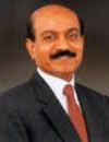 Dr. BVR Mohan Reddy Dr. BVR Mohan Reddy
Chairman
Infotech Enterprises
India
Mohan Reddy is acknowledged to have pioneered the CAD/CAM
culture in India by introducing computer systems for design and
manufacturing applications as far back as 1982. In the past 10
years, through Infotech Enterprises, he established the
'Engineered in India' brand by providing design engineering services
to reputed global companies that include names like Boeing,
Airbus, Pratt & Whitney, Bombardier, Philips, Siemens and
Westinghouse. Reddy was associated with prestigious companies
in India for over two decades before establishing Infotech Enterprises
in 1991. Reddy has been a member of the NASSCOM Executive
Council since 2003, and has also served as the Chairman
of Confederation of Indian Industry Southern Region, from 2008-
09. He is associated with councils of various academic and industry
forums and has led several initiatives for benefit of industry.
Bio
|
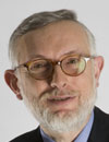 Jean Francois Rocchi Jean Francois Rocchi
President
BRGM
France
Bio
Jean-François Rocchi graduated in law and political science and
Inspector General for Administration, was appointed Chairman of
the BRGM in the Cabinet of 25 November, 2009. Former student
of ENA, Jean-François Rocchi began his career with the
Department of the Interior, before being assigned in 1985 to Planning
Commission as rapporteur. From 1985 to 1990 he was seconded
to the Deposit, successively as assistant deputy director of
the Deposit, then head of production specialized bank. From 1991
to 1993 he served in the National Assembly. Promoted to Inspector
General of the administration, he then led the firm of André
Rossinot, Minister of Public Service, between 1993 and 1995. As
regards the areas of competence of BRGM , Jean-François Rocchi
has worked fifteen years in business oriented mining or
post-mining, as well as to territorial issues.
|
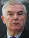 Prof Jozef Dubinski Prof Jozef Dubinski
President
World Mining Congress
Poland
Bio
Professor Józef Dubiński – correspondent member of the Polish Academy of Science – is graduated from the Faculty of Exploration Geology at the Mining and Metallurgy Academy (AGH) – University of Science and Technology in Kraków (1969) with the specialization of applied geophysics. In 1971 he joined Central Mining Institute in Katowice, where he worked in the Department of Rockburst (Laboratory of Mining Seismology). In the years 1991-2001 he was associate director in charge of research and science and since 2001 he is managing director of the Central Mining Institute. He has rich scientific achievements – more than 300 articles, papers and monographs – published in the domestic and foreign magazines and publishing houses. Professor Dubiński is a leader of scientific school based on his alumni. He is well recognized in Poland and abroad as a specialist in the mining problems. He serves several important functions in many international mining organizations such as Coal Industry Advisory Board and Euracoal. Since 2004 he is Chairman of the World Mining Congress.
Abstract
Mining Industry in World Economy: Prospects and Directions
Intense economic and technological world development has resulted in the increase of the consumption of the raw minerals. It has been estimated, that the value of 47 ÷ 56 billion Mg of the raw materials has been extracted annually around the world, and this value continues to grow. As the consequence the natural resources have already become the goods of the highest importance and because of this they have become the tool of the international politics.
The 20th century, particularly after the World War II, was characterised by dynamic increase in the extraction and processing of the raw materials. This increase has been visible in a various extent, both in case of the energy and non-energy raw materials. The crucial problem has then been the efficient use of the natural resources – especially those non-renewable. Mining and investment in mineral’s extraction have been the driving force for the economic and social development of many economies around the world; e.g. in highly developed countries such as Australia, the USA as well as in dynamically developing-ones like China, India, Brazil etc. Strong interest in the investments in mining was caused by the global raw materials market associated with the need to meet both: the growing resources’ needs of the individual countries as well as with ensuring the stability of the supply and availability of these raw materials for the external customers.
|
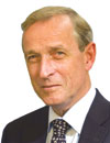 A J Baayen A J Baayen
Managing Director
Deltares
The Netherlands
Bio
Harry Baayen is managing director of Deltares. Deltares is an independent institute based in the Netherlands, created by the merger of Delft Hydraulics, GeoDelft, the Subsurface and Groundwater unit of TNO and parts of Rijkswaterstaat. Deltares combines knowledge and experience in the field of water, soil and the subsurface and provides innovative solutions to make living in deltas, coastal areas and river basins safe, clean and sustainable.
Baayen started as a trainee at the General Directorate of Housing of the Ministry of VROM (Housing, Spatial planning and the Environment).
He continued work at the ministry after finishing his study in a number of different capacities, in areas like housing subsidies, improvement of existing housing and urban renewal.
From 1987 on he held the position of Director/Inspector for housing in a number of Provinces: Groningen, Flevoland, Gelderland and, up to 1993 Zuid-Holland.
From 1990 he combined this with responsibilities in the main office in The Hague as deputy Inspector-General, coordinating the 12 Inspectorates. In this capacity he was responsible for a major restructuring of the Inspectorates.
In the fall of 1993 Baayen was appointed Director in the General-Directorate for the Environment.
At first he led the Directorate for Noise and Traffic, later the directorates of Air and Energy and of Climate change and Industry. This last Directorate is responsible for policy on all major emissions to the air and their global and national environmental impact.
In september 2000 Baayen was appointed Deputy Director-General of the Government Building Agency.
Responsibilities among others were organisation-development, human resources and procurement.
(The GBA lets about 2000 buildings, with a total floor area of 7 million m2. Most buildings are government offices, penitentiaries, courts of law, palaces and museums.)
In 2005-2006 he started the knowledge-network PIANOo, aimed at increasing awareness and expertise in public procurement.
Baayen has a Degree in Housing and Architecture (Delft University, 1975)
Baayen (1949) is married to Eugenie Marechal, they have one son (1970) and two grandchildren.
Hobbies are Photography, Wine, Golf, Work.
Abstract
Co-creation: combining open data with open software to create information
With the recent advent of modern sensor technologies the water sector is overwhelmed by valuable measurement data. This is known as the digital data deluge. Mankind faces the challenge to turn this wealth of data into useful information. Yet the previous data deluge, the overwhelming output from numerical models, was not even solved yet. Combining both data deluges is known as the fourth paradigm . It is the great challenge for this century and has fundamentally changed all aspects of sharing of data and software. Only players exchanging data and information freely, can benefit from clients and users that are working together within communities. Information and software is increasingly made open source so communities can work together on data and information enhancement. This is especially noticeable within Deltares' sector: the field of water, subsurface and infrastructure. In this presentation I will show how Deltares has adapted to these changes. By means of examples I will show how this has benefited us and our relationships with others.
Communities are essential for efficient use of data and information. In fact, bottom-up communities such as wikipedia work more efficiently and effectively by sharing data and software freely. Not only is software and data made available, by working together in communities information and software is enhanced and strengthened by interaction between scientists, data providers, software developers and clients. At Deltares we have recently taken the major decision to make part of our formerly commercial Delft3D software open source. This required a certain level of commitment and bravery, and a good business plan. But within a year it paid off. Furthermore, we are working together with many clients within communities on a mutually beneficial "co-creation" cooperation basis. We have for instance co-developed the Open Earth community in which we have streamlined the exchange data, information and software tools between scientists, governments, clients (e.g. the major dredging companies) and citizens. Open Earth is being used extensively in large projects, such as the Sand Engine and Building with Nature. Other examples are OpenMI, OpenDA.
Why is this essential? There are many issues facing us. Global and local water scarcity, pollution, overpopulation and salinization to name a few. To tackle these issues, we need to work together and exchange our information. Within the Netherlands we are already tackling this by the forming of the NMDC and closer co operations between the knowledge institutes. Data and technology providers need to think about making data and software more freely available and work together in communities to create improved information products.
|
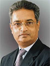 Mitrasen Bhikajee Mitrasen Bhikajee
Executive Secretary
Inter-governmental Oceanographic Commission
UNESCO
France
Bio
Dr. Mitrasen BHIKAJEE holds a M.Sc. in Fisheries Management
and a Ph.D. in Marine Biology. He has been Associate Professor at
the University of Mauritius and Director of the Mauritius
Oceanography Institute. He has carried out consulting
assignments for the Indian Ocean Commission, the Global
Environment Facility, UNEP and UNDP. He was Chairman of the
Indian Ocean component of the Global Ocean Observation System
which is a permanent global system for observations, modelling
and analysis of marine and ocean variables to support operational
ocean services worldwide. He is presently the
Director and Deputy Executive Secretary of the Intergovernmental
Oceanographic Commission of UNESCO.
Abstract
Ocean Resources in World Economy – A Geospatial Point of View
Recent decades have witnessed an increasing use of geospatial technology in the management and exploitation of marine resources. Emerging technologies assist in providing a global perspective of, what was earlier, a fragmented and incomplete view of the ocean resources. Satellite imagery is now widely accepted and used as a tool for determination of potential fishing zones (PFZ). A combination of seas surface temperature, ocean colour and altimetry data obtained by satellites allow the determination of areas which potentially have a higher concentration of fish. This technology is now used by several countries for more efficient fishing, thus saving on fuel and time. To counteract the argument that this increased efficiency can lead to overfishing, Vessel Monitoring Systems (VMS) allow controlling agencies to keep a close watch on the fishing effort of individual licensed vessels. An emerging issue is the newly acquired marine resource base of some countries as a result of the recommendations of the United Nations Commission on the Limits of the Continental Shelf (UNCLCS). Not only the delineation of the new marine territories but their exploitation also rely heavily on geospatial technology. Ocean research provide important inputs to the sustainable exploitation of marine resources. Satellite technology through online tide gauges and drifting and fixed buoys help in studying ocean processes which provide the information for predicting climate – an important factor in food production. Ocean data transmitted through remote systems allows the monitoring of cyclones and tsunamis, both of which have an impact on our economic resource base.
|
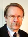 Geoff Zeiss Geoff Zeiss
Director Utility Industry
Program
Autodesk
USA
Bio
Geoff Zeiss has more than 20 years experience in the geospatial software industry and 15 years experience working with utilities, communications, and public works in enterprise geospatial IT around the world. His focus is on the convergence of engineering, geospatial and 3D visualization and its application to infrastructure design and operations to support intelligent networks such as smart grid. He has been directly involved in some of the largest successful implementations of geospatial network documentation/records management systems in the utility and telecommunications sectors.
Abstract
Contribution of Geospatial to the Infrastructure Sector
Worldwide, it is anticipated that there will be a massive spend on infrastructure, on the order of $24 trillion over the next two decades. Infrastructure engineering companies are discovering the benefits of the convergence of model–based design, 3D visualization, and integrated geospatial information and technology in order to increase productivity. When large industries face a serious business challenge such as low or declining margins, they invest in technology to help them dramatically increase productivity. This transformation as essential if infrastructure owners are to attract the private investment they so urgently require. An important trend in engineering design technology is reality capture using new techniques for geospatial data acquisition. Laser scanning (terrestrial, mobile, and LiDar), satellite photography and radar, high-resolution aerial photogrammetry and radar, oblique photogrammetry, and street-level photography, to name a few of the new geospatial data acquisition types that are being used by infrastructure engineers and designers to improve the productivity throughout the plan, design, build, and maintain infrastructure lifecycle.
|