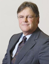
 Siebe Riedstra Siebe Riedstra
Secretary General
Ministry of Infrastructure and Environment
Government of The Netherlands
Bio
In 1986, after a period of teaching in higher education, Mr Riedstra started his civil service career as a policy adviser at the Ministry of Education and Science, where he ultimately became Deputy Director of the Minister’s office.
In 1993 he joined the Ministry of Transport, Public Works and Water Management. From 1993 to 1999 he played a key role in the restructuring of the Dutch public transport sector to become a competitive, expanding and sustainable player in the mobility market. In 1999 he was promoted to Director, and up to 2002 was responsible for making the freight transport sector sustainable through a thorough overhaul of logistic efficiency and the introduction of strict requirements for vehicles. He was also involved in the decision-making process regarding land reclamation for the Port of Rotterdam, in particular the “Maasvlakte 2” project, as part of a smart investment drive to minimise the environmental impact of economic development. From 2002 to 2005 he held the post of Director of the Minister’s office, responsible for matters such as spatial planning policy. In 2005, he became Director-General for Passenger Transport and later for Mobility. This entailed responsibility for sustainable mobility policies, including the long-term national mobility plan and the investment policy for infrastructure in the Netherlands.
Mr Riedstra was appointed Secretary-General for Transport, Public Works and Water Management on 1 December 2009. In October 2010, the Ministry of Transport, Public Works and Water Management was merged with parts of the Ministry of Housing, Spatial Planning and the Environment to form a new Ministry of Infrastructure and the Environment, where Mr Riedstra holds the position of Secretary-General for Infrastructure and the Environment.
|
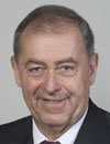 Prof FJ Radermacher
Ulm University
Germany
Bio
Prof. Franz Josef Radermacher is the Director of FAW/n (Research
Institute for Applied Knowledge Processing/n), Ulm, and holds a faculty
position for Database / Artificial Intelligence at the University of Ulm.
He has received 1997 Scientific Award of the German Society for
Mathematics, Economics and Operations Research, 2005 Laureate of
the Salzburg Award for Future Research, Austria, 2007 Laureate of
“Vision Award 2007“ of Global Economic Network. Prof. Radermacher
is a member of the Rotarian Action Group for Population & Development
- German Section - and is the Member of the German National
Committee of the UNESCO for the World Decade "Education for
Sustainable Development”.
|
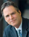 Matt O’Connel Matt O’Connel
CEO
GeoEye Inc.
USA
Bio
.O’Connell came to the commercial remote sensing industry in 2001 as CEO of GeoEye’s predecessor, ORBIMAGE. In January 2008, O’Connell was appointed by the Department of the Interior to serve on its National Geospatial Advisory Committee. He also serves on The National Oceanic and Atmospheric Administration's Advisory Committee on Commercial Remote Sensing. In February 2008, O’Connell was elected to the U.S. Geospatial Intelligence Foundation’s Board of Directors. In October 2007, O’Connell was presented with their Industry Leader award. In June 2007, Mr. O’Connell was named “Entrepreneur of the Year” by Ernst and Young for Communications in the Washington, D.C. region.
Mr. O’Connell has over 25 years of experience in communications management and finance. Prior to joining GeoEye, Mr. O’Connell was a managing director at Crest Advisors, a New York-based private merchant bank that invested in and advised communications companies, and senior vice president of Legal and Business Affairs for Sony Worldwide Networks, a division of Sony Corporation specializing in radio and Internet programming. Before working at Sony, he served as senior vice president and general counsel of Osborn Communications Corporation, a publicly traded radio and television station operator. Prior to his tenure at Osborn, Mr. O’Connell was the assistant general counsel at Cablevision Systems Corporation, where he was responsible for acquisitions and finance, including the Company’s initial public offering. Mr. O’Connell began his career on Wall Street as a lawyer specializing in mergers and acquisitions and corporate finance. Mr. O’Connell holds a Bachelor of Arts degree in Classics from Trinity College, where he was elected to Phi Beta Kappa, and a Juris Doctor from the University of Virginia Law School.
Abstract
Today, more and more consumers, businesses, and governments, whether they realize it or not, are both users and influencers of the commercial remote sensing industry. They increasingly define how services are consumed and how the industry’s leaders operate on a daily basis. The industry’s broader mandate and its strength come from the combined needs of countless people in many nations.
The commercial remote sensing industry is complex yet highly visible due to the increasing demand for the services the industry provides. As a result, companies like GeoEye must increasingly invest in innovative technologies that enable them to operate seamlessly.
See how commercial remote sensing companies like GeoEye are usingEarth imagery, geospatial expertise and enabling technologies to make the invisible visible, whether uncovering human rights abuses, aiding in emergency disaster relief and damage assessment, or monitoring and managing the world’s resources. GeoEye will highlight examples of how they created geospatial solutions to help people see, understand, anticipate and respond to change.
|
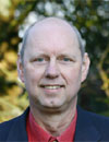 Fred Hagman Fred Hagman
Managing Director
Aerodata International
Belgium
Bio
Fred Hagman, educated as an ecologist from Wageningen
University in 1982 has worked in private industry and government
on using aerial photography and other remote sensing techniques
in environmental applications and in photogrammetric
mapmaking. Since 2003 he is Managing Director at Aerodata
International Surveys. Aerodata is a remote sensing company,
part of the PASCO Corporation, active in a wide geographical
region and specialized in airborne data acquisition and value added
geo-information products.
|
 Brian L. Soliday Brian L. Soliday
Vice President of Sales
Branded Products
Intermap Technologies
USA
Bio
Brian Soliday has over 25 years of extensive experience working in sales, marketing and channel development within the GIS and remote sensing industries. He currently serves as Vice President of Sales, Branded Products for Intermap Technologies, Inc., based out of their Denver, CO headquarters. His career includes VP and director level positions with leading geospatial organizations such as Autodesk, Trimble Navigation, Space Imaging, LizardTech, TerraGo, SANZ, Genasys and VLSystems. Mr. Soliday has presented at over 50 geospatial events on an international basis and has written published articles in; Planning, Point of Beginning, GEOinformatics, The World & I, GEOEurope, Journal of the American Congress on Surveying and Mapping, Arc News, Space News, and Earth Observation Magazine.
He currently serves on the Board of Directors for GIS Colorado (GISCO) and served on the Board of Directors for the Rocky Mountain Region of ASPRS for 8 years (’99-2007), including serving as President during 2004 when Denver hosted the ASPRS national conference. Additionally, Soliday has served the last 7 years as the Colorado Volunteer Chair for the Rocky Mountain Elk Foundation, a leading conversation organization of over 180,000 members. Soliday graduated Summa cum laude with a master’s of arts degree in geography specializing in remote sensing and GIS in 1987, and earned a bachelor’s of science degree in geography in 1983. Both degrees were earned from the University of Nebraska at Omaha.
Abstract
The Living Planet report calculates that humans are using 30% more resources than the Earth can replenish each year, which is leading to deforestation, degraded soils, polluted air and water, increased demands for energy, and dramatic declines in numbers of fish and other species. By 2030, if nothing changes, humankind will need two planets to sustain its lifestyle. Digital imaging our planet through remote sensing technologies will allow us to move closer toward solutions to manage our world’s natural resources. This presentation takes a look at a few examples of how remotely sensed elevation and Image data are impacting the management of sustainable natural resources such as precision agriculture, renewable energy sources such as oil palm, wind and solar energy, water and natural hazard risk assessments, and managing our
forests and reducing carbon emissions.
|