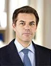
 Ingrid Vanden Berghe
Administrator General
National Geographic Institute of Belgium and
President – Eurogeographics
Bio
Ingrid has served as an adviser to several Belgium Cabinet
Ministries and before taking up her current role at the Belgium
National Mapping Agency, she was the Director of the Christian
Democrat parties’ Centre for Political, Economic, and Social
Studies (CEPESS). She started her career as a scientist at the
Leuven University, Belgium, entering public service in 1989 as an
agricultural engineer for the Department of Land Use
Development in the Flemish Region.
|
 Jack Dangermond Jack Dangermond
Founder and President
Esri Inc. USA
Bio
A landscape architect by training, Jack Dangermond founded
Environmental Systems Research Institute (Esri) in 1969 with a
vision that computer mapping and analysis could help us design a
better future. Under Dangermond's leadership, that vision has
continued to guide Esri in creating cutting-edge GIS and GeoDesign
technologies used in every industry to make a difference
worldwide. Dangermond fostered the growth of Esri from a small
research group to an organization recognized as the world leader
in GIS software development. Esri employs 2,700 people in the
U.S.; many who shared his passion for GIS in the early days are
still with the company and remain dedicated to helping our users
be successful.
|
 Ola Rollen Ola Rollen
President and CEO
Hexagon
Sweden
Abstract
Igniting the “Dynamic Geospatial Ecosystem”: Bringing Geospatial Information to the World
The Dynamic Geospatial Ecosystem – it’s the next paradigm of the information revolution, and it commands a new equilibrium in the geospatial industry. This new ecosystem not only integrates geospatial technologies and data into mainstream business enterprise systems but now also extends geographic information and its unlimited applications to consumers – not just the GIS user. However, geospatial data usage by everyone demands widespread access and distribution. Furthermore, extending geospatial information’s utility and relevance beyond the few and to the many requires a shift in thinking, to look beyond today and towards a new set of applications.
The ability to digitally describe and understand the real world in 5D with faster tools that not only measure accurately but also provide more frequent and real-time updates will open new doors for the development of real-world applications. The exploitation and usage of such data for personal benefit will bring about a new era in socialising geography beyond the traditional geospatial genres of surveying, photogrammetry, remote sensing, GIS and CAD. Hexagon is uniquely positioned to bring about such change by leveraging all of these geospatial ingredients to extend the geospatial ecosystem to the world, and, in turn, transform the economics of the industry by empowering a billion+ people.
|
 Greg Bentley Greg Bentley
CEO
Bentley Systems
USA
Bio
Greg Bentley, CEO, Bentley Systems, the global leader dedicated to providing comprehensive software solutions for architects, engineers, constructors, and operators of the infrastructure that sustains the world's economies and environment.. Under his leadership, the company has grown to nearly 3,000 colleagues and annual revenues of $500 million. Prior to joining Bentley Systems in 1991, Mr. Bentley founded and served as CEO of Devon Systems International, Inc., a provider of financial trading software. In 1987, that company was acquired by SunGard Data Systems, Inc. Mr. Bentley served as a director of SunGard, from 1991 until 2005. Mr. Bentley earned a bachelor's degree in Decision Sciences from the University of Pennsylvania and an M.B.A. in Finance from the Wharton School. He is a member of the Board of Overseers for the School of Design at the University of Pennsylvania and the recipient of the Geospatial World Forum 2011 Lifetime Achievement Award.
Abstract
The Geospatial Opportunity for Sustaining Infrastructure
With the world’s population topping 7 billion, there is both an urgent need and a tremendous opportunity to leverage digital “infrastructure” in the development of physical infrastructure, with the goal of creating sustainable communities. The resulting intelligent infrastructure will deliver higher performance, which, in turn, will sustain both the economy and the environment.
Over the last 20 years, the methods for representing design and engineering information have expanded from 2D schematics to include 3D physical models, and now “semantic” models, which simulate behavior and performance, and which represent the next leap forward. Information modeling has transcended the old boundaries between “geospatial” and “engineering” data and has enabled a richer, federated content strategy that can span infrastructure performance from design through operations. This is equally important in the developed and the developing world, where creating a sustainable environment requires a performance-based model that simulates relationships of interdependent systems for water, energy, transportation, safety and resilience. With the mainstreaming of connected devices like the iPad, the value of information modeling increases exponentially, delivering information mobility wherever it is needed, from the office to the construction site and from initial planning through construction and into operations. Bentley Systems CEO Greg Bentley will present real-world scenarios in which information modeling and information mobility are being leveraged to enhance infrastructure performance over its lifecycle, for improved quality of life.
|
 Paul Cheung Paul Cheung
Director
United Nations Statistics Division and GGIM Secretariat
USA
Bio
Professor Paul Cheung is the Director of United Nations Statistics Division (UNSD) and the Secretariat of the UN Committee on Global Geospatial Information Management (UN-GGIM) and UN Conference on Geographic Names. In this role, he facilitates the development of the global statistical system and coordinates the work of the United Nations Statistical Commission, and has the responsibility of implementing the UN mandates on geospatial information, cartography, and geographic names. In 2011, his initiative of establishing an inter-governmental platform to address issues on Global Geospatial Information Management (GGIM) was warmly endorsed by the member states and the first global forum was held in Seoul, Republic of Korea. Professor Cheung is recognized globally for his work in advancing the development of a global statistical and geospatial information system.
Abstract
UNGGIM and the Geospatial Industry: Working Together to Advance a Global Agenda
The geospatial industry has done a great deal to provide the technology, the privately sourced information, and the dissemination platforms to meet the needs of global users and to enhance the availability of global geospatial information. As a result, the profile and value of geospatial information is now increasingly recognized by the users and policy makers. However, many governments are struggling to deal with the privately sourced geospatial information with respect to their credibility, accuracy, legitimacy and their status vis-à-vis official geospatial information. The governments realize that they have the mandate and responsibility to guarantee a steady and reliable flow of geospatial information to the public within their national regulatory frameworks and to safeguard the interest of the public in the production and dissemination of such information. They also realize that there is a need for the governments to consult with each other and to evolve a community of practice on the use and development of geospatial information with respect to institutional arrangements, legal frameworks, common standards, and code of conduct. Consequently, the UN initiative on Global Geospatial Information Management (GGIM) was established as the inter-governmental mechanism for the countries to make joint decisions on the production and use of geospatial information within national and global policy frameworks. The government and the industry must find a complementary modality of working together in this joint effort to build a global geospatial information system.
|