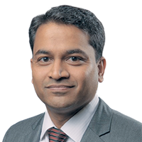
Speakers Bio & Abstract

|
SHAILESH SHANKAR
Manager Sales Engineering DigitalGlobe India BiographyShailesh Shankar has been active in this field of Remote Sensing and GIS for the last 18 years. Shailesh has a Masterís Degree in Environmental Science. He has served various roles in the industry, managing presales, business development and project implementation with prominent companies in the industry. Over the years he has gained a wide experience in various industry domains.Abstract Satellite derived elevation models for water resources managementAccurate and detailed elevation models are foundational elements for water resources management. This paper will discuss how satellite imagery can be used to create detailed and accurate elevation models, both surface and terrain models, at scale by leveraging timelapse imagery. Also the paper will discuss how surface water features such as lakes, reservoirs, rivers, can be mapped and monitored overtime. |